


Billeder af vores brugere
-
 © Andre HahnOprettet den 06.09.2022
 -
 © Andre HahnOprettet den 06.09.2022
 -
 © Stefan BonnesOprettet den 07.09.2025
 -
 © Patrick SchiphorstOprettet den 07.09.2025
 -
 © renekjOprettet den 06.09.2025
 -
 © Stefan BonnesOprettet den 06.09.2025
 -
 © Patrick SchiphorstOprettet den 06.09.2025
 -
 © Patrick SchiphorstOprettet den 06.09.2025
 -
 © Patrick SchiphorstOprettet den 06.09.2025
 -
 © Patrick SchiphorstOprettet den 06.09.2025
 -
 © Patrick SchiphorstOprettet den 06.09.2025
 -
 © Ralf UmmingerOprettet den 18.07.2025
 -
 © Ralf UmmingerOprettet den 18.07.2025
 -
 © Ralf UmmingerOprettet den 18.07.2025
 -
 © Ralf UmmingerOprettet den 18.07.2025
 -
 © Ralf UmmingerOprettet den 18.07.2025
 -
 © Ralf UmmingerOprettet den 18.07.2025
 -
 © Ralf UmmingerOprettet den 18.07.2025
 -
 © Ralf UmmingerOprettet den 18.07.2025
 -
 © Ralf UmmingerOprettet den 18.07.2025
 -
 © Ralf UmmingerOprettet den 18.07.2025
 -
 © Ralf UmmingerOprettet den 18.07.2025
 -
 © Ralf UmmingerOprettet den 18.07.2025
 -
 © Ralf UmmingerOprettet den 25.09.2024
 -
 © Ralf UmmingerOprettet den 25.09.2024
 -
 © Ralf UmmingerOprettet den 25.09.2024
 -
 © Daniel HerzOprettet den 30.08.2024
 -
 © Daniel HerzOprettet den 30.08.2024
 -
 © Daniel HerzOprettet den 30.08.2024
 -
 © Daniel HerzOprettet den 30.08.2024
 -
 © Daniel HerzOprettet den 30.08.2024
 -
 © Daniel HerzOprettet den 30.08.2024
 -
 © Simon LiranzoOprettet den 16.10.2022
 -
 © Simon LiranzoOprettet den 16.10.2022
 -
 © Simon LiranzoOprettet den 16.10.2022
 -
 © Simon LiranzoOprettet den 16.10.2022
 -
 © Simon LiranzoOprettet den 16.10.2022
 -
 © Simon LiranzoOprettet den 16.10.2022
 -
 © Simon LiranzoOprettet den 16.10.2022
 -
 © Simon LiranzoOprettet den 16.10.2022
 -

 © gbittnerOprettet den 12.09.2019
 -
 © Mark FreyOprettet den 07.09.2025
 -
 © Mark FreyOprettet den 07.09.2025
 -
 © Mark FreyOprettet den 07.09.2025
 -
 © Mark FreyOprettet den 07.09.2025
 -

 © Johann mitterhuberOprettet den 25.08.2025
 -
 © Josef WohlgenanntOprettet den 10.08.2025


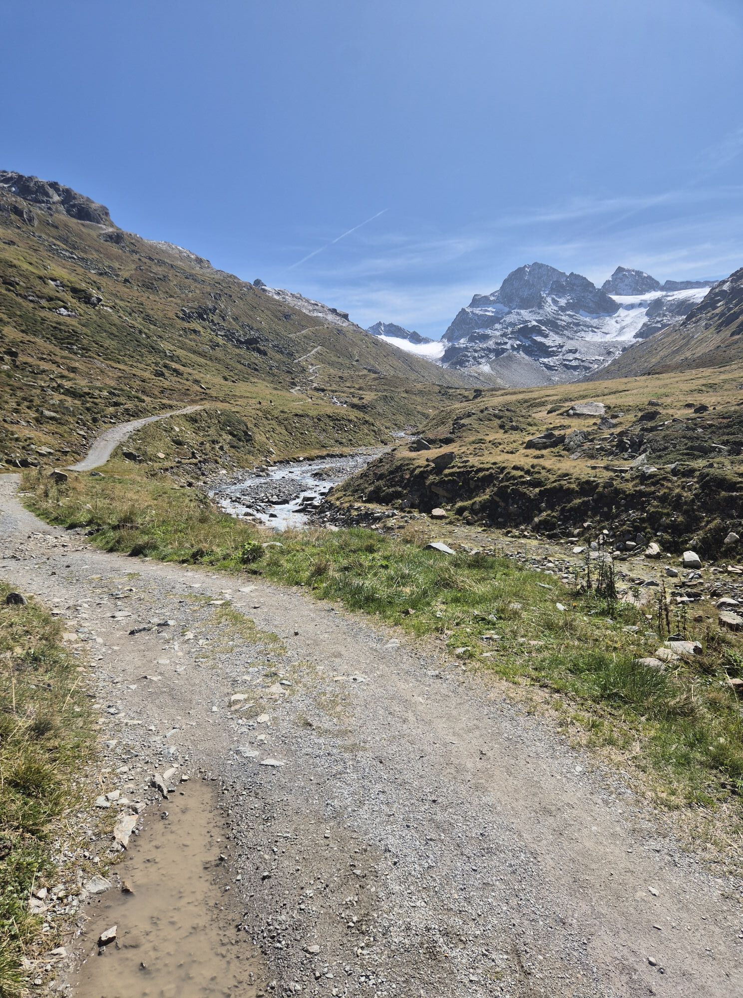
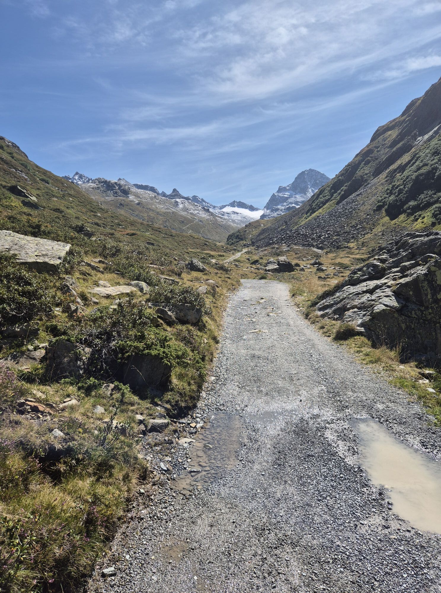

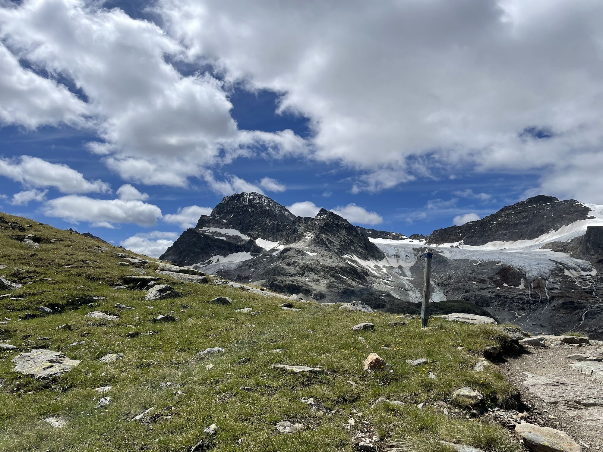

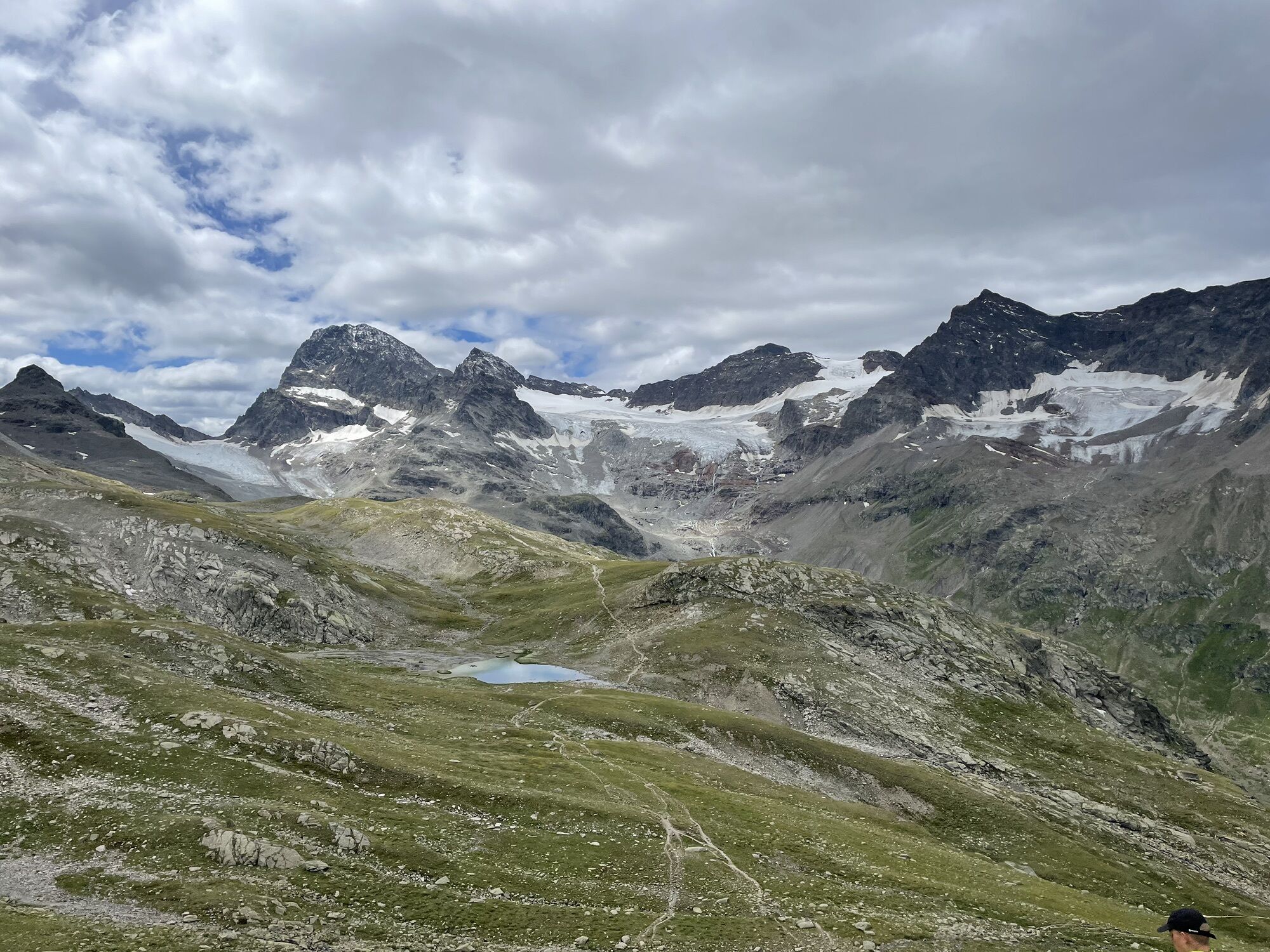

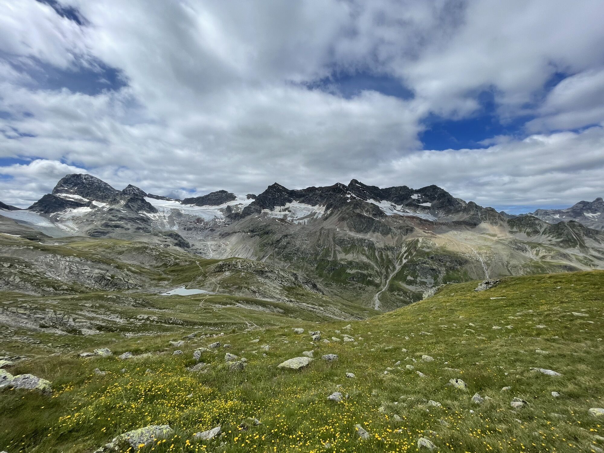


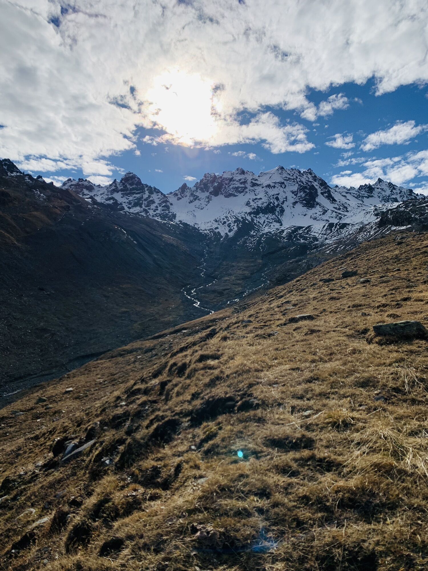

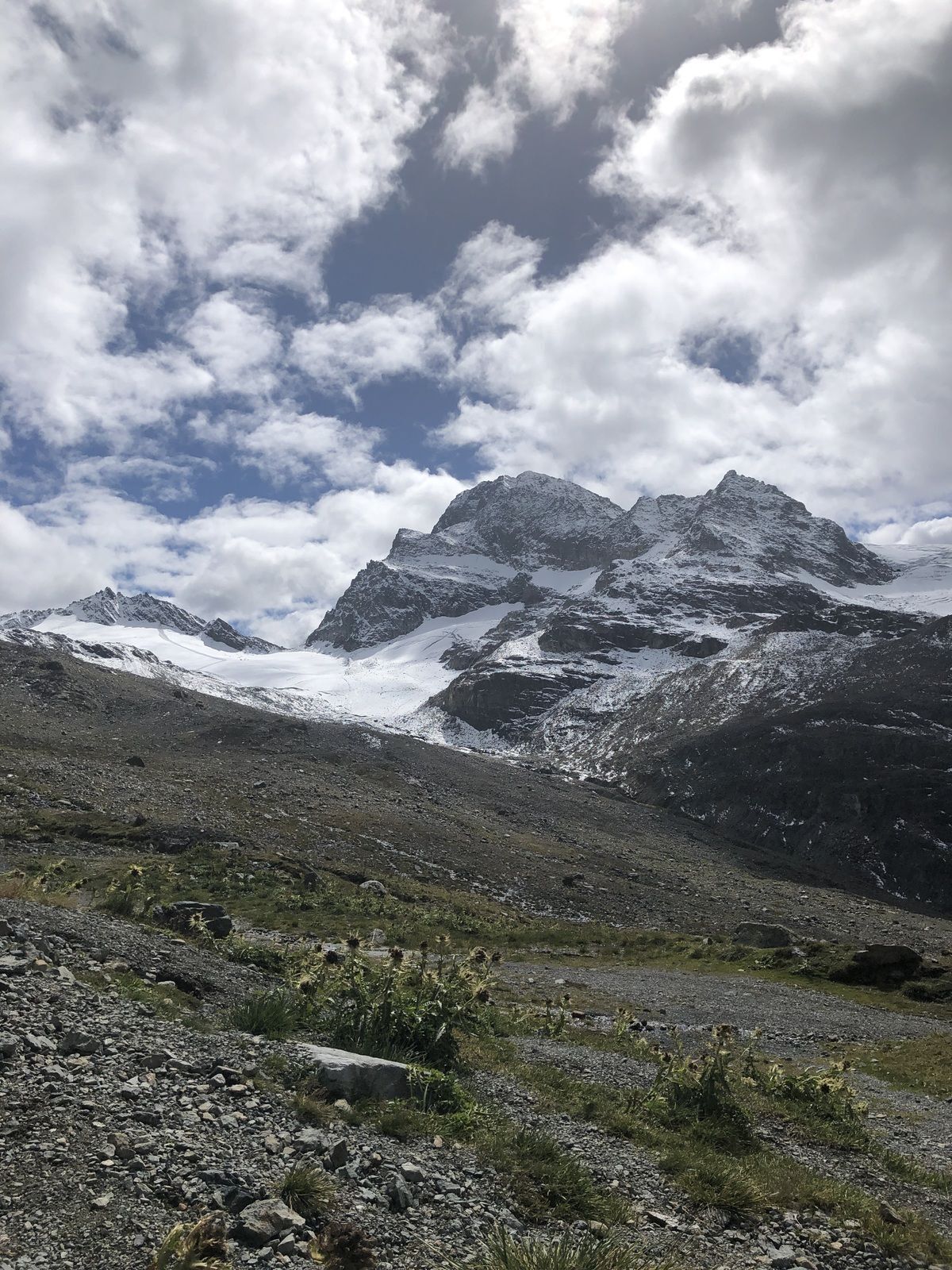


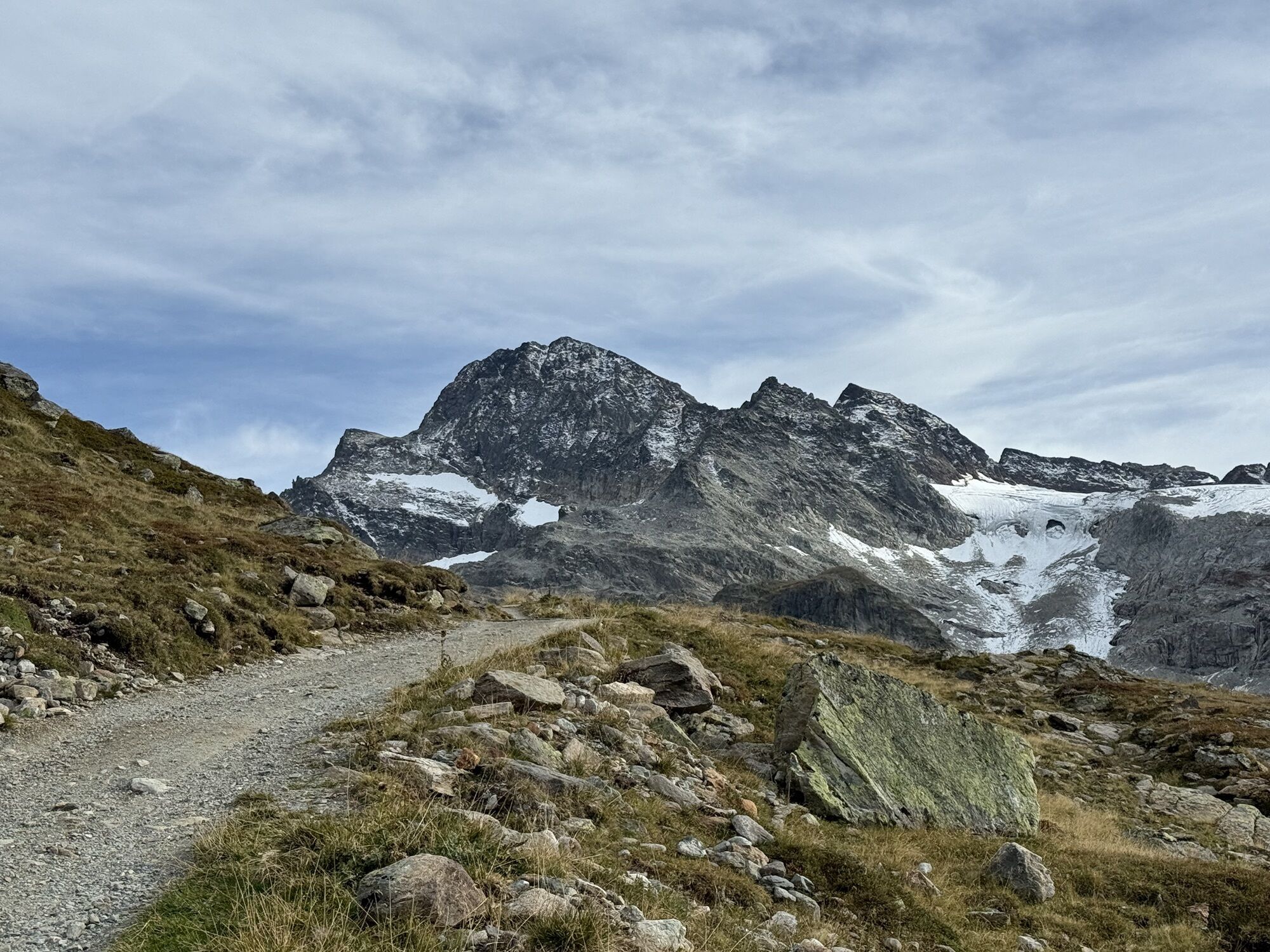
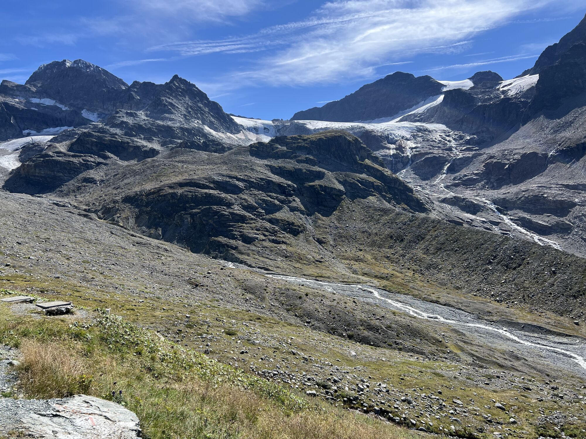

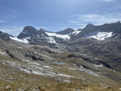
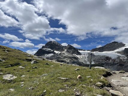
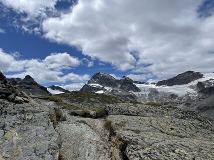
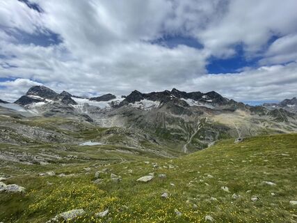
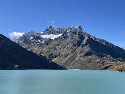
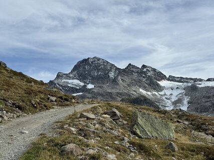
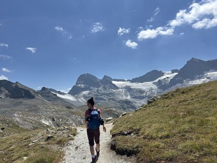
Magnificent view of Piz Buin (highest mountain of Vorarlberg 3,312 m) and its glaciers, the source area of the Ill. The hike leads into high alpine terrain.
The Silvretta High Alpine Road (toll road) is...
Magnificent view of Piz Buin (highest mountain of Vorarlberg 3,312 m) and its glaciers, the source area of the Ill. The hike leads into high alpine terrain.
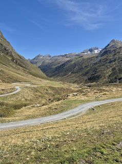
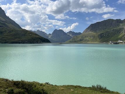
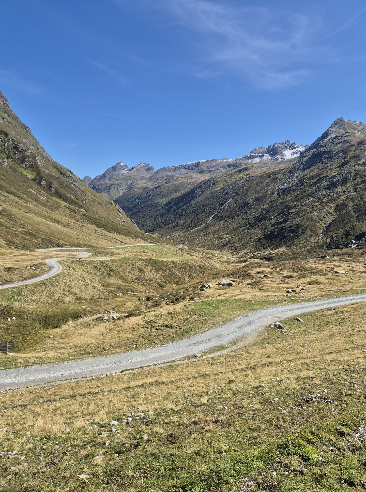
The Silvretta High Alpine Road (toll road) is considered one of the most beautiful and popular panoramic roads in the Alps. It is 22.3 km long and leads from Partenen in Montafon in a total of 34 hairpin bends up to the 2,032 m high Silvretta-Bielerhöhe and on to Galtür in the Paznaun valley.

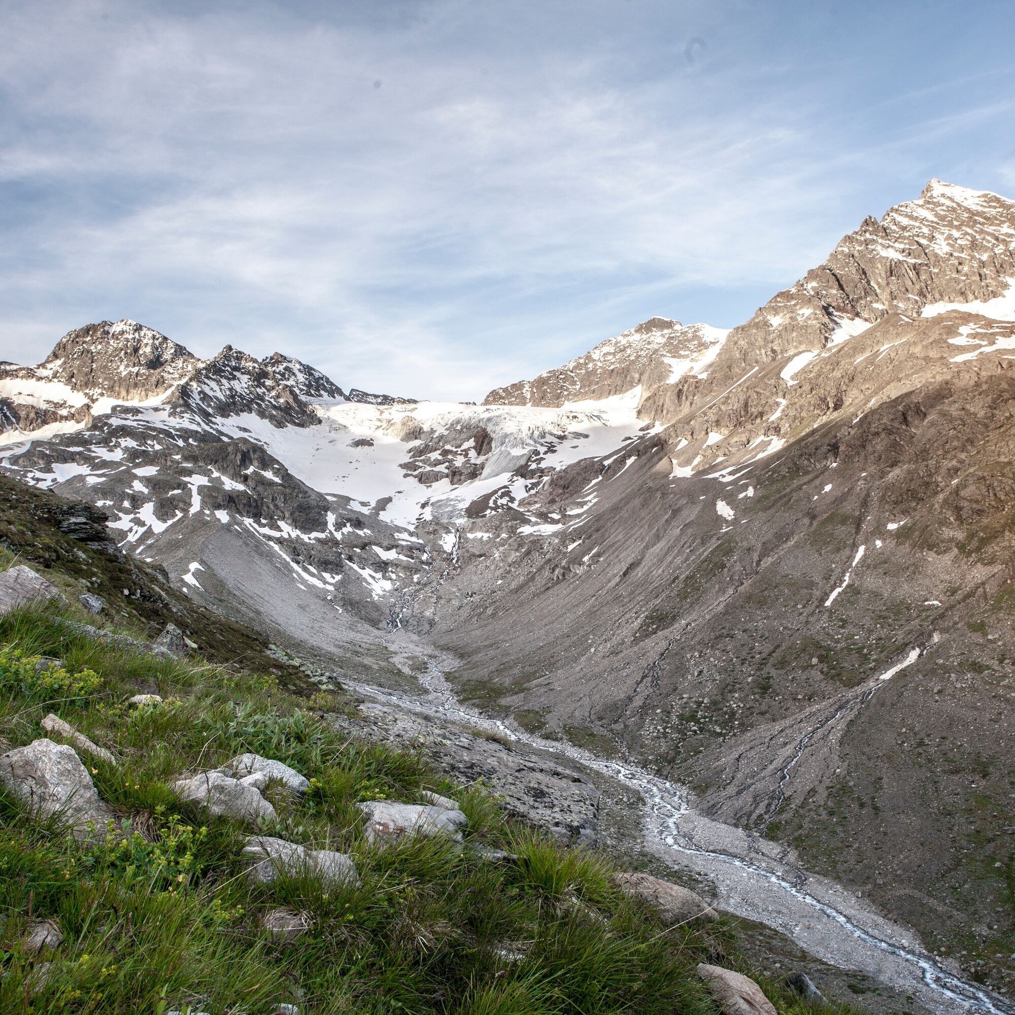
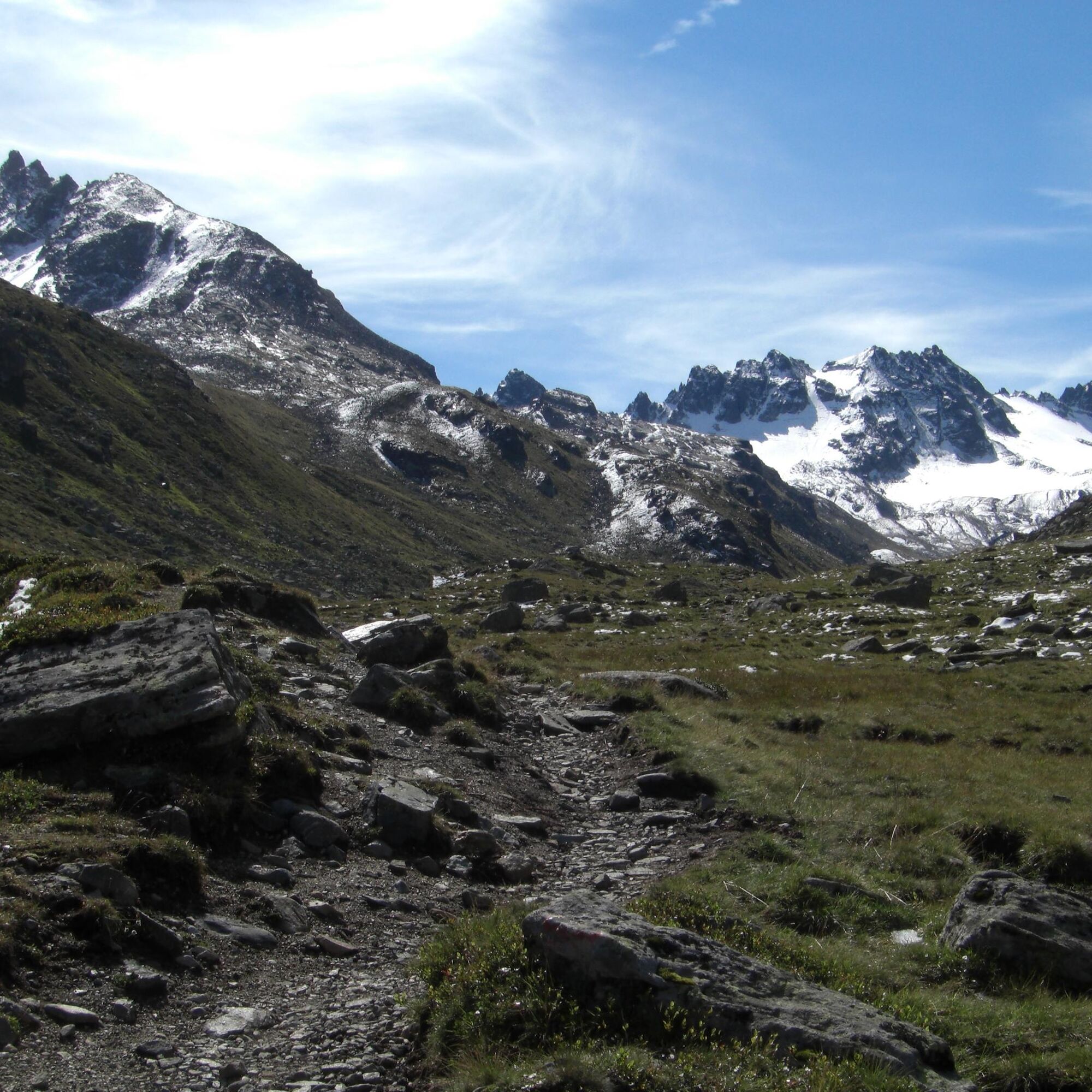
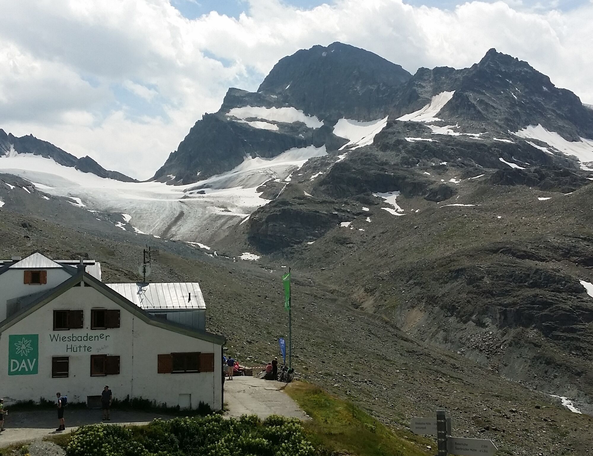
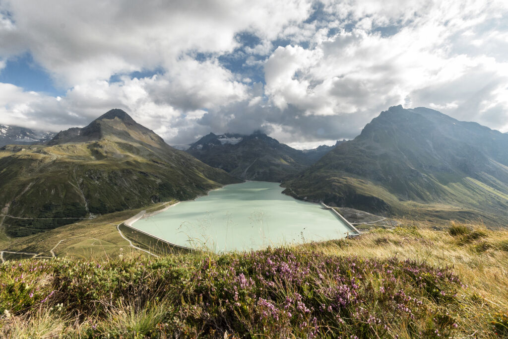
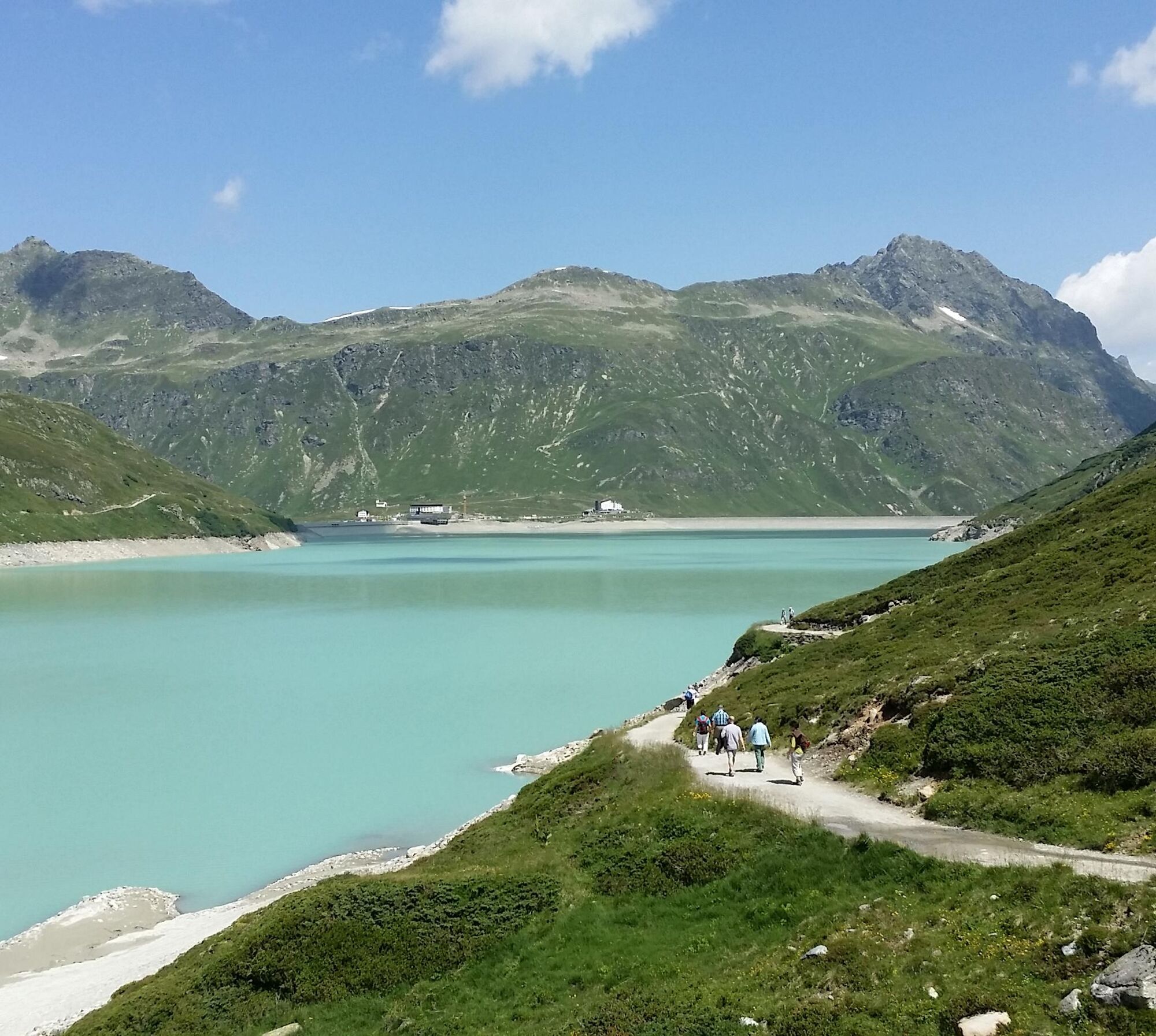
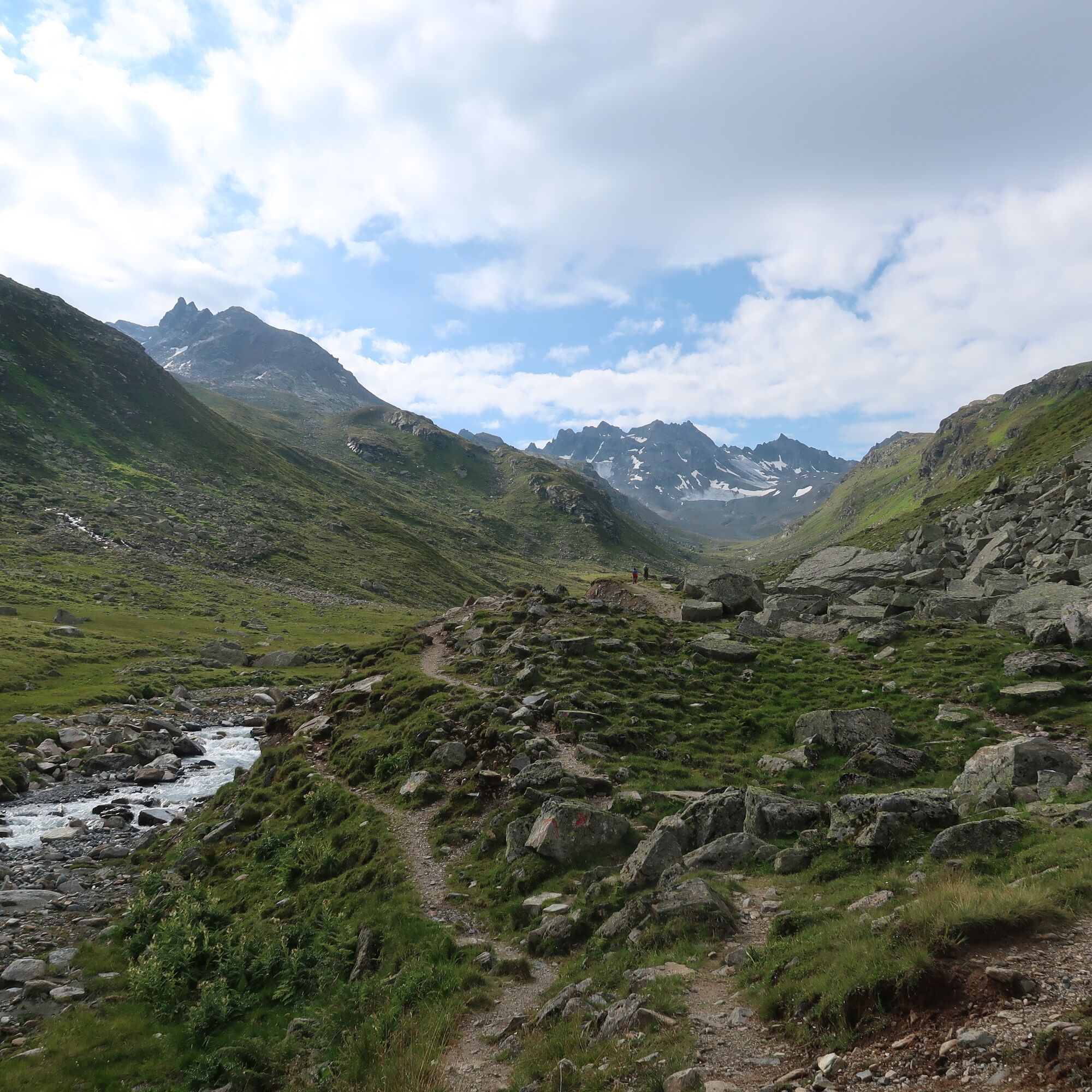
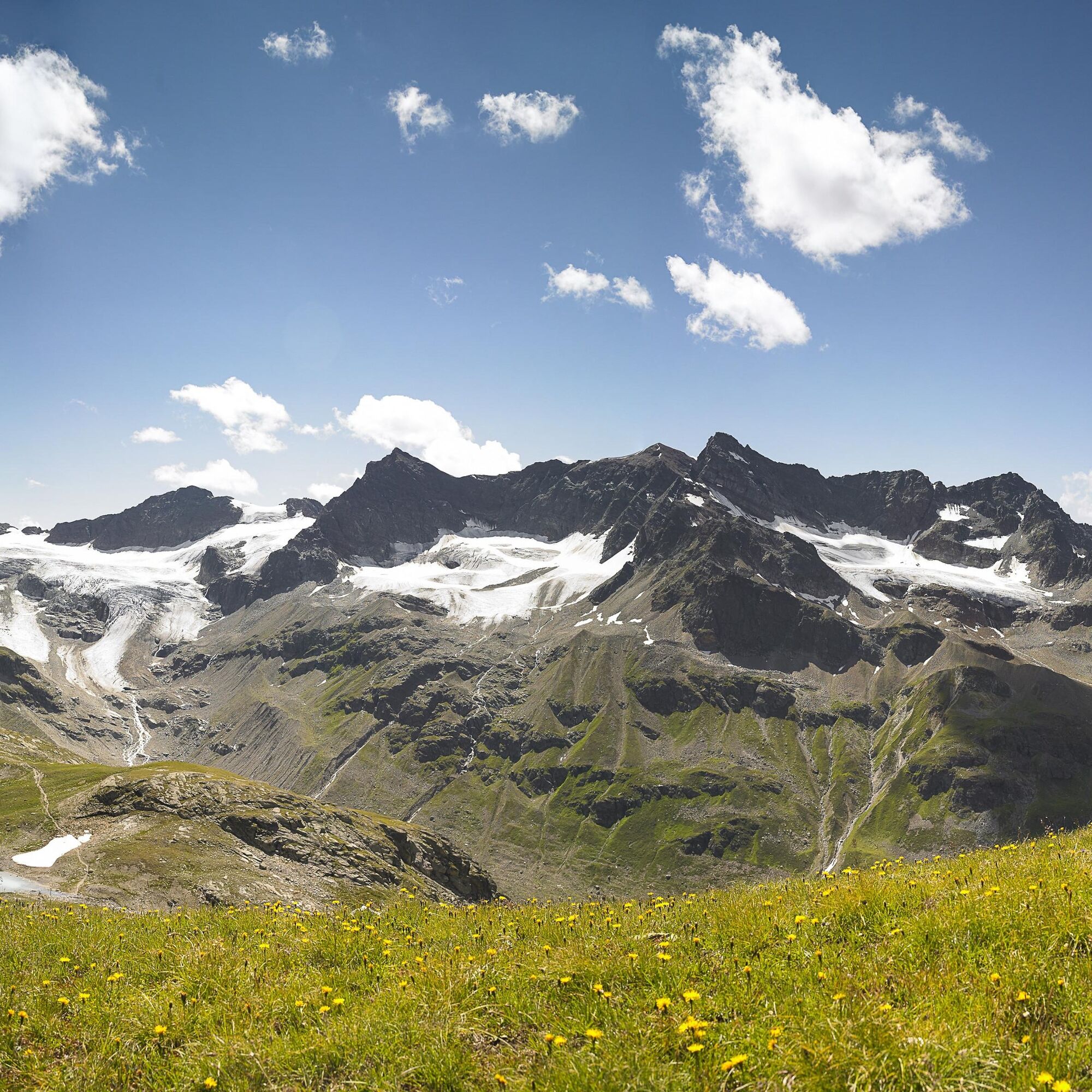
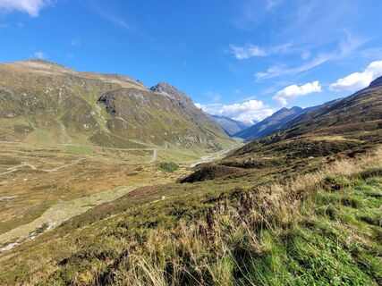
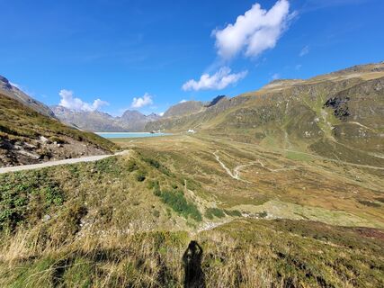
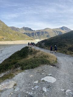
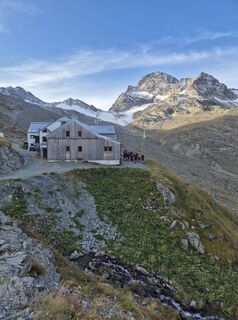
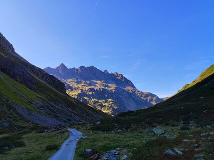
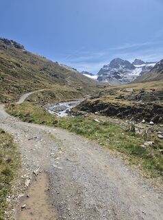
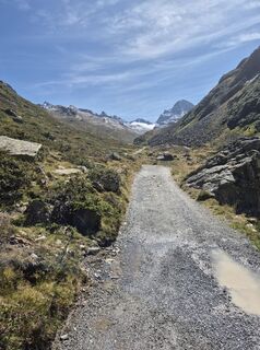
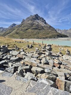
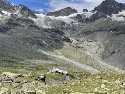
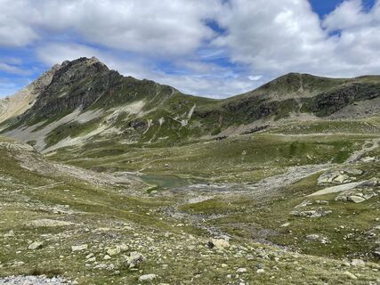
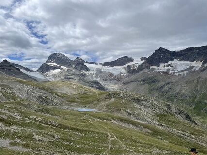
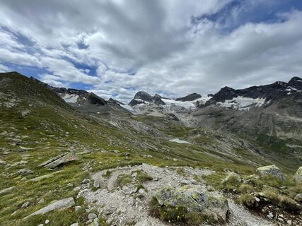
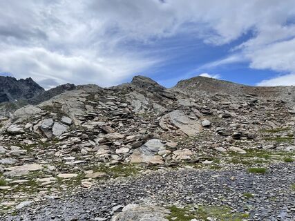
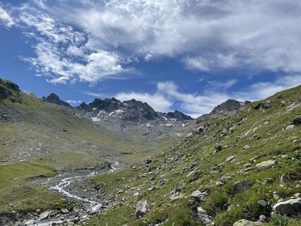
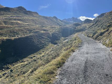
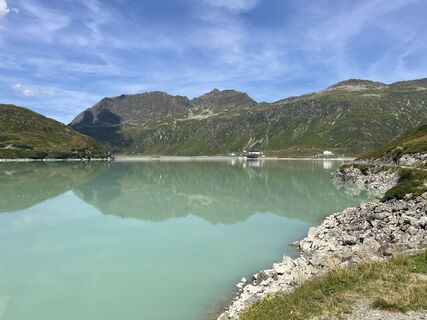
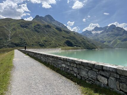
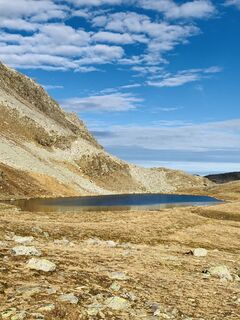
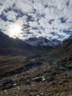
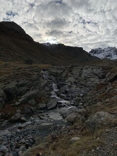
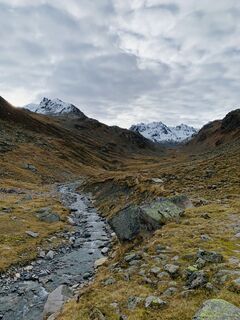
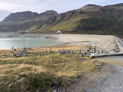
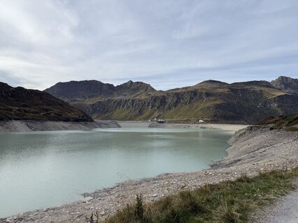
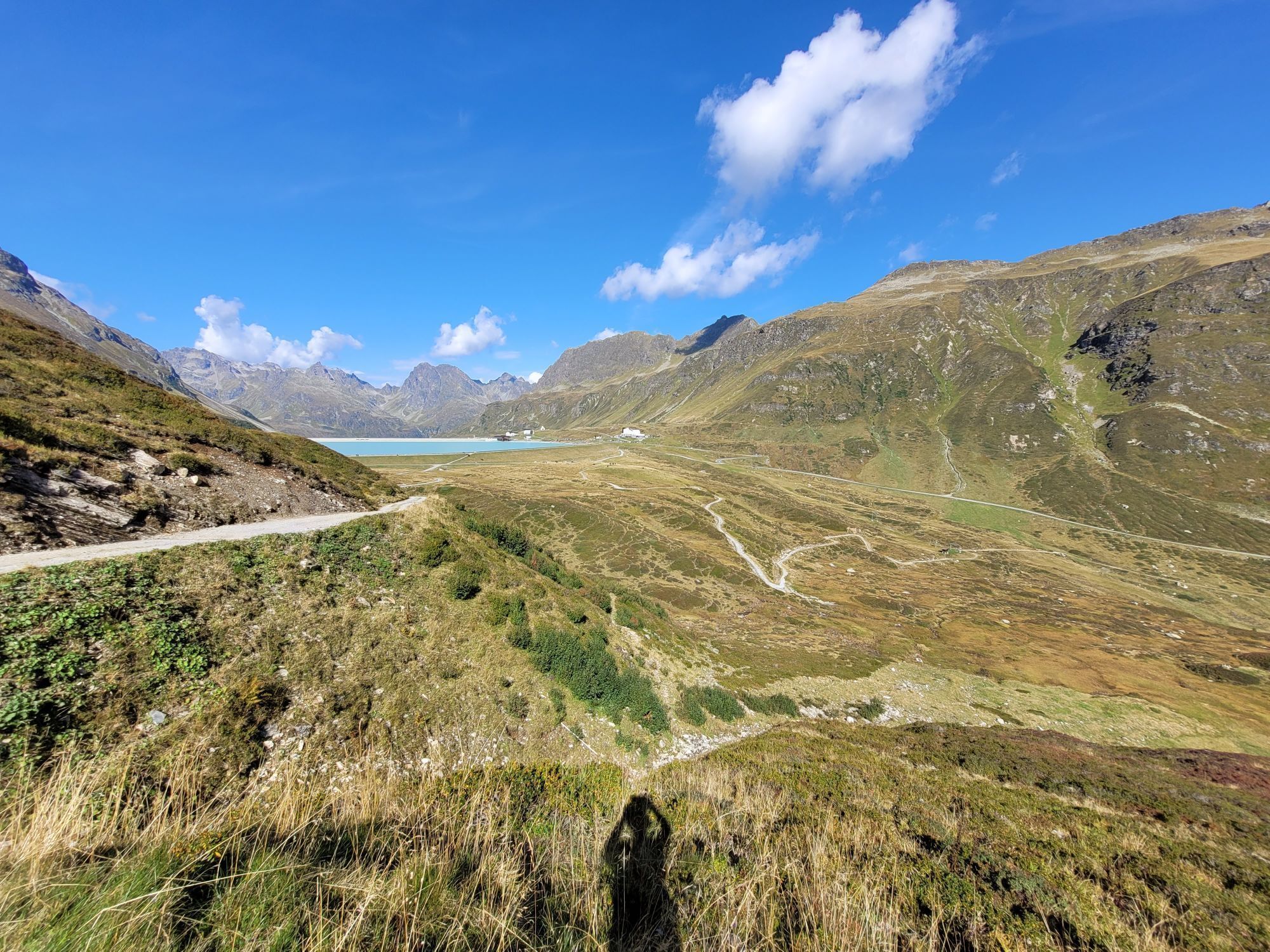
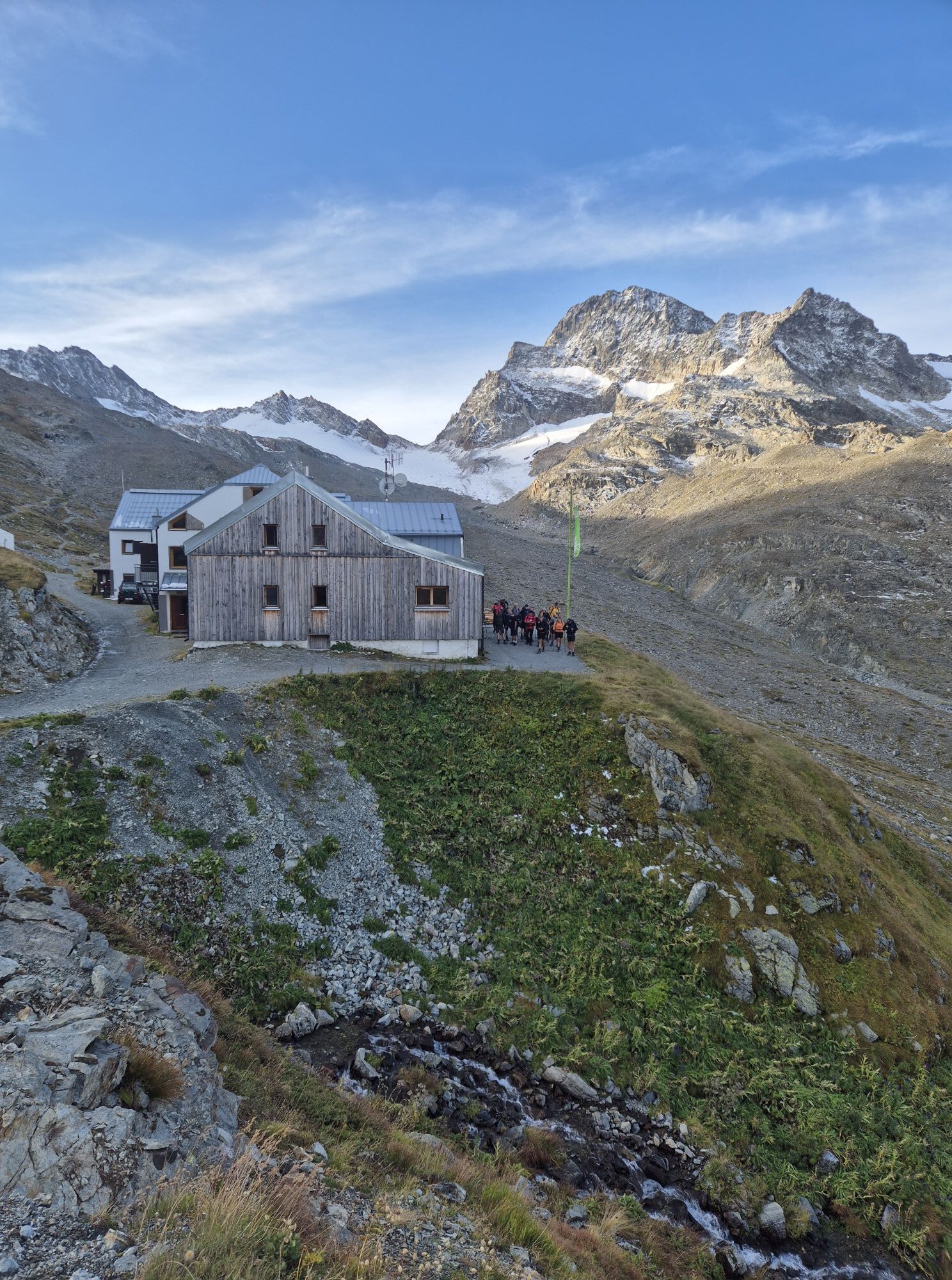
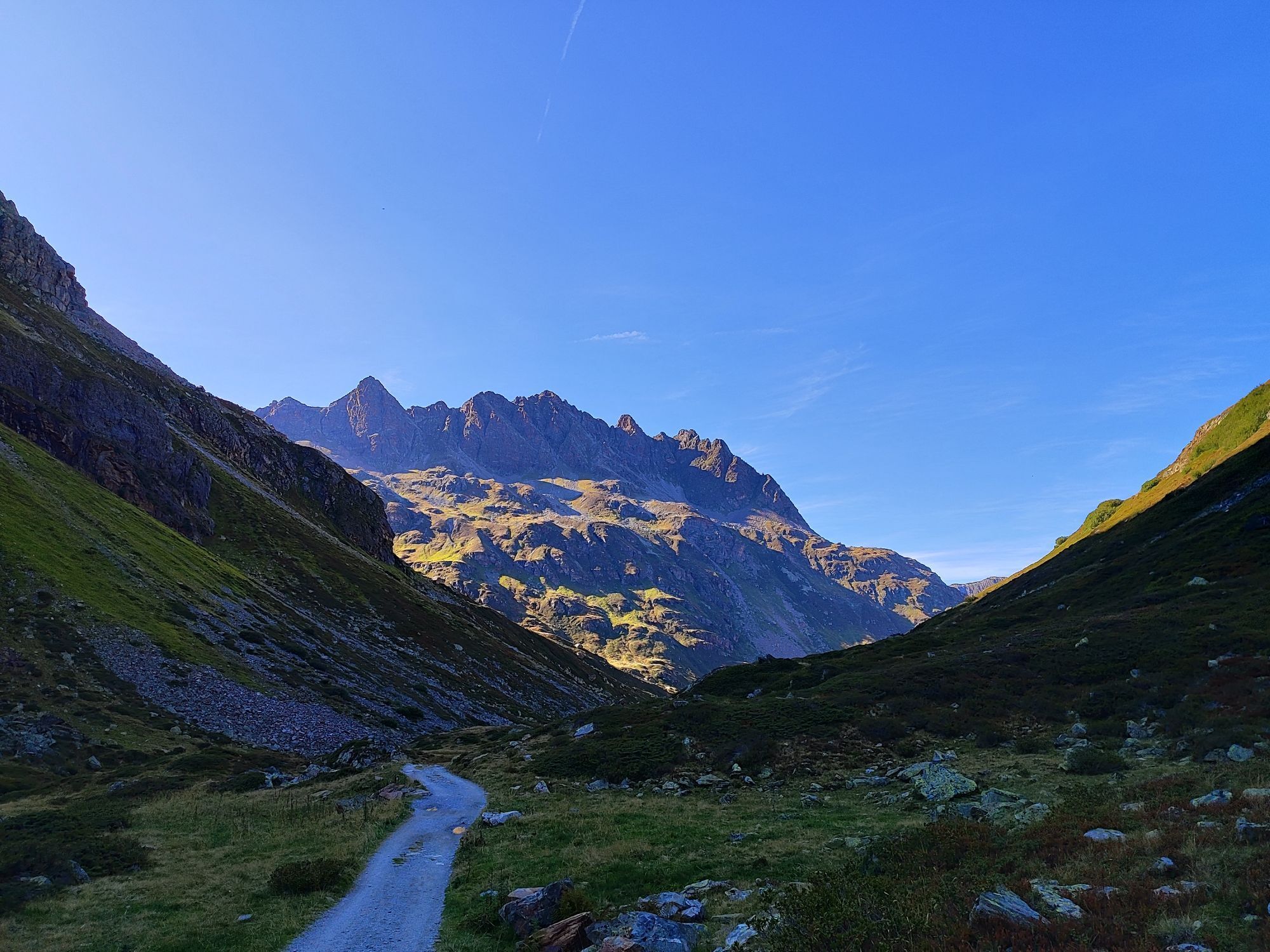
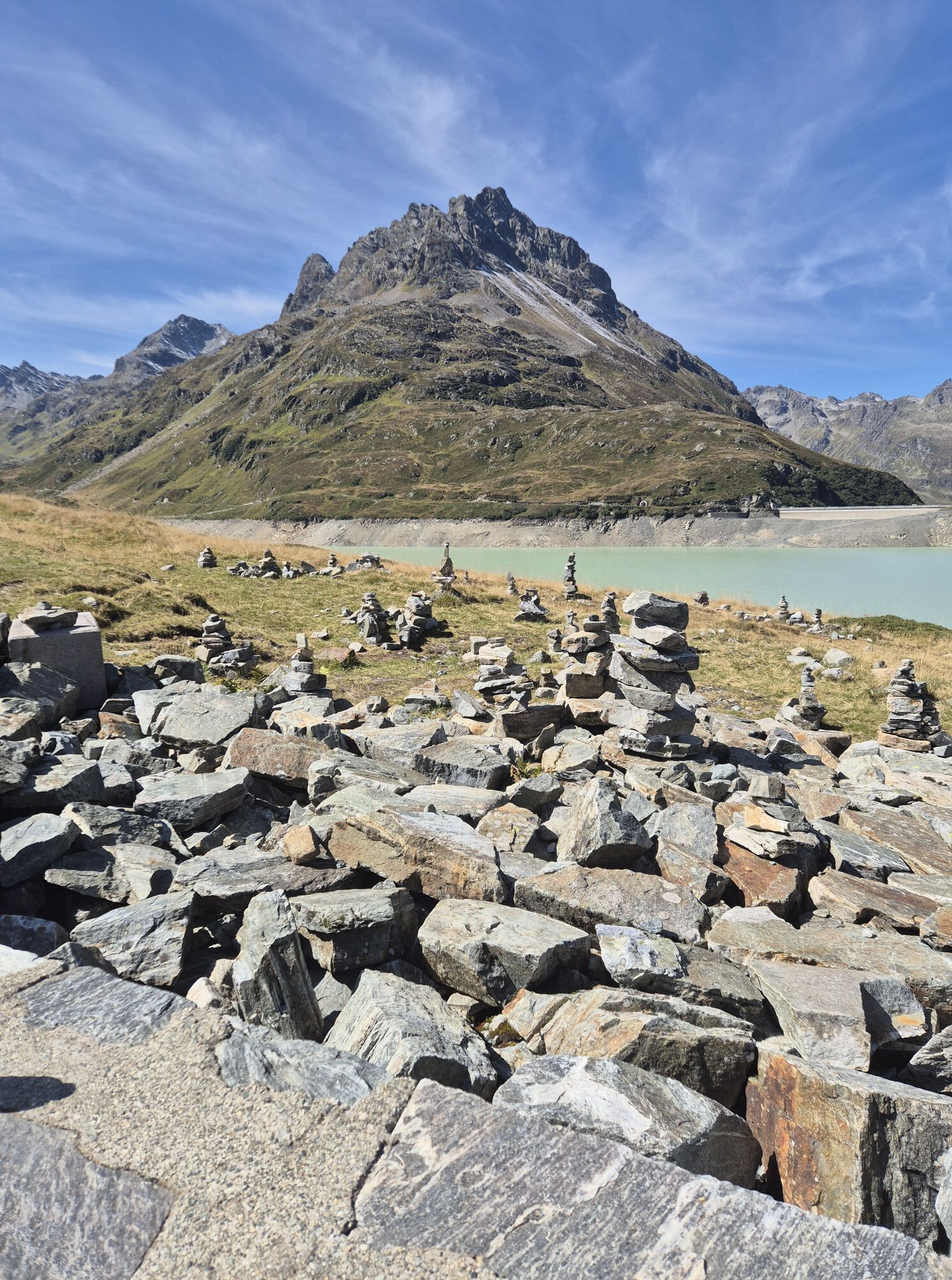
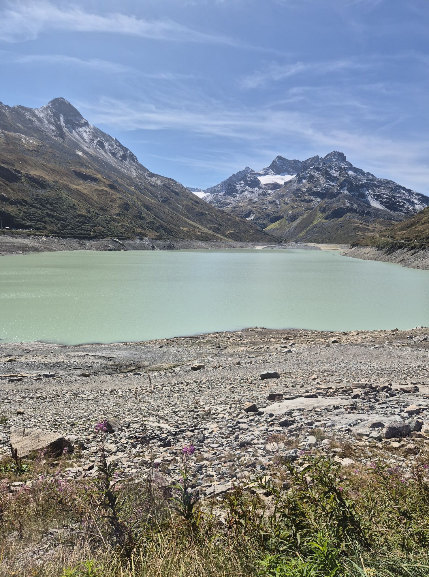
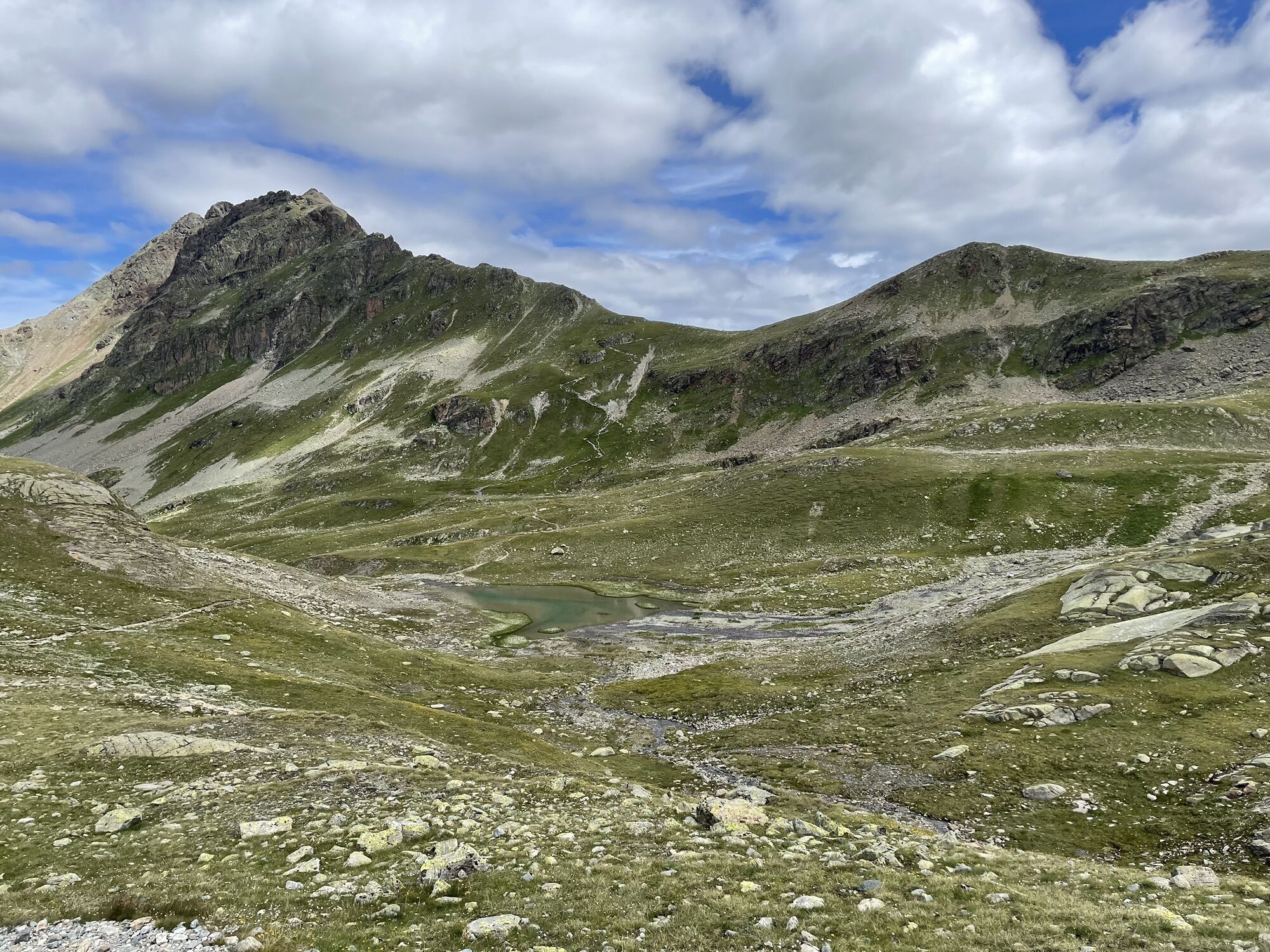
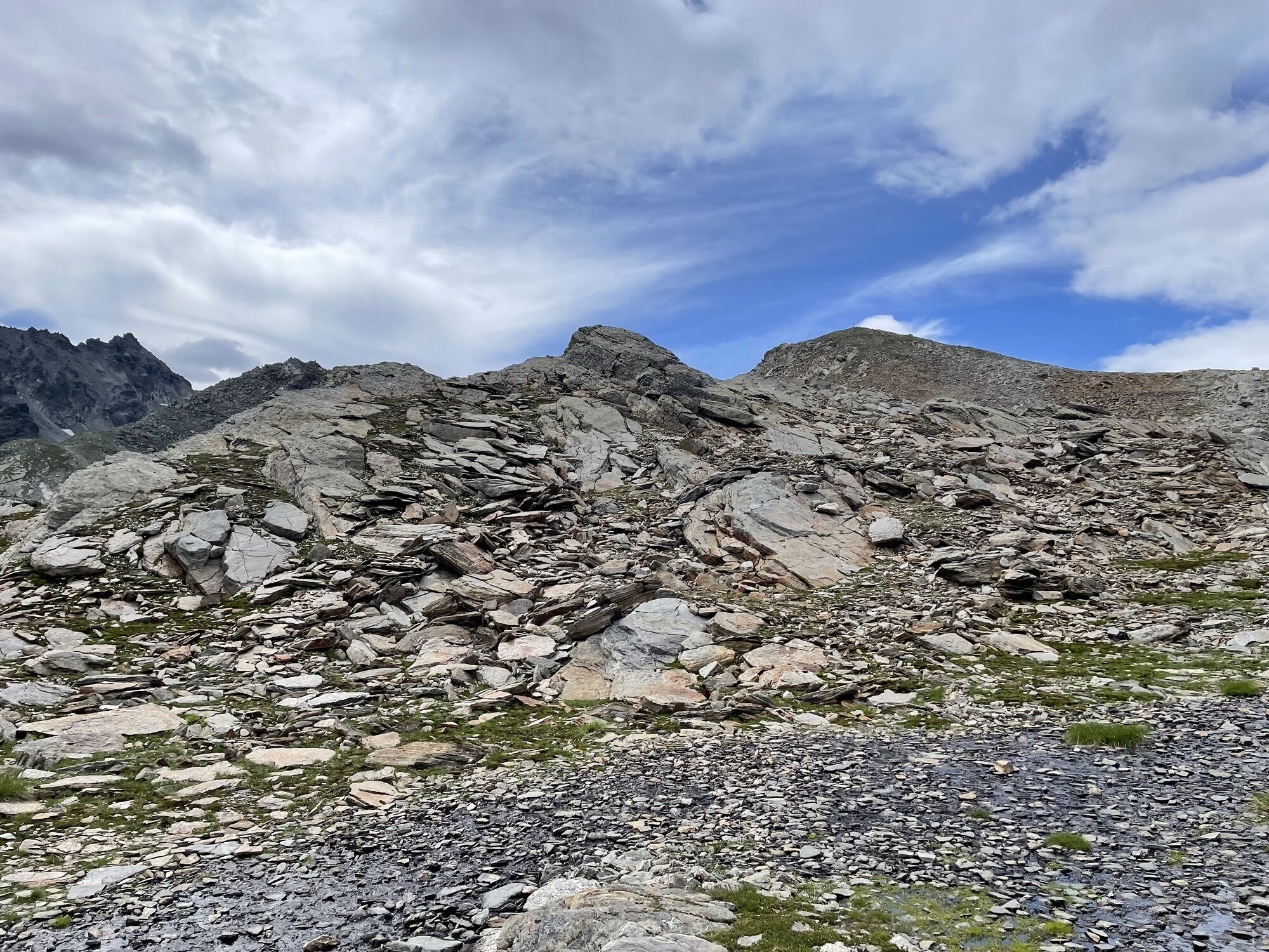
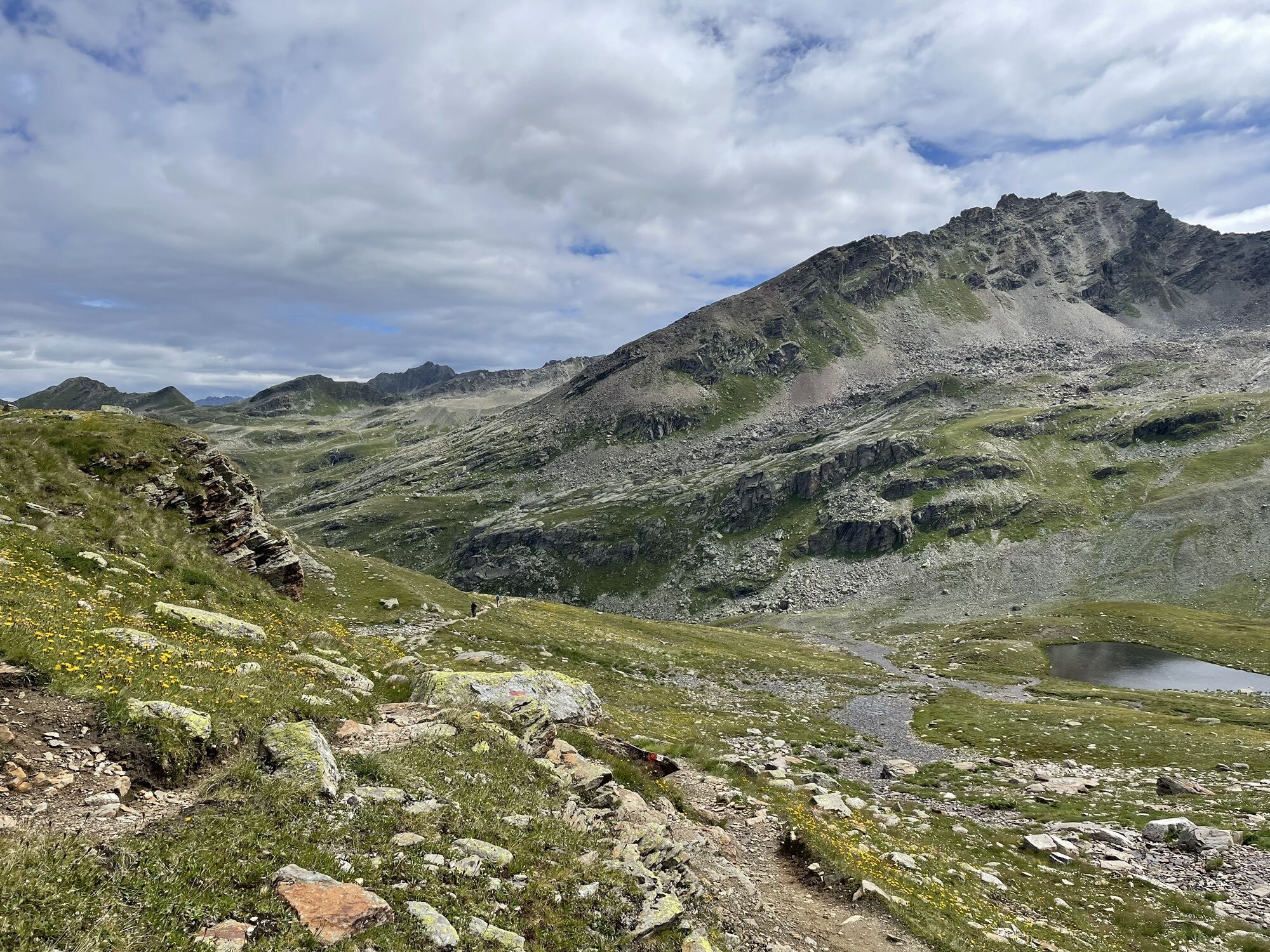
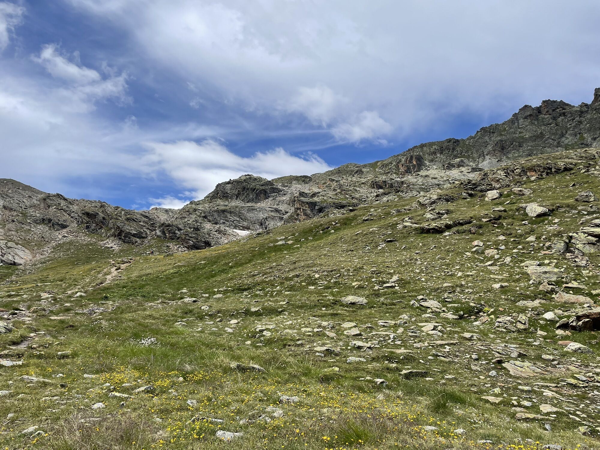
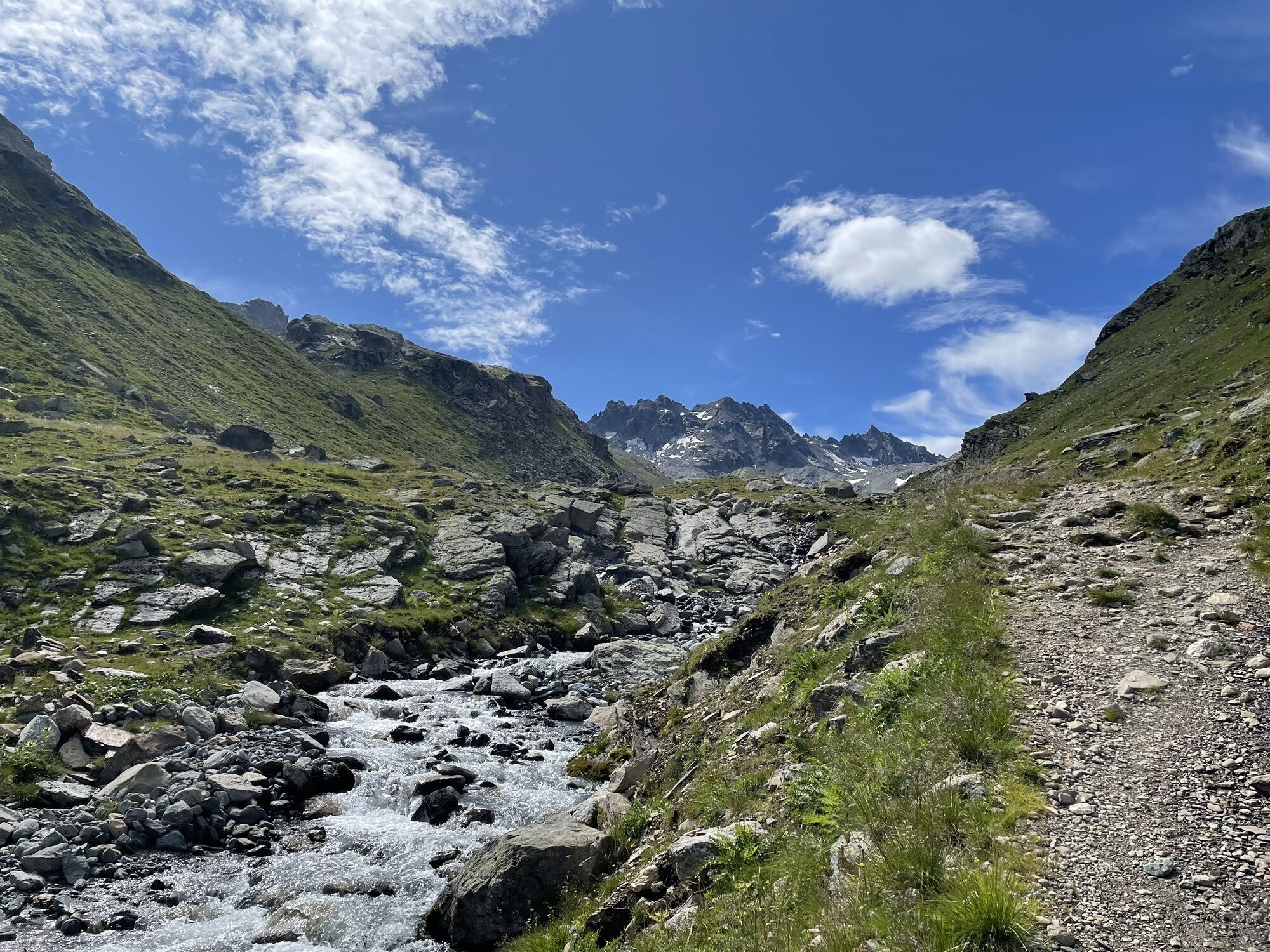
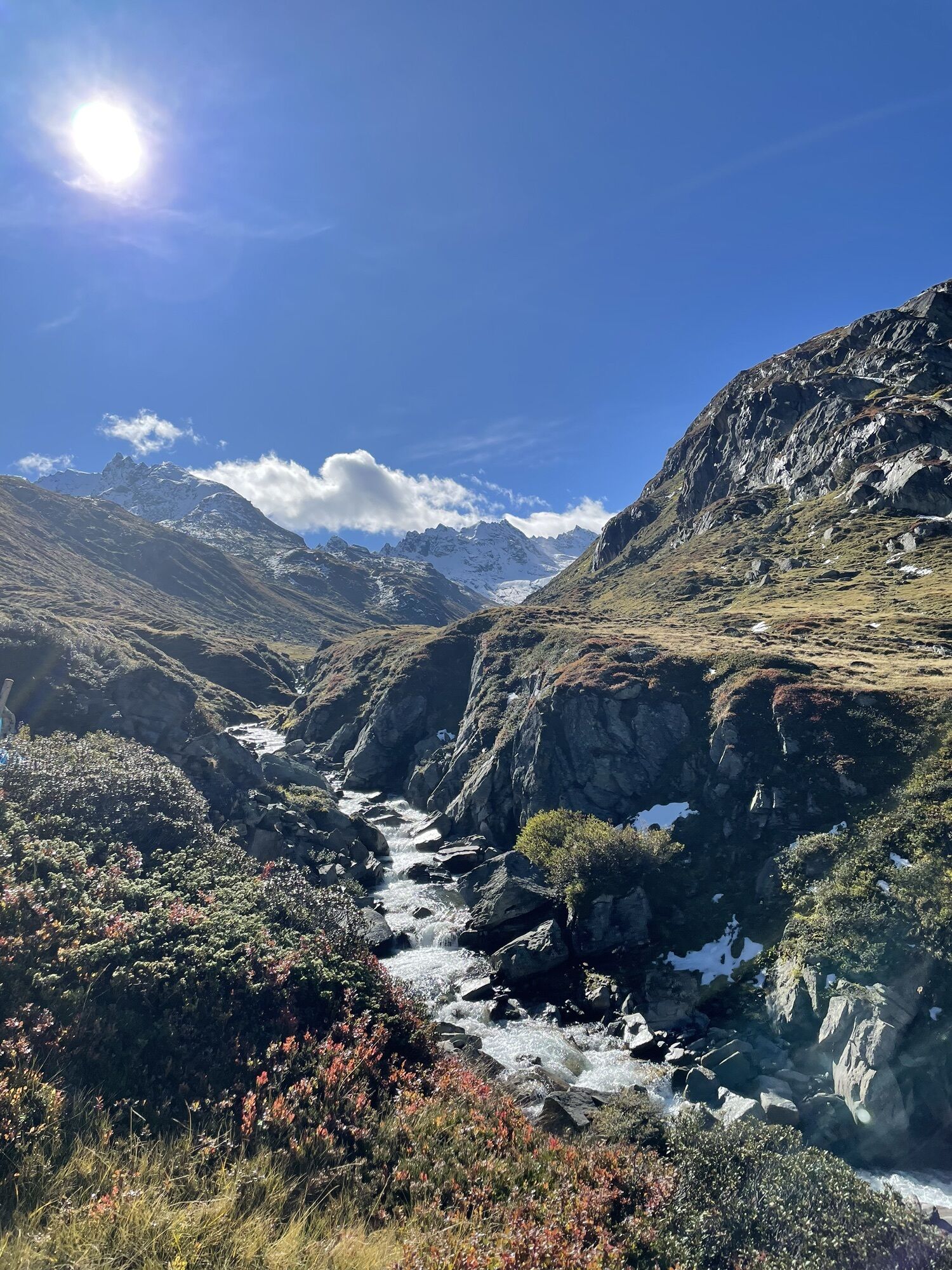
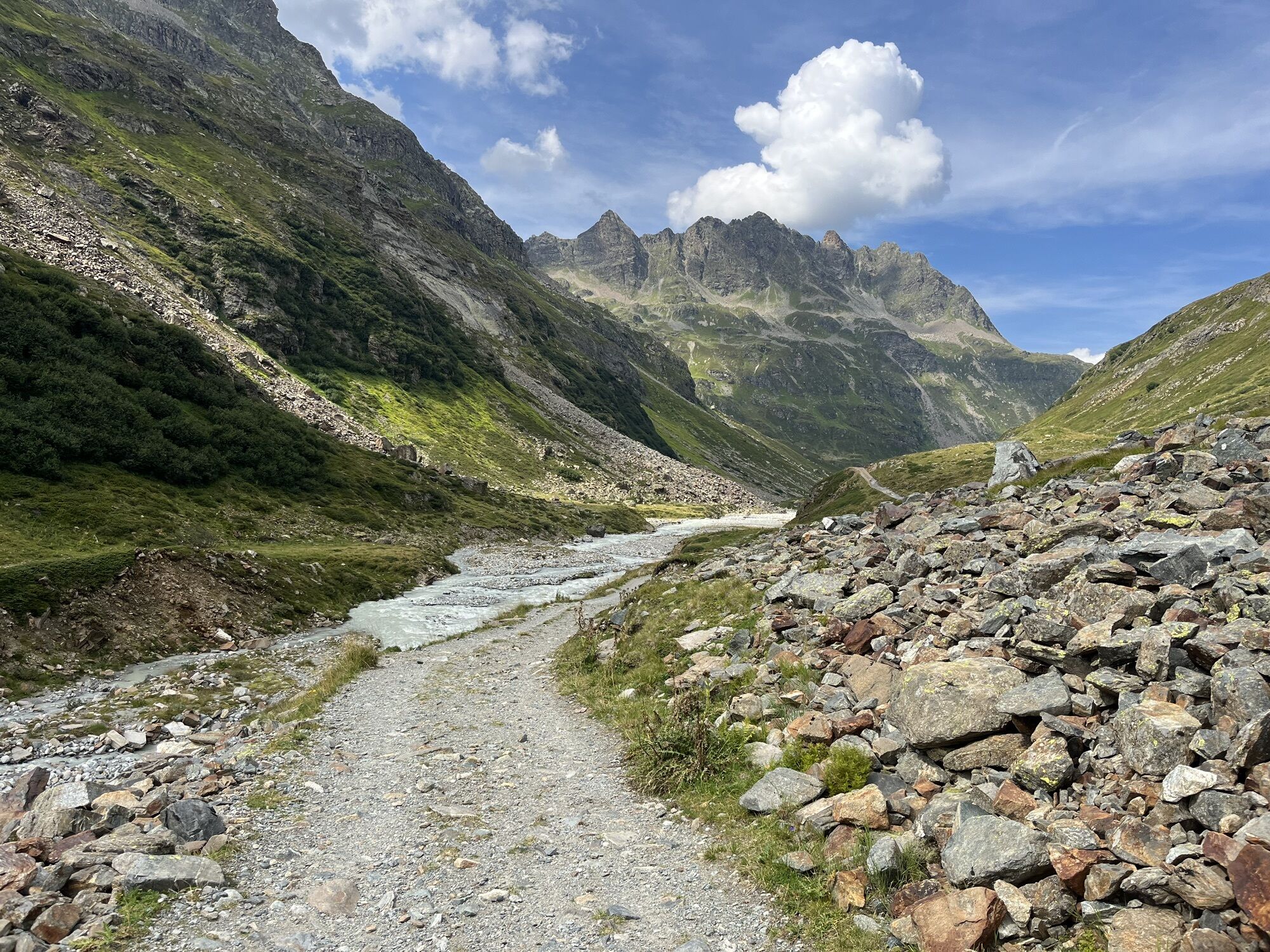
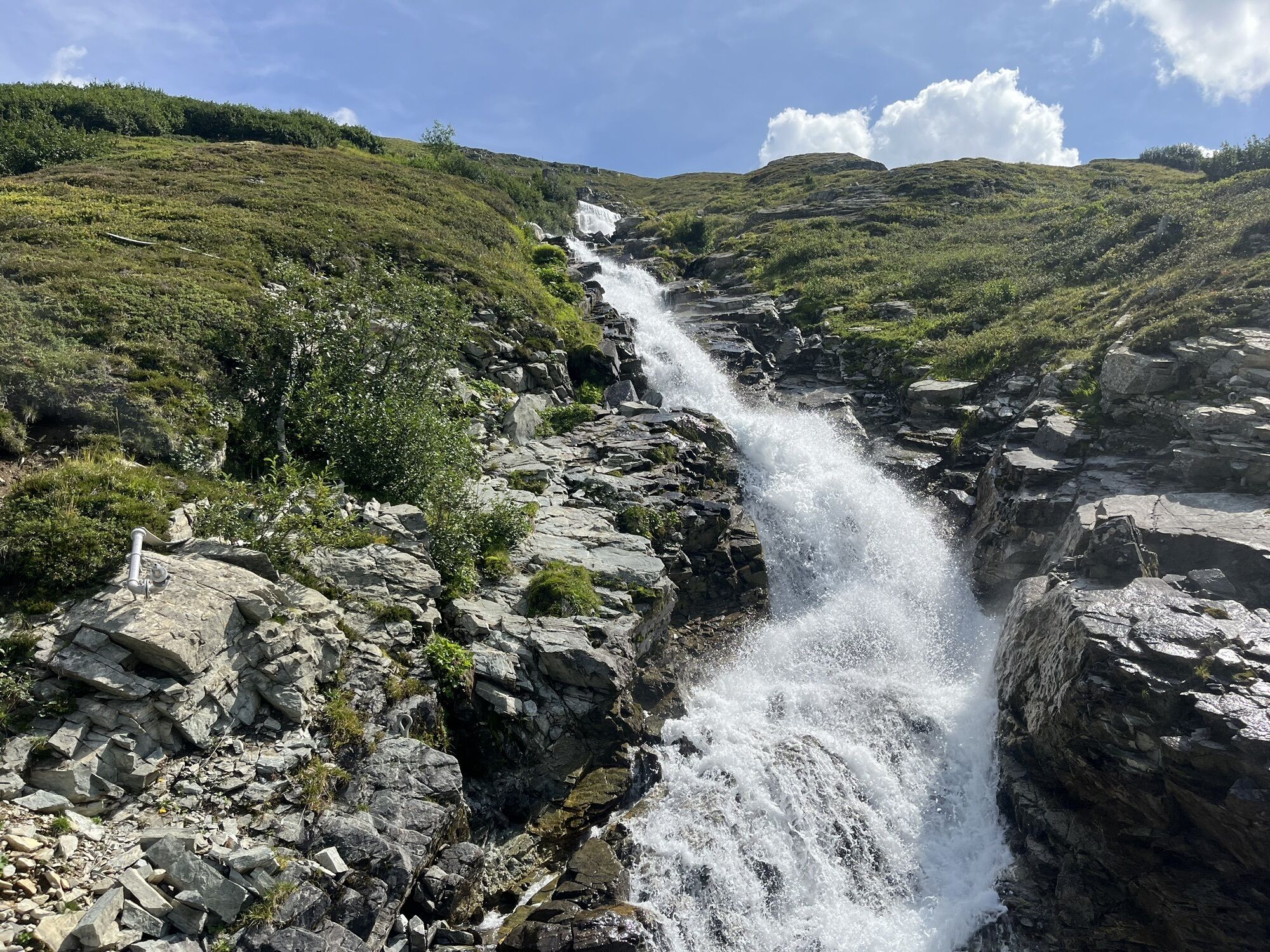
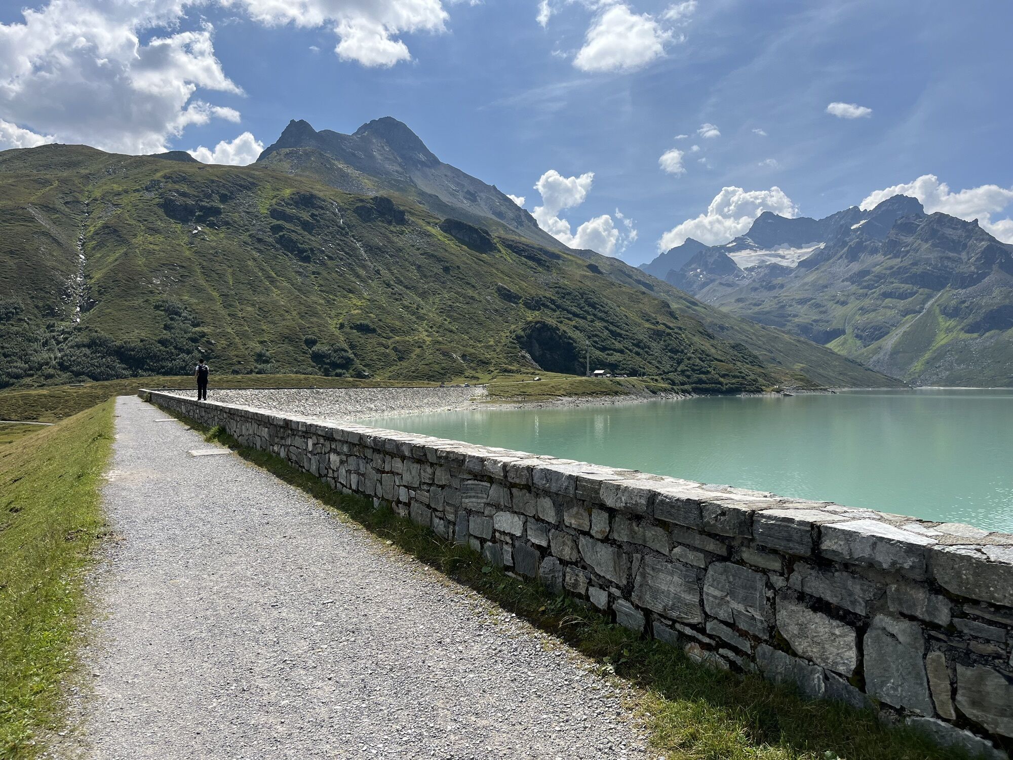
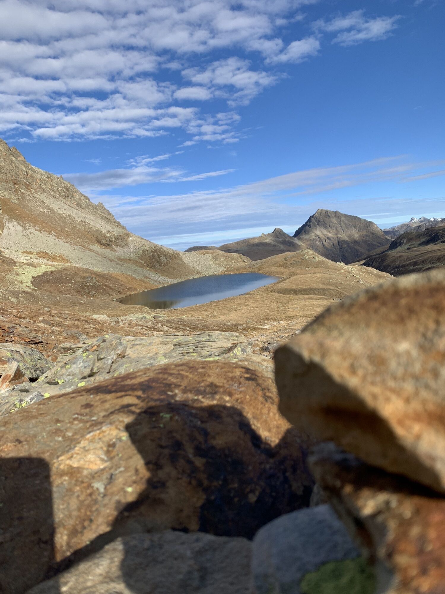
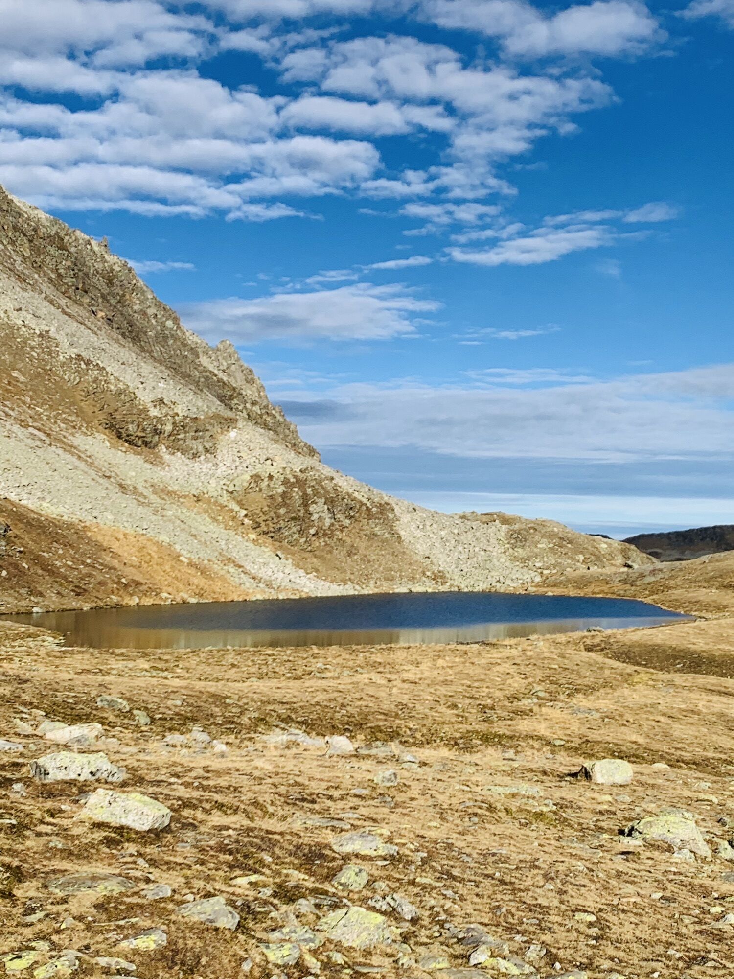
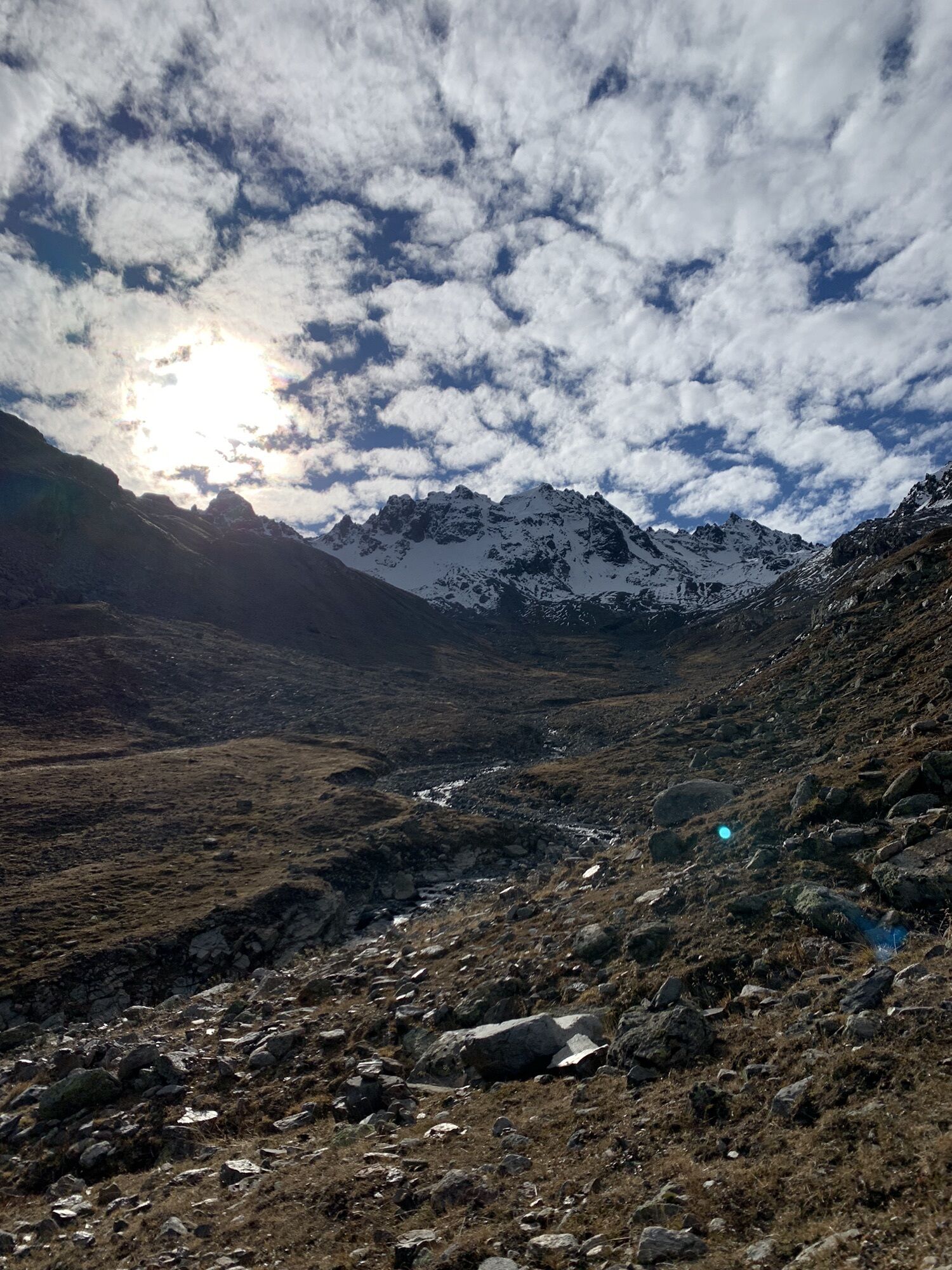
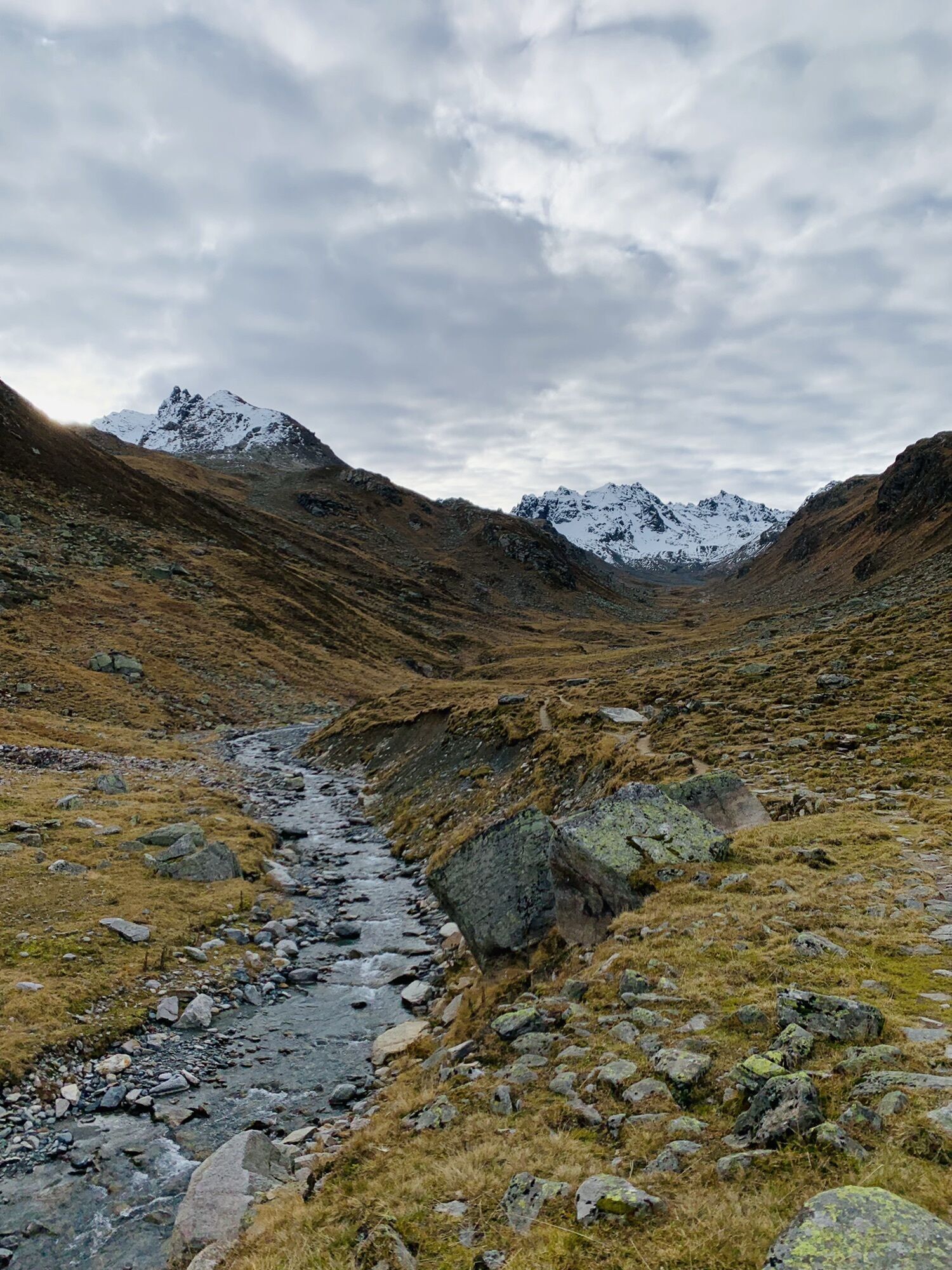
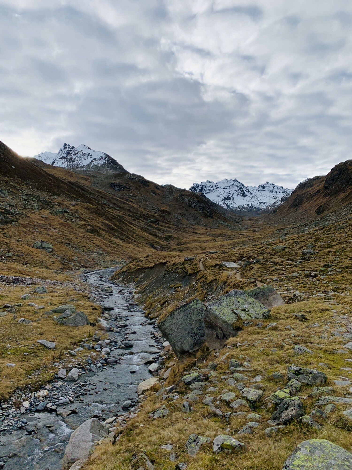
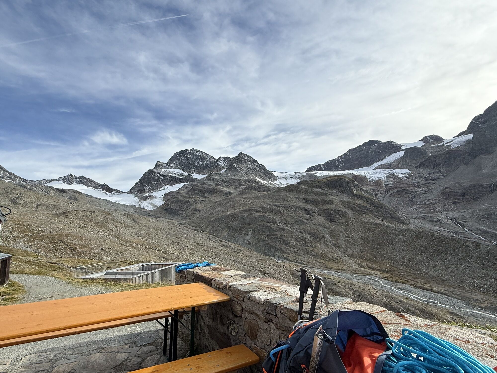
The hike starts at the Silvretta Lake and leads left over the dam to the junction into the Bieltal. The lively Bieltalbach overcomes the first altitude meters. As a larger lake, the Radsee lies to the right of the path on a height, embedded in green meadows. Now it is necessary to cross rock and scree fields. Further up, the path becomes wetter because smaller lakes are located in the terrain. The Radsattel is reached. The view is magnificent. Gray-green and rust-red rugged rock ridges rise from green mats. Behind them shine the white firn fields and imposing glaciers. The descent to the Wiesbadner Hut is initially somewhat steep and then descends in a zigzag. The day's goal is reached. The Wiesbadner Hut, which lies at the foot of Piz Buin, is a heavily frequented and popular hut. The descent is via the summer path. First follow the road to the small chapel. Then turn into the narrow hiking trail. This winds along the mountainside of the Hoher Rad and the Ochsentales. At first, there are still green and lush meadows. The closer you get to the Silvretta Lake, the more dwarf shrubs and alpine roses appear. The path ends at the waterfall. Return goes over the dam path of the Silvretta Lake and shortly afterwards you reach the starting point.
Ja
Good footwear and appropriate clothing absolutely necessary. Surefootedness and a head for heights are absolutely required.
Euro emergency call 112 (works with any mobile phone/network)
www.vorarlberg.travel/sicherheitstipps
Take the A14 to the Bludenz/Montafon exit and continue on the Montafon road L188 to Partenen to the toll station for the Silvretta High Alpine Road. Via the Silvretta High Alpine Road, you then reach the Vermuntsee and further to the Silvretta Lake. (Toll applies)
Just leave your car standing
Country buses operate throughout Montafon. The main lines run every half hour from Schruns train station.
Bus stop for the start/finish of the route: Bielerhöhe Silvretta Lake / Line 650
Timetable: www.vmobil.at
Arrival by train to Montafon
From Bludenz station, the Montafonerbahn runs hourly (partly every half hour). There are also direct connections from Lindau (D) or from Bregenz.
Timetable: www.oebb.at
Parking is available at the Silvretta Lake
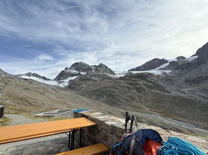
From the terrace of the Wiesbadner Hut, you have a magnificent view of the Ochsental Glacier and Piz Buin.
Populære ture i området
-
5.0
Großer Piz Buin (3.312m), Normalweg 2019 über Ochsentaler Gletscher
tungHøj tur 24.1 km -
2.8
Bielerhöhe and circular hike around the Silvretta reservoir
MediumVandring 13.1 km -
4.8
Heilbronner lodge
MediumVandring 13.0 km -
4.4
Vom Kopssee zur Breitspitze Gemeinde Gaschurn, Vorarlberg/Österreich
MediumVandring 12.5 km -
5.0
Wiegensee-Kopssee
MediumVandring 8.17 km -
4.4
Madrisella summit path
MediumTemaspor 10.8 km -
1.0
High mountain route to the highest summit of Vorarlberg, the Piz Buin (3,312 m)
tungHøj tur 22.4 km -
5.0
Wiegenseeweg
MediumTemaspor 12.7 km -
5.0
Menta Alm - Scheibenalm
lysVandring 11.4 km -
Bieler Höhe - Wiesbadener Hütte - Runde ums Hohes Rad
MediumVandring 15.6 km
Vandring og sporing


Gå ikke glip af tilbud og inspiration til din næste ferie
Din e-mailadresse er blevet tilføjet til mailinglisten.