


Sværhedsgrad: S1


Along the path that winds through the valley floor, countless testimonies of the valley's past are encountered. Starting from Olivone heading towards Biasca, after crossing mule tracks and trails, you...
Along the path that winds through the valley floor, countless testimonies of the valley's past are encountered. Starting from Olivone heading towards Biasca, after crossing mule tracks and trails, you reach the core of Ponto Aquilesco and the hamlet of Aquila, then reach the hamlet of Dangio passing in front of Cima Norma, an old chocolate factory that in the last century significantly contributed to the valley's economy, producing up to 1,500 tons of chocolate in the 1940s–1950s and employing over 300 workers.
A short climb on a trail leads to the pass where the castle of Curterio once stood, of which no significant traces remain, where in 1182 the Pact of Torre was signed in which the people of Blenio and Leventina declared their desire to remain free, with no jurisdiction other than that of the Milanese.
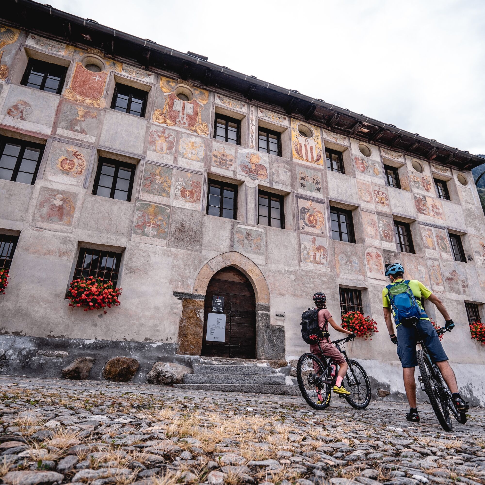
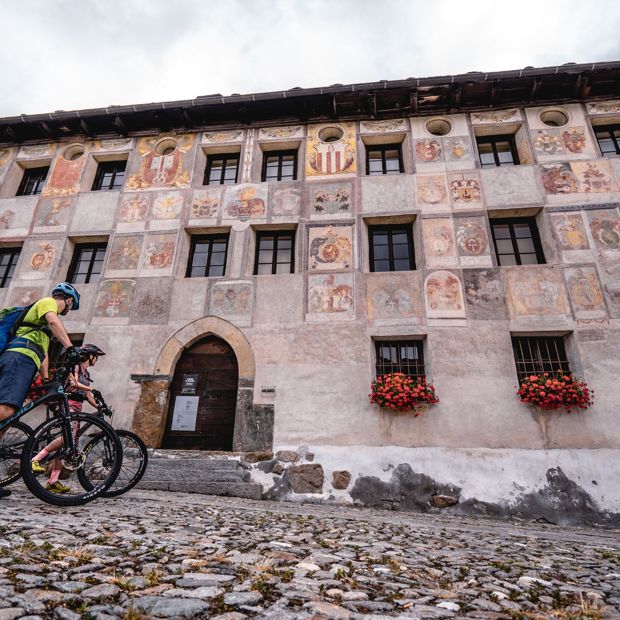
The route then continues towards Lottigna, home to the Blenio Museum, then descends along a trail to the Acquarossa Thermal Baths, a well-known place of cure throughout Switzerland. The current building, now closed since 1971, was inaugurated in 1886.
Continuing along the old Satro road, you arrive in the hamlet of Dongio passing through the grotto area and vineyards, where you can easily admire with the naked eye the Pagani house hanging on the rocks overlooking the village.
The path then continues between Motto and Malvaglia with a stretch of dirt road along the route of the Biasca-Acquarossa railway line, built in 1911 and dismantled in 1973. After crossing the hamlet of Malvaglia, the route heads towards its end, passing through Legiuna, a floodplain area of national importance.
The route winds along the valley floor past numerous testaments to the valley’s history. From Olivone towards Biasca, after passing the small village of Ponto Aquilesco and the hamlet of Aquila along mule tracks and hiking paths you reach the hamlet of Dangio and pass Cima Norma, the old chocolate factory which produced up to 1,500 tonnes of chocolate and employed more than 300 workers in the 1940s and 1950s, making a significant contribution to the valley’s economy in the last century.
A short rise on a path leads to the hill where the Curterio Castle once stood, although there are no significant remnants of it left today. The Oath of Torre was signed here in 1182, in which the inhabitants of Blenio and Leventina expressed their desire to remain free, with no jurisdiction other than that of the Milanese.
The route then continues towards Lottigna, home of the Blenio Museum, then descends along a path to the Terme di Acquarossa hot spring, renowned throughout Switzerland as a spa. The current building, which has been closed since 1971, was inaugurated in 1886.
Continuing along the old Satro road you arrive at the hamlet of Dongio, passing through an area of caves and vineyards, where the «houses of the pagans» can be made out hollowed out of the rocks overlooking the town.
The route then continues between Motto and Malvaglia on a section of dirt road following the Biasca-Acquarossa railway line, created in 1911 and dismantled in 1973. After passing through the hamlet of Malvaglia you take the end of the path from Legiuna, a floodplain of national importance.
Wear protection Correctly assess your abilities Give priority to hikers Stay on the path Close the gates
Careful planning of routes is the key to enjoying a route. Check in advance the weather and path conditions at local information centers. Depending on the season and weather conditions, the route may be closed or interrupted.
Highway A2, exit Biasca then direction Lukmanier until Olivone. Alternative: Lukmanier Pass then direction Biasca until Olivone.
Bus no. 62.131 - Biasca to Olivone or Bus no. 62.136 - Lukmanier Pass to Olivone (from June to October).
Free parking near the town hall of Olivone.
S1
Follow the mountain bike logo shown on the red signs: Valle di Blenio Bike no. 387
Populære ture i området
-
5.0
lago retico
lysVandring 9.81 km -
Cima del Simano (2580 m)
Vandring 9 km -
5.0
Cusié > Capanna Quarei > Laghetto dei Cadabi > Alpe di poxxo > Cusié
MediumVandring 13.0 km -
Capanna Quarnei
lysVandring 10.8 km -
5.0
Cancorì Bike (SvizzerMobile 383)
tungMountainbike 23.8 km -
Via Alta Crio
tungLangdistance-vandresti 106.0 km -
La Strada Alta della Leventina
Langdistance-vandresti 48.1 km -
Selvasecca Forest Reserve, Lucomagno
lysVandring 3.98 km -
Giro delle Tre Valli (SwitzerlandMobile 625)
MediumVandring 12.1 km -
Giro del Castello di Serravalle (SwitzerlandMobility 626)
Vandring 6.17 km
Vandring og sporing


Gå ikke glip af tilbud og inspiration til din næste ferie
Din e-mailadresse er blevet tilføjet til mailinglisten.