


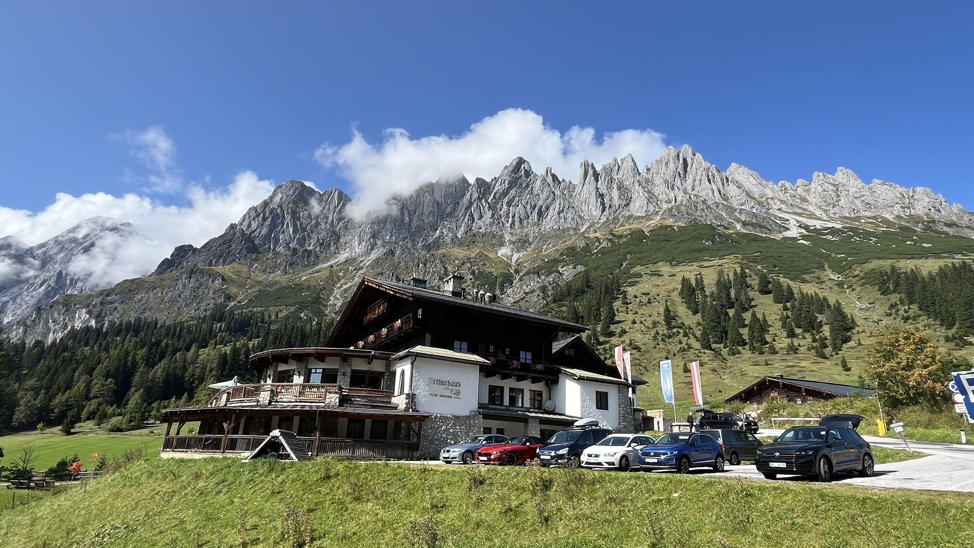
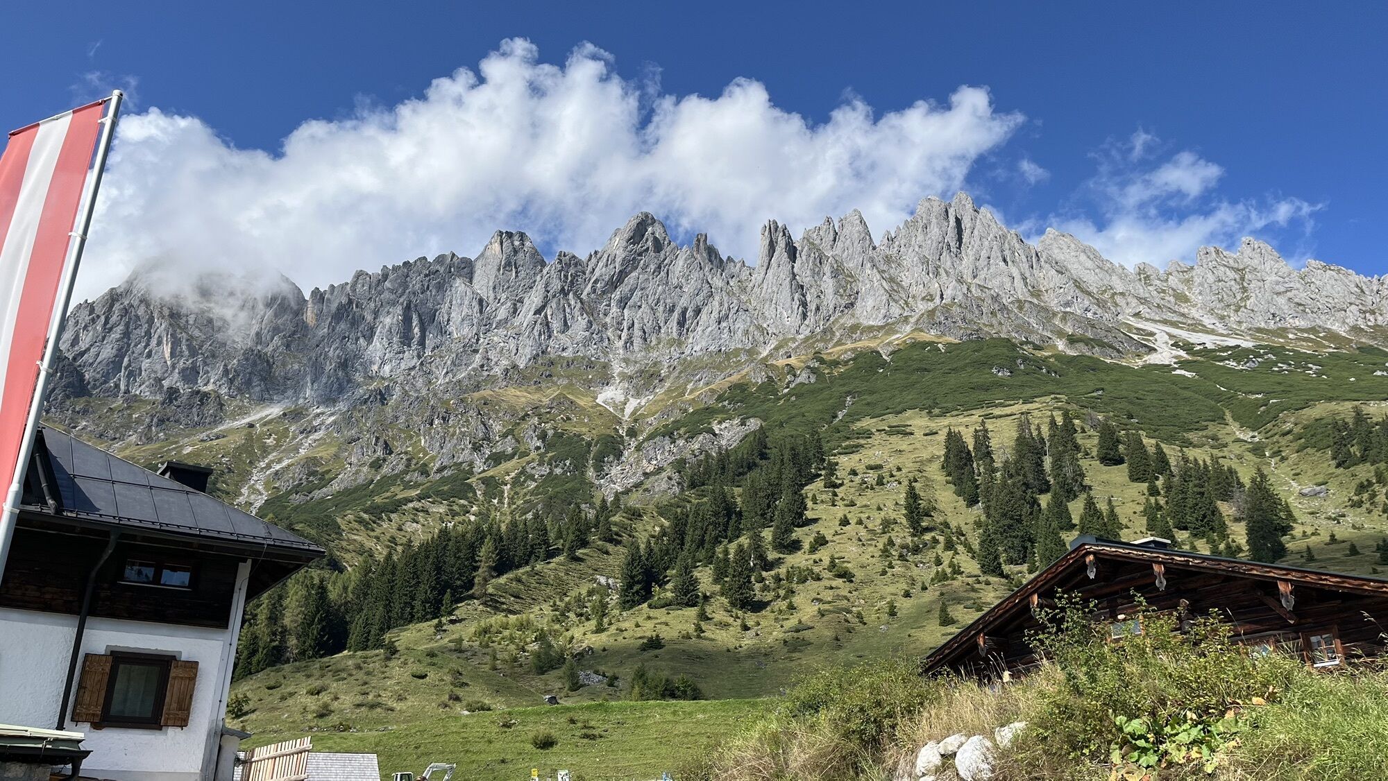
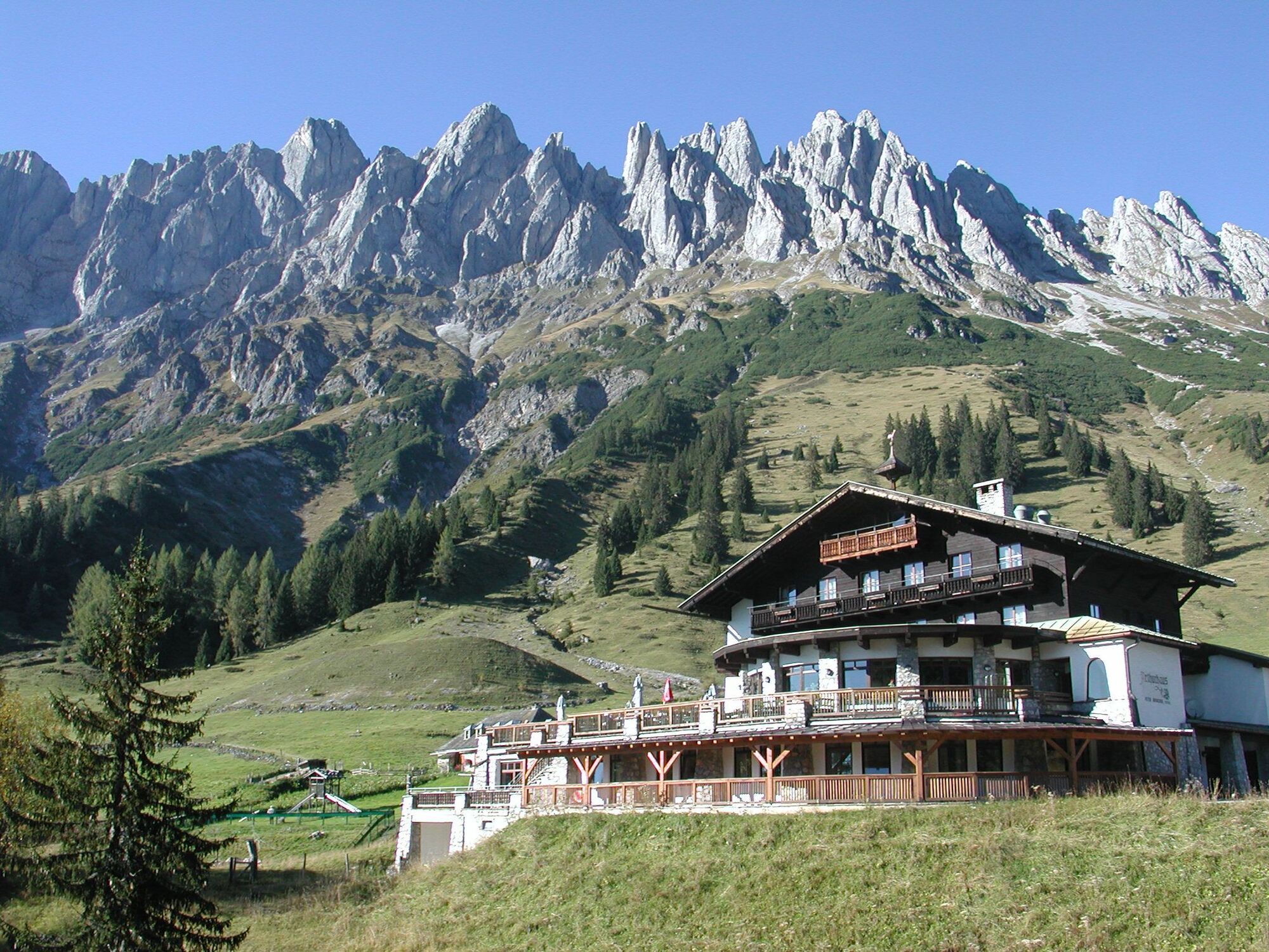
From the mountain hotel Arthurhaus follow path 85 uphill for a short distance to the Hochkeilweg, then downhill past the valley station of the "Rosswieslift" to the Keltenloch. Past the Hochkeilhaus continuing...
From the mountain hotel Arthurhaus follow path 85 uphill for a short distance to the Hochkeilweg, then downhill past the valley station of the "Rosswieslift" to the Keltenloch. Past the Hochkeilhaus continuing to Mandelwandstraße. At Mandlwandhaus you reach the entrance to the Barbara Gorge. The secured path that was once built by miners leads through the gorge. The trail joins below the Ruperti tunnel into the old Mitterberg road (Hochkönig sports hall), follow this downhill and turn left over a masonry arch bridge further through the high forest, turn right towards Viererwasch. Over the route of the old field railway or the old Mitterberg road, the path leads further to Kniegut. From there across the meadow to Bernhardgut. Immediately after turn right over the meadow, continue down to Schrammbach, following the path to Mühlbach.
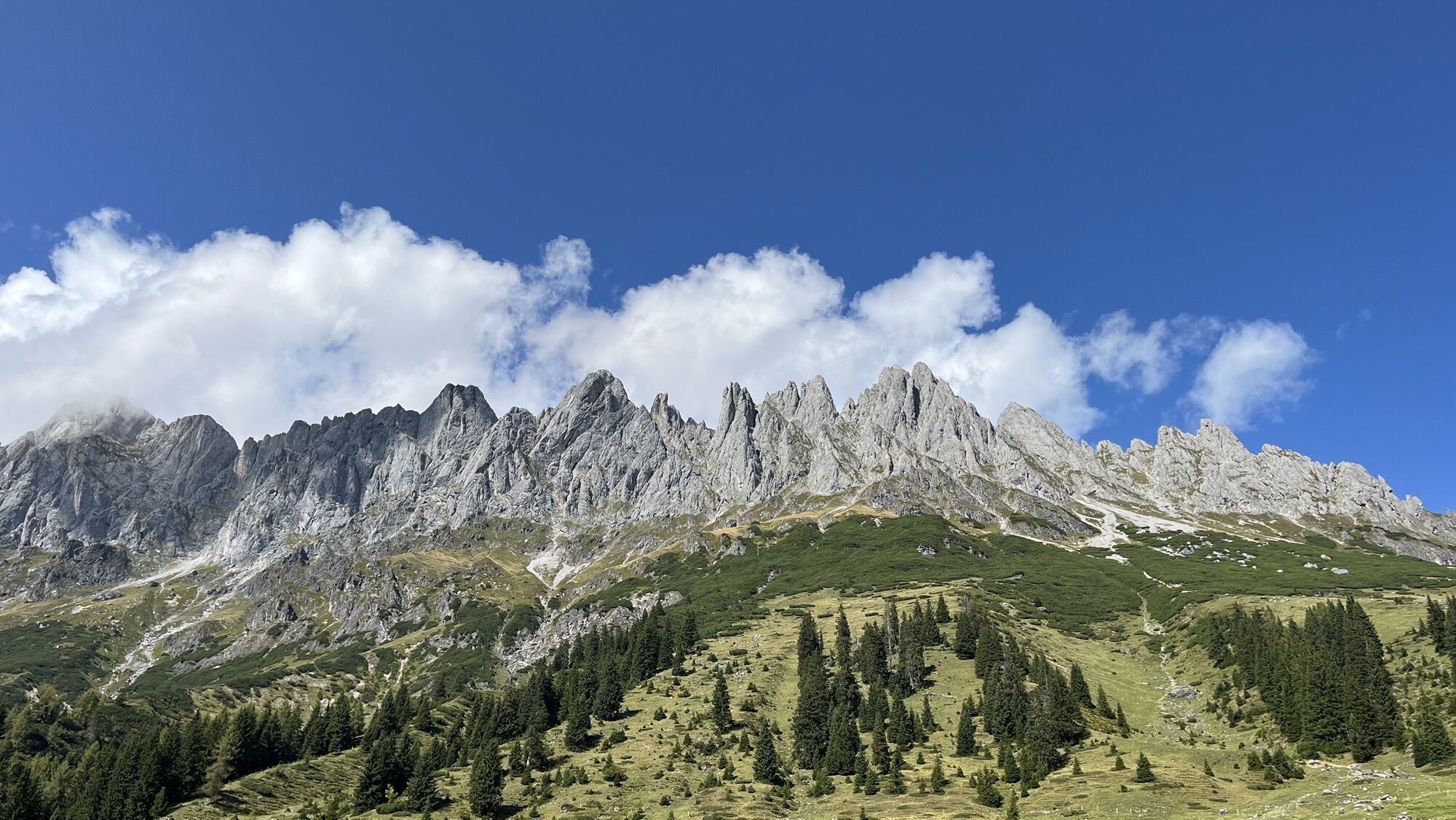
From the starting point „Arthurhaus“ you always follow the path No. 85 past the extraction sites of the prehistoric copper mining, downhill to the tunnels of the modern copper mining and former processing plants. Then it goes on a trail through the romantic Barbara Gorge. This flows below the Ruperti tunnel into the old Mitterberg road. You follow this downhill and over a masonry arch bridge further through the high forest to the Viererwasch. The path leads over the route of the old field railway to the Kniegut and further to Mühlbach.
Ja
Ja
Sturdy, ankle-high footwear
Hiking clothing
Hiking poles
Headgear
Sunscreen and sunglasses with UV protection
Rain protection
Drinks and a small snack
Necessary medications
First aid kit
Hiking map
Self-assessment: Before every mountain tour, check your physical fitness and correctly estimate your strength as well as that of your companions – especially your children! Sure-footedness and a head for heights are often very important!
Planning and preparation: Plan every intended mountain tour carefully in advance. Hiking maps and guides, as well as information from alpine clubs and locals such as mountain guides and hut hosts, can be helpful.
Equipment: On the mountain you need appropriate equipment and clothing, especially sturdy, high footwear with a grippy sole. Weather and cold protection are essential; weather can often change unexpectedly.
Weather forecasts: Observe current weather conditions at: zamg.at or www.uwz.at.
Togetherness: Observe the 10 rules for proper conduct with grazing animals and leave no waste in nature!
Do not kick stones: Do not kick stones because this can seriously endanger other hikers. Marked areas with falling rock danger should be crossed as quickly and carefully as possible.
Turn back on time: This is not a shame but a sign of reason. It becomes necessary when the weather changes, fog sets in, or if the trail is too difficult or not in good condition.
Emergency numbers: Alpine emergency: 140, International emergency: 112, Rescue: 144
Coming from Bischofshofen on the B164, turn right and take Mandelwandstraße to the end (approx. 8 km). Parking available at Arthurhaus.
Coming from Bischofshofen on the B164 into the town, park at the fire station and take the hiking bus to the starting point at Arthurhaus.
Coming from Maria Alm on the B164 into the town, park at the fire station and take the hiking bus to the starting point at Arthurhaus.
Coming from Maria Alm on the B164 through the town, turn left and take Mandelwandstraße to the end (approx. 8 km). Parking available at Arthurhaus.
Train: Station Bischofshofen - ÖBB Scotty
Bus: Line 591 to the stop Kabinenbahn Karbachalm - schedule information
Parking available at Arthurhaus.
In town parking available at the fire station parking lot.
More information on hikes and activities in the Hochkönig region:
For detailed information about hiking maps, summer opening times of mountain lifts as well as huts and alpine pastures, we recommend visiting the service center on site. There you will not only get the hiking map but also valuable tips on the best hiking routes and current conditions.
Summer opening times of mountain lifts: The mountain lifts offer different opening times during summer months, which can vary depending on weather and season. Please check the current operating hours in advance.
Summer opening times of huts & alpines pastures: The huts and alpine pastures in the region are ideal resting places for hikers. Here too, opening times can vary depending on season and weekday. Let the friendly hosts advise you on local offers and specialties.
For further information please visit our website: www.hochkoenig.at.
If you have questions or want specific information, feel free to contact us:
Email: region@hochkoenig.at
Telephone: +43 (0)6584 20388
We look forward to helping you and wish you much fun exploring the beautiful hiking region Hochkönig!
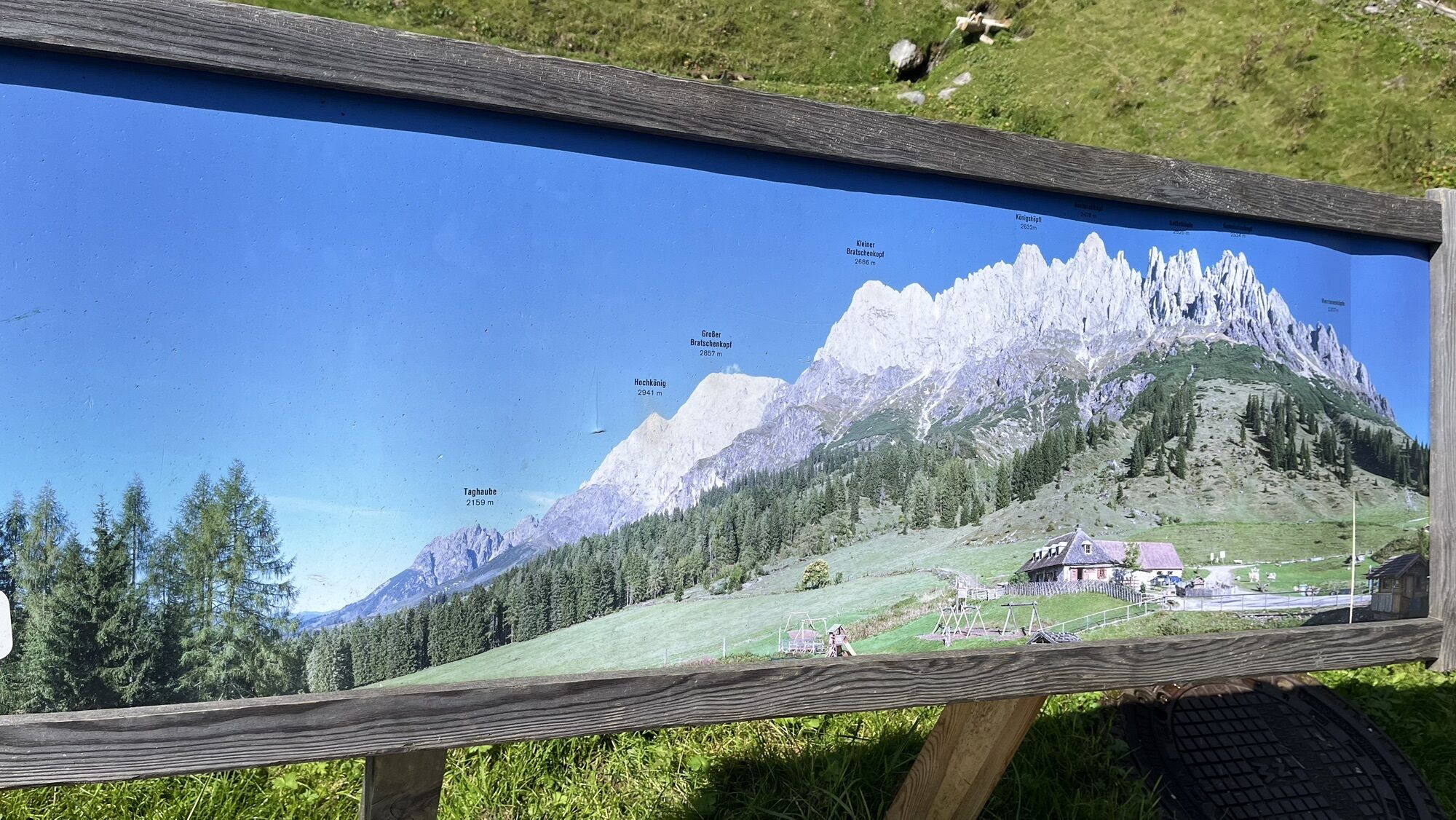
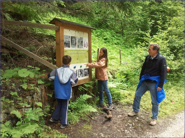
Take time to read the information boards to learn as much as possible about copper mining in Mühlbach.
Populære ture i området
-
4.8
Summit storming route Taghaube
tungVandring 6.25 km -
4.9
Hochkönig - Gipfel der Gefühle - Matrashaus
tungVandring 20.9 km -
3.8
Hochkönig summit route - main ascent
tungVandring 18.1 km -
4.7
Panorama hike to the Hochkeil
MediumVandring 6.07 km -
4.8
Summit stormer route Lauskopf
tungVandring 8.16 km -
3.6
Wanderung zur Ostpreußenhütte in Werfen (1.630 m)
MediumVandring 11.2 km -
4.7
About the "Four Huts circular route" to Windraucheggalm
MediumVandring 10.1 km -
3.7
Auf die Ostpreussenhütte
MediumVandring 16.6 km -
3.9
Mühlbacher Höhenweg
MediumVandring 11.2 km -
4.8
Großarl: Mooslehenalm – Niggeltalalm – Viehhausalm
MediumVandring 5.44 km
Vandring og sporing


Gå ikke glip af tilbud og inspiration til din næste ferie
Din e-mailadresse er blevet tilføjet til mailinglisten.