


Sværhedsgrad: 1


The Achleit circuit is a very popular route for walkers and runners. The Achleit circuit offers a route through nature. You start directly in Mittersill and then run along the so-called "Schinterpalfen"...
The Achleit circuit is a very popular route for walkers and runners. The Achleit circuit offers a route through nature. You start directly in Mittersill and then run along the so-called "Schinterpalfen" through quiet residential areas until, after a short climb, you reach the edge of the forest. The path then continues somewhat flatter through a bright forest section to the district of Rettenbach. Here you switch to the asphalt road and cross the Salzach. The return route is completely flat along the Salzach on the Tauern cycle path.

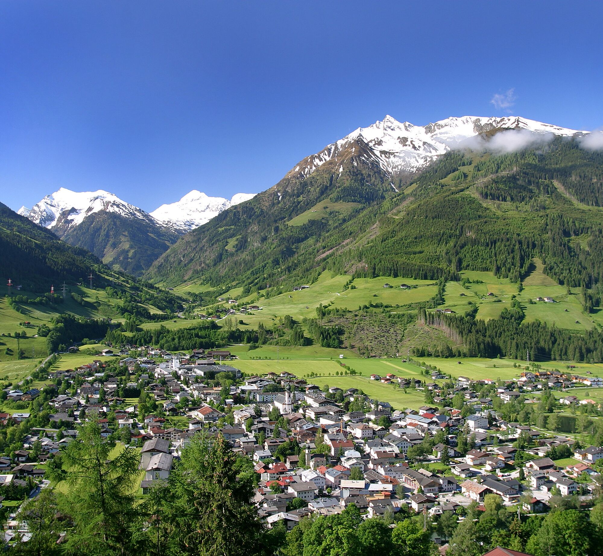
The starting point is at Mittersill station. You walk right over the Salzach bridge and immediately after the bridge turn right onto a narrow path. At the end of the narrow path, you walk straight ahead, past the Caritas center and the flag gardener. You follow the path along the Salzach (Kürsingerdamm) straight ahead until the next bridge in Rettenbach. There you walk right over the bridge and follow the road. At the first intersection, turn right. There is a short uphill section. At the fork, keep right again and follow the street (Achleitweg). Now it goes straight ahead. You walk along the sidewalk, pass some farms and briefly cross meadows and woods. Then you follow the asphalt road downhill. Now you are on Wachtlehenweg, which you follow. After a few minutes, you will be back at the starting point, at Mittersill station.
Running shoes with a slightly firmer tread for the forest section.
Especially on hot days, take something to drink with you!
Coming from all directions to Mittersill station
Mittersill station is easily accessible by the Pinzgauer Lokalbahn or ÖBB buses.
There are plenty of free parking spaces at Mittersill station.
1
Mittersill Plus GmbH, Zeller Straße 2, 5730 Mittersill, Tel. +43(0) 6562 4292
The optimal route to run a varied circuit.
Populære ture i området
-
3.6
Smaragdwanderweg Habachtal/Bramberg
lysVandring 7.17 km -
4.7
Tristkogel
tungVandring 15.6 km -
4.4
Bramberg: Smaragdweg
lysTemaspor 7.27 km -
4.5
Smaragdweg
lysVandring 7.84 km -
3.3
Wildkogel Arena: The longest illuminated sled run in the world
tungKælkning 12.0 km -
5.0
Manlitzkogel
tungVandring 13.4 km -
3.8
Mittersill - Hintersee und Plattachsee
tungVandring 9.90 km -
4.7
Smaragdweg, Habachtal, Bramberg
lysVandring 15.5 km -
4.7
Frühmesser
MediumVandring 10.6 km -
3.3
Hinterglemm: Talschluß-Höhenweg
lysVandring 10.8 km

Vandring og sporing


Gå ikke glip af tilbud og inspiration til din næste ferie
Din e-mailadresse er blevet tilføjet til mailinglisten.