Road bike route: Klingenthal-Pöhl-Mylau-Schönheide
Medium
Landevejscykel
Naviger
Naviger
Få denne tur på din mobiltelefon
Kort
Road bike route: Klingenthal-Pöhl-Mylau-Schönheide
Medium
Landevejscykel
118.55 km
Scan QR-koden, og start navigationen i bergfex -appen
QR Code
Vandring og sporing
Vandring og sporing

Road bike route: Klingenthal-Pöhl-Mylau-Schönheide

Medium
Landevejscykel
Afstand
118.55 km
Varighed
06:39 h
Opstigning
1357 hm
Havets niveau
299 - 768 m
Download af spor
Kort
Road bike route: Klingenthal-Pöhl-Mylau-Schönheide
Medium
Landevejscykel
118.55 km

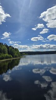
The route leads from Klingenthal past the Pöhl dam to the Göltzschtal Bridge and back via Auerbach and the space town Morgenröthe-Rautenkranz. Besides the impressive landscapes and tourist highlights,...


Beskrivelse af

The route leads from Klingenthal past the Pöhl dam to the Göltzschtal Bridge and back via Auerbach and the space town Morgenröthe-Rautenkranz. Besides the impressive landscapes and tourist highlights, both climbing sections and long distances can be experienced on this route.
Rute
Rute
Kort
Road bike route: Klingenthal-Pöhl-Mylau-Schönheide
Medium
Landevejscykel
118.55 km
Klingenthal
(554 m)
By
0.4 km
Brunndöbra
(581 m)
Nabolag
2.9 km
Zur Talsperre
(714 m)
Restaurant
10.6 km
Muldenberg
(708 m)
Landsby
11.1 km
Der Bayerische Hof
(703 m)
Restaurant
15.6 km
Zur Turnhalle
(710 m)
Restaurant
16.1 km
Grünbach
(702 m)
Landsby
16.3 km
Kinderspielvogtland Grünbach e.V.
(699 m)
Restaurant
16.8 km
Siehdichfür
(641 m)
Afregning
18.0 km
Werda
(627 m)
Landsby
22.8 km
Kottengrün
(576 m)
Landsby
24.2 km
Lottengrün
(528 m)
Landsby
27.6 km
Theuma
(484 m)
Landsby
31.1 km
Maria-Magdalena
(483 m)
Sted for tilbedelse
31.2 km
Lochschänke
(438 m)
Afregning
34.0 km
Neuensalz
(411 m)
Landsby
35.7 km
Gasthof Voigtsgrün
(437 m)
Restaurant
37.6 km
Voigtsgruen
(434 m)
Landsby
37.6 km
Gasthaus Edelweiß
(371 m)
Restaurant
40.7 km
Möschwitz
(368 m)
Landsby
40.7 km
Plauen
(366 m)
By
40.7 km
Alt-Jocketa
(404 m)
Landsby
44.0 km
Neudörfel
(408 m)
Landsby
45.4 km
zum Posthaus
(427 m)
Restaurant
45.7 km
Foschenroda
(421 m)
Landsby
51.1 km
Dungersgrün
(383 m)
Landsby
52.1 km
Netzschkau
(349 m)
By
53.0 km
St. Joseph
(340 m)
Sted for tilbedelse
53.4 km
Mylau
(303 m)
Nabolag
55.1 km
Mühlwand
(324 m)
Landsby
58.0 km
Weißensand
(356 m)
Landsby
61.3 km
Wolfspfütz
(403 m)
Afregning
64.5 km
Treuen
(428 m)
By
68.1 km
Veitenhäuser
(436 m)
Afregning
69.7 km
Schreiersgrün
(450 m)
Landsby
70.5 km
Kuxenberghäuser
(460 m)
Topmøde
71.6 km
Rebesgrün
(503 m)
Nabolag
73.6 km
Auerbach/Vogtland
(555 m)
By
76.9 km
St. Laurentius
(477 m)
Sted for tilbedelse
77.0 km
Gasthof zur Eiche
(556 m)
Restaurant
78.4 km
Hinterhain
(542 m)
Nabolag
78.4 km
Hohengrün
(626 m)
Nabolag
80.6 km
Kirche Beerheide
(666 m)
Sted for tilbedelse
81.9 km
Beerheide
(669 m)
Nabolag
82.1 km
Altes Kaffeehaus
(685 m)
Restaurant
83.7 km
Zöbischhaus
(726 m)
Restaurant
85.8 km
Carolagrün
(656 m)
Afregning
90.0 km
Schönheide Süd
(598 m)
Jernbanestation
93.1 km
Morgenröthe-Rautenkranz
(629 m)
Landsby
96.6 km
Landgasthof & Pension Frischhütte
(623 m)
Restaurant
96.6 km
Muldenhammer
(624 m)
Afregning
97.7 km
Tannenbergsthal (Vogtl)
(629 m)
Jernbanestation
98.5 km
Jägersgrün
(632 m)
Landsby
98.9 km
Pizzaria Pension Damiano
(635 m)
Restaurant
99.1 km
Hammerbrücke
(678 m)
Landsby
104.7 km
Spielplatz am Sportplatz Hammerbrücke
(683 m)
Legeplads
104.8 km
Muldenberg
(708 m)
Landsby
107.2 km
Zur Talsperre
(714 m)
Restaurant
107.9 km
Brunndöbra
(581 m)
Nabolag
115.6 km
Klingenthal
(554 m)
By
118.1 km
Beskrivelse af

Very demanding, scenic road bike route.

Teknologi
n.a.
Tilstand
4 / 6
Landskab
5 / 6
Erfaring
4 / 6
Bedste tid på året
Jan
Feb
Mar
Apr
Maj
Jun
Jul
Aug
Sep
Okt
Nov
Dec
Del tur
Kort
Road bike route: Klingenthal-Pöhl-Mylau-Schönheide
Medium
Landevejscykel
118.55 km
Fejl
Der er opstået en fejl. Prøv venligst igen.
Information om ruten
Rute

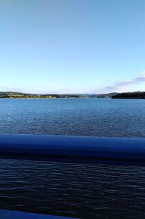
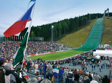
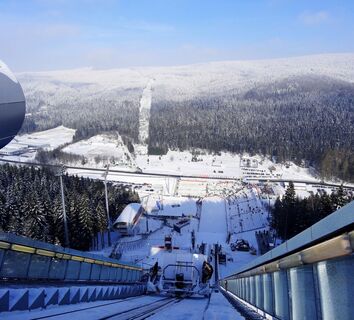
We start at the train station in Klingenthal heading towards Muldenberg. Passing the Vogtland ski jump, we reach Muldenberg after a climbing section. Here, we continue in the direction of Grünbach and then turn left towards Neudorf onto smaller roads. Through Werda, Kottengrün, and Lottengrün, we reach Theuma. Shortly after the town, we cross the B169 towards Neuensalz and then leave the B169 again heading towards Voigtsgrün and on to Möschwitz. We pass the Gunzenberg campsite and cross the dam to Neudörfel and Netzschkau. If interested, you can take a small detour to the Göltzschtal Bridge in Mylau. In Mylau, we turn towards Mühlwand and Weißensand to Lengenfeld. Just before reaching Lengenfeld, we take the right junction to Treuen and continue via Schreiersgrün towards Auerbach. Through Auerbach, we take the junction to Grünheide and further over smaller side roads towards Morgenröthe-Rautenkranz, Muldenhammer, and Muldenberg back to Klingenthal. 

Geologiske højdepunkter

Ja

Envejstur

Ja

Udstyr

Professional equipment highly recommended.

Sikkerhedsinstruktioner

The road bike route has been tested with road cyclists. However, personal fitness must absolutely be considered and self-critically assessed by the cyclist.

Please pay attention to your safety as you are on public roads!

Information om ankomst
Ankomst

You can reach Klingenthal via the A72 (exit Plauen South) and the B92 / B283.

Offentlig transport

Klingenthal train station (entry is also possible in Reichenbach or Muldenberg)

Parkering

Public parking is available in the area of the train station.

Yderligere information og tips
Yderligere information

This route can also be done as a climb starting from Reichenbach, as this is the lowest point at 299 meters elevation. Normally, the athlete first rides a short climb, then a long descent, followed by another long climb, and at the end another short descent to cool down.

Tips

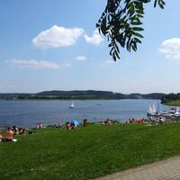
Swimming in the Pöhl, counting stones at the Göltzschtal Bridge, and lifting off at the space exhibition - lots of fun!

Vandring og sporing

Vandring og sporing

Vandring og sporing
Over 550.000 turforslag, detaljerede kort og en intuitiv ruteplanlægger gør appen til et must-have for alle naturentusiaster.
Vandring og sporing