


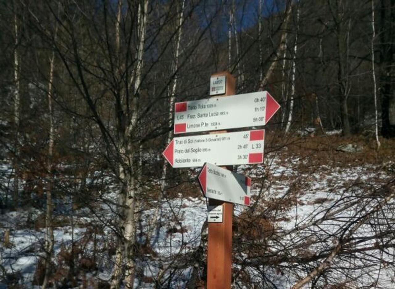
For cycle hikers or more trained hikers who want to link the first and second stages of the Vermenagna ring, there is the possibility of continuing at high altitude along the Vallone di San Giovanni, following...
For cycle hikers or more trained hikers who want to link the first and second stages of the Vermenagna ring, there is the possibility of continuing at high altitude along the Vallone di San Giovanni, following the CNAL08 path from Tetto Caia and up to the crossroads for the Ceresole Pass. From the L08/04 sign post, turn right and continue towards Tetto Gaspard and Limone, descending into the Vallone Salet and rejoining the route of the second stage, near Tetto Tola.

Populære ture i området
-
Giro del Marguareis tapa 4 variante
MediumVandring 14.5 km -
anello s giacu
Vandring 17.1 km -
GTA Upper variant of Marguareis: Stage 68A Limonetto - Rifugio Don Barbera
MediumVandring 19.6 km -
Roccasparvera - Cuneo / Pagarine Route (stage 10)
MediumVandring 15.9 km -
San Giacomo di Entracque - Valdieri / Pagarine route (stage 8)
MediumVandring 19.6 km -
Tour of Marguareis Stage 1 | Pian delle Gorre - Garelli refuge
MediumVandring 7.34 km -
Car-free Piedmont | Vernante-Limone Piemonte
tungLangdistance-vandresti 29.6 km -
Traversata scialpinistica delle Alpi Liguri. Terza tappa.
tungSkitour 19.6 km -
Tour of Marguareis | Stage 5 Don Barbera refuge - Pian delle Gorre
MediumVandring 17.9 km -
Giro del Marguareis | Tappa 2 Rifugio Garelli - Rifugio Mondovì
MediumVandring 4.88 km
Vandring og sporing


Gå ikke glip af tilbud og inspiration til din næste ferie
Din e-mailadresse er blevet tilføjet til mailinglisten.