


In 1689 the Waldenses exiled in Switzerland and led by the shepherd and commander Arnaud Henri, took 13 days to cover the 250 km that separated them from their lands of origin. The memorable enterprise...
In 1689 the Waldenses exiled in Switzerland and led by the shepherd and commander Arnaud Henri, took 13 days to cover the 250 km that separated them from their lands of origin. The memorable enterprise towards the return to freedom has gone down in history with the name of "Glorieuse Rentrée". The hiking route crosses environments of high naturalistic value, including natural parks and sites of the Natura 2000 ecological network. The second stage is demanding but extremely suggestive in its panoramas and glimpses, such as that of the "Dolomitic" 4 Denti di Chiomonte, the Fort of Exilles, the village of Salbertrand and the Gran Bosco Park, retracing the ascent along the paths that the Waldensians made while fleeing into the woods after forcing the garrison of the Franco-Piedmontese army at the Chenebiere bridge. The itinerary also crosses the Via Alpina the Balcony Path and the GTA. This long stage can be interrupted and an overnight stay at the Levi Molinari Refuge is recommended. The itinerary is being promoted within the platform as part of the PITEM M.I.T.O. project. – Outdoor OFF - Interreg Italy-France Cross-Border Cooperation Program ALCOTRA 2014-2020.

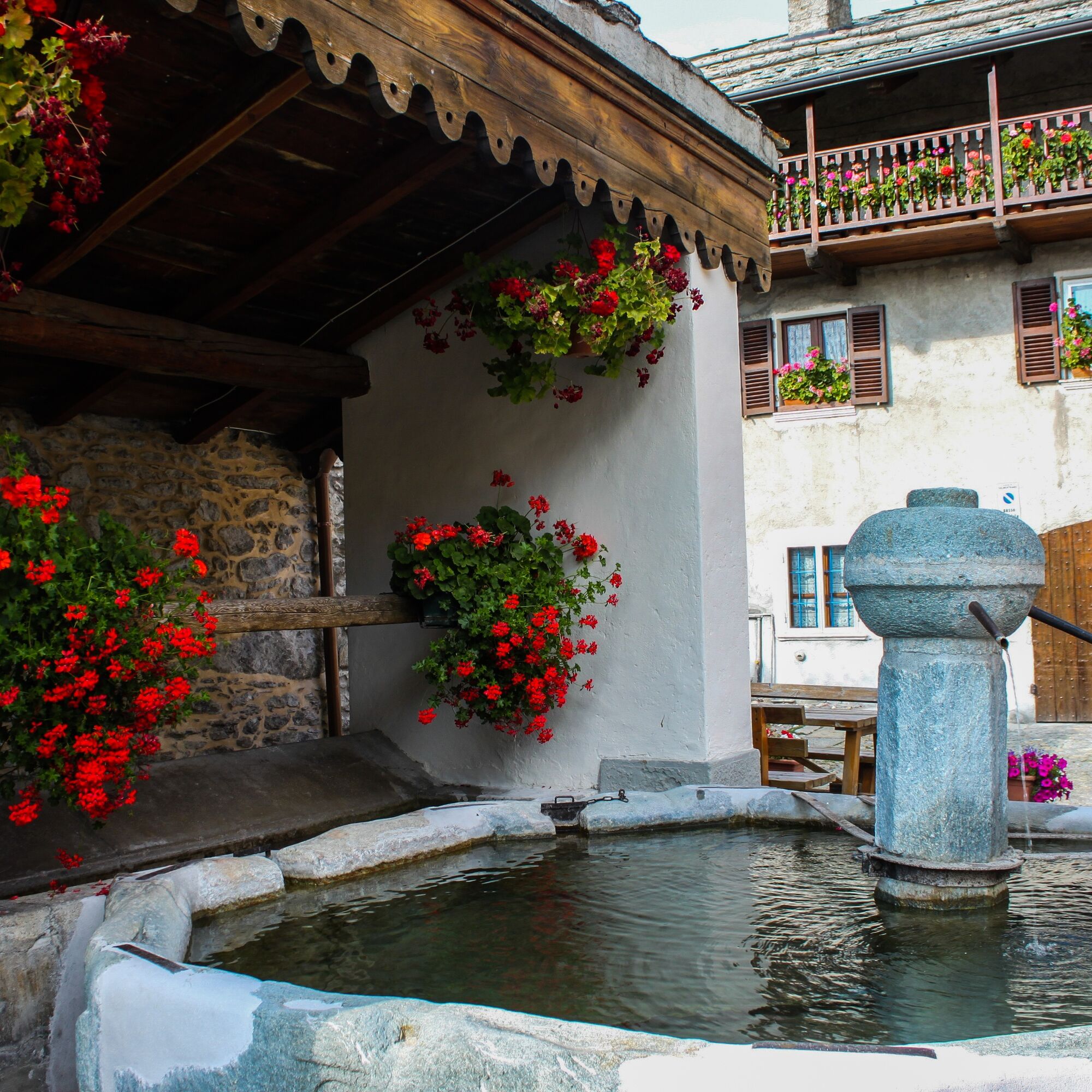
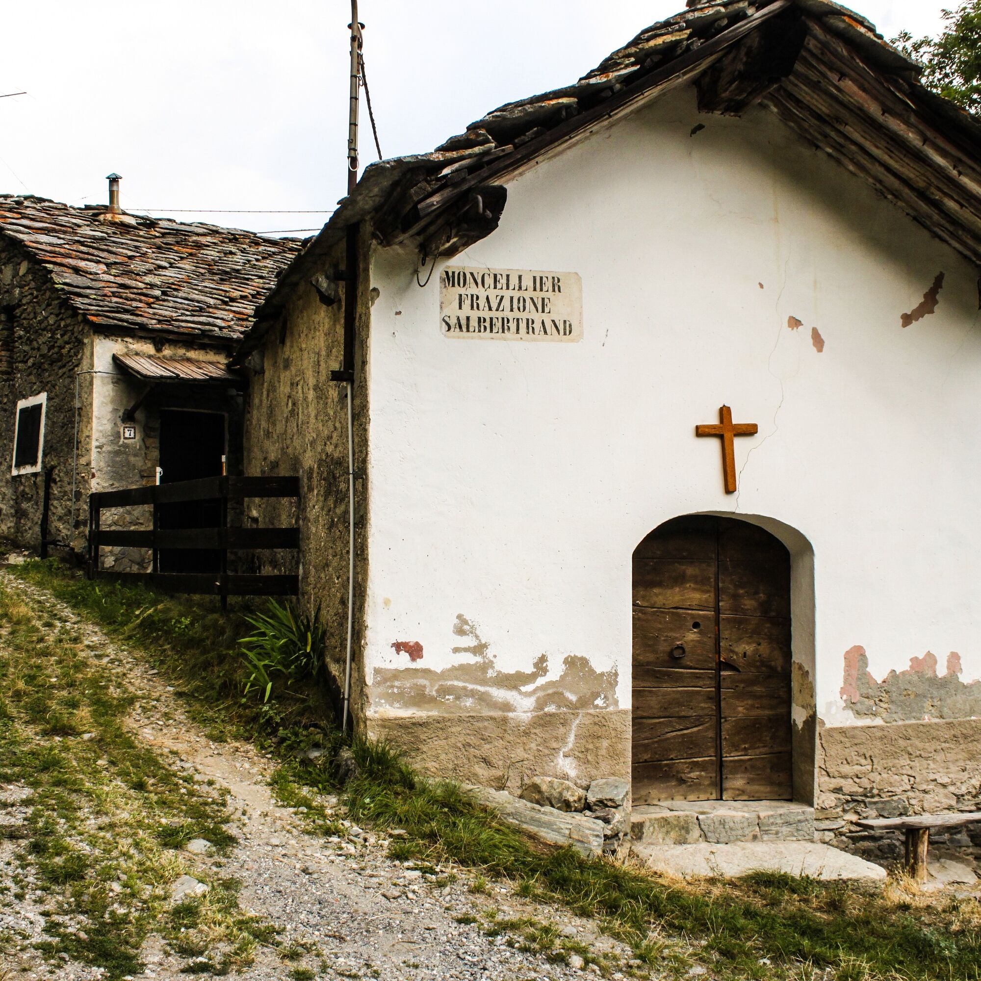
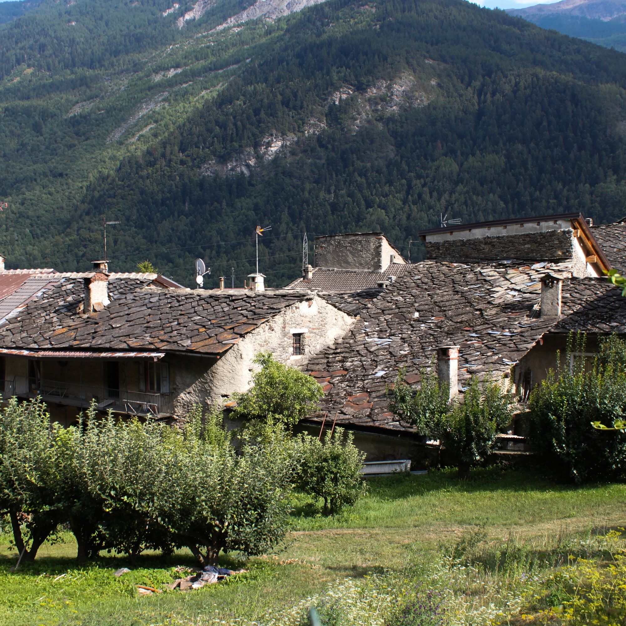
From the hamlet of San Giacomo, take the path that leads to Borgata Tiraculo in three quarters of an hour. From here, continue up to Grange Thullie, crossing a wood first of chestnut and then of conifers, in another two hours you are at Grange Thullie. At the crossroads, go left for the Quattro Denti (Sentiero Balcone), a peak that can be reached in about half an hour. Immediately below Cima Quattro Denti, ignoring all the paths that lead towards the valley, continue along the hillside and keeping to the right you arrive at Pertus di Colombano Romean (hydraulic work from 1533). Continue along the narrow path that crosses a larch forest at high altitude with beautiful views of the Forte di Exilles, Salbertrand and the Oulx basin, dominated by Mount Chaberton, always keeping the same direction until you reach the Clot Brun pasture. At this point the path ends and you take the dirt road towards the valley, which is blocked shortly after with a rudimentary fence. Arrived at the bend below, continue in the woods with a path. You cross a first stream and then a second one. The path ends shortly thereafter and a cart track on a grassy surface now takes shape near Grange della Valle. You cross the hamlet between the houses, passing two fountains and exiting in front of a church. Continue on the dirt road that climbs from S. Colombano towards the bridge over the Rio di Galambra which takes its name from the valley of the same name. On the right, passing in front of the Colonia Alpina Viberti along the dirt road, you will reach the Levi Molinari Refuge in a few minutes, while on the left, the dirt road becomes a paved road in the direction of Eclause. This long stage can be interrupted here by staying overnight at the Levi Molinari Hut, in which case you would reach Montagne Seu at the Arlaud Hut, splitting the stage in two and lengthening the itinerary by a day. If you continue, instead of climbing to the right at the refuge, you cross the Galambra stream on the paved road: after about 200 meters, take the path to Soullier, Margaria, Combes on the left in front of a widening. The path that follows the water pipe becomes a dirt road. You pass under Alpe Soullier and ignoring two detours, for Margaria Superiore you head towards Strada Combes (Via Alpina-Sentiero Balcone). You come out of the wood, take a stretch of mule track bordered by stone walls and start a turn with steep descents towards Combes. It passes between the stone houses of Combes until it crosses the GTA. At the Combes fountain, turn right and climb the GTA about 150 meters to arrive at Eclause. After crossing the village, you cross the road that comes from the Grange della Valle and continue on the GTA-Via Alpina path. Salbertrand and the Gran Bosco appear. Having reached Moncellier di sopra, cross the asphalted roadway of Pramand and reach Moncellier di sotto, always walking along the old mule track until you reach the square of the church of Salbertrand (1038 m asl) from here you descend until you cross an under pass state road 24, then take the first road on the right which with a single bridge crosses both the railway and the Dora. Immediately after the bridge, turn right following a dirt road which runs alongside the Dora and passes between a playground on the right and a sports field on the left, continue under an A32 motorway viaduct until you reach the bridge over the Dora after about 600 meters at right said of the Chenebieres. At this point, turn left, where after a few meters there is the Cippus and a notice board commemorating the battle against the French to cross the bridge, which determined the success of the entire enterprise. The road winds slightly uphill for about 500 meters until it reaches another dirt road that comes from Salbertrand, where you turn left crossing a small wooden bridge over the stream called "Rio delle Gorge". After 50 meters on the right is the start of the GTA path which, with a difference in altitude of about 750 meters, leads to Montagne Seu crossing the Grange d'Himbert.
Ja
Copertura cellulare
Parziale
From Susa Taxi service to Giaglione A Salbertand Railway and Bus station
http://www.lestradedeivaldesi.it/it/san-giacomo-di-giaglione-salbertrand.html
The Grange Thullie Alp, used even if in ruins the Thullie trou, an underground canal of which a hole can be seen in one wall, which brings water from the Tiraculo valley to the Susa Valley the peak of the Quattro Denti (2024 m above sea level) the Thullie tunnel, just down from the Quattro Denti: designed and dug from 1526 to 1533 by Colombano Romean di Chiomonte, it is a tunnel-aqueduct that brought fertility to a sterile slope. The Exilles fort that can be seen from above, the beautiful villages of Combes, pais d’oc, Eclause (late-Gothic bell tower, a carved stone window on the small square of the fountain), Salbertrand with the late-Gothic parish church of San Giovanni Battista (11th –14th century).
Populære ture i området
-
5.0
BARDONECCHIA Decauville
lysVandring 7.29 km -
BARDONECCHIA Colle Sommeiller
MediumMountainbike 25.4 km -
SESTRIERE Assietta Road
MediumMountainbike 43.3 km -
La Via dei Saraceni (Sauze d'Oulx)
MediumMountainbike 33.6 km -
BARDONECCHIA Decauville - Rifugio Scarfiotti Ring
lysMountainbike 34.0 km -
Sentiero Italia: Salbertrand - Bardonecchia
MediumVandring 19.5 km -
Trail Sentiero Balcone: Stage 6 Chateau Beaulard - Cesana Torinese
MediumVandring 17.5 km -
5.0
BARDONECCHIA Forte Jafferau Ring
tungMountainbike 36.8 km -
Jouvenceaux-Gad/Cotantin (n°9)
lysVandring 2.82 km -
BARDONECCHIA Forte Foens - Galleria dei Saraceni - Forte Pramand
MediumMountainbike 34.3 km

Vandring og sporing


Gå ikke glip af tilbud og inspiration til din næste ferie
Din e-mailadresse er blevet tilføjet til mailinglisten.