Chläggi-Route
tung
Cykling
Naviger
Naviger
Få denne tur på din mobiltelefon
Kort
Chläggi-Route
tung
Cykling
58.06 km
Scan QR-koden, og start navigationen i bergfex -appen
QR Code
Vandring og sporing
Vandring og sporing

Chläggi-Route

Afstand
58.06 km
Varighed
04:30 h
Opstigning
691 hm
Havets niveau
360 - 622 m

Sværhedsgrad: 3

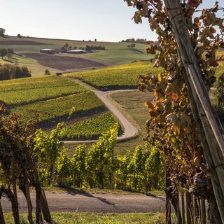
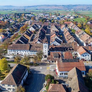
Cycle through the rural Klettgau, through endless vineyards, past breathtaking viewpoints, through lush meadows and rustling forests. Let yourself be enchanted by the charm of the wine-growing villages...


Beskrivelse af

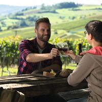
Cycle through the rural Klettgau, through endless vineyards, past breathtaking viewpoints, through lush meadows and rustling forests. Let yourself be enchanted by the charm of the wine-growing villages and treat yourself to a good drop in one of the numerous cozy wine cellars.

The Chläggi-Route offers you a varied experience with culinary, cultural and scenic highlights. Discover a part of the Regional Nature Park Schaffhausen on two wheels.
Rute
Schaffhausen
(403 m)
By
0.3 km
Neuhausen
(410 m)
By
3.4 km
Reformierte Kirche
(467 m)
Sted for tilbedelse
8.3 km
Reformierte Dorfkirche St. Moritz
(432 m)
Sted for tilbedelse
18.8 km
Freie Evangelische Gemeinde
(425 m)
Sted for tilbedelse
34.0 km
Reformierte Kirche St. Jakob
(446 m)
Sted for tilbedelse
36.8 km
Reformierte Kirche
(413 m)
Sted for tilbedelse
54.7 km
Rute
Kort
Chläggi-Route
tung
Cykling
58.06 km
Schaffhausen
(404 m)
Jernbanestation
0.1 km
Schaffhausen
(403 m)
By
0.3 km
Gemeinde für Christus
(405 m)
Sted for tilbedelse
0.4 km
Neuapostolische Kirche
(387 m)
Sted for tilbedelse
1.6 km
Flurlingen
(413 m)
Landsby
2.1 km
Neuhausen
(397 m)
Jernbanestation
2.4 km
Neuhausen
(410 m)
By
3.4 km
Wirtschaft zum Bahnhof
(447 m)
Restaurant
7.3 km
Beringen
(449 m)
Landsby
8.0 km
Restaurant Gemeindehaus
(455 m)
Restaurant
8.2 km
Restaurant Ochsen
(455 m)
Restaurant
8.2 km
Reformierte Kirche
(467 m)
Sted for tilbedelse
8.3 km
Löhningen
(479 m)
Landsby
9.8 km
Restaurant Weinstube Klettgauerhof
(428 m)
Restaurant
14.8 km
Neunkirch
(429 m)
Landsby
14.8 km
Gmaandhuus8213
(427 m)
Restaurant
14.9 km
Städtlikirche
(427 m)
Sted for tilbedelse
14.9 km
Neunkirch
(427 m)
Jernbanestation
15.2 km
Reformierte Dorfkirche St. Moritz
(432 m)
Sted for tilbedelse
18.8 km
Trattoria La Calabrisella
(433 m)
Restaurant
18.8 km
Rathauskeller
(427 m)
Restaurant
18.9 km
Hallau
(421 m)
Landsby
19.1 km
Oberi Egg
(565 m)
Korridor/terræn
26.2 km
Berghaus
(567 m)
Korridor/terræn
28.8 km
Trasadingen
(403 m)
Landsby
31.1 km
Freie Evangelische Gemeinde
(425 m)
Sted for tilbedelse
34.0 km
Wilchingen
(419 m)
Landsby
34.5 km
Rest. Trauben
(424 m)
Restaurant
34.5 km
Gwelb
(423 m)
Afregning
34.5 km
Rest. Gemeindehaus
(427 m)
Restaurant
34.6 km
Bergtrotte Osterfingen
(457 m)
Restaurant
36.2 km
Osterfingen
(438 m)
Landsby
36.4 km
Reformierte Kirche St. Jakob
(446 m)
Sted for tilbedelse
36.8 km
Rossberg
(625 m)
Restaurant
41.7 km
Neuapostolische Kirche
(448 m)
Sted for tilbedelse
46.7 km
Jestetten
(429 m)
Landsby
47.3 km
Altenburg
(397 m)
Landsby
50.1 km
Taverne Nohlbuck
(413 m)
Restaurant
52.3 km
Nohlbuck
(406 m)
Korridor/terræn
52.5 km
Nohl
(382 m)
Landsby
52.7 km
Laufen-Uhwiesen
(409 m)
Landsby
53.3 km
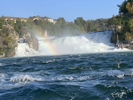
Rhine Falls
(370 m)
Vandfald
54.2 km
Reformierte Kirche
(413 m)
Sted for tilbedelse
54.7 km
Neuhausen
(410 m)
By
54.8 km
Neuhausen
(397 m)
Jernbanestation
55.3 km
Flurlingen
(413 m)
Landsby
55.8 km
Neuapostolische Kirche
(387 m)
Sted for tilbedelse
56.2 km
Gemeinde für Christus
(405 m)
Sted for tilbedelse
57.5 km
Schaffhausen
(403 m)
By
57.6 km
Schaffhausen
(404 m)
Jernbanestation
57.9 km
Beskrivelse af

A sporty and relaxing bike ride through the expanses of the cross-border Klettgau awaits you. Discover the various villages and their surroundings. 

Teknologi
3 / 6
Tilstand
5 / 6
Landskab
4 / 6
Erfaring
3 / 6
Bedste tid på året
Jan
Feb
Mar
Apr
Maj
Jun
Jul
Aug
Sep
Okt
Nov
Dec
Forfatter
Turen Chläggi-Route leveres af outdooractive.com.
Logo
Del tur
Kort
Chläggi-Route
tung
Cykling
58.06 km
Fejl
Der er opstået en fejl. Prøv venligst igen.
Information om ruten
Rute

You start in Schaffhausen at the train station and follow the signs along the cycle path towards Beringen. In the middle of the village of Beringen, take a right turn to the natural swimming pool «Gwaagge Badi» – perfect for a short cooling off in summer. Then continue to the next village, Löhningen. Before entering the village, take the left turn to the Schmerlat airfield. From there, you proceed to the small town of Neunkirch. Distinctive and well-preserved buildings, a picturesque old town with charming alleys and romantic backyards give the town an incomparable charm.

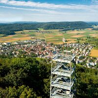
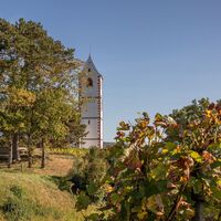
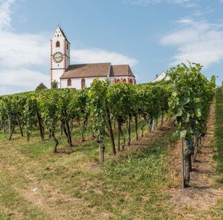
The cycle path continues to Hallau, the largest wine-growing village in the Klettgau. Now the route goes uphill, but the climb is worth it. On the way up Hallauerberg, you pass the romantically situated mountain church St. Moritz, the landmark of Hallau, and numerous vineyards. Once at the top, you can enjoy a wonderful view over the Klettgau and on clear days all the way to the majestic Alps.

Follow the signs to Trasadingen and then to Wilchingen. Explore the picturesque small villages before continuing in the direction of Osterfingen. The wine-growing village Osterfingen lies between the Wannenberg and the Rossberg. Its history is shaped by the long tradition of viticulture. A prominent witness to this is the well-known Bergtrotte, which perches above the village in the vineyard. The venue invites you to a cosy celebration and enjoyment. Here you will discover regional delicacies and the abundance of Schaffhausen wines.

Now you cycle over the Rossberg towards Jestetten (DE). On the south slope of the Rossberg, not directly on the route but worth a detour, stands the Radegg castle ruins on a rugged promontory. When you stand on the ruins, you can see as far as Säntis and the Churfirsten. And with some luck, you may encounter the «Kätterli vo Radegg» or find his blue rose bush. The view is certainly fabulous.

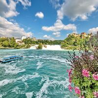
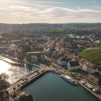
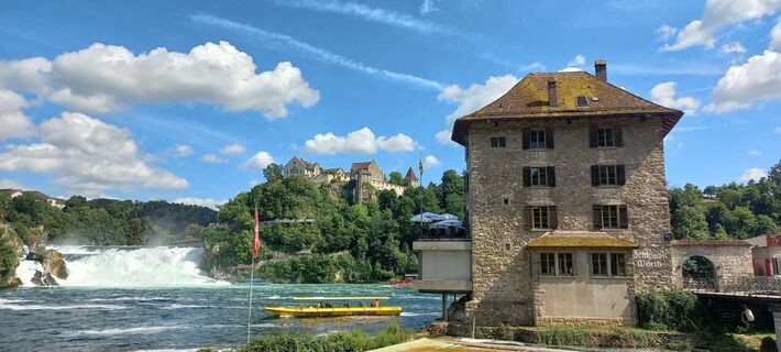
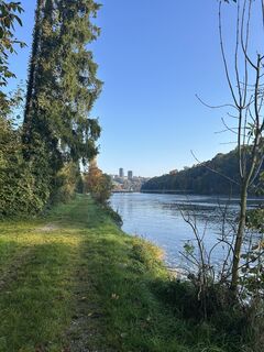
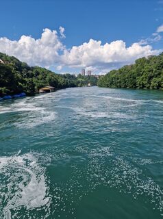
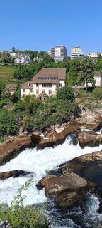
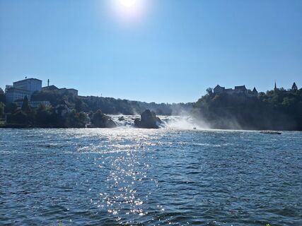
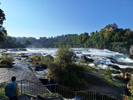
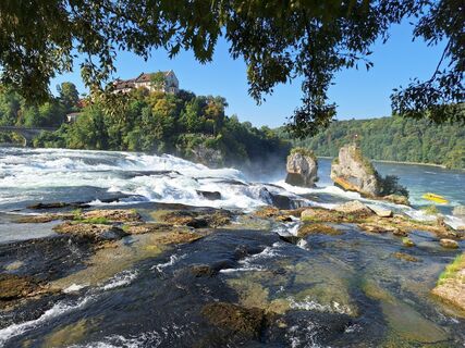
On the way from Jestetten to Neuhausen am Rheinfall, you cycle past the Celtic rampart in Altenburg from the 2nd century BC. It testifies to the Celtic history of the area. In Neuhausen you pass by the Rhine Falls – you might even feel the spray on your skin. Then continue along the Rhine back to Schaffhausen. Enjoy the northernmost city of Switzerland with its 171 bay windows and if you like, climb the impressive Munot.

Geologiske højdepunkter

Ja

Udstyr

Roadworthy bicycle, bike helmet, drinks and snacks for in between.

Sikkerhedsinstruktioner

You ride on cycle paths, gravel roads and streets – a bike helmet is therefore recommended.

Information om ankomst
Ankomst

Starting point: Schaffhausen train station

Route planner

Offentlig transport

Starting point: Schaffhausen train station

Stop: Schaffhausen train station

sbb.ch

Parkering

Near Schaffhausen train station there are several parking garages.

Yderligere information og tips
Sværhedsgrad

3

Yderligere information

Order the route map or download it directly at: https://www.natourpark.ch/tour/chlaeggi-route/ 

schaffhauserland.ch 

Tips

Taste the wines from the Schaffhauser Blauburgunderland.

Download route map at: https://www.natourpark.ch/tour/chlaeggi-route/  

Ingen anmeldelser endnu
Skriv en anmeldelse

Anmeldelser hjælper andre brugere med at vælge deres næste eventyr. Bedøm venligst kun turen, ikke vejret eller din snack.

Vælg en af stjernerne for at bedømme turen
Dårlig tur
Svag tur
Middelmådig tur
God tur
Fremragende tur
bergfex logo Få indsigten Altid live på stedet med over 9.500 webkameraer. bergfex Som Pro-bruger kan du nu se de tilsvarende webkameraer for mange ture i Tours-appen fra. Det giver dig mulighed for at se de aktuelle forhold direkte.
Vandring og sporing

Vandring og sporing

Vandring og sporing
Over 550.000 turforslag, detaljerede kort og en intuitiv ruteplanlægger gør appen til et must-have for alle naturentusiaster.
Vandring og sporing