


Sværhedsgrad: 2


A family bike route with four “mountain prizes” and a total of 730 meters of elevation requires not only strong legs but also several intermediate goals to keep yourself and the youngsters motivated again...
A family bike route with four “mountain prizes” and a total of 730 meters of elevation requires not only strong legs but also several intermediate goals to keep yourself and the youngsters motivated again and again. Fortunately, there are several of these on this nearly 20-kilometer circular route along the middle course of the Necker.
Experience a scenic bike round trip with a worthwhile stop at the treetop path.

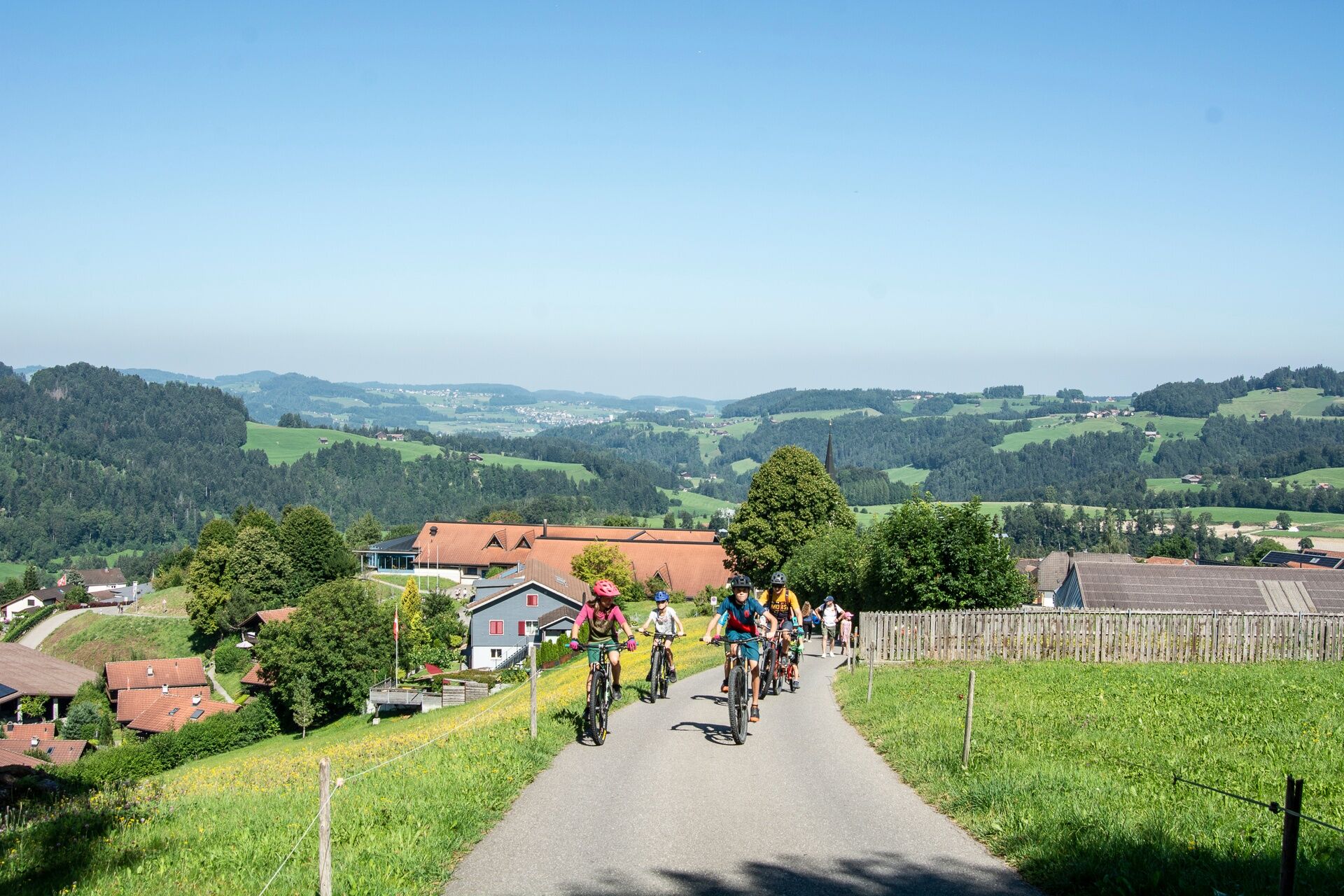
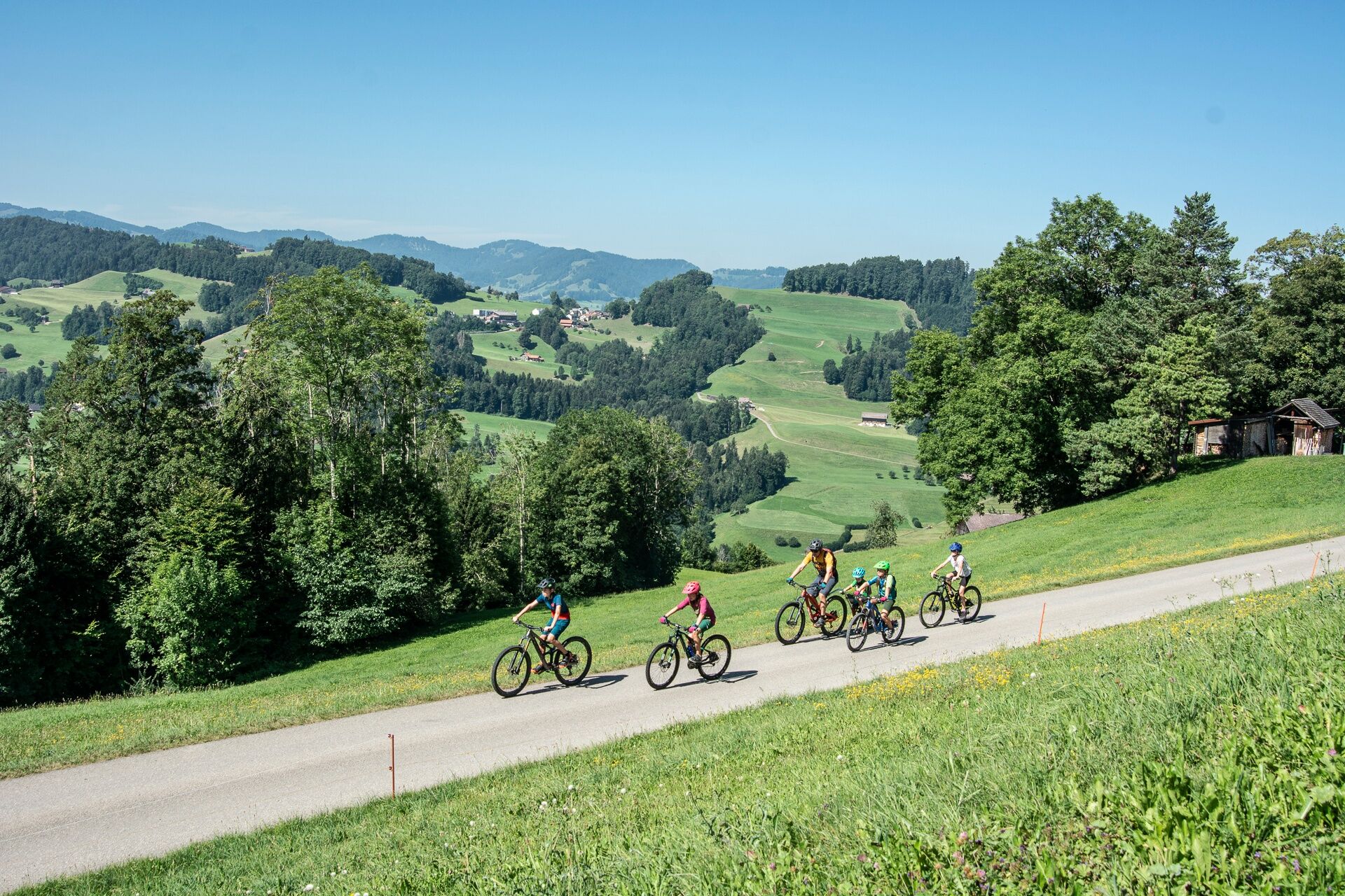
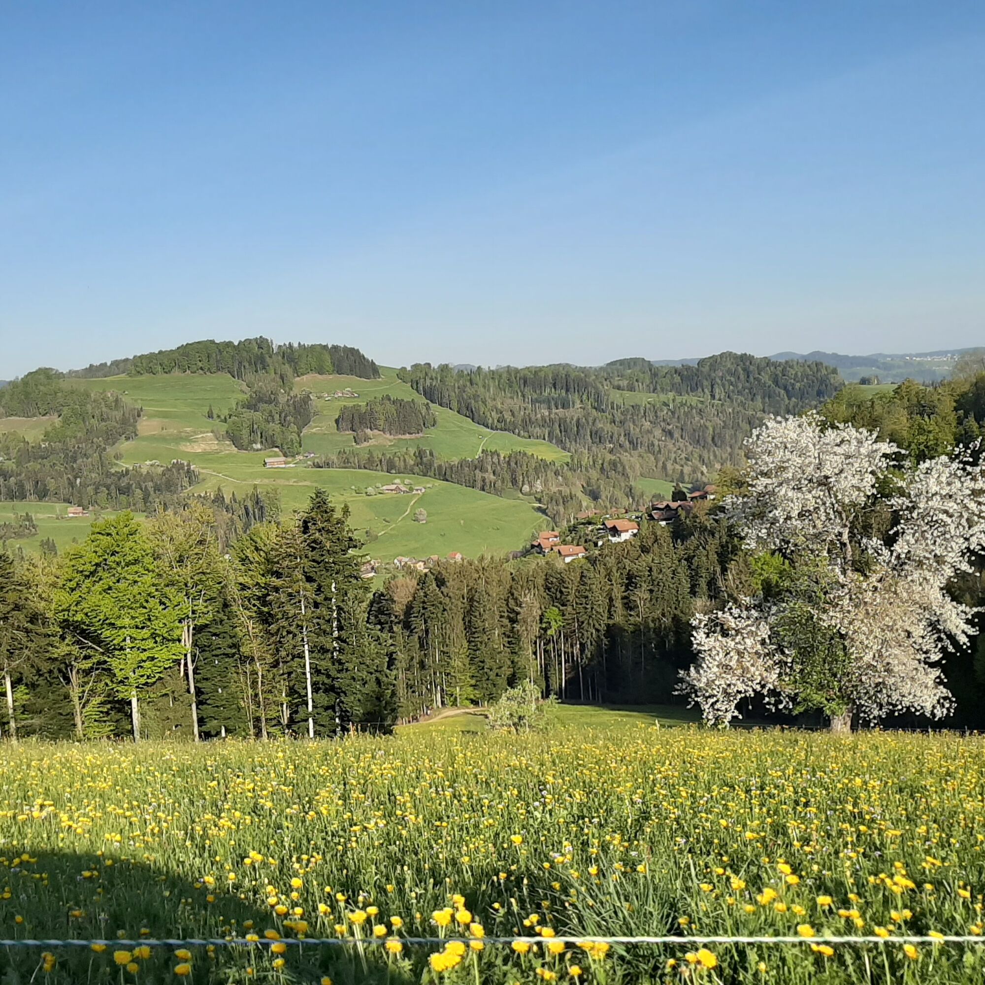
At Freudenberg (862 m) above Oberhelfenschwil, it is primarily the view of the longest descent of the day. In Anzenwil, you cross the Necker for the first time and find several nice barbecue and bathing spots on the banks. One of the nicest can be reached by taking a minimal detour and riding down to the old wooden bridge, which you cross while heading towards Brunnadern. Refreshed and highly motivated, you then tackle the very steep climb to Herrensberg, which leads up the meadow via an agricultural track. After a short descent with a counter climb, you finally reach the hamlet of Nassen, where you enjoy an ice cream in the cozy village pub. If you’re rolling well, you can of course also treat yourself to this first in the historic Gasthaus Rössli in Mogelsberg.
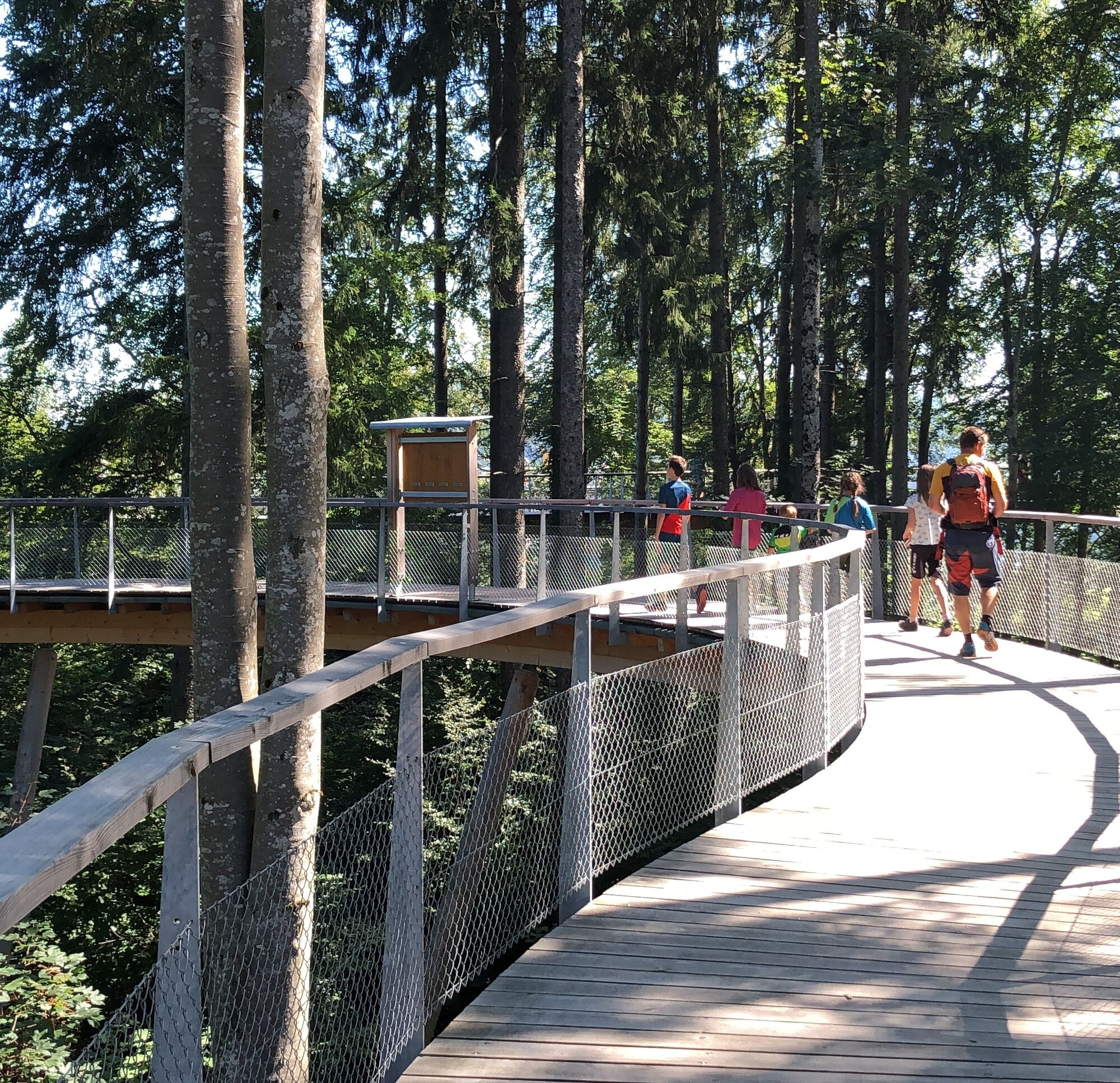
Then in the lowest gear, you ride up the paved road to Felsenburg, where the unique Neckertal treetop path is located. At dizzying heights, you discover the forest from an unusual perspective and learn a lot about the forest and nature at 30 learning and experience stations – with all your senses. A large forest playground, numerous picnic tables, and fire pits invite you to linger. It's another 60 meters ascent to Oberlöffelsberg (860 m), from where you zoom down to Necker. For the last few meters back to Brunnadern-Neckertal station, no additional motivation boost is needed – having reached the goal together is incentive enough for cycling families.
Route:
Brunnadern - Oberhelfenschwil - Freudenberg - Bleiken - Anzenwil - Herrensberg - Dieselbach - Jomertobel - Nassen - Böschenbach - Mogelsberg - Büelhöchi - Löffelsberg - Ebersol - Brunnadern
Ja
Roadworthy mountain bike and bike with suspension, bicycle helmet, day cycling backpack (approx. 20 liters) with rain cover, weather-appropriate and durable clothing in multiple layers (e.g., functional shirt, cycling jersey, bib shorts, arm and leg warmers), shatterproof cycling glasses, pump, bicycle tools, sun and rain protection, provisions and drinking water, first aid kit, pocket knife, mobile phone, maps
E-bike: spare battery, charger.
The routes are only signposted in the biker-recommended direction.
From St.Gallen, the route leads after the St.Gallen Winkeln motorway exit via Herisau, Waldstatt, Schönengrund, St. Peterzell to Brunnadern.
From Grabs, you reach Brunnadern via Obertoggenburg, Wattwil, Lichtensteig, Wasserfluh to Brunnadern.
Brunnadern is very well accessible by public transport. From St.Gallen via Herisau to Brunnadern or from Wattwil.
There are enough paid parking spaces available at Brunnadern station.
2
E-bikes are rented by the Gasthaus Löwen in Hemberg. An e-bike charging station is available at Gasthaus Rössli Mogelsberg.
Toggenburg Tourism
Hauptstrasse 104
9658 Wildhaus
T +41 71 999 99 11
Webkameraer på turen
Populære ture i området
-
4.2
Schnebelhorn Rundwanderung
MediumVandring 11.9 km -
3.2
Winter hike at the Hulftegg
lysVandring om vinteren 7.39 km -
4.5
Hulftenegg - Hörndli
lysVandring om vinteren 6.98 km -
4.0
Schönengrund - Hochhamm - Schönengrund
MediumVandring 9.51 km -
Wanderung von Hemberg zum Ofenloch
MediumVandring 10.9 km -
4.5
Hike from Ebnat-Kappel to Tanzboden
MediumVandring 14.5 km -
4.5
Atzmännig Chrüzegg Rundwanderung
lysVandring 7.44 km -
Toggenburg High Trail, Stage 4, Tanzboden - Chrüzegg
MediumVandring 17.2 km -
Toggenburg Höhenweg
tungVandring 95.4 km -
4.0
Toggenburg Ridgeway, Stage 5, Chrüzegg - Hulftegg
MediumVandring 11.3 km

Vandring og sporing


Gå ikke glip af tilbud og inspiration til din næste ferie
Din e-mailadresse er blevet tilføjet til mailinglisten.