Circular Trail Grillenparz
lys
Vandring
Naviger
Naviger
Få denne tur på din mobiltelefon
Kort
Circular Trail Grillenparz
lys
Vandring
8.66 km
Scan QR-koden, og start navigationen i bergfex -appen
QR Code
Vandring og sporing
Vandring og sporing

Circular Trail Grillenparz

Afstand
8.66 km
Varighed
03:00 h
Opstigning
428 hm
Havets niveau
465 - 833 m
Download af spor
Kort
Circular Trail Grillenparz
lys
Vandring
8.66 km

To climb Schlierbach's local mountain, go to the back of the monastery and follow the meadow path to the Calvary Chapel, past the Haslinger houses, past the Schmickinger Chapel to the Grillenparz and back...


Beskrivelse af

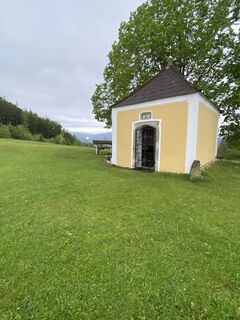
To climb Schlierbach's local mountain, go to the back of the monastery and follow the meadow path to the Calvary Chapel, past the Haslinger houses, past the Schmickinger Chapel to the Grillenparz and back via the Schaumberg.

Trail number: K80

Rute
Rute
Kort
Circular Trail Grillenparz
lys
Vandring
8.66 km
Holzofenpizzeria San Marco
(473 m)
Restaurant
0.0 km
Schlierbach
(466 m)
Landsby
0.0 km
Gasthaus und Fleischerei Schröcker
(468 m)
Restaurant
0.1 km
Kalvarienbergkapelle
(529 m)
Sted for tilbedelse
0.9 km
Grillenparz
(842 m)
Topmøde
3.2 km
Oberndorf
(795 m)
Afregning
3.6 km
Kirchdorf an der Krems
(452 m)
By
4.8 km
Scherleiten
(602 m)
Restaurant
5.3 km
Jausenstation Zeisl
(545 m)
Restaurant
7.2 km
SPES
(497 m)
Restaurant
7.9 km
Gasthaus und Fleischerei Schröcker
(468 m)
Restaurant
8.5 km
Holzofenpizzeria San Marco
(473 m)
Restaurant
8.5 km
Schlierbach
(466 m)
Landsby
8.6 km
Beskrivelse af

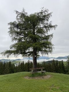
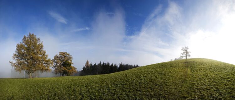
Hike up the Schlierbach local mountain including a magnificent view of the Upper Kremstal.

Teknologi
n.a.
Tilstand
2 / 6
Landskab
5 / 6
Erfaring
3 / 6
Bedste tid på året
Jan
Feb
Mar
Apr
Maj
Jun
Jul
Aug
Sep
Okt
Nov
Dec
Del tur
Kort
Circular Trail Grillenparz
lys
Vandring
8.66 km
Fejl
Der er opstået en fejl. Prøv venligst igen.
Sidst sporet 2 dage siden
Information om ruten
Rute

To climb Schlierbach's local mountain, go to the back of the monastery and follow the meadow path to the Calvary Chapel, past the Haslinger houses to the end of the asphalt road. From there, a meadow and forest path leads up into the wooded slope of the Grillenparz. Once you have reached the Schmickinger Chapel, there is only a short climb to the summit.

There you will be rewarded with the magnificent view all the way to the hilly Mühlviertel. On the descent over meadow paths you will enjoy a magnificent view of the Tote Gebirge. Over the Schaunberg you will then come through the forest to the Jausenstation Zeisl, where you can already see the towers of Schlierbach Abbey.

Information om ankomst
Ankomst

From Vienna/Salzburg: A1 towards Linz > A9 Pyhrnautobahn - exit Inzersdorf.

From Linz: A9 Pyhrn motorway - exit Inzersdorf

From Graz: A9 Pyhrnautobahn > exit Klaus > federal road B 138

Offentlig transport

Arrival with the Pyhrnbahn, there are stops in Schlierbach, Kirchdorf/Krems and Micheldorf.

Details at www.ooevv.at

Parkering

Schlierbach/parking near the center of the village

Yderligere information og tips
Tips

Climate-friendly to the National Park Region - railway station Schlierbach: By train you can reach the starting point for this hike in about 1 hour from Linz and in about 2.5 hours from Vienna.

Ingen anmeldelser endnu
Skriv en anmeldelse

Anmeldelser hjælper andre brugere med at vælge deres næste eventyr. Bedøm venligst kun turen, ikke vejret eller din snack.

Vælg en af stjernerne for at bedømme turen
Dårlig tur
Svag tur
Middelmådig tur
God tur
Fremragende tur
bergfex logo Få indsigten Altid live på stedet med over 9.500 webkameraer. bergfex Som Pro-bruger kan du nu se de tilsvarende webkameraer for mange ture i Tours-appen fra. Det giver dig mulighed for at se de aktuelle forhold direkte.
Vandring og sporing

Vandring og sporing

Vandring og sporing
Over 550.000 turforslag, detaljerede kort og en intuitiv ruteplanlægger gør appen til et must-have for alle naturentusiaster.
Vandring og sporing