


Sværhedsgrad: 4


The Syväjoki-Lietejoki paddling route offers varied scenery and numerous rapids between Ukkohalla and Hyrynsalmi. In high water conditions, the route can start from the Syväjoki just below Komulanköngäs...
The Syväjoki-Lietejoki paddling route offers varied scenery and numerous rapids between Ukkohalla and Hyrynsalmi. In high water conditions, the route can start from the Syväjoki just below Komulanköngäs waterfall, from where the route runs along the Syväjoki to the Liete River near Little Tuomivaara and from there all the way to Hyrynsalmi at the Emä River.
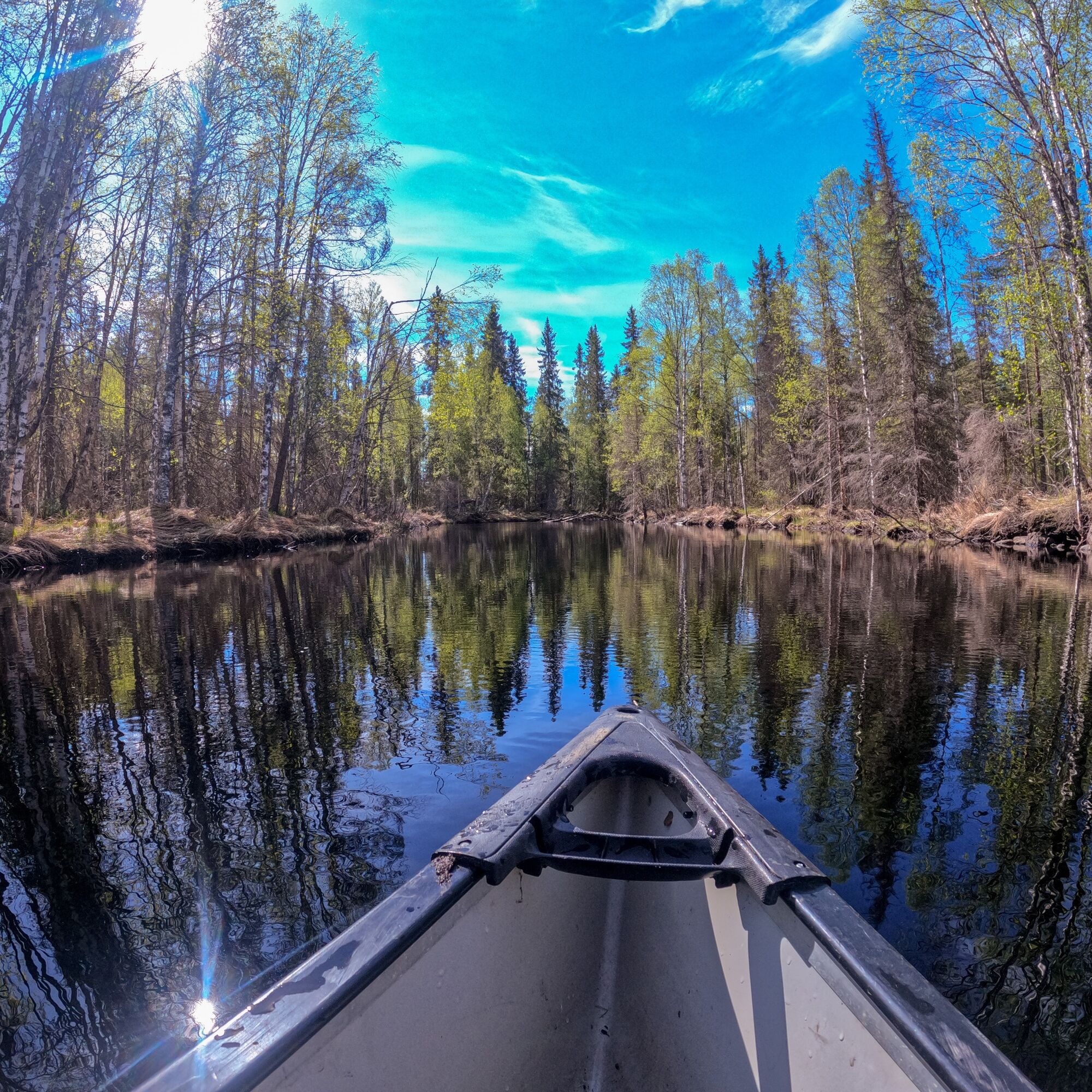
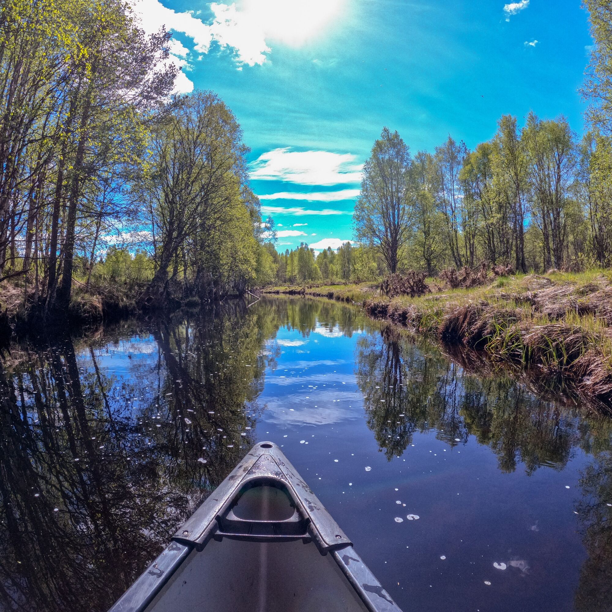
The route is easy. At its beginning, there are shallower rapids sections and a narrow river channel, after which the route widens as the Syväjoki merges into the Liete River. On the Liete River side, rapids are deeper and swifter but still navigable with expedition equipment.
Rapids classifications are around class I and II-; the routes are easy to spot, and falls rarely cause more than bruises. There are several lean-tos along the route, with the Pitkänkoski lean-to half-way serving as an excellent rest stop. There are some summer cottages along the route and, near the end, a fish farming facility and a shooting range.

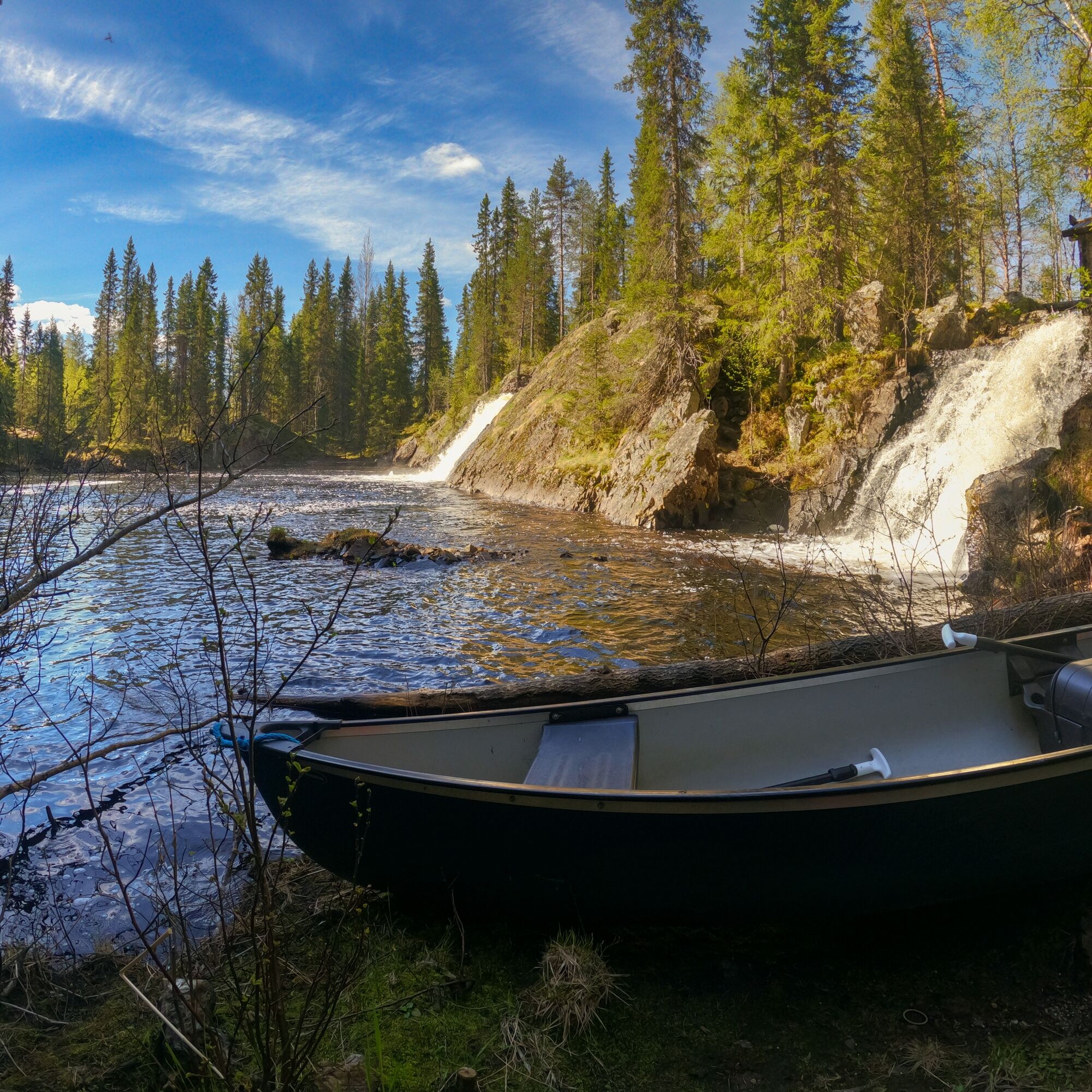
The route starts from the pond below Komulanköngäs waterfall, from where the route proceeds along the Syväjoki River towards the Liete River. The rapids sections on Syväjoki are shallow with low water current pressure. The rapids sections are short and numerous in the early part of the route. If necessary, you can get out of the canoe/kayak in rapids and carry across the shallower parts.
The route merges discreetly into the Liete River shortly after the ski bridge crossing the route and continues as the wider Liete River. Right by Little Tuomivaara is Paskonkoski rapid. After Paskonkoski, the route continues next to Little Tuomivaara and soon begins to curve to the right. Before Pitkänkoski rapid, on the left is the Pitkänkoski shelter, which is an excellent resting place about halfway along the route. Pitkänkoski is a low rapid section, where the upper part is the most challenging. The lower part of the rapid alternates between riffle and calm water.
After Pitkänkoski, the route features pleasant calmer river stretches, accompanied by small rapids. Before the bridge crossing the Liete River is Saarikoski rapid, which has a couple of fallen trees over it; it is possible to carry around them over land. After Saarikoski, a larger bridge is passed under, after which Keskikoski rapid starts immediately, followed by the most challenging rapid of the route, Louhenkoski. Louhenkoski is, however, quite navigable or easy to carry along a path on the left side. After Louhenkoski, on the left is the Louhenkoski shelter. A little further from Louhenkoski, across the river, several trees have fallen, which cannot be passed without getting out of the canoe/kayak and moving it over the trees. After this, on the right side of the route, there is a red house by which there is a subtle drop of a couple of meters, which is easily navigable through the middle of the riverbed.
The final part of the route is pleasant and leisurely riverbed, accompanied by small rapids. The route first passes under the Liete River bridge, then under the Liete River railway bridge, after which comes the Virrantie bridge. It is possible to exit from Liete River and Virrantie bridges or continue all the way to the Emä River and turn left, paddling all the way to Hyrynjärvi and the center of Hyrynsalmi.
The route is navigable with expedition equipment. Sturdy hiking boots are good to wear, which makes possible exits from the canoe/kayak in rapids safer.
Life jackets, helmet, sufficient canoe/kayak floats, adequate and water-suitable clothing - which protects from sun, splashes, and cold - and spare clothes are the basic essentials.
Plan the paddling route according to your skills, and paddle calmly at about 4 kilometers per hour. The difficulty of rapids varies; it is advisable to check a suitable line from land at places with strong currents. Safety instructions for paddlers If you get into an emergency during your trip, call 112 and make an emergency notification.
You can reach the starting point of Komulanköngäs by car from Ukkohalla and Paljakka:
From Ukkohalla tourist center, it is 4.2 km by car to the parking area. Drive south on Syväjärventie and after 2 km turn left at the junction onto Hallanmaantie. Drive 2.1 km on Hallanmaantie, after which the parking area is on the left. When coming from Paljakka tourist center, turn from Ristijärventie onto Hallanmaantie (signposted to Ukkohalla) and drive 13.6 km, after which the parking area is on the right.
Other possible starting points/locations can be found by checking the map services for roads leading to the riverbank.
No public transport.
Free parking area at Komulanköngäs along Hallanmaantie.
4
Paddling the Syväjoki-Lietejoki route is not recommended in low water because the rapids are either impassable or nearly so. At normal water levels, it is advisable to check conditions at one rapid before starting too far up. In high water, it is possible to start from the top, either Komulanköngäs or from Lietejärvi.
A nice route for adventure seekers. It is recommended to check the starting point lower down the river during low water levels.
Populære ture i området
-
Kokko Harju hiking route to Komulanköngäs 9 km, Ukkohalla
MediumVandring 8.97 km -
Vorlok route hiking trail 14 km, Ukkohalla
tungVandring 13.5 km -
Paljakka MTB round tour 46/65 km, Paljakka - Ukkohalla
tungMountainbike 65.2 km -
Jyrkä route mountain biking 24.2 km, Ukkohalla
MediumMountainbike 24.2 km -
Vorlokki mountain bike route 13.3 km, Ukkohalla
tungMountainbike 13.2 km -
Pienenmäen route 12.6 km, Ukkohalla
MediumMountainbike 12.5 km -
Ukkohalla-Hyrynsalmi UKK route 14.5 km, Hyrynsalmi
MediumVandring 14.4 km -
Mustarinda nature trail at Paljakanvaara 3.8 km, Hyrynsalmi
lysVandring 3.73 km -
Fatbike Loop 9,8 km, Ukkohalla, Finland
MediumMountainbike 8.99 km -
Metlanmetsä forest mountain biking trail 3,5 km, Paljakka - Finland
lysMountainbike 3.47 km
Vandring og sporing


Gå ikke glip af tilbud og inspiration til din næste ferie
Din e-mailadresse er blevet tilføjet til mailinglisten.