


Sværhedsgrad: T2


This hike takes you up to Muottas da Schlarigna (2,305m/7,562ft). From Pontresina railway station, the route briefly runs in the direction of the Val Roseg, then takes a right turn through a residential...
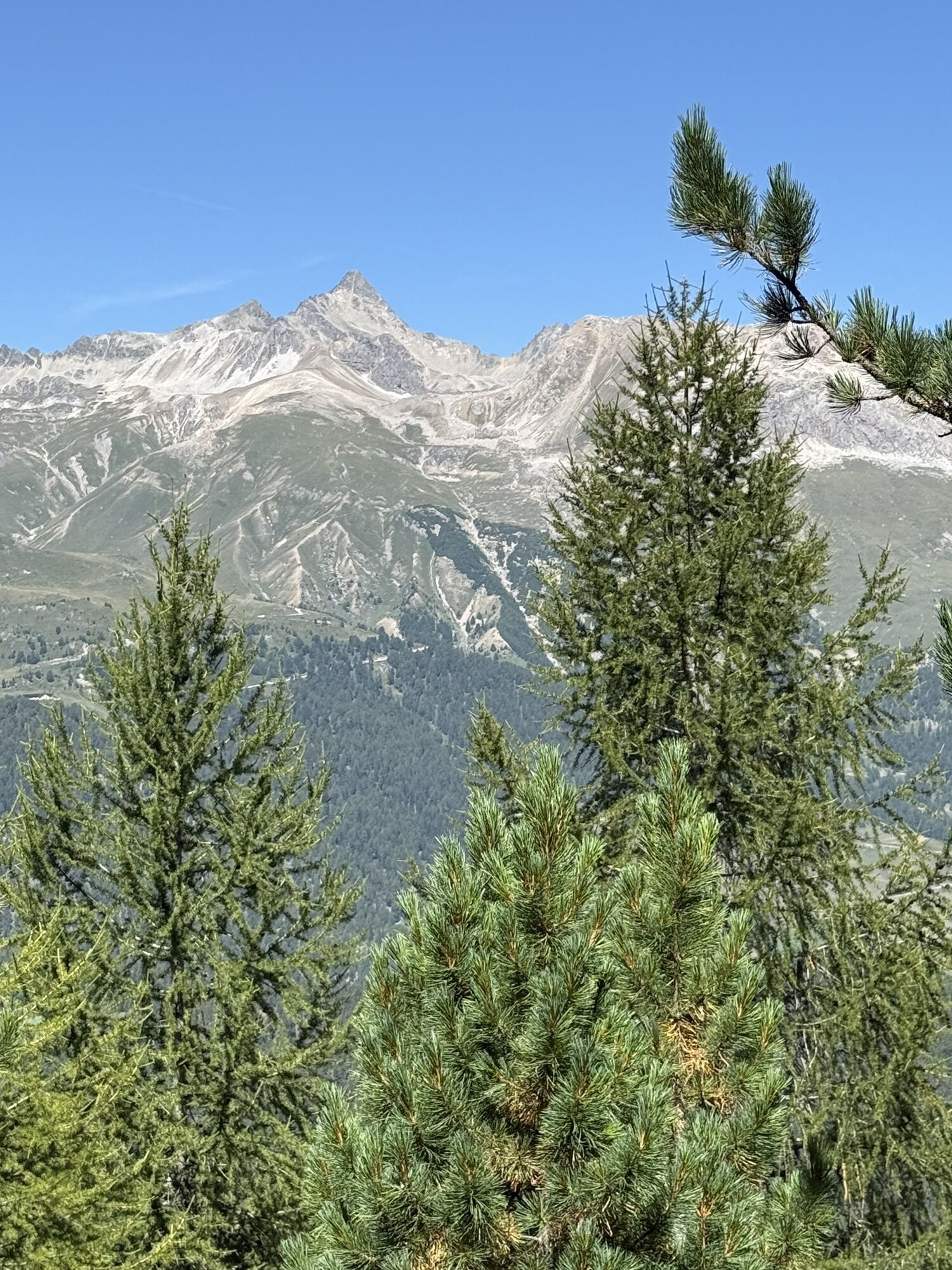
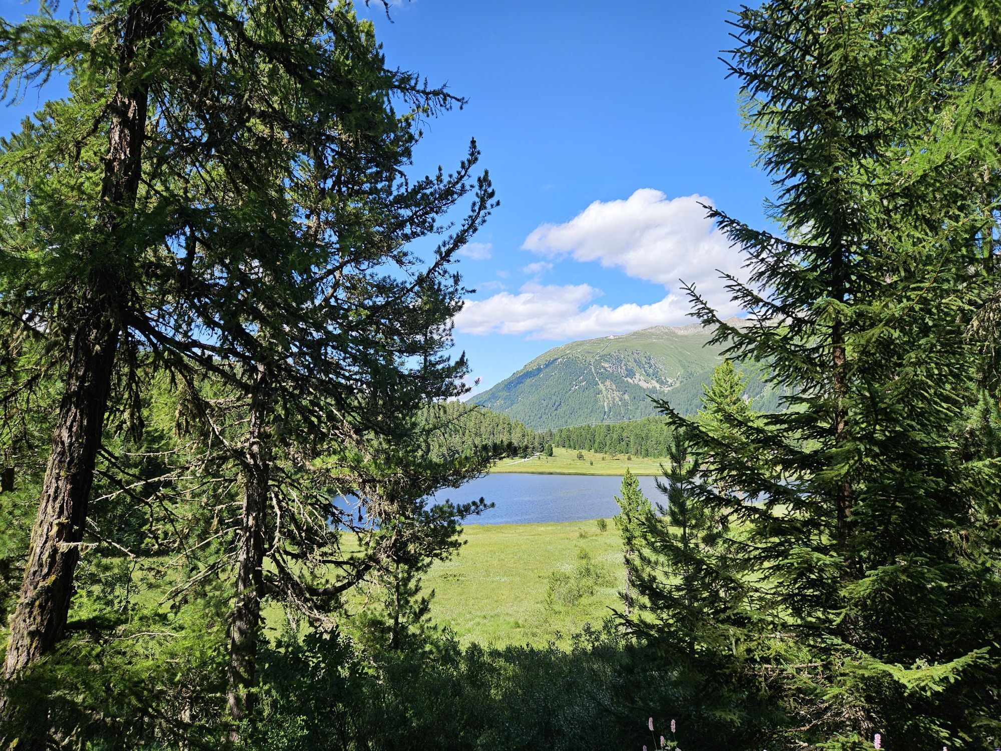
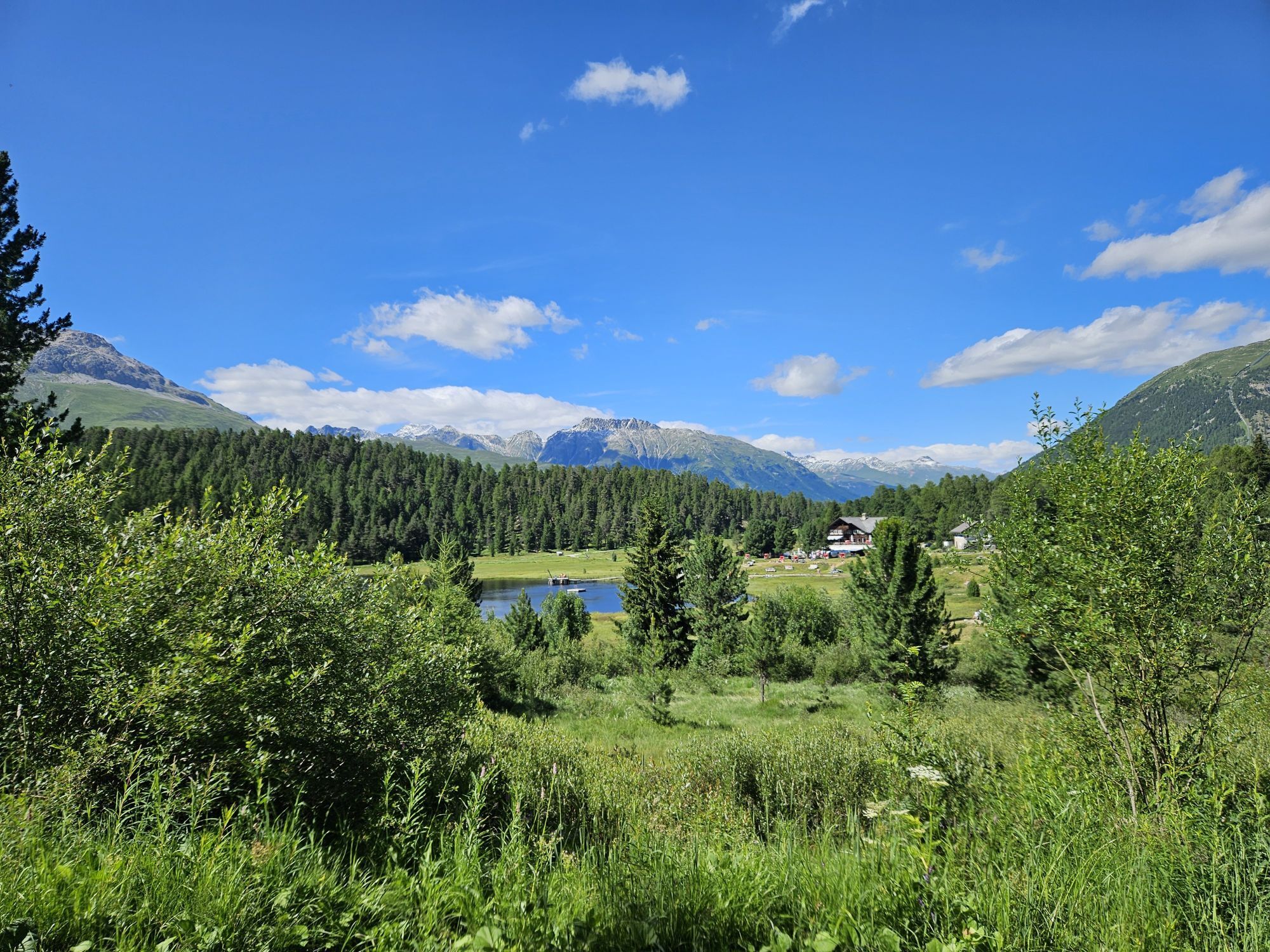
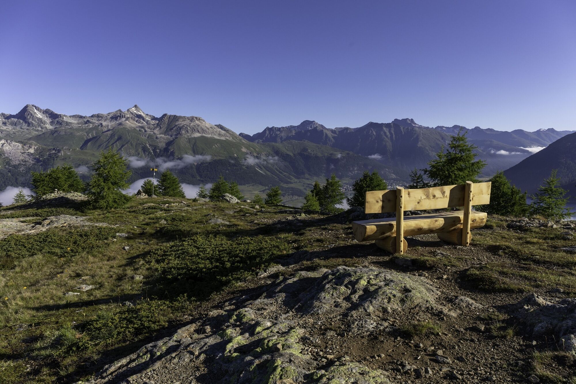
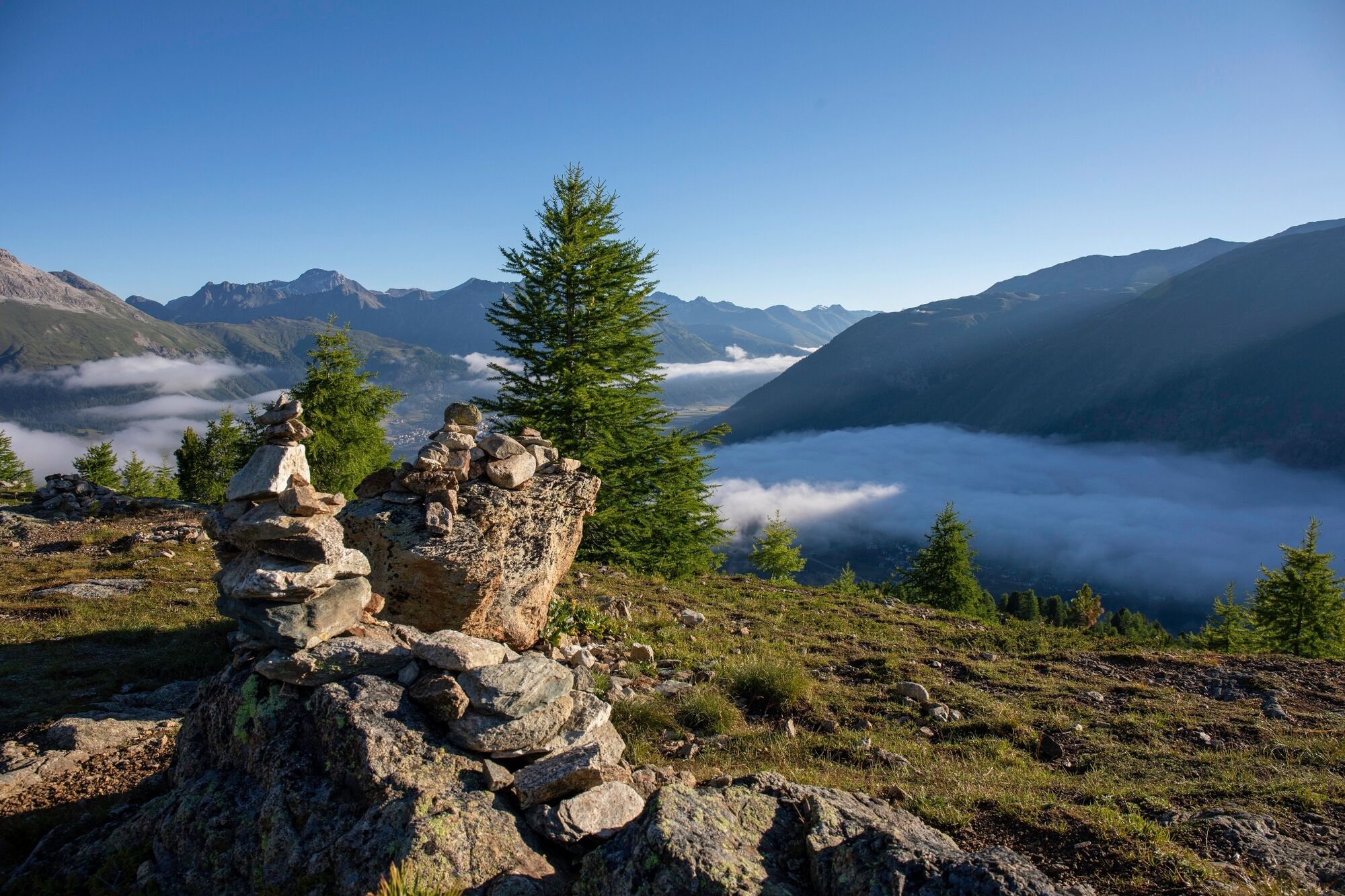
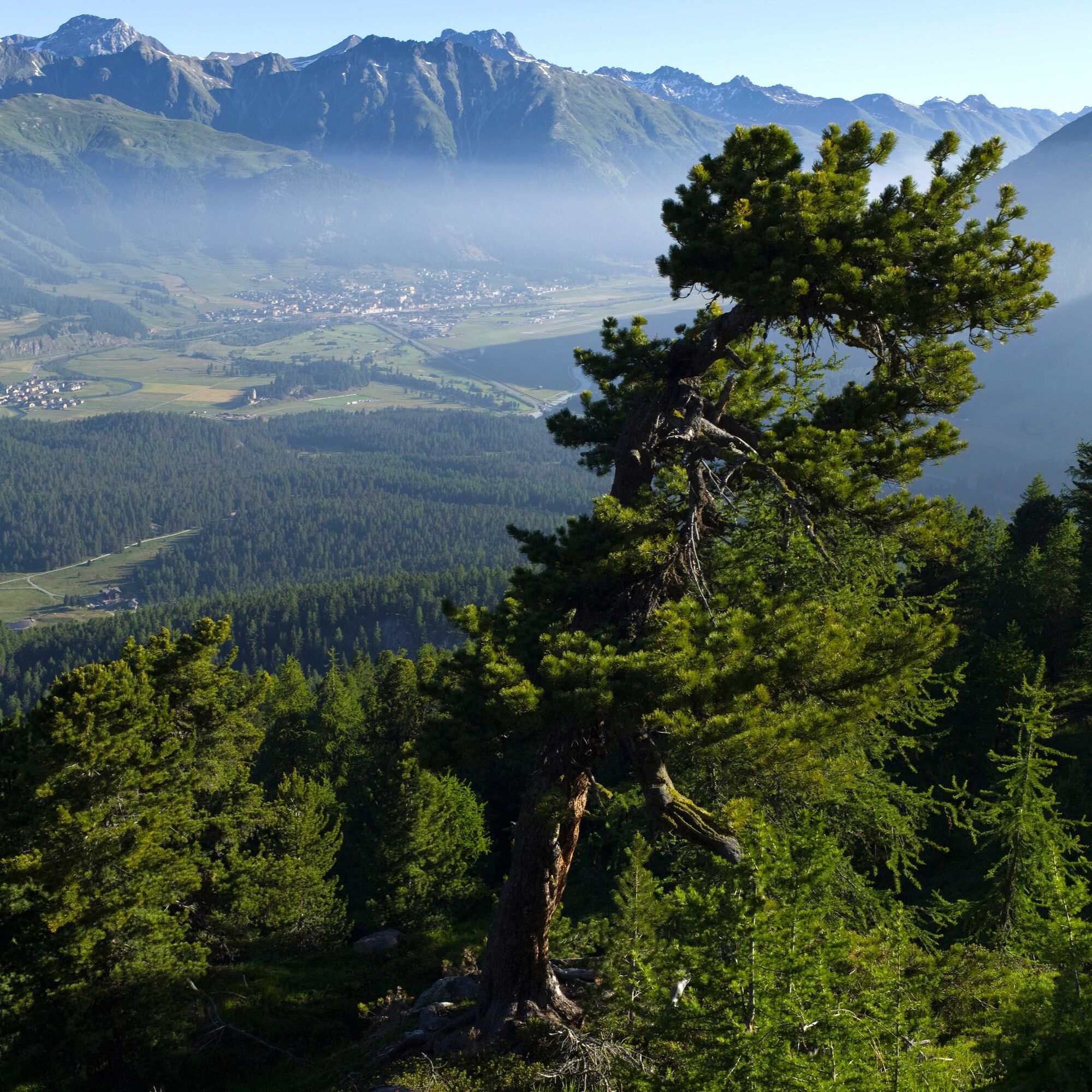
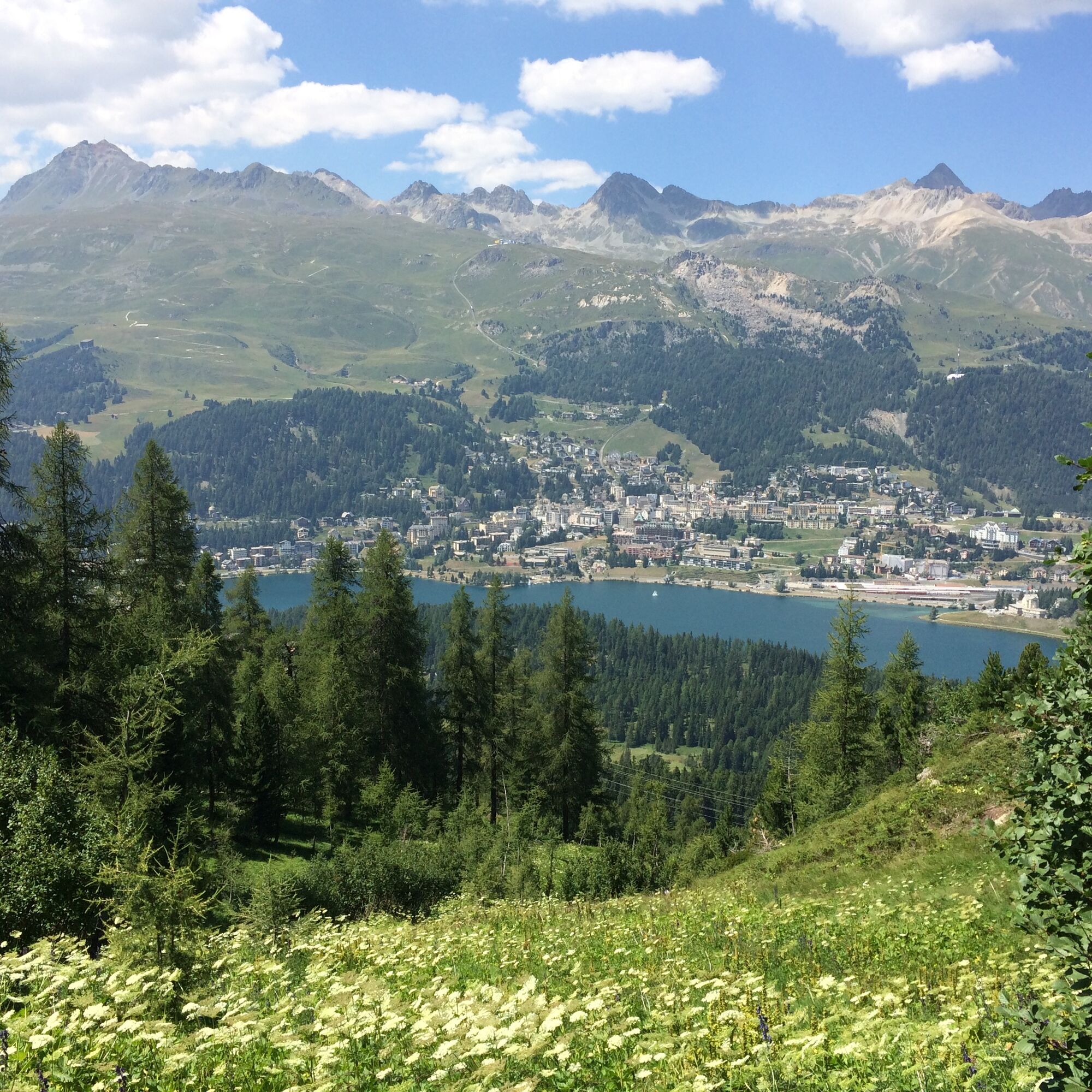
This hike takes you up to Muottas da Schlarigna (2,305m/7,562ft). From Pontresina railway station, the route briefly runs in the direction of the Val Roseg, then takes a right turn through a residential area. Following the signposts, cross the edge of the forest to the Muottas da Schlarigna viewpoint, which is a lovely place to linger a while and take in the breathtaking, almost 360°view of the valleys and mountains. You will have already traversed various areas of primeval woodland on the way up to the vantage point. If you want to see the oldest Swiss stone pine, which is over 1,400 years old, on the way down take the path towards Alp Staz. The gnarled pine is on the right of the trail, shortly after the intersection. From Alp Staz, a wide gravel trail leads down to the idyllic Lake Staz. If you prefer to spend more time hiking up on high, do not branch off to the ancient pine, but follow the high route past old stone pines, Alpine roses and alders, from where you can occasionally snatch a glance at Lake St. Moritz, St. Moritz and Corviglia. Eventually you reach St. Moritz and then make your way along the valley floor back to Lake Staz. On sunny days, the lake is warm enough for bathing. The lakeside is dotted with places where you can relax and enjoy an afternoon snooze or rustle up a barbecue. The route resumes behind the Restaurant Lake Staz and returns through the forest to Pontresina.
More information
Engadin Tourismus AG
Via Maistra 1
CH-7500 St. Moritz
Phone: +41 81 830 00 01
E-mail: allegra@engadin.ch
Internet: www.engadin.ch


Pontresina - Muottas da Schlarigna - St.Moritz-Bad - Lej da Staz - Pontresina
T2
The oldest Swiss stone pine is about 5 minutes away from the junction Alp Staz/St. Moritz. There is an information board next to the tree. It is also worth a visit if you take the high-level trail to St. Moritz.
Webkameraer på turen
-
Corviglia
-
St. Moritz / Samedan - Muottas Muragl
-
Camping Morteratsch
-
Corvatsch
-
Marguns - Plateau Nair
-
Silvaplana - Restaurant Mulets
-
Samedo - Engadin Golf
-
St. Moritz / Samedan - Muottas Muragl
-
St. Moritz / Samedan - Muottas Muragl
-
St. Moritz / Samedan - Muottas Muragl
-
St. Moritz / Samedan - Muottas Muragl
-
Corviglia
-
Corviglia
-
Corviglia
-
Corviglia
-
Corviglia
-
Corviglia
-
Corviglia
-
Corvatsch
-
Corvatsch
-
Corvatsch
-
Corvatsch
-
Corvatsch
-
Corvatsch
-
Piz Nair - St. Moritz
-
Celerina - Skiwiese Provuler
-
St. Moritz - Berghotel Randolins
-
Samedan - Engadin Airport
-
El Paradiso
-
Piz Nair Bergstation
-
Piz Nair Bergstation
-
Piz Nair Bergstation
-
Piz Nair Bergstation
-
Piz Nair Bergstation
-
Piz Nair Bergstation
-
Piz Nair Bergstation
-
Piz Nair Bergstation
-
Sporthotel Pontresina
-
Corvatsch - Hossa Bar
-
Silvaplana - Hossa Bar
Populære ture i området
-
5.0
Muottas Muragl - Segantini hut - Pontresina
MediumVandring 6.46 km -
5.0
Morteratsch railway station - Boval Hut
MediumVandring 10.5 km -
4.7
Diavolezza - Munt Pers
lysVandring 3.82 km -
4.7
SAC Tschierva
lysVandring 24.7 km -
5.0
Alp Languard - Paradis hut - Pontresina
lysVandring 7.05 km -
4.5
Pontresina - Val Roseg - Pontresina
lysVandring 13.8 km -
4.8
Paradis route
lysVandring 4.81 km -
Muottas Muragl - Segantini Hütte - Pontresina
MediumVandring 17.5 km -
4.5
Diavolezza - Lej da Diavolezza
MediumVandring 6.22 km -
Mittelstation Murtèl – Fuorcla Surlej – Val Roseg – Pontresina
MediumVandring 23.5 km
Vandring og sporing


Gå ikke glip af tilbud og inspiration til din næste ferie
Din e-mailadresse er blevet tilføjet til mailinglisten.