


Sværhedsgrad: T2


Billeder af vores brugere
-
 © Marius TrompetterOprettet den 08.08.2025
 -
 © Marius TrompetterOprettet den 16.10.2022
 -
 © Marius TrompetterOprettet den 16.10.2022
 -
 © Marius TrompetterOprettet den 16.10.2022
 -
 © Marius TrompetterOprettet den 16.10.2022
 -
 © Marius TrompetterOprettet den 16.10.2022
 -
 © Marius TrompetterOprettet den 16.10.2022
 -
 © João LealOprettet den 16.10.2022
 -
 © Aurelian BöhlerOprettet den 11.09.2025
 -
 © Aurelian BöhlerOprettet den 11.09.2025
 -
 © Aurelian BöhlerOprettet den 11.09.2025
 -
 © Aurelian BöhlerOprettet den 11.09.2025
 -
 © Aurelian BöhlerOprettet den 11.09.2025
 -
 © Aurelian BöhlerOprettet den 11.09.2025
 -
 © Aurelian BöhlerOprettet den 11.09.2025
 -
 © Aurelian BöhlerOprettet den 11.09.2025


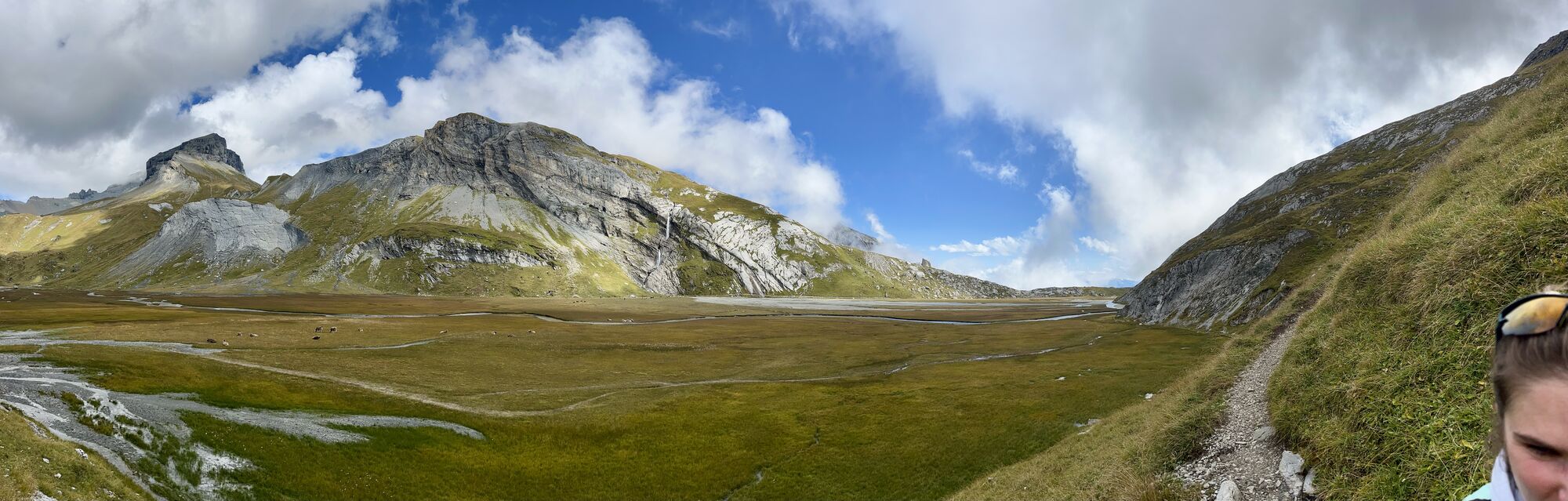

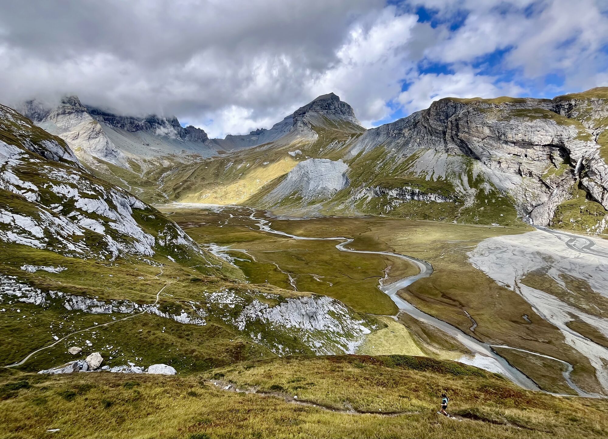
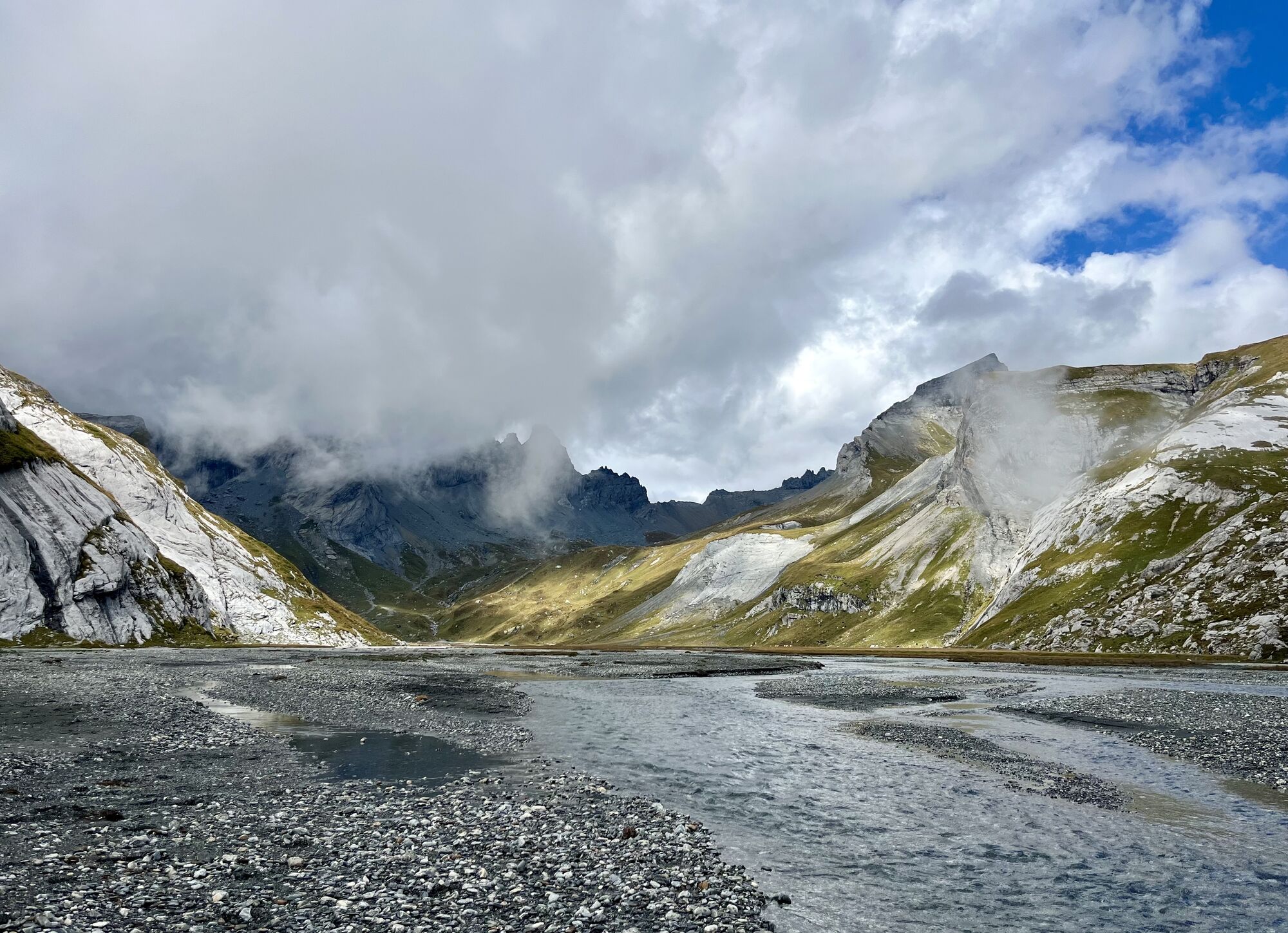
Flims and the surrounding area are a must for nature lovers. The Flims rockslide shaped not only the sunny plateau but also the wild Rhine Gorge as well as the crystal-clear swimming lakes Cauma, Cresta...
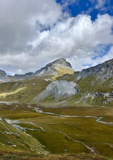
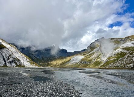
Flims and the surrounding area are a must for nature lovers. The Flims rockslide shaped not only the sunny plateau but also the wild Rhine Gorge as well as the crystal-clear swimming lakes Cauma, Cresta and Laax.
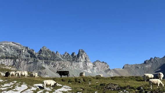
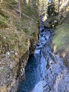
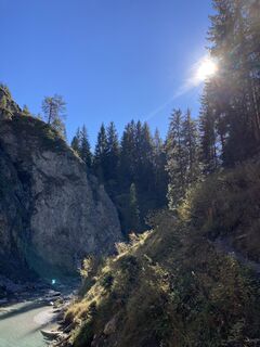
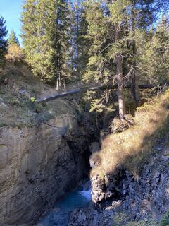
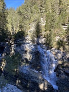
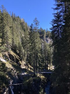
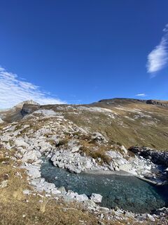
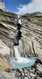
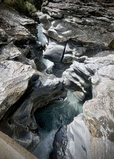
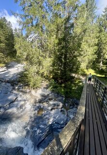
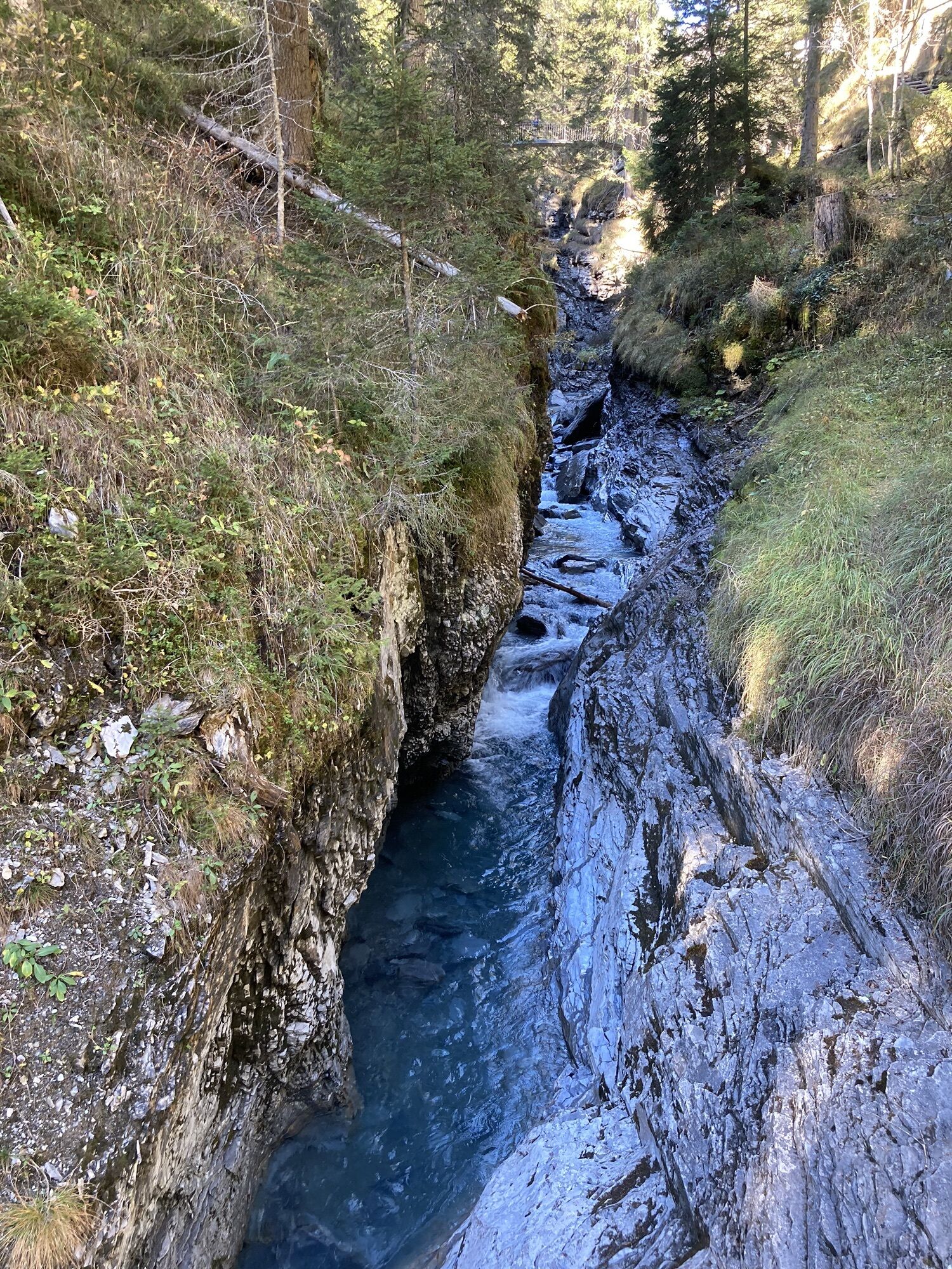
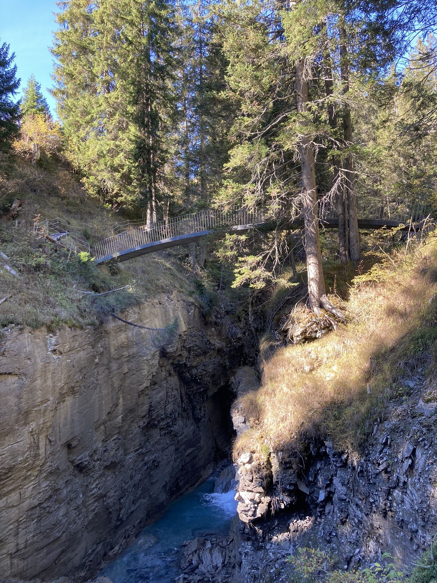
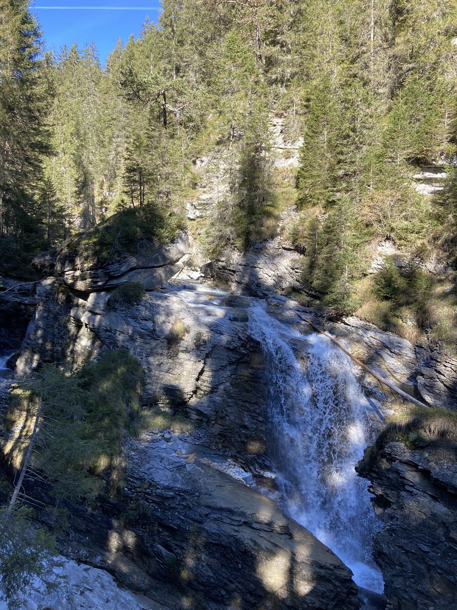
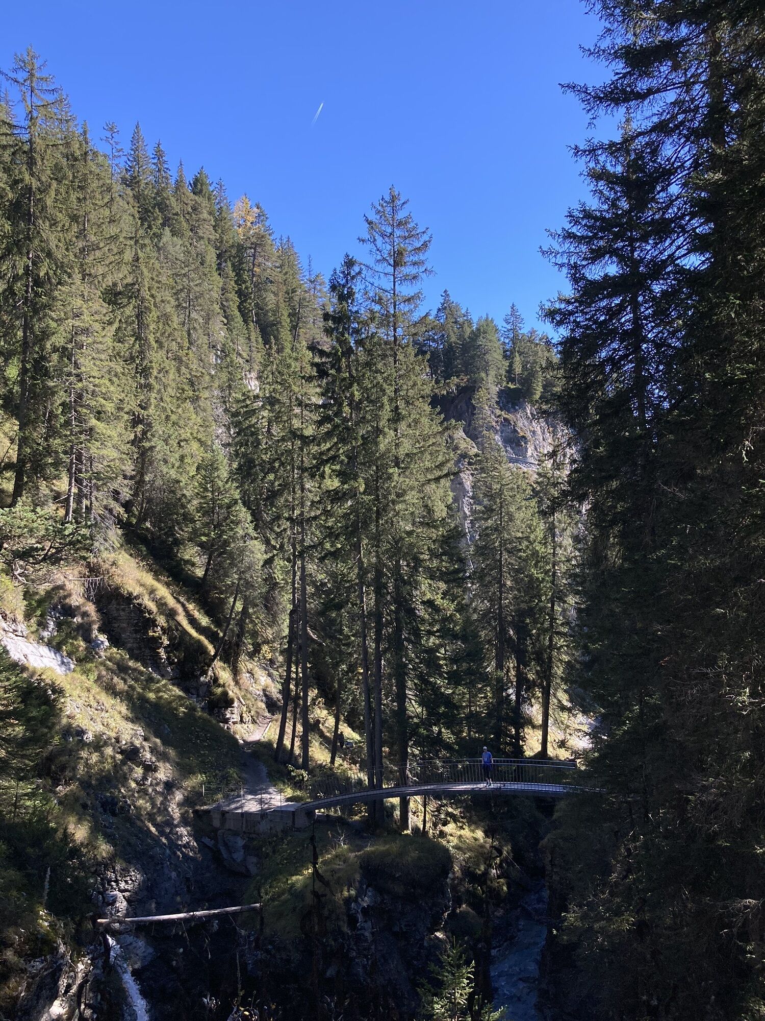
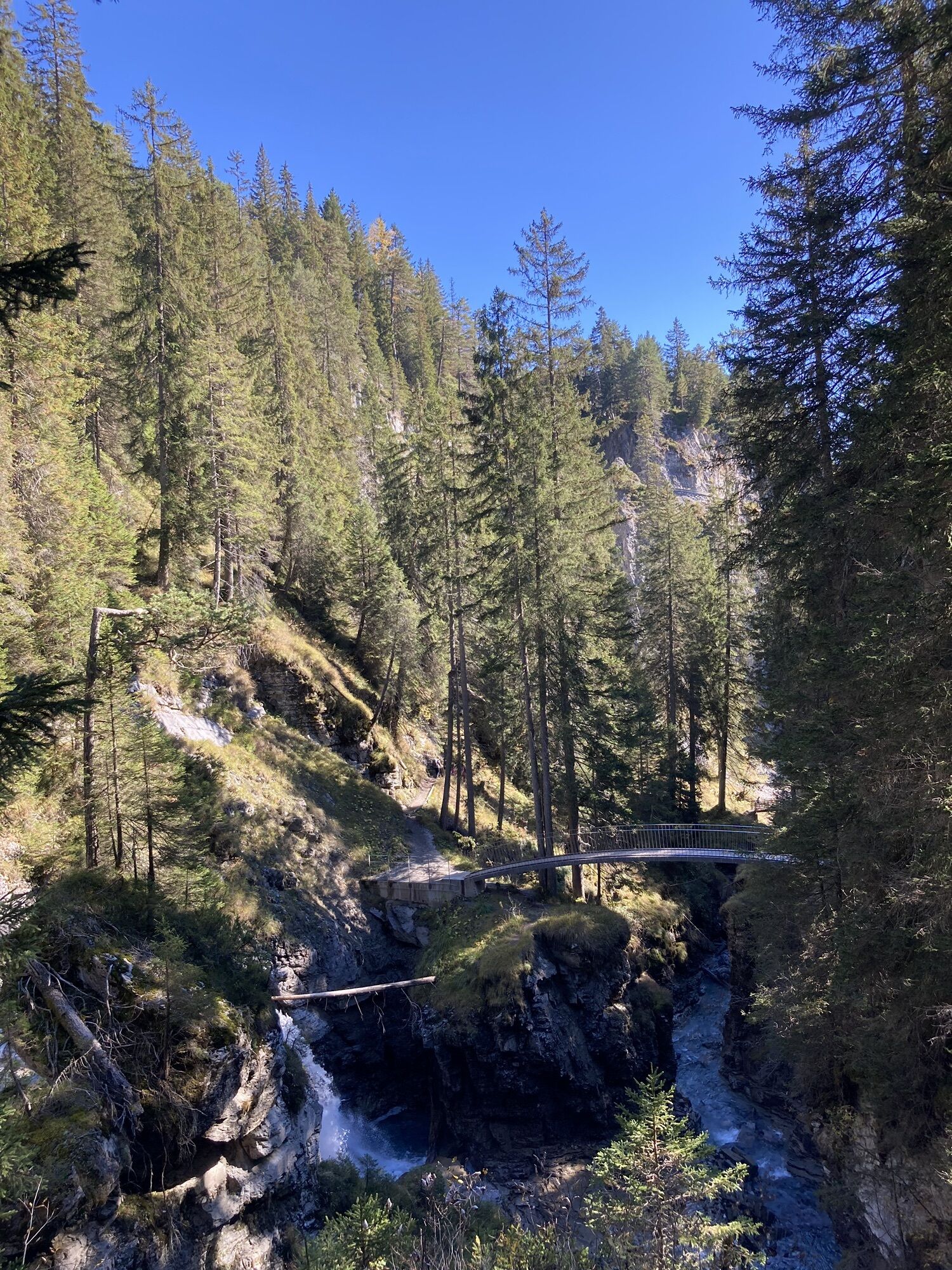
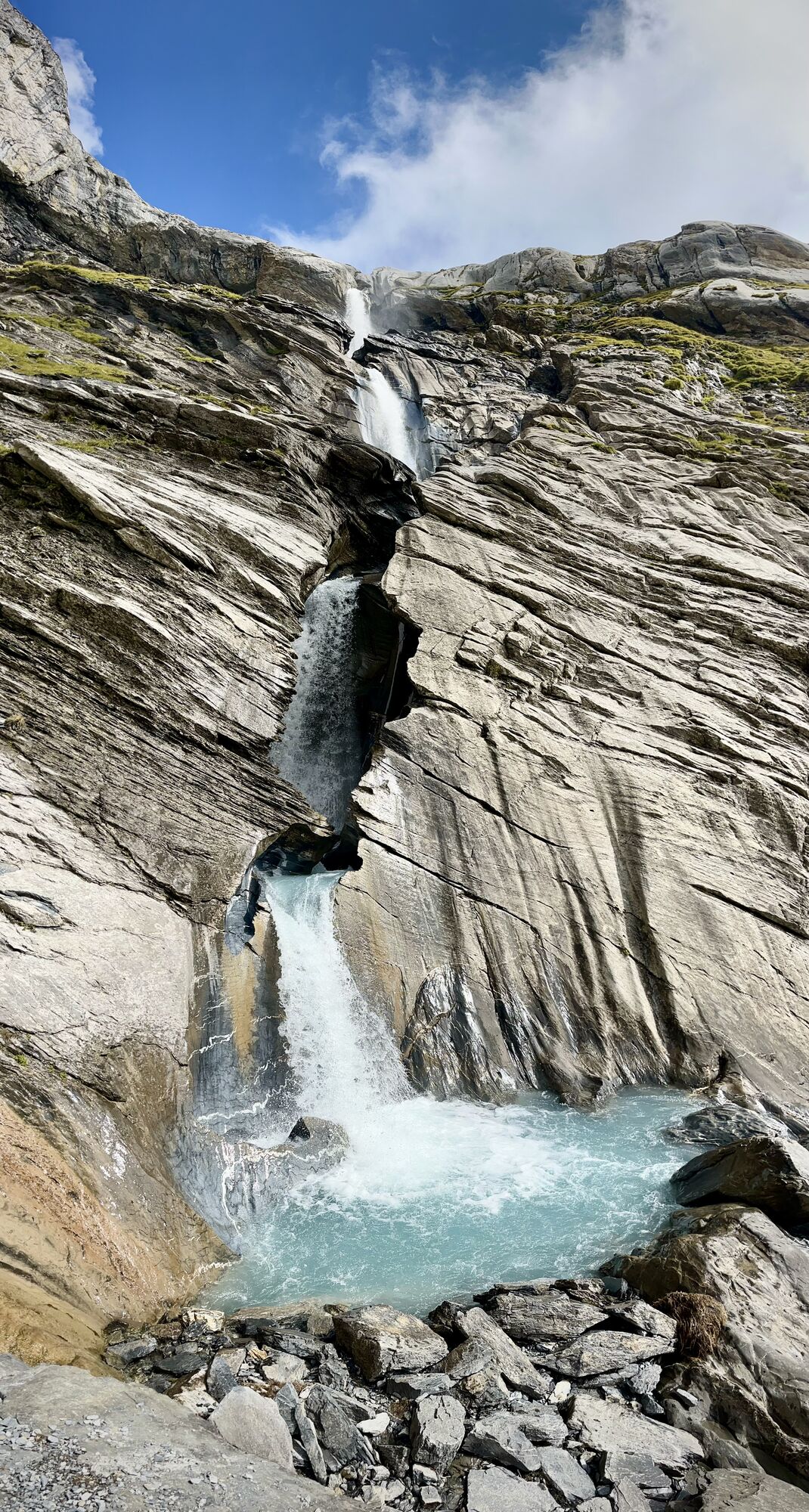
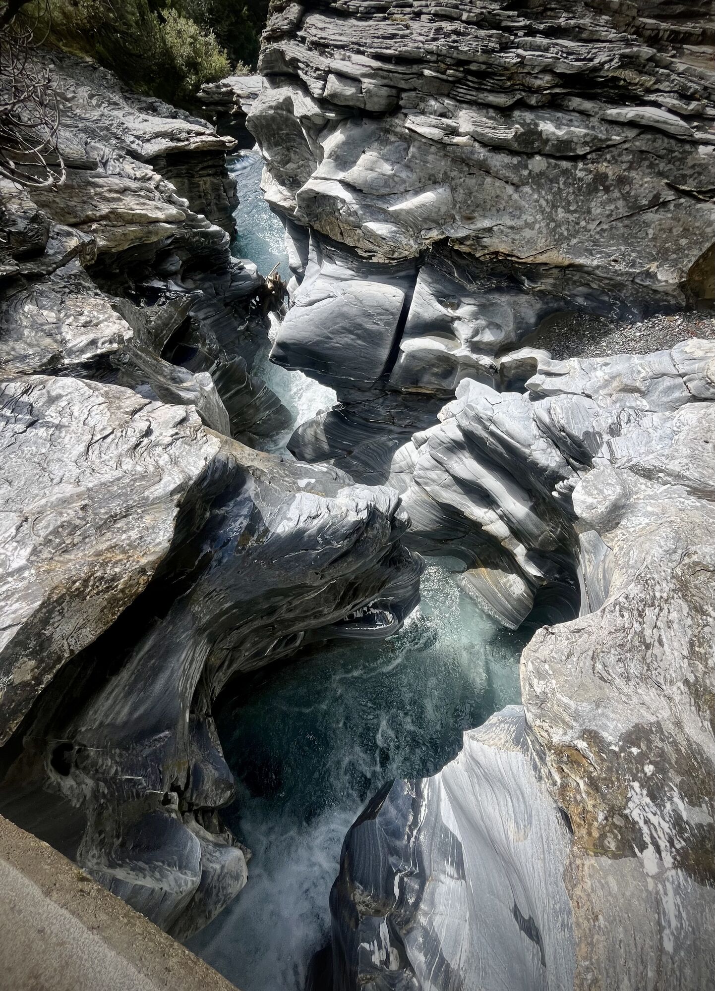
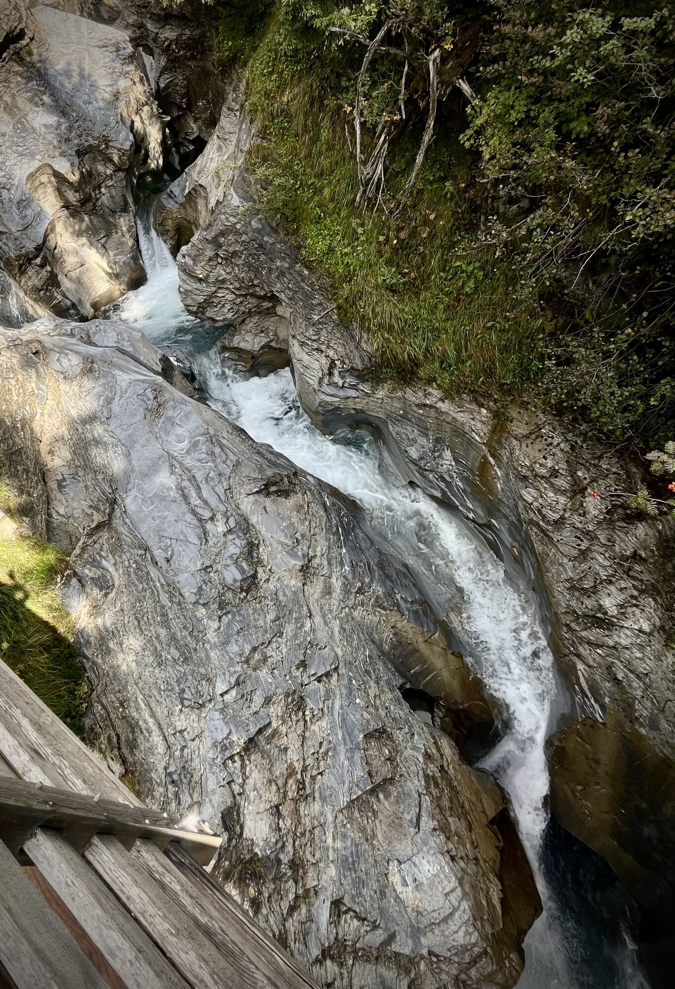
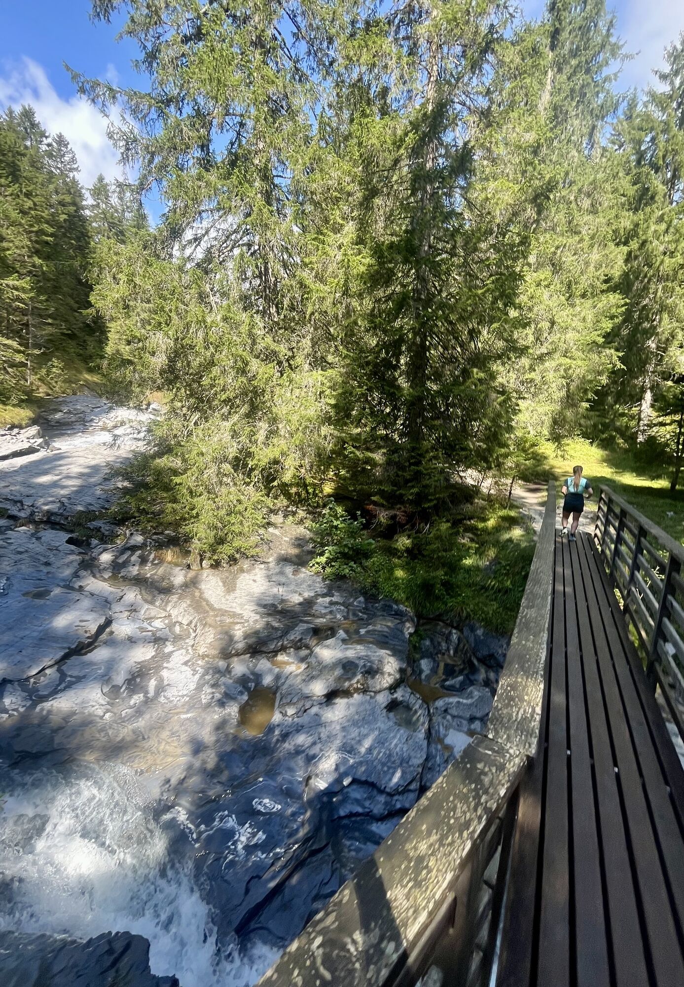
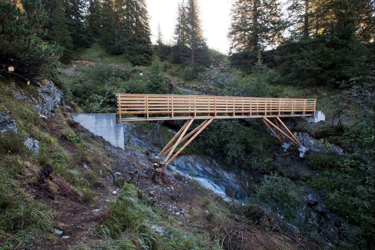
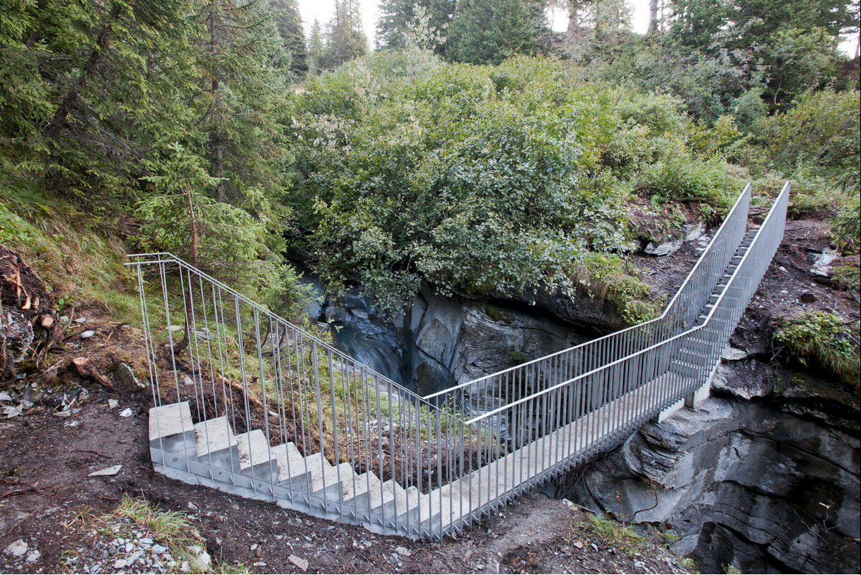
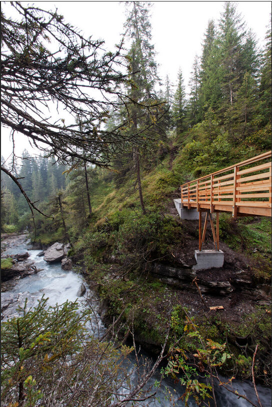
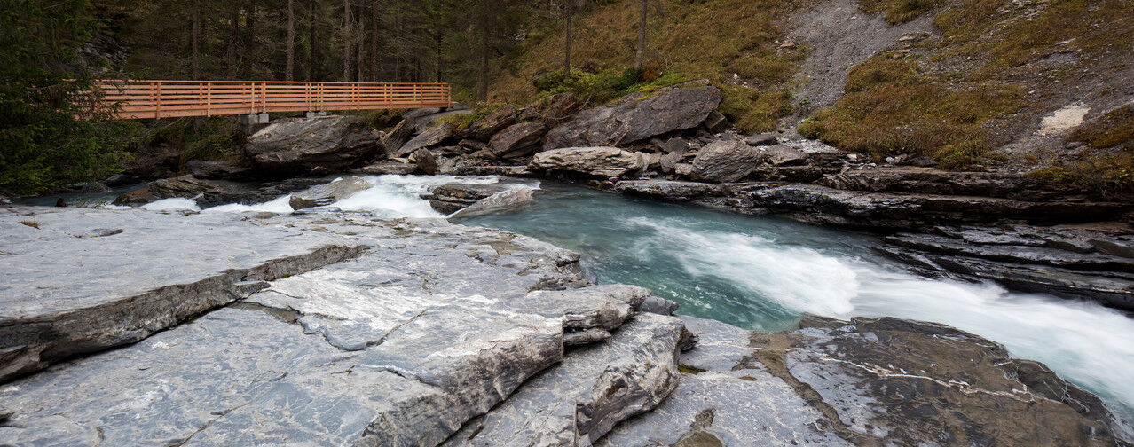
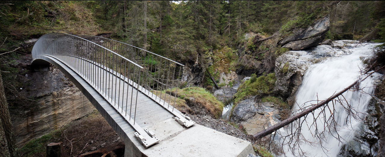
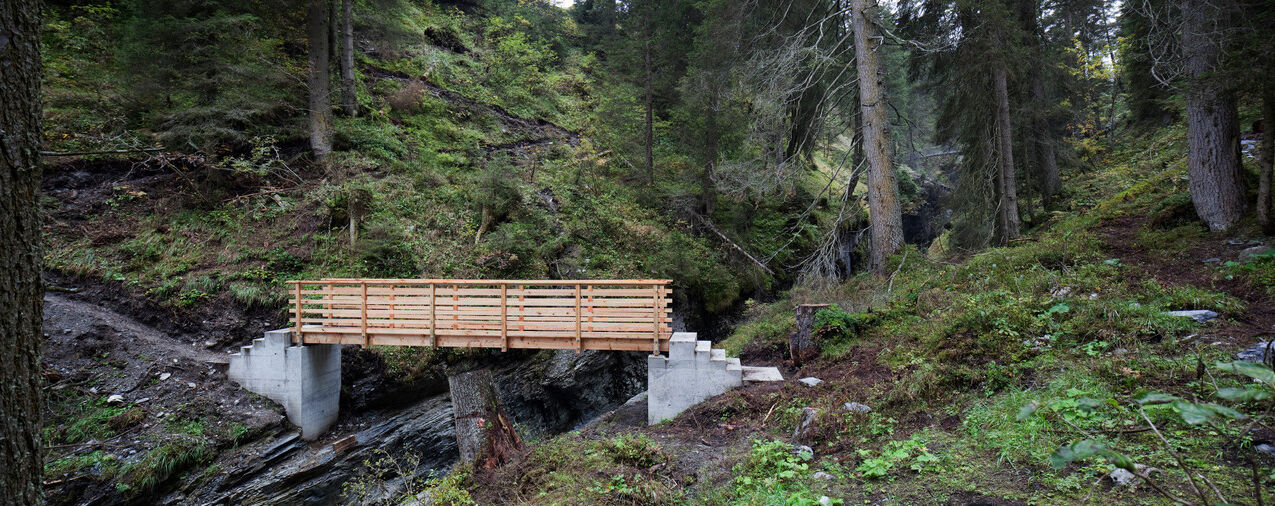
The Flims water route (Romansh: Trutg dil Flem) leads from the waterfall in the lower Segnesboden to the center of the village. On the one hand, it guides visitors directly along the river through narrow gorge landscapes over unique bridges, past waterfalls, mills and slides. On the other hand, you move along the upper edge of the valley of the stream, along lovely alpine landscapes and alpine pastures.
The Flem is crossed on a total of six sometimes daringly constructed bridges. From them, the bizarre rock formations of the Flem gorges can be particularly well observed. Finally, near the valley station, there are two platforms where the hiker can once again enjoy the sound of water music.


Uphill:
The starting point of the path is the valley station of the cable cars in Flims. From there, the path, marked with hiking route 764, leads in just under four hours and 1260 meters of altitude gain past the seven bridges specially designed for the water route to the waterfall on the lower Segnesboden.
Downhill:
By FlemXpress from Segnes station or from Nagens Sura.
By bus from Nagens.
Cable Cars:
Flims Cable Cars – Segnesboden (or Nagens Sura)
Bus:
Laax Cable Cars – Nagens mountain station
Outdoor clothing, sturdy shoes, rain protection, long pants, backpack.
Attention: The Trutg is a narrow mountain hiking trail with various difficulties: slope traverses, bridges and footbridges over flowing water. Mountain shoes, surefootedness and occasional freedom from dizziness are required.
To make the Trutg dil Flem accessible to less experienced hikers, it can be completed in sections with several entry and exit points.
Use of the path is at your own risk.
Insurance coverage is the responsibility of each individual.
Bikers are not permitted on the Trutg dil Flem.
By car via the A13 motorway from Zurich, exit 18 Flims
By PostBus from Chur to Flims Cable Cars.
Parking in the STENNA underground car park at the Flims valley station.
T2
Guest Information Flims Laax Falera
Via Nova 62
7017 Flims
+41 (0)81 920 9200
Email: info@flimslaax.com
Web: www.flimslaax.com
The Segnes hut invites you not only to eat but is also the starting point for numerous other hikes.
Populære ture i området
-
4.5
4-lake hike
MediumVandring 12.8 km -
4.7
The riverside trail: Trutg dil Flem
MediumTemaspor 13.5 km -
4.3
Via Ferrata Pinut
MediumVia ferrata 5.82 km -
4.7
Rhine Gorge Hike: Senda Ruinaulta (659)
lysVandring 9.39 km -
Piz Fess 2880m, der Stolze
tungVandring 12.8 km -
4.8
Rheinschlucht: From Ilanz to Versam into the heart of the Rheinschlucht
MediumVandring 11.4 km -
4.3
Round trip hike Falera - Curnius - Alp Dadens - Falera
MediumVandring 11.4 km -
5.0
Staderas - Conn - Rhein Gorge Ruinaulta-Staderas
MediumVandring 19.8 km -
5.0
Rhine Gorge Circular Hike
MediumVandring 11.4 km -
Rhine Gorge/Ruinaulta: Ilanz - Reichenau
MediumVandring 21.2 km

Vandring og sporing


Gå ikke glip af tilbud og inspiration til din næste ferie
Din e-mailadresse er blevet tilføjet til mailinglisten.