Bonaduzer Wald (256)
lys
Mountainbike
Naviger
Naviger
Få denne tur på din mobiltelefon
Kort
Bonaduzer Wald (256)
lys
Mountainbike
13.21 km
Scan QR-koden, og start navigationen i bergfex -appen
QR Code
Vandring og sporing
Vandring og sporing

Bonaduzer Wald (256)

Afstand
13.21 km
Varighed
01:30 h
Opstigning
299 hm
Havets niveau
656 - 944 m
Download af spor
Kort
Bonaduzer Wald (256)
lys
Mountainbike
13.21 km

The best place to start this mountain bike tour is in the village of Bonaduz, which together with Rhäzüns forms an actual high plateau. Bonaduz is also the gateway to the Rhine Gorge natural monument....


Beskrivelse af

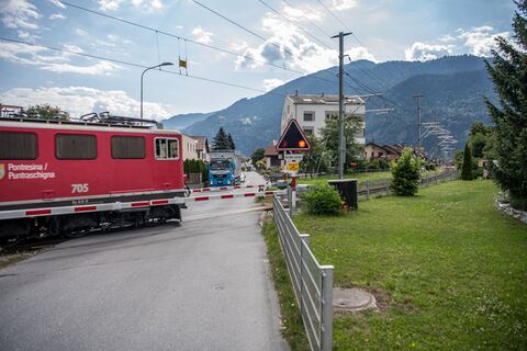
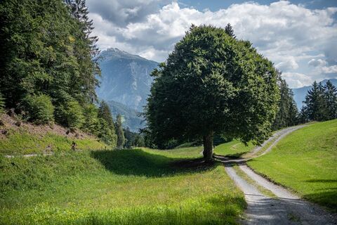
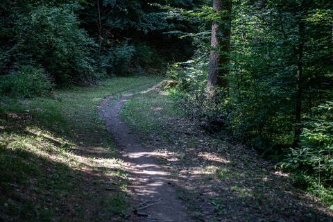
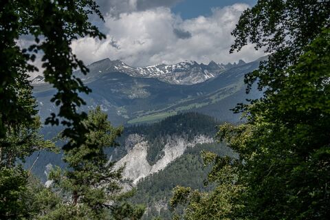
The best place to start this mountain bike tour is in the village of Bonaduz, which together with Rhäzüns forms an actual high plateau. Bonaduz is also the gateway to the Rhine Gorge natural monument. After you have crossed the idyllic forest landscape near Bonaduz on well-maintained forest paths, there follows an ascent on a road with little traffic, which leads to Sigl Ault with a view. A single trail soon awaits you, leading smoothly down to the panoramic road above the Rhine Gorge. The "Ruinaulta", as the gorge is called in Romansh, is one of the most magnificent and diverse landscapes in the Alps, created 10,000 years ago by a landslide. You now follow this gorge with a magnificent view, past the "Zault" viewing platform (a photo stop is recommended), before finally diving back into the woods and returning to Bonaduz on extensive forest paths.

Beskrivelse af

Snowline map  

While at higher altitudes there is at best already snow, the trails in the valley are still free of snow. Our interactive snow depth map helps you to plan your tour. Here you can see at a glance at www.flims.com/schneesituation where you can already expect snow on the paths and trails and where you can still be on the road without getting cold feet. 


This tour opens up a magnificent view of the imposing Rhine Gorge. From Bonaduz, the route leads through beautiful forest paths into the Rhine Gorge and back again.

Teknologi
2 / 6
Tilstand
2 / 6
Landskab
4 / 6
Erfaring
5 / 6
Bedste tid på året
Jan
Feb
Mar
Apr
Maj
Jun
Jul
Aug
Sep
Okt
Nov
Dec
Forfatter
Leveret af Flims Laax Falera
Logo
Del tur
Kort
Bonaduzer Wald (256)
lys
Mountainbike
13.21 km
Fejl
Der er opstået en fejl. Prøv venligst igen.
Information om ruten
Rute

Bonaduz - Sigl Ault - Zault - Bonaduz

Envejstur

Ja

Udstyr

Repair and first aid kit belong in the rucksack

Sikkerhedsinstruktioner

Watch out for hikers. In the canton of Graubünden we share the paths.

Information om ankomst
Ankomst

By car on the A13 motorway from Zurich to Chur, exit 18 Reichenau

Offentlig transport
Stop:

Flims Dorf, mountain railways
By post bus from Chur or the public Flims Laax Falera Shuttle.

Timetable
www.sbb.ch

Parkering

You will find parking spaces in Bonaduz at the railway station.

Yderligere information og tips
Yderligere information
App
Inside Laax

- with all tours and information

Tips

Photo stop at the "Zault" viewing platform

Ingen anmeldelser endnu
Skriv en anmeldelse

Anmeldelser hjælper andre brugere med at vælge deres næste eventyr. Bedøm venligst kun turen, ikke vejret eller din snack.

Vælg en af stjernerne for at bedømme turen
Dårlig tur
Svag tur
Middelmådig tur
God tur
Fremragende tur
bergfex logo Få indsigten Altid live på stedet med over 9.500 webkameraer. bergfex Som Pro-bruger kan du nu se de tilsvarende webkameraer for mange ture i Tours-appen fra. Det giver dig mulighed for at se de aktuelle forhold direkte.
Vandring og sporing

Vandring og sporing

Vandring og sporing
Over 550.000 turforslag, detaljerede kort og en intuitiv ruteplanlægger gør appen til et must-have for alle naturentusiaster.
Vandring og sporing