


For leisure cyclists, the predominantly flat tour can be completed in three to four days. This gives you plenty of time to get to know the region, the natural surroundings, and the two “green lungs” of...
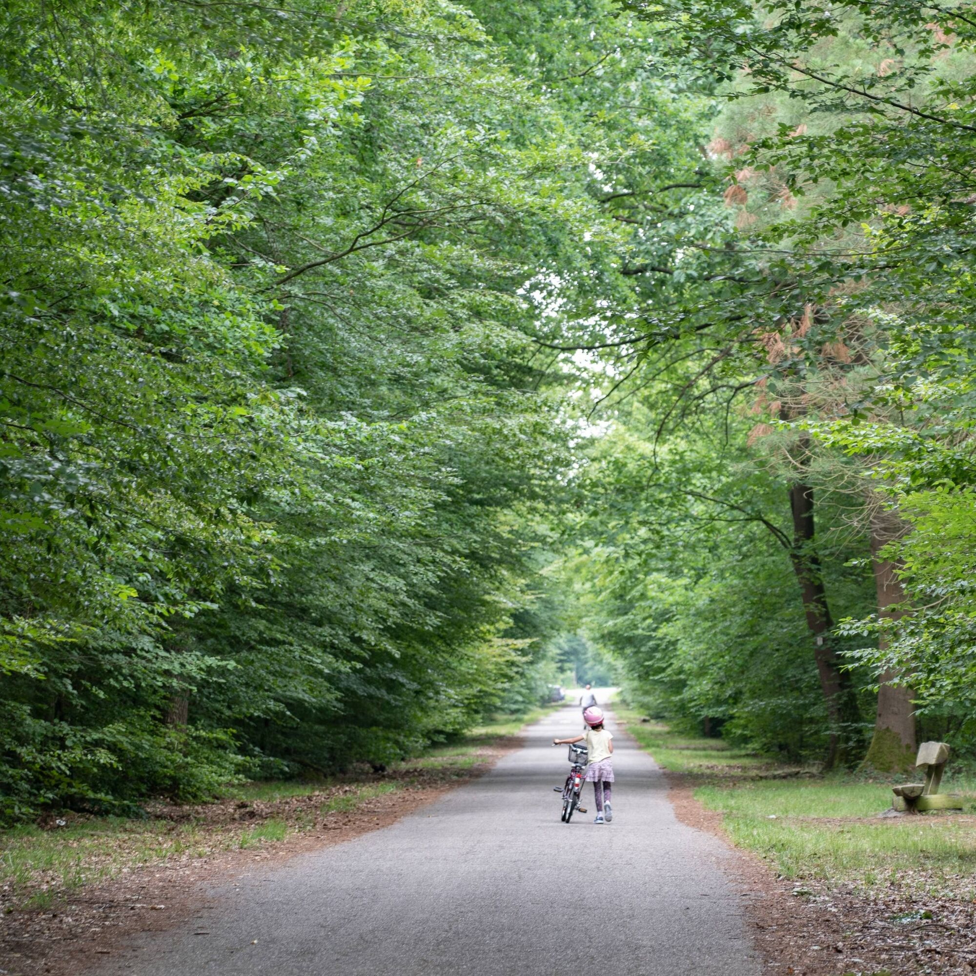
For leisure cyclists, the predominantly flat tour can be completed in three to four days. This gives you plenty of time to get to know the region, the natural surroundings, and the two “green lungs” of the Rhine Valley: the Haguenau Forest in Alsace and the Bienwald Forest in southern Palatinate. The two large forests in the Rhenish lowlands impress with their diversity of tree populations and their flora and fauna.
The Haguenau Forest is the sixth largest lowland forest in France. Due to its unique history, landscape, biodiversity, and valuable woods, the forest has been awarded the French label “Forêt d'Exception.”
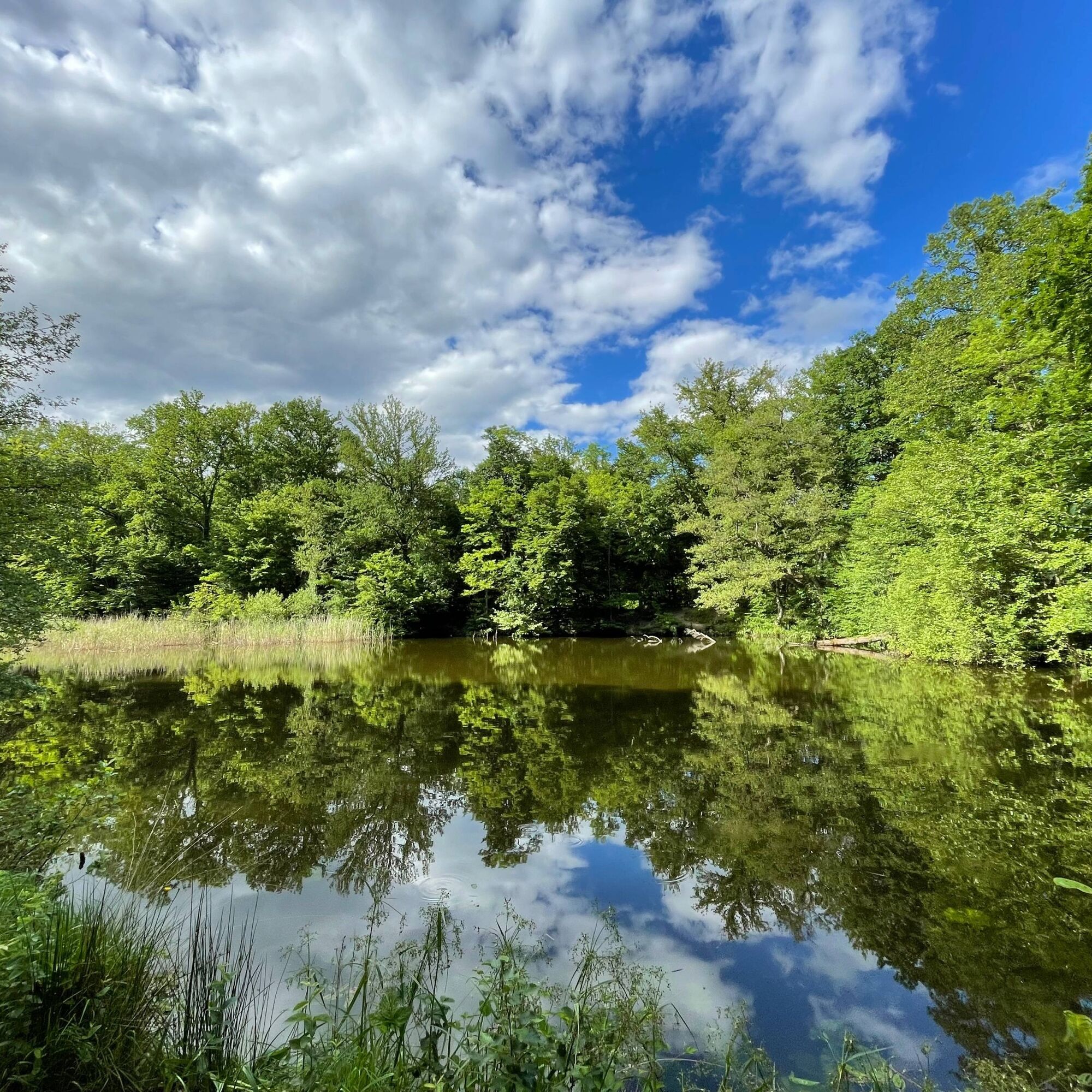
The Bienwald is the largest forest area in the Palatinate Rhine plain. With its babbling brooks, gnarled oaks, natural silence, and impressive biodiversity, this forest is an extraordinary natural experience.
From the Haguenau Forest to the Bienwald, the route takes you through northern Alsace with its idyllic villages, meadows, and fields. North of the Bienwald, from Wörth-Schaidt to Kandel, you drive through the “Viehstrich” (cattle trail) of the Southern Palatinate, which owes its name to the former prevalence of cattle farming and is now a very unusual region where time seems to stand still. From lush pastures and fertile fields, the route continues to Hatzenbühl, Germany's oldest tobacco-growing region. The tobacco fields are in full bloom, especially in summer (July/August). The journey back to France takes us along the Rhine and the remarkable nature reserve of the Sauer Delta near Seltz in France.

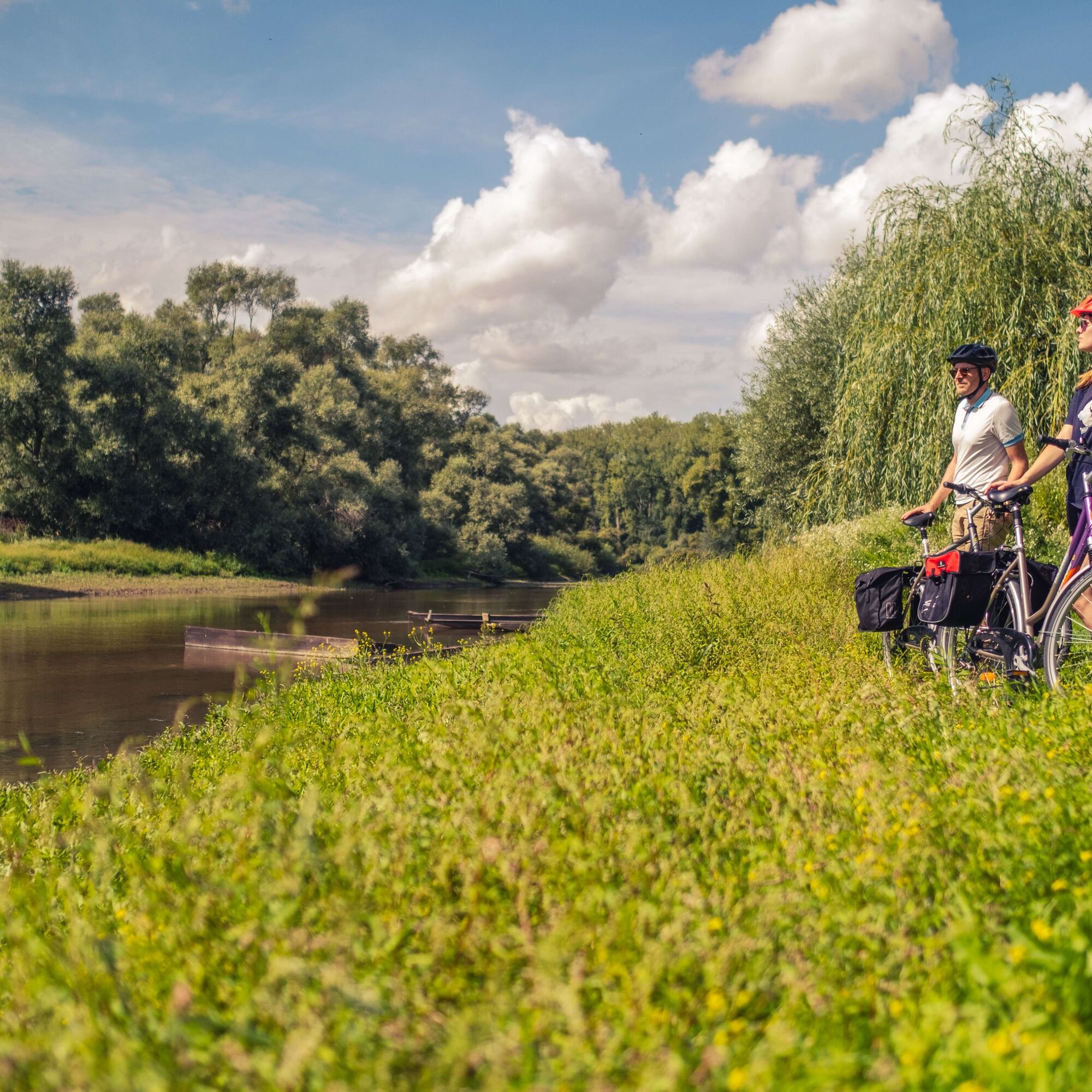
After crossing the border, we pass through Lauterbourg, a charming little town known as the “Gateway to France” and home to one of the most beautiful water sports centers in Alsace, the Base des Mouettes. We follow the Lauter Valley cycle path (IC51) for a few kilometers before joining the EuroVelo15 Rhine cycle path. We cross the Delta de la Sauer National Nature Reserve at Munchhausen. Don't hesitate to visit the Maison de la Nature to learn more about the region's natural riches! We continue on the EuroVelo15 and pass near the Seltz ferry, which is very popular with cycling tourists. Before reaching Beinheim, we approach the Rhine and take the cycle path that stretches for a good ten kilometers along the Rhine dam to Drusenheim. On the way, be sure to make a detour to Fort Louis, a former fortress designed by Vauban along the Rhine.
Drusenheim is a small town on the Rhine. Decorated with flowers, it is an ideal place for a refreshing break in the gardens of Altwasser or a cultural stopover at the Paso Museum, dedicated to the painter who hailed from the municipality.
We then follow part of the PAMINA South Route, which connects the towns of Haguenau, Rastatt, and Baden-Baden and is marked with special signage. We head towards Soufflenheim, the famous town of Alsatian potters, which is inextricably linked to the Haguenau Forest and its high-quality clay deposits. We continue on the IC25 and then reach the heart of the Haguenau Forest. The Haguenau Forest is the sixth largest lowland forest area in France, stretching 30 km from west to east and 10 km from north to south. It is a popular recreational area for the inhabitants of Haguenau and visitors alike. It has been designated a “Forêt d'Exception” (exceptional forest) and offers numerous opportunities for walks and activities. We pass a place called “Gros Chêne,” where there is a children's playground, a picnic area, and an auberge where you can enjoy tarte flambée on the terrace. We can also discover the Saint-Arbogast chapel and, not far from it, the monument to Gloria Friedmann's oak tree.
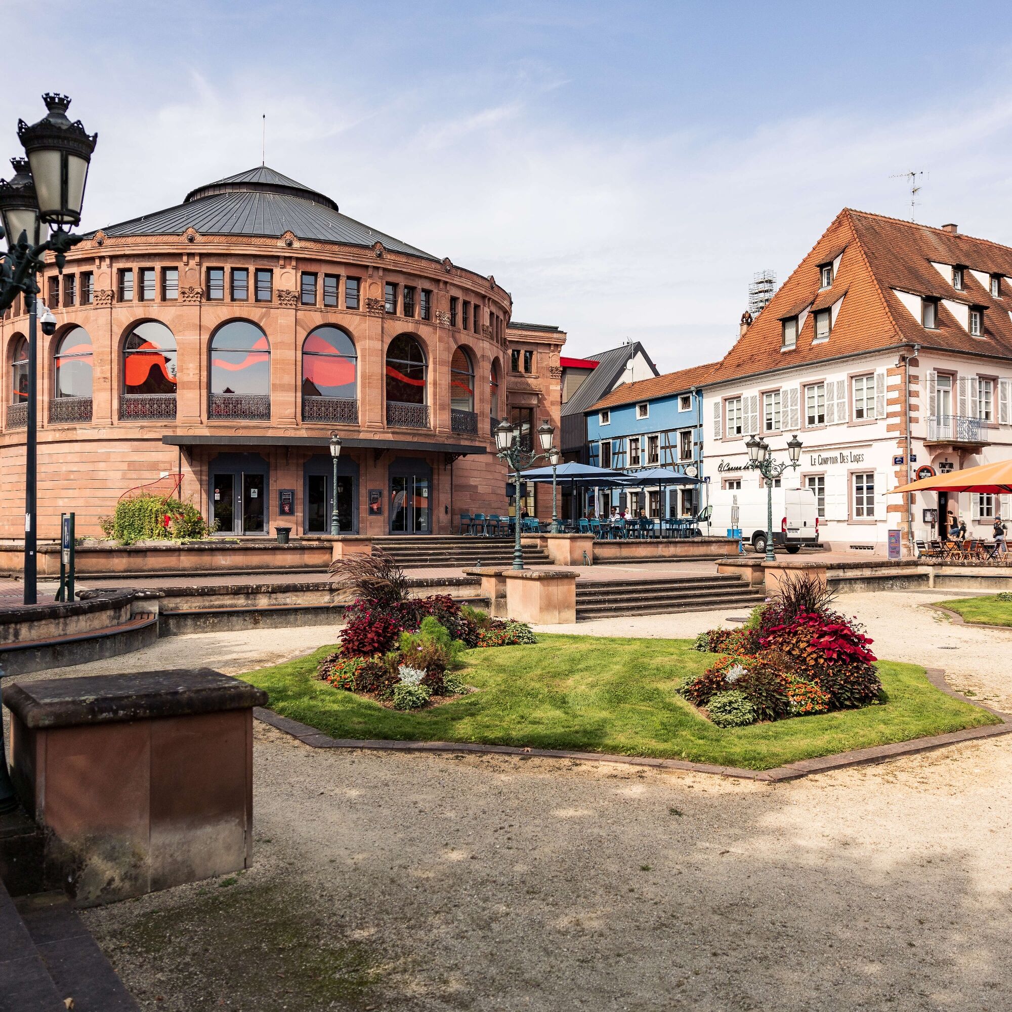
We take the cycle path again towards Haguenau, the gateway to northern Alsace and the city of Barbarossa. Haguenau is a so-called “small big city” with a cozy, car-free city center that invites you to stroll among monuments, museums, shops, tea rooms, bars, and restaurants, always in a peaceful and pleasant atmosphere!
From there, we continue north on the IC20 towards Walbourg with its former Benedictine abbey of Sainte-Walburge and its museum-mémorial. We then reach Biblisheim and continue east on the Sauertal cycle path (IC52). We discover Betschdorf, another famous Alsatian pottery town that produces glazed stoneware ceramics with cobalt blue decoration, then Kuhlendorf with its half-timbered church and Hatten with its “Abri de la Ligne Maginot” museum.
We then take the brand new IC66 route, which leads through Green Alsace, also known as Outre-Forêt, where traditions are well preserved, especially in Seebach, a charming little town with remarkable rows of white half-timbered houses. We then reach the Lauter Valley cycle path (IC51), which we leave at Salmbach to cross the border again.
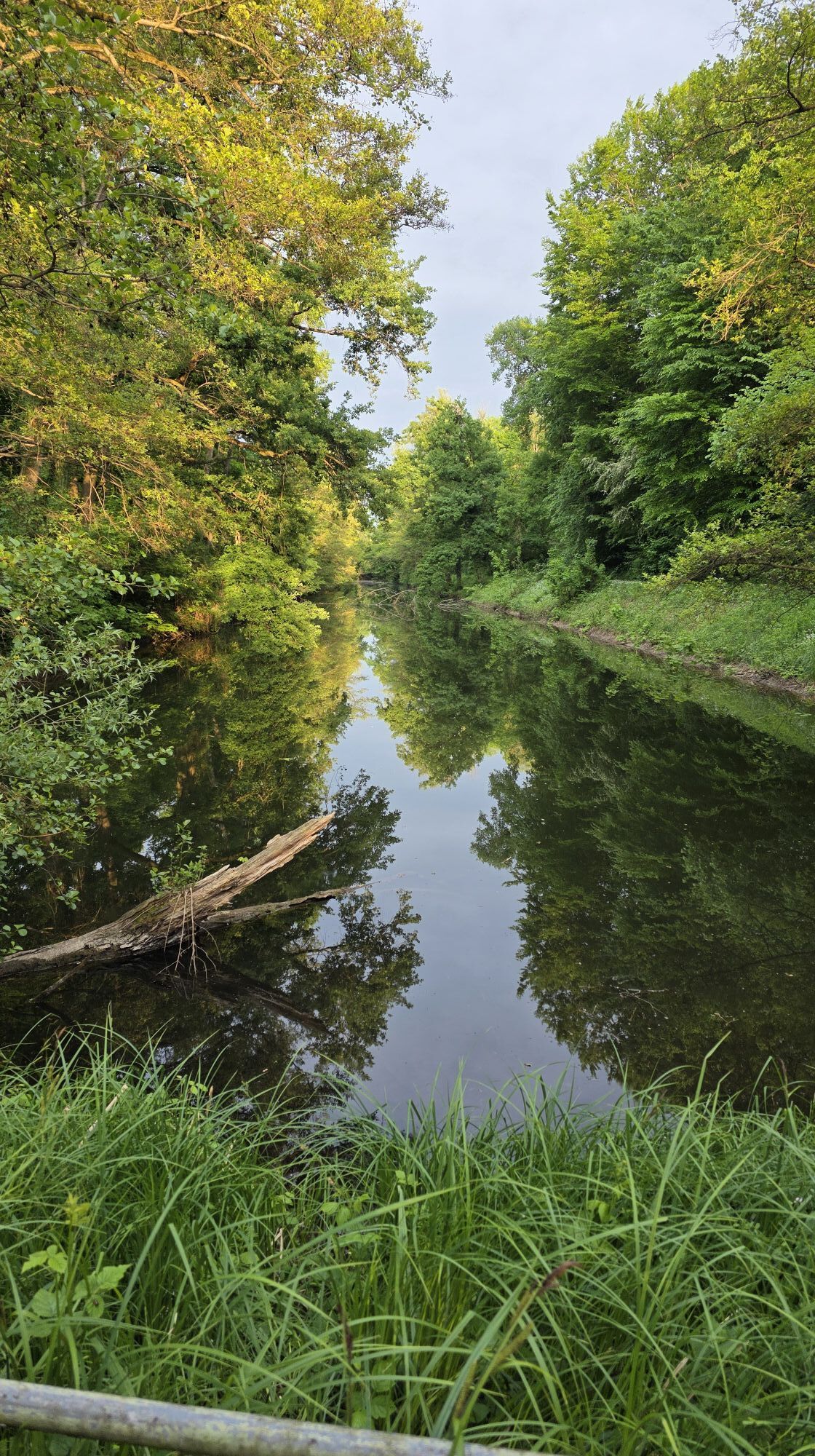
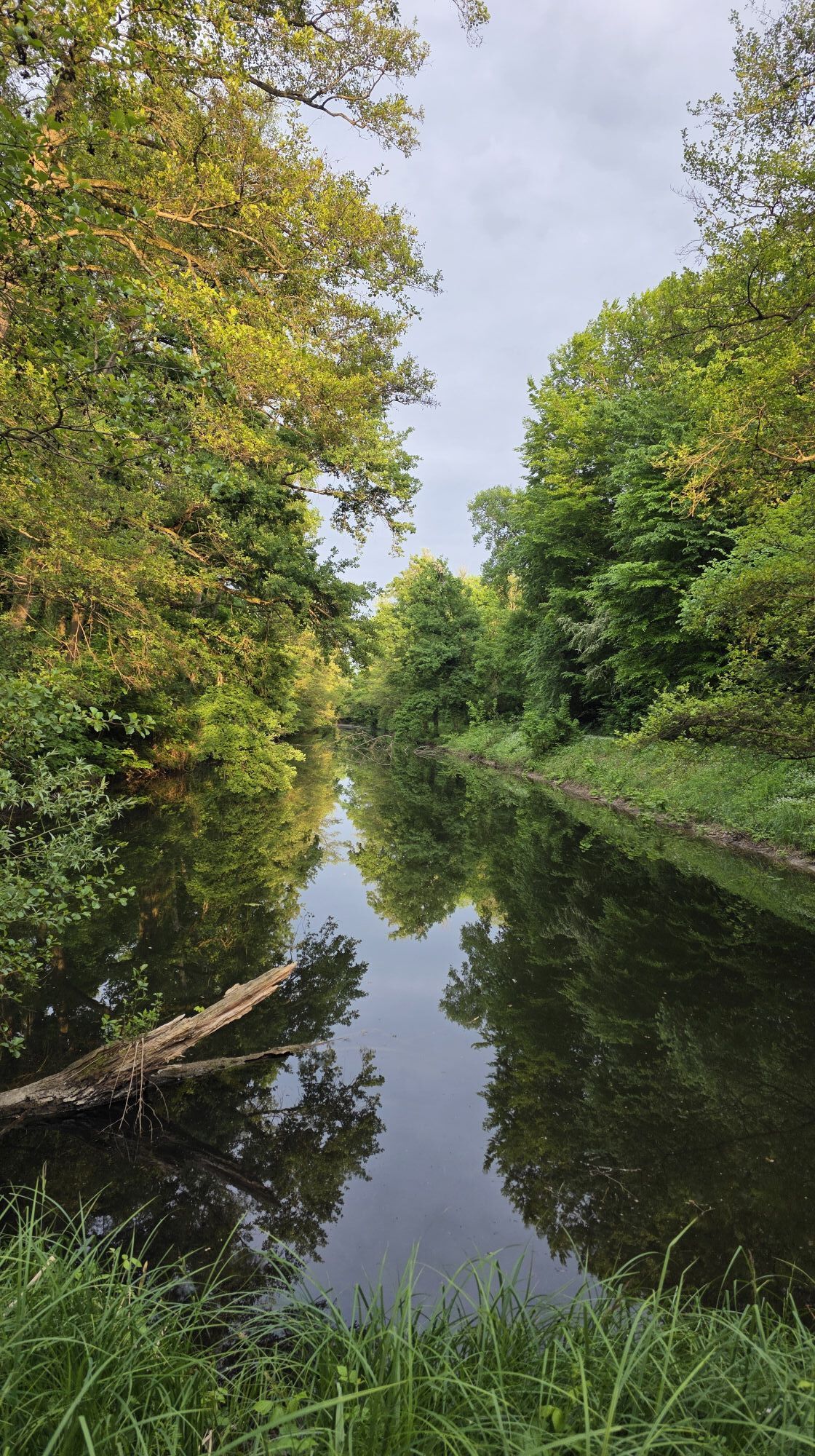
We cross the Lauter into Germany and enter the mystical Bienwald forest. We cycle through the forest on the PAMINA Rheinpark Nord cycle route (orange sign with a bicycle and German-French flag). The Mundatweier invites us to take a short break. Here we can enjoy the natural silence and let the sounds of the forest wash over us.
At Wörth-Schaidt, we leave the Bienwald forest. We continue to follow the PAMINA Rhine Park North Circular Trail through the village towards Freckenfeld and Minfeld. Shortly before Kandel, however, we continue straight ahead. Here we follow the signs for the Kraut-und-Rüben Cycle Route and the South Palatinate Cycle Route into Kandel. At the edge of Kandel, we pass the Zapf farm shop. Here you can buy fresh fruit and vegetables or baked goods. At Hatzenbühl, we leave the Kraut-und-Rüben-Radweg.
Instead of turning left towards Hayna/Herxheim, we turn right into Hatzenbühl and follow the themed cycle path “Vom Riesling zum Zander” (From Riesling to Zander) (sign with fish and wine glass). This is Germany's oldest tobacco-growing region. This is clearly evident from the many old tobacco sheds that can still be seen here in the village and outside it. The tobacco plants begin to flower in July and August. If you have the time and inclination to learn more about tobacco cultivation, it is worth taking the short tobacco circular trail, which starts right next to the church.
Then we continue on the Riesling-Zander Cycle Route to Rheinzabern. On the main road in Rheinzabern, near the Terra Sigillata Museum, which is well worth a visit, we rejoin the PAMINA Rheinpark Nord cycle route, which we follow south towards Jockgrim.
After Jockgrim, we ride through the eastern edge of the Bienwald forest again. Behind the railroad tracks at the Hermannsruhe rest area, we leave the tourist-oriented themed bike paths and turn left onto the bike path that runs alongside the tracks to the Bienwaldhalle in Wörth.
We follow the green and white cycle signs towards Kandel, ride through Ottstraße and cross Hanns-Martin-Schleyer-Straße and the S-Bahn tracks. Then we turn left onto the cycle path and at the junction with the road “Im Bödel” we turn right towards Hagenbach and Lauterbourg (F).
We turn right and ride along the roadside bike path to Hagenbach. We ride to Hagenbach train station, where we turn right at the roundabout onto Bahnhofstraße.
At the end of the street, we turn left towards Wissembourg (F)/Lauterbourg (F). We continue straight ahead on this bike path. Shortly after Hagenbach, we enter the Bienwald forest again, which looks very different here from the previous sections due to the different tree population. Passing Neuburg am Rhein, we ride into Berg, past the sports field, and at the end of the road we turn left onto Bruchbergstraße.
Then we turn right onto Ludwigstraße and follow the PAMINA Lautertal (blue sign), Rund um den Bienwald, and Bienwald-Rheinauen-Tour tourist cycle routes until we finally cross the border at Neulauterburg and Lauterbourg. In Lauterbourg, we follow the PAMINA-R cycle route again. turn left into Rue de la Chapelle and continue to our starting point, Lauterbourg train station.
To set off on your cycling routes in complete safety, we recommend the following equipment:
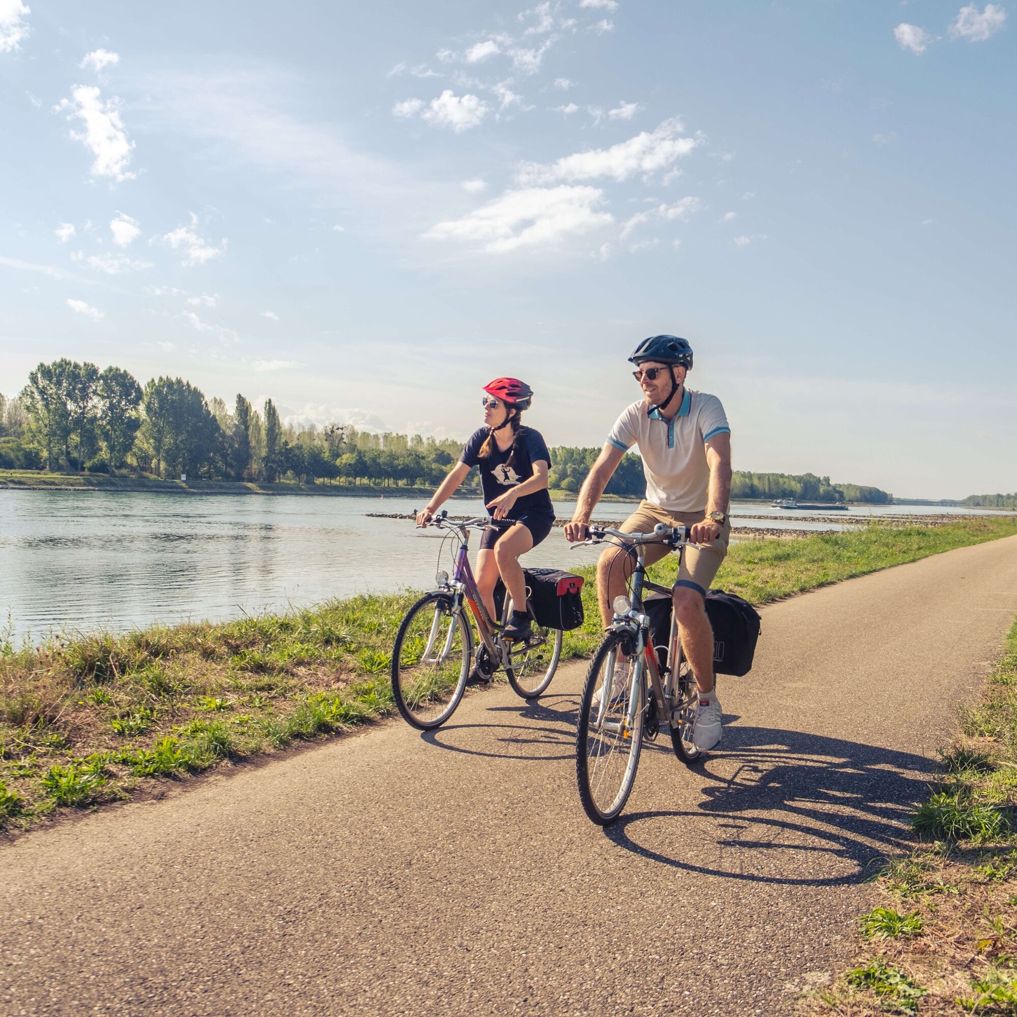
Touring bike, electric assistance is welcome for added comfort,
bike helmet,
waterproof technical clothing in case of bad weather,
bike bag, for storing equipment and supplies,
sunglasses,
insect repellent
smartphone,
repair kit,
sun protection.
Please note that the route follows farm tracks, roads with little traffic, and dedicated cycle paths. The surfaces are mainly asphalt, with some sections on dirt tracks or gravel roads.
Coming from the A65, take the B9 at Kandel-Süd towards Lauterbourg (F). From the B9, take the L554 towards Lauterbourg (F) and Neulauterburg. At Neulauterburg, cross the border and in Lauterbourg take the “Rue de la Chapelle” towards the train station and follow the road signs.
From France to Lauterbourg:
From the A35, exit shortly before Scheibenhard onto the D3 towards Lauterbourg train station.
The route can be started from several train stations and stops on the Palatinate or French side, such as Lauterbourg, Seltz, Munchhausen, Drusenheim, Haguenau, Wörth-Schaidt, Kandel, Rheinzabern, Jockgrim, Wörth a. Rhein, Hagenbach, Berg, Neuburg.
For more information about Rhineland-Palatinate, visit www.vrn.de and for Alsace, visit www.sncf.com
Bicycles are allowed on regional trains in the Palatinate (Verkehrsverbund Rhein-Neckar (VRN)) – subject to a charge on weekdays between 6 a.m. and 9 a.m., free at other times. Passengers, strollers, and wheelchairs are given priority in the event of a lack of space.
Bicycles are allowed and free of charge on regional trains in Alsace outside rush hour (check www.sncf.com).
There are several parking options along the route. Free parking in Lauterbourg is available at the train station or at the Eurodistrict Pamina building on Allée des Cygnes.
Südpfalz-Tourismus Landkreis Germersheim e.V.
Luitpoldplatz 1
76726 Germersheim
+49 (0) 7274 53300
Pays de Seltz-Lauterbourg
+33 (0)3 88 05 59 79
www.tourisme-pays-seltz-lauterbourg.fr
Pays rhénan
+33 (0)3 88 96 44 08
Pays de Haguenau
+33 (0)3 88 06 59 99
Alsace Verte
+33 (0)3 88 80 89 70
Cycling in Alsace
There are many rest areas, a playground, and an auberge where you can stop for refreshments at the large oak tree known as the Gros chêne in the Haguenau Forest. On the German side, there is a counterpart to this, the Bismarck Oak, which is located a little further away and quieter on the Schaidter Westwallweg quality hiking trail. You can enjoy a good meal at the “Bienwaldmühle” on the German-French border or at the Naturfreundehaus Kandel.
Populære ture i området
-
Cycling circuit: PAMINA Rhine Park loop Haguenau – Rastatt
tungLangdistance-cykelsti 133.6 km -
Cross-border bike tour "On the trail of history: bunkers, ramparts, casemates" (PAMINA)
tungLangdistance-cykelsti 399.4 km -
Cross-border cycle route "Orchard" (Espace PAMINA)
MediumCykling 395.8 km -
Transboundary cycling circuit "Remarkable natural spaces" (PAMINA area)
tungLangdistance-cykelsti 432.2 km -
Bike route: BL722 - Goethe and the potters' villages
lysCykling 26.9 km -
Randonnée autour de Cleebourg
MediumVandring 12.3 km -
Educational bee trail in Büchelberg
lysTemaspor 4.78 km -
Cross-border cycling route "Orchards" (PAMINA Area)
tungLangdistance-cykelsti 398.5 km -
Westwall hiking trail
MediumTemaspor 7.96 km -
Bike circuit “Rhine Adventure”
MediumCykling 52.9 km
Vandring og sporing


Gå ikke glip af tilbud og inspiration til din næste ferie
Din e-mailadresse er blevet tilføjet til mailinglisten.