

© Zermatt - Matterhorn - Fabienne Fux

© Zermatt - Matterhorn - Fabienne Fux

© Zermatt - Matterhorn - Fabienne Fux

© Zermatt - Matterhorn - Fabienne Fux

© Unbekannt - Zermatt Tourismus

- Kort beskrivelse
-
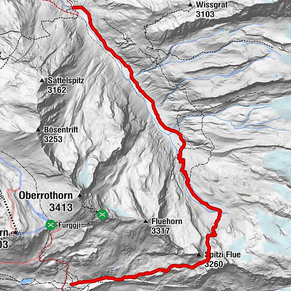
The hike over the Pfulwe (Fluh Pass) reveals the magnificent wild hinterland to the east of Täsch and Zermatt. The steep valley of the Mellichbach river enchants hikers with its arid beauty.
- Sværhedsgrad
-
tung
- Evaluering
-
- Rute
-
Ottafe (2.205 m)0,0 kmFlue9,5 kmFluhalp9,5 km
- Bedste sæson
-
janfebmaraprmajjunjulaugsepoktnovdec
- Højeste punkt
- 3.145 m
- Destination
-
Fluhalp (2,616 m)
- Højdeprofil
-
 © outdooractive.com


- Forfatter
-
Rundvisningen Täschalp-Fluhalp (Pfulwe) (Nr. 46) bruges af outdooractive.com forudsat.
GPS Downloads


Generel information
Forfriskningsstop
Flora
Fauna
Lovende
Flere ture i regionerne
-
Oberwallis
1873
-
Mattertal
555
-
Täsch
195


")


