

- Kort beskrivelse
-
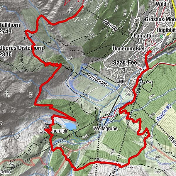
This hike starts with a steady, wooded climb above town followed by a rolling traverse through larches and blueberry meadows, past waterfalls, with beautiful views throughout.
- Sværhedsgrad
-
medium
- Evaluering
-
- Rute
-
Reformierte Kirche0,2 kmAm Biel0,2 kmBlomattu0,4 kmAlpin Express I (1.798 m)0,4 kmUndri Gassu0,4 kmSaas-Fee (1.798 m)0,5 kmChalmattu0,7 kmPlattjen (1.806 m)0,9 kmSpielboden (1.806 m)0,9 kmGletschergrotte4,7 kmGletscherälpli4,8 kmBergrestaurant Hannig9,6 km
- Bedste sæson
-
janfebmaraprmajjunjulaugsepoktnovdec
- Højeste punkt
- 2.339 m
- Destination
-
Hannig
- Højdeprofil
-
 © outdooractive.com
-

-
ForfatterRundvisningen Saas Fee dayike Hannig bruges af outdooractive.com forudsat.
GPS Downloads


Generel information
Forfriskningsstop
Flere ture i regionerne
-
Oberwallis
1872
-
Saastal
484
-
Saas-Fee
128


