

© Alpenregion Bludenz Tourismus GmbH - Alex Kaiser

© Alpenregion Bludenz Tourismus GmbH - Alex Kaiser

© Vorarlberg Tourismus GmbH
- Kort beskrivelse
-
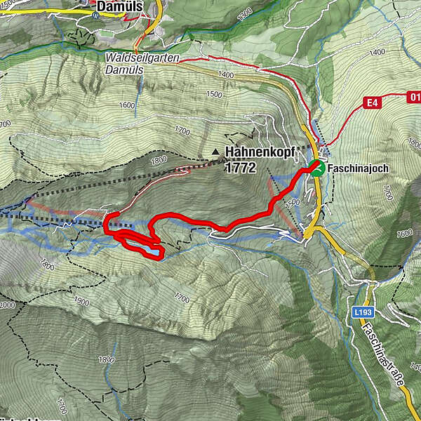
Leisurely hike for connoisseurs to the Stafelalpsee and further to the Franz-Josef-Hütte.
- Sværhedsgrad
-
medium
- Evaluering
-
- Rute
-
Faschina0,0 kmFranz-Josef-Hütte2,6 kmFaschina4,4 km
- Bedste sæson
-
janfebmaraprmajjunjulaugsepoktnovdec
- Højeste punkt
- 1.700 m
- Destination
-
Parking lot at the Faschinajoch, Fontanella-Faschina
- Højdeprofil
-


- Forfatter
-
Rundvisningen Via the Stafelalpsee to the Fanz-Josef-Hütte | Fontanella-Faschina bruges af outdooractive.com forudsat.
GPS Downloads


Generel information
Forfriskningsstop
Flere ture i regionerne
-
St. Gallen - Bodensee
2065
-
Biosphärenpark Großes Walsertal
2006
-
Damüls
576


