
- Kort beskrivelse
-
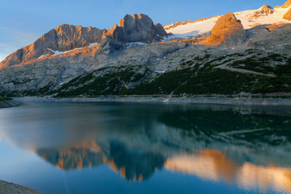
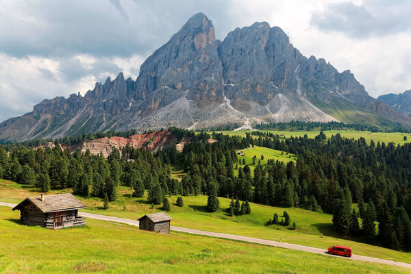
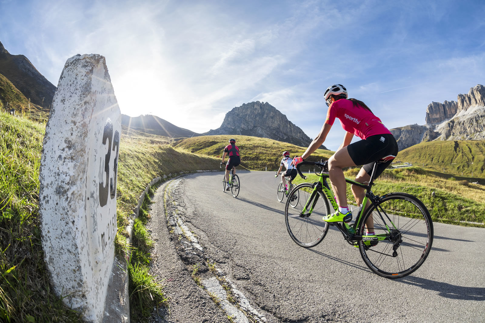
Test yourself at the famous amateur race course, without the anxiety of the stopwatch.
- Sværhedsgrad
-
tung
- Evaluering
-
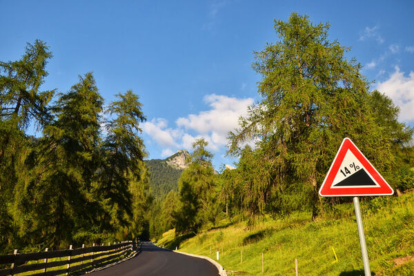
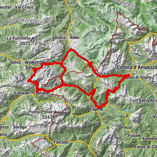
- Rute
-
Arabba0,1 kmPallua1,3 kmPont de Vauz3,5 kmAlbergo Ristoro Lezuo7,7 kmBar Maria Ristorante9,1 kmPecol (1.926 m)13,9 kmMonti Pallidi16,2 kmRistorante B&b Pian Schiavaneis16,2 kmPudra25,4 kmChalet Gèrard27,8 kmSan Mauriz32,1 kmGardena Pass (2.121 m)32,3 kmRön (1.737 m)37,8 kmLa Pozza (1.688 m)38,9 kmPecëi (1.672 m)39,0 kmKolfuschg (1.645 m)39,3 kmSorá (1.622 m)39,7 kmAdventure Park Calfosch40,2 kmBurjé41,7 kmCorvara (1.568 m)41,7 kmCostes da l'Ega41,9 kmzur Hl. Katharina von Alexandrien42,2 kmCrep de Mont44,5 kmLa Tambra46,9 kmHotel Boe47,1 kmVarda50,4 kmArabba51,3 kmAlfauro53,2 kmLa stua dei bacagn53,6 kmRenaz53,8 kmCostazza54,3 kmFossal54,6 kmSan Giovanni54,7 kmPezzei54,8 kmRuaz55,5 kmFedèra56,2 kmLiviné57,4 kmBrenta57,9 kmPieve58,7 kmLivinallongo del Col di Lana58,8 kmPizzeria Klematys58,8 kmSalesei di Sotto (1.350 m)59,7 kmAndraz62,0 kmCernadoi62,8 kmCollaz66,2 kmRucavà (1.300 m)68,1 kmRistorante Grill Bar Belvedere70,0 kmVillagrande71,5 kmColle Santa Lucia (1.453 m)71,5 kmPizzeria Fursil71,6 kmPallua71,7 kmVarazza71,8 kmRiz71,8 kmCosta71,9 kmFossal72,5 kmPian72,8 kmSelva di Cadore73,7 kmCodalonga73,7 kmInsom le Crepe78,7 kmRifugio Piezza - Da Aurelio82,7 kmPasso Giau83,6 kmMuraglia del Giau88,0 kmDrone Viewpoint89,0 kmStrobel103,4 kmFunivia Lagazuoi104,3 kmRifugio "Passo Valparola"106,4 kmSciaré (1.647 m)112,6 kmCentro Fondo112,9 kmArmentarola (1.611 m)114,1 kmPlan (1.560 m)115,6 kmLa Sieia115,7 kmSalotta115,8 kmSt. Kassian (1.537 m)116,2 kmCostadedoi (1.506 m)117,3 kmSotcianins (1.416 m)119,0 kmAltin119,1 kmVilla Nöia119,8 kmStern (1.477 m)120,5 kmRuac (1.438 m)121,0 kmFuntanacia (1.491 m)121,4 kmVerda (1.469 m)122,1 kmCorvara (1.568 m)124,3 kmzur Hl. Katharina von Alexandrien125,1 kmCrep de Mont127,4 kmLa Tambra129,7 kmHotel Boe129,8 kmVarda133,2 kmArabba134,2 km
- Bedste sæson
-
janfebmaraprmajjunjulaugsepoktnovdec
- Højeste punkt
- 2.244 m
- Destination
-
Center of "Arabba"
- Højdeprofil
-
 © outdooractive.com
-

-
ForfatterRundvisningen "Maratona dles Dolomites" tour bruges af outdooractive.com forudsat.
GPS Downloads


Generel information
Forfriskningsstop
Kulturel/Historisk
Insider-tip
Flora
Lovende
Flere ture i regionerne