© Ötztal - Roland Grüner
- Kort beskrivelse
-
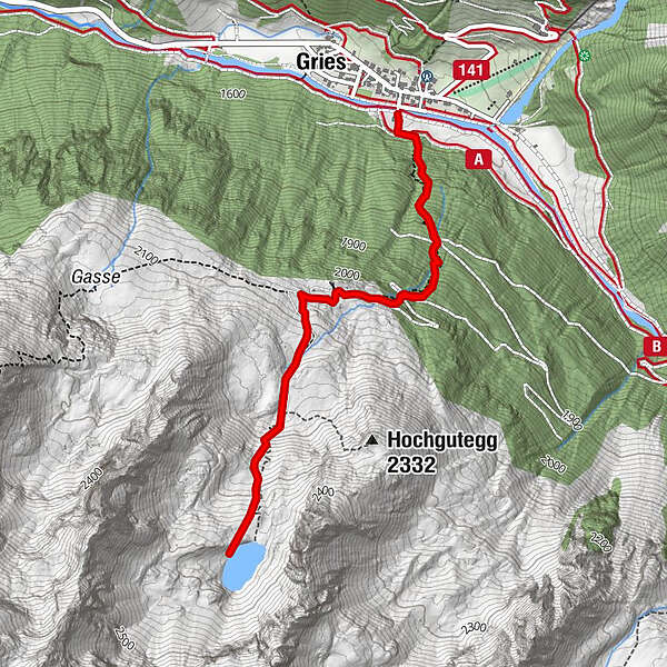
GRIES PARKPLATZ -> Center Gries -> steep track in direction Nissl Alm -> Nissl Alm -> steep track in direction Schönrinnenkarsee -> SCHÖNRINNENKARSEE
Increased truck and car traffic on the entire Sulztalweg.
Driving times:
Trucks: Mon - Fri from 06:00 a.m. - 10:00 p.m
Car: all day
- Sværhedsgrad
-
medium
- Evaluering
-
- Rute
-
Gries (1.569 m)Nisslalm (2.051 m)1,3 kmGries (1.569 m)5,3 km
- Bedste sæson
-
janfebmaraprmajjunjulaugsepoktnovdec
- Højeste punkt
- 2.358 m
- Destination
-
Gries, parking at the end of the village
- Højdeprofil
-

- Forfatter
-
Rundvisningen Lake Schönrinnenkarsee bruges af outdooractive.com forudsat.
GPS Downloads


Generel information
Forfriskningsstop
Lovende
Flere ture i regionerne
-
Ötztal
1111
-
Längenfeld - Huben - Gries
355