


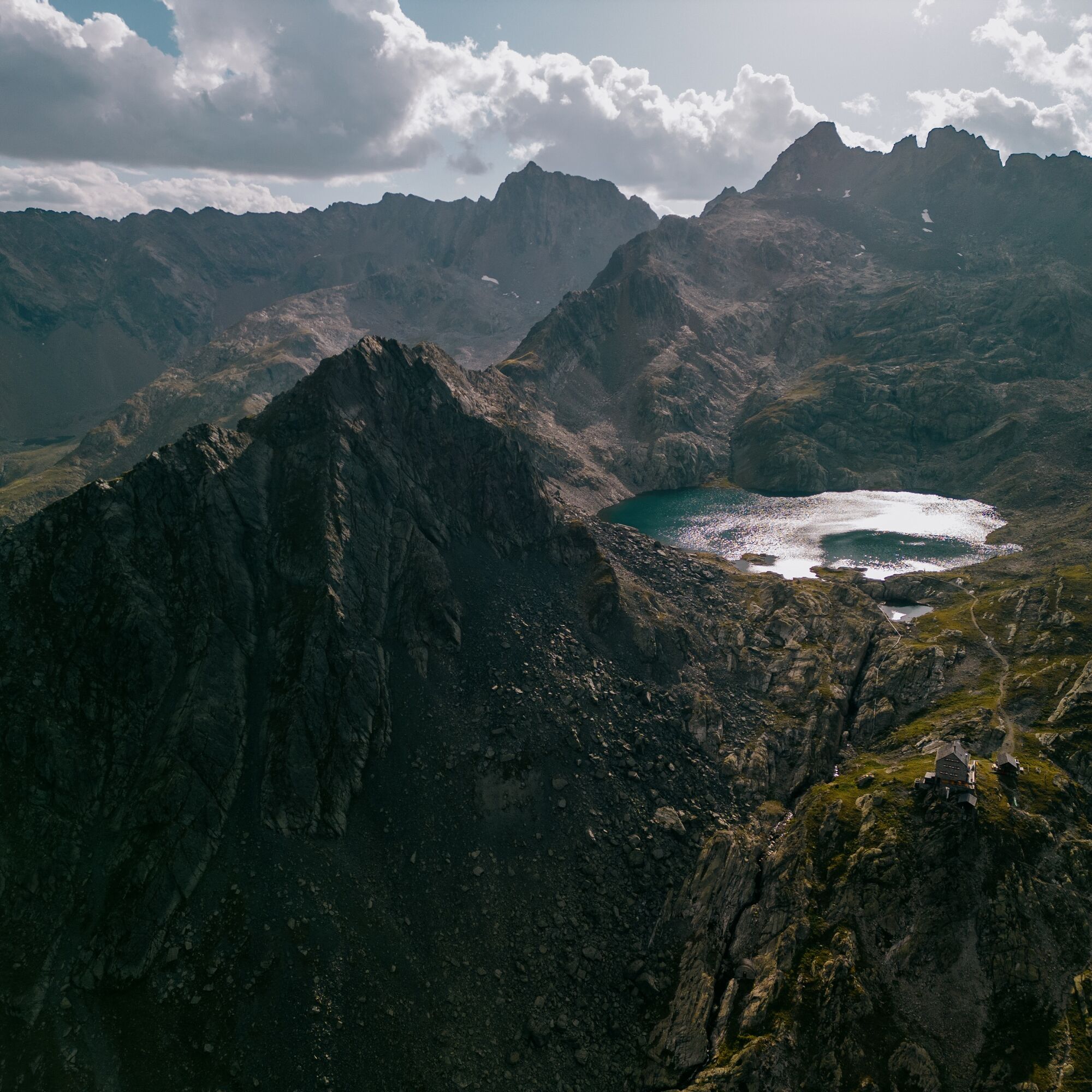
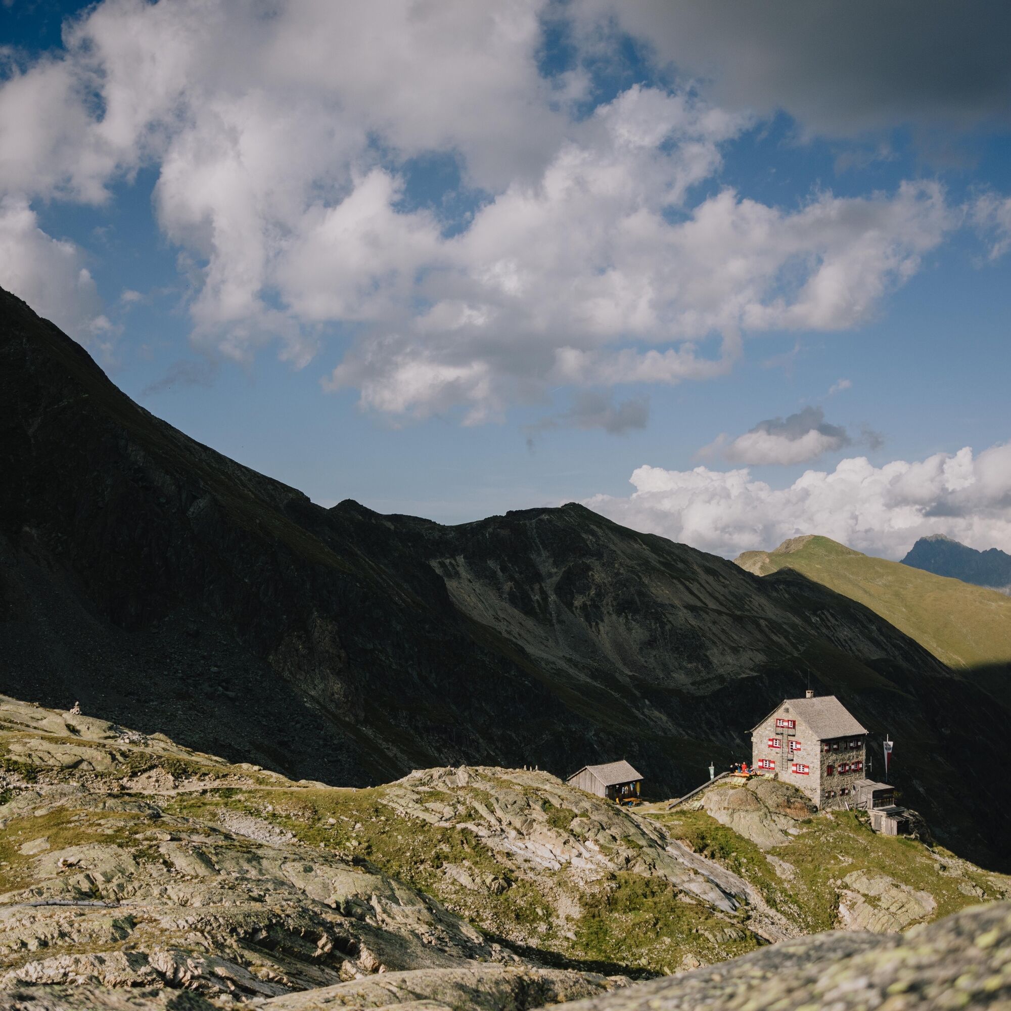
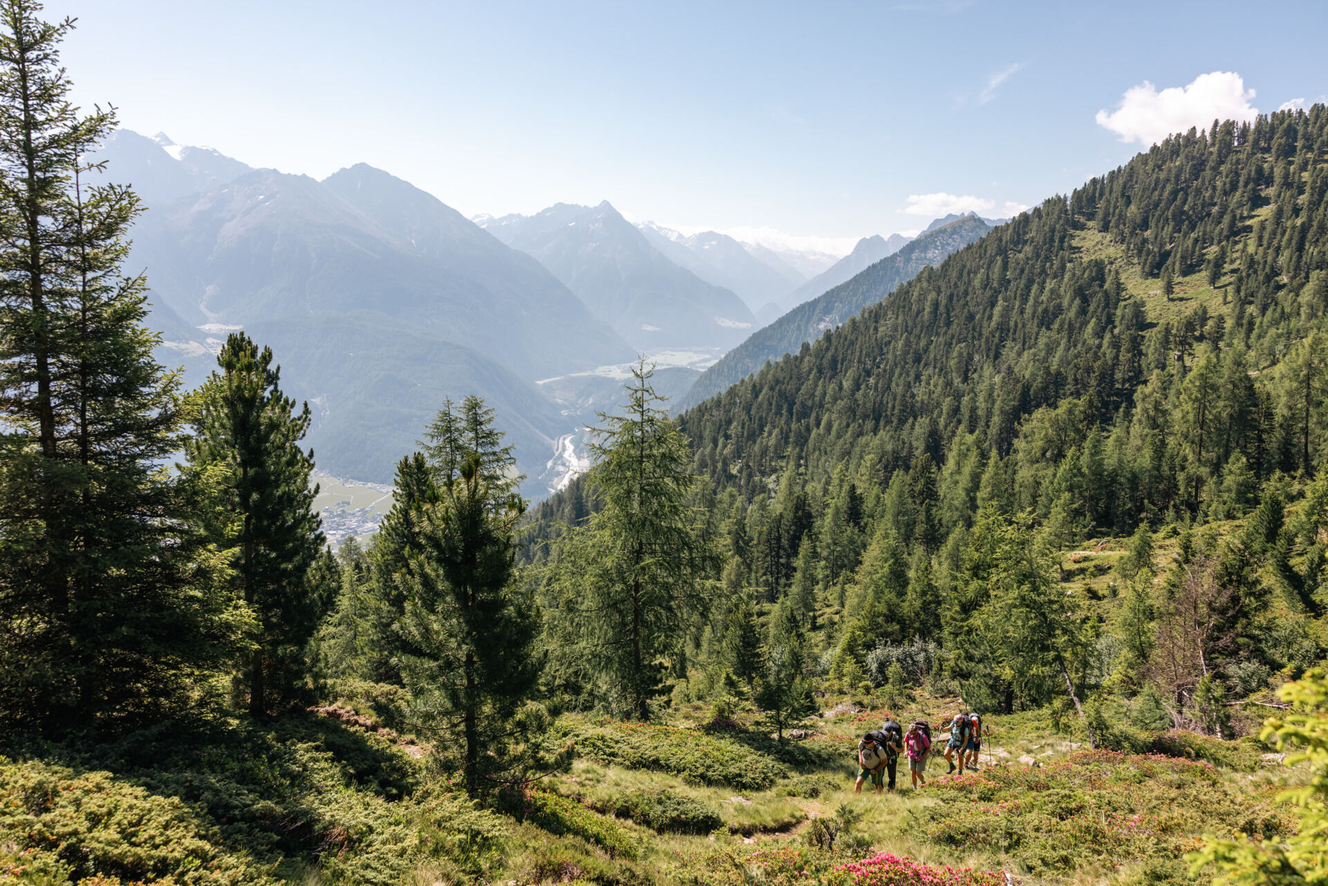
The start of the 1st stage is at the Gehsteig Alm above Tumpen. You can get there with the local hut taxi and thus save many kilometers and elevation meters on forest roads. From Gehsteig Alm, continue...
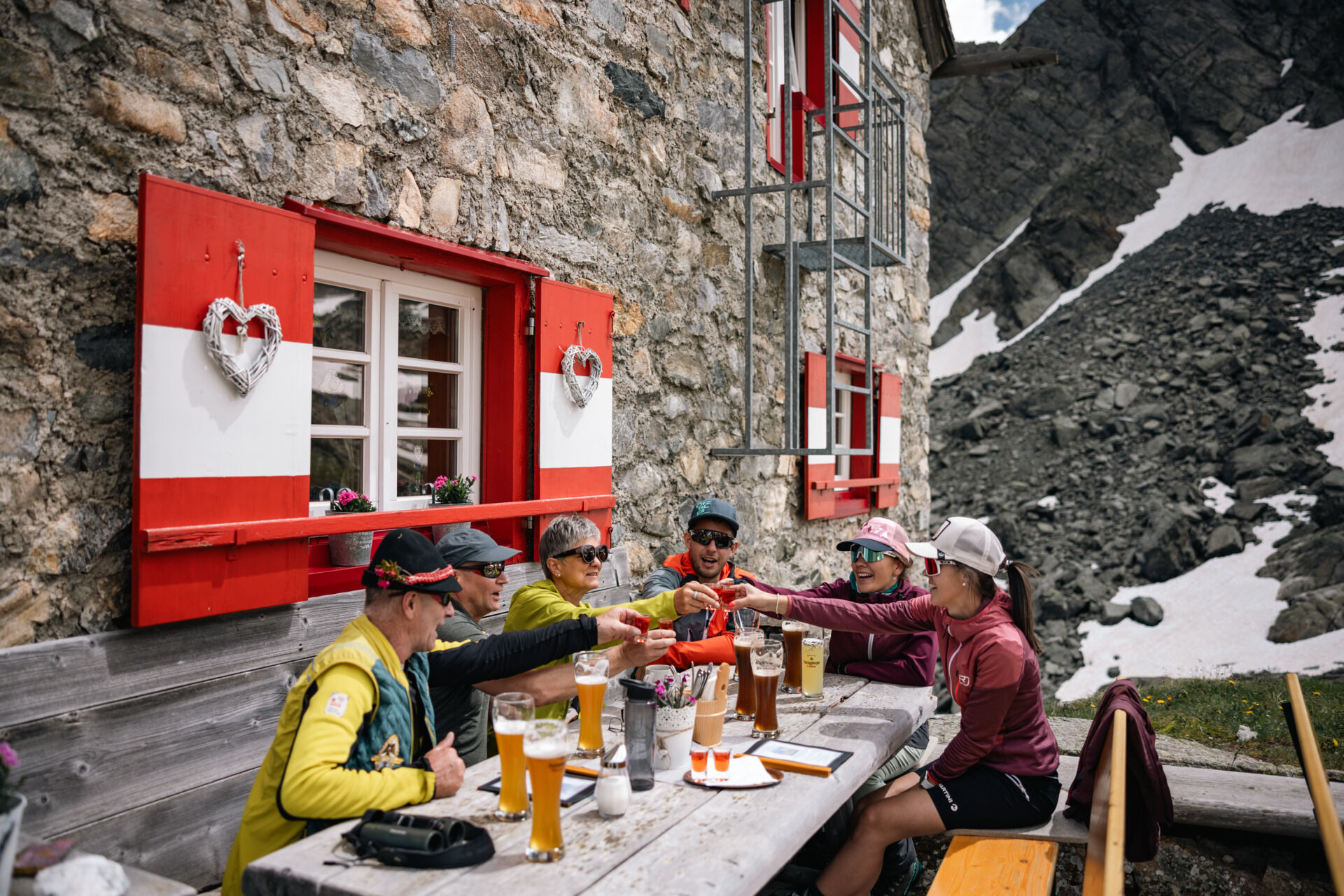
The start of the 1st stage is at the Gehsteig Alm above Tumpen. You can get there with the local hut taxi and thus save many kilometers and elevation meters on forest roads. From Gehsteig Alm, continue left on a significantly narrower mountain path uphill. At the fork, turn left (follow the signpost towards Erlanger Hut) in an ascending traverse over a wide gully to a mountain basin. From there, a beautiful, evenly leveled high path leads towards the hut. In the last section, it goes uphill again, and just before the hut, there is a rock protrusion to master. However, this is secured with iron chains. Upon arrival at the hut, you can enjoy the unique atmosphere and unwind in the evening. A visit to the Wettersee just above the hut is of course not to be missed.

Appropriate equipment for alpine mountain hikes is a matter of course on all tours in the Alps. Sure-footed hiking boots or mountain shoes, breathable outdoor pants, a rain jacket, as well as a backpack with provisions, drinks, and a first aid kit always belong to the standard equipment for tours in the Alps. Sunglasses, sunscreen, headgear such as a bandana or hiking hat are also highly recommended, as well as a warm second jacket, trekking poles if desired, and possibly gloves. The choice of clothing should of course always be adapted to the current weather .
Suitable for those without fear of heights and sure-footed hikers. Good physical condition, some alpine experience, and mountain equipment recommended. Please note the current weather report .
The car trip to the ÖTZTAL. Located in Tyrol, the ÖTZTAL branches off to the south as the longest side valley of the Eastern Alps. The route by car takes travelers through the Inn valley to the entrance of the valley and continues along the Ötztal. In addition to the toll highway, country roads can also be used. The route planner allows you to determine your drive quickly and conveniently: To the route planner: https://www.google.at/maps
Travel comfortably and safely by train to the Ötztal train station. The final stop or exit point is the ÖTZTAL station. Afterwards, you can travel conveniently and quickly by public transportation or local taxi companies through the entire valley to your desired destination.
The current bus schedule is available at: http://fahrplan.vvt.at
In Tumpen, the following parking options are available to you.
- Tumpen Primary School | free of charge
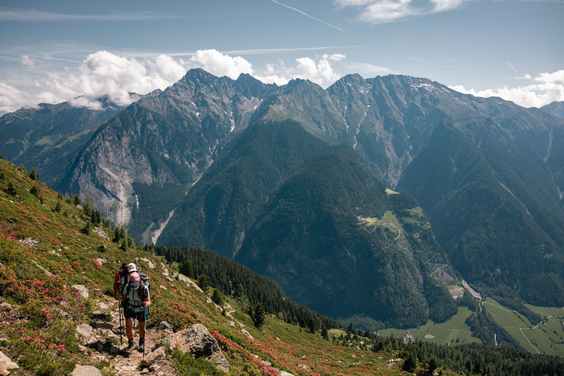
The Wettersee above the hut must not be missed. Bold hikers and nature lovers dare to jump into the cool mountain lake – an experience you won't forget quickly, with refreshing and regenerative effects included.
Populære ture i området
-
4.6
Summit route Faltegartenköpfl
MediumVandring 4.04 km -
4.4
Oetz - Piburger See - Oetz
MediumVandring 7.16 km -
4.2
Hike Stuibenfall - Umhausen
lysVandring 2.95 km -
4.4
Stuibenfall Umhausen circular hike
lysVandring 9.32 km -
5.0
Larstigalm - Niederthai
lysVandring 3.24 km -
4.6
Trip Tirol ➤ Hike to the Blue Grotto in Rosengarten Gorge Imst
MediumVandring 4.86 km -
4.8
Faltegartenköpfl (01)
lysSkitour 4.19 km -
4.7
Umhausen - Stuibenfall - Umhausen
MediumVandring 7.94 km -
4.6
Summit route Weather Cross from Hochoetz
MediumVandring 3.06 km -
4.4
Rundwanderung Hängebrück3
lysVandring 6.32 km
Vandring og sporing


Gå ikke glip af tilbud og inspiration til din næste ferie
Din e-mailadresse er blevet tilføjet til mailinglisten.