Ilmtal Cycle Path - From the Rennsteig through the Weimarer Land to the Saale River


© Weimarer Land Tourismus - Uwe Germar

© Weimarer Land - Uwe Germar

© Weimarer Land Tourismus - Katy Kasten-Wutzler

© Weimarer Land Tourismus - Uwe Germar

© Weimarer Land - Uwe Germar

© Volker Schaedel

© Weimarer Land Tourismus - Ralph Kallenbach

© Weimarer Land - Ralph Kallenbach

© Weimarer Land Tourismus - Uwe Germar

© Weimarer Land Tourismus - Ralph Kallenbach

- Kort beskrivelse
-
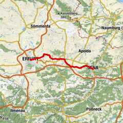
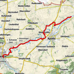
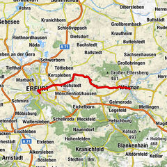
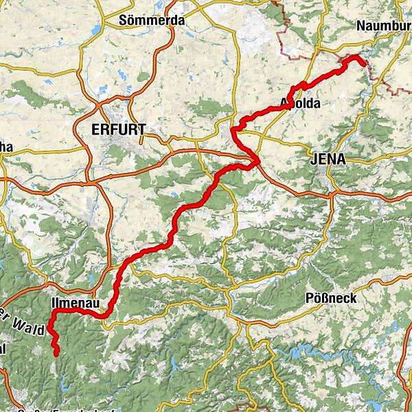
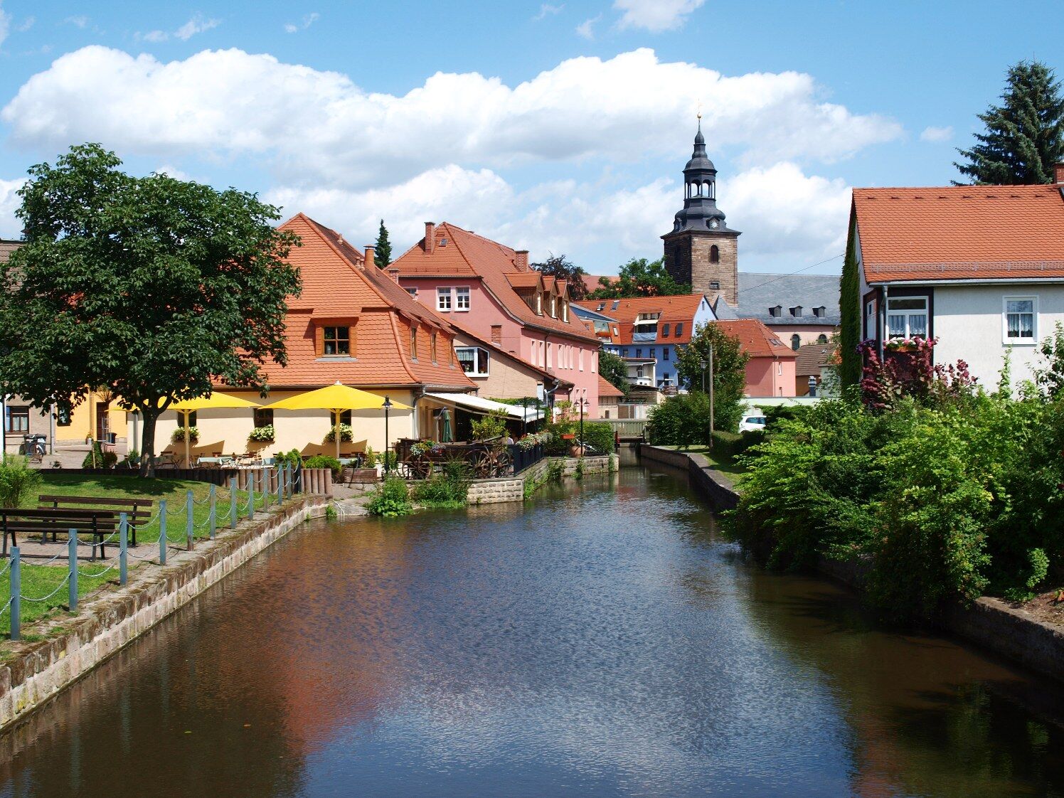
On a route of 123 km length you will experience Thuringian landscapes - from the forest to the vineyard through the Weimarer Land, from the source of the Ilm to the mouth of the Saale, from Ilmenau via Weimar to Großheringen.
- Sværhedsgrad
-
medium
- Evaluering
-
- Rute
-
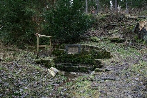
AllzunahHotel und Gasthof Am Park3,7 kmStützerbach4,2 kmStützerbach (591 m)4,5 kmMeyersgrund7,0 kmHotel Thüringer Wald8,8 kmElisabethenbrunnen9,0 kmManebach10,5 kmCarl Alexander Brunnen12,2 kmIlmenau (500 m)14,5 kmFridolin16,8 kmLangewiesen (454 m)19,4 kmAnnawerk23,0 kmGräfinau-Angstedt25,7 kmGaststätte Zur Scharfen Ecke25,9 kmDörnfeld an der Ilm30,0 kmCottendorf (388 m)30,3 kmGriesheim32,8 kmOberilm35,9 kmStadtilm36,9 kmGroßhettstedt41,3 kmKleinhettstedt42,2 kmDienstedt45,7 kmKarsthöhle Dienstedt (340 m)47,0 kmBarchfeld48,9 kmKranichfeld52,0 kmTannroda56,3 kmSt. Marien61,9 kmBad Berka62,3 kmSankt Martin64,7 kmHetschburg64,7 kmZum Lindenbaum64,8 kmSpitzwiese66,6 kmUnterm Hausholze66,9 kmBuchfart67,8 kmSchenkenberg68,0 kmMännerwirtschaft69,3 kmOettern70,0 kmDorfkirche Oettern70,1 kmMellingen (230 m)74,5 kmOberweimar79,8 kmSankt Peter und Paul79,8 kmLäuterquelle81,5 kmParkvorstadt81,5 kmLeutraquelle81,5 kmOchsenauge (Leutraquelle)81,7 kmWeimar (208 m)82,0 kmFuchsleite83,6 kmTiefurt85,4 kmKromsdorf-Süd87,4 kmKromsdorf-Nord87,9 kmDenstedt89,2 kmUlrichshalben91,9 kmOßmannstedt92,5 kmRastplatz OL Oßmannstedt92,6 kmSankt Peter92,8 kmZum Kuhstall92,8 kmBackhausteichplatz92,8 kmRastplatz Oberroßla Ortseingang94,9 kmVerweilplatz Oberroßla96,5 kmOberroßla96,6 kmSpielplatz Oberroßla96,7 kmOberroßla/Rödigsdorf96,7 kmApolda (205 m)97,6 kmRastplatz Niederroßla98,3 kmNiederroßla99,4 kmSankt Vitus101,5 kmZottelstedt101,6 kmZum alten Kuhstall101,7 kmSankt Marien102,2 kmMattstedt102,4 kmRastplatz bei Poche105,1 kmRastplatz OE Wickerstedt105,7 kmSankt Vitus106,3 kmWickerstedt106,8 kmSt. Margarete109,8 kmEberstedt109,9 kmNiedertrebra110,1 kmÖlmühle Eberstedt110,5 kmDarnstedt112,7 kmHeinrichsquelle113,0 kmBad Sulza114,1 kmDorfsulza114,3 kmRastplatz Gradierwerk115,8 kmGroßheringen119,0 kmKleinheringen119,0 kmKaatschen120,4 kmWeichau120,4 km
- Bedste sæson
-
janfebmaraprmajjunjulaugsepoktnovdec
- Højeste punkt
- 753 m
- Destination
-
Kaatschen-Weichau
- Højdeprofil
-
 © outdooractive.com

-
-
ForfatterRundvisningen Ilmtal Cycle Path - From the Rennsteig through the Weimarer Land to the Saale River bruges af outdooractive.com forudsat.
GPS Downloads


Generel information
Forfriskningsstop
Kulturel/Historisk
Lovende
Flere ture i regionerne
-
Thüringer Wald
62
-
Erfurt
38
-
Weimar
20