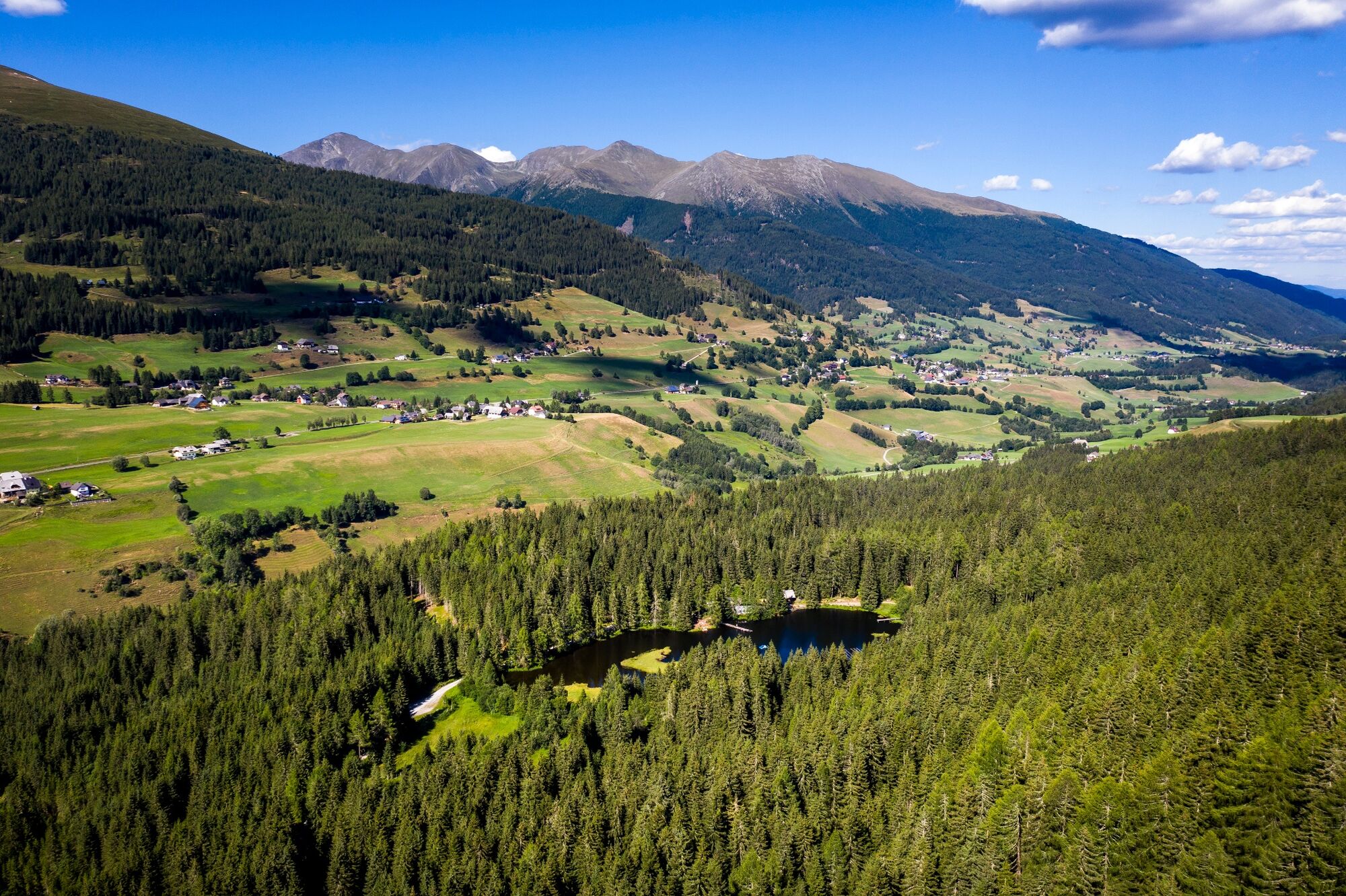
Nature Trail Krakauschatten

Logo Nature Trail Krakauschatten
Turnédatoer
1,67km
1.195 - 1.203m
Distanz
4hm
3hm
Opstigning
00:34h
 
Varighed
Kort beskrivelse

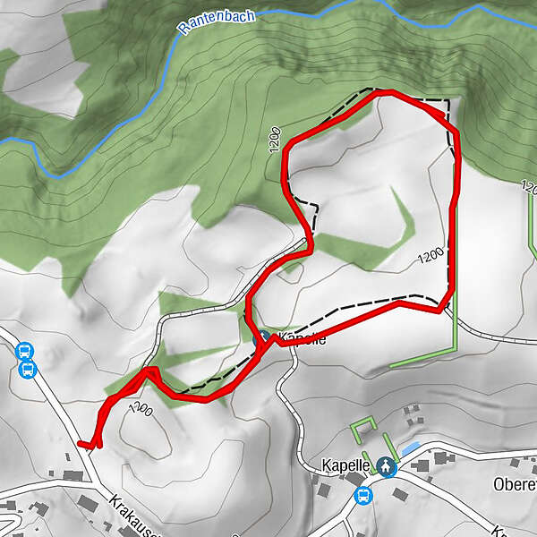
Idyllic circular trail about 1.5 km long - located in the middle of the beautiful Krakau High Valley.

Sværhedsgrad
let
Evaluering
Teknologi
Kondition
Landskab
Erfaring
Rute
Kapelle
1,3 km

Bedste sæson
jan
feb
mar
apr
maj
jun
jul
aug
sep
okt
nov
dec
Højeste punkt
1.203 m
Destination

Nature trail entrance

Højdeprofil

Forfatter
Rundvisningen Nature Trail Krakauschatten bruges af outdooractive.com forudsat.

Samlet vurdering

5

0

%

4

0

%

3

0

%

2

0

%

1

0

%

Fejl
Der er opstået en fejl. Prøv venligst igen.
Tak for din anmeldelse

Bedømmelsen blev slettet

GPS Downloads
  • GPX GPS Exchange Format (XML)
  • KML Google Earth, Google Maps
QR-downloadkoder til mobiltelefoner

Generel information

Forfriskningsstop
Flora
Fauna
Lovende

Populære ture i området

3-lakes-hike to the Kaltenbachseen

medium
4,2km | 493hm | 03:00h

Höchstein (2.543 m)

tung
11,25km | 805hm | 06:00h

Summit Tour to the Knallstein

medium
15,51km | 1430hm | 08:00h

Schladming - Hochgolling

tung
20,64km | 1731hm | 10:30h