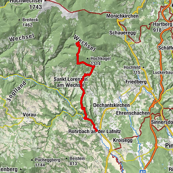
HWW-Hiking route: Rohrbach/Lafnitz - Römerhütte - Auerbach - Trahütte


© Oststeiermark Tourismus - XKarin Hofer
- Kort beskrivelse
-
This HWW hiking route is part of the Wechselland Historical Long-Distance Hiking Trail (HWW), which tells the story of Wechselland along more than 100 HWW stations. More information can be found at www.wechsel-wandern.at.
- Sværhedsgrad
-
medium
- Evaluering
-
- Rute
-
Rohrbach an der LafnitzFalk0,4 kmJausenstation Uhl1,7 kmRömerhütte4,4 kmDörfl8,4 kmAuerbach9,4 kmLorenzkogel (1.353 m)15,7 kmGlatzl Trahütten17,6 km
- Bedste sæson
-
janfebmaraprmajjunjulaugsepoktnovdec
- Højeste punkt
- 1.337 m
- Destination
-
Glatzl Trahütten Alm, St. Lorenzen am Wechsel
- Højdeprofil
-

-

-
ForfatterRundvisningen HWW-Hiking route: Rohrbach/Lafnitz - Römerhütte - Auerbach - Trahütte bruges af outdooractive.com forudsat.
GPS Downloads


Generel information
Kulturel/Historisk
Flere ture i regionerne
-
Wiener Alpen
3048
-
Kräuterregion Wechselland
1085
-
St. Lorenzen am Wechsel
250