© Tourismusverband ERZBERG LEOBEN - Norbert Rainer
© Tourismusverband ERZBERG LEOBEN - TV ERZBERG LAND

© Christoph Hofschweiger

© Tourismusverband ERZBERG LEOBEN - pi_doubleyou IG

© Tourismusverband ERZBERG LEOBEN - sigridwiener IG

© Tourismusverband ERZBERG LEOBEN - susisilencelehner IG

© Tourismusverband ERZBERG LEOBEN - jofotografie.outdoor IG
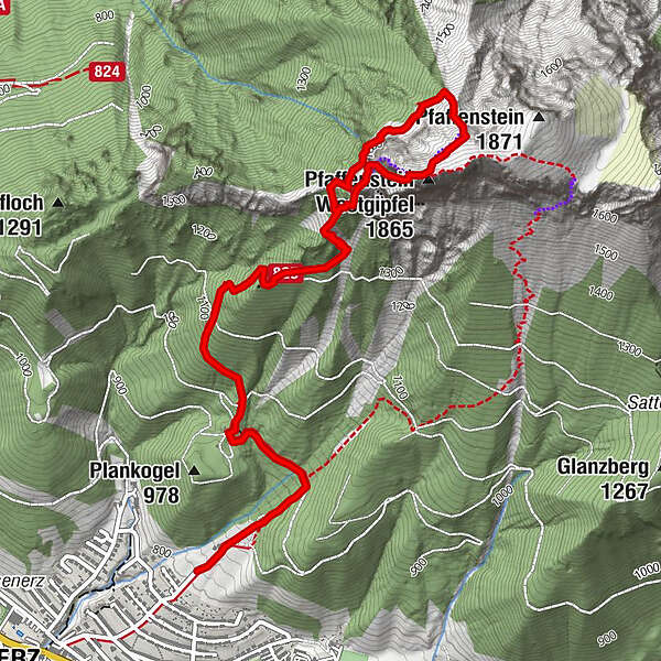
Turnédatoer
7,47km
812
- 1.835m
1.020hm
1.009hm
06:50h
- Sværhedsgrad
- C/D

- Kort beskrivelse
-
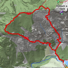
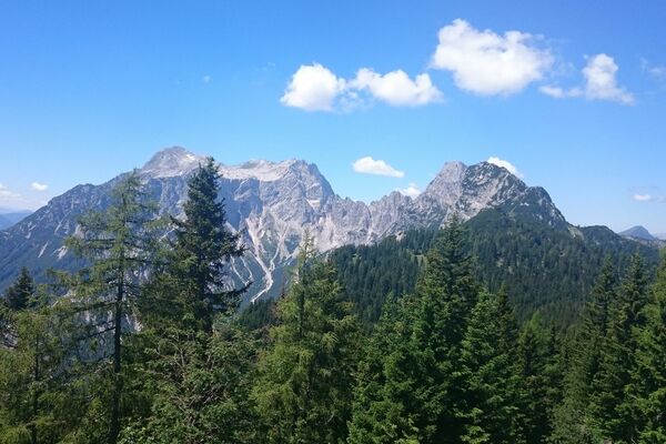
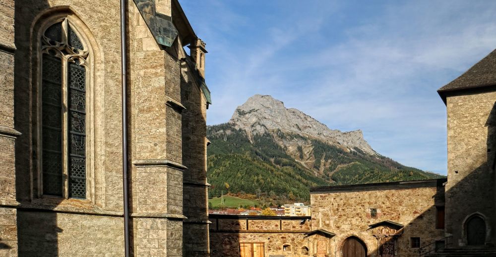
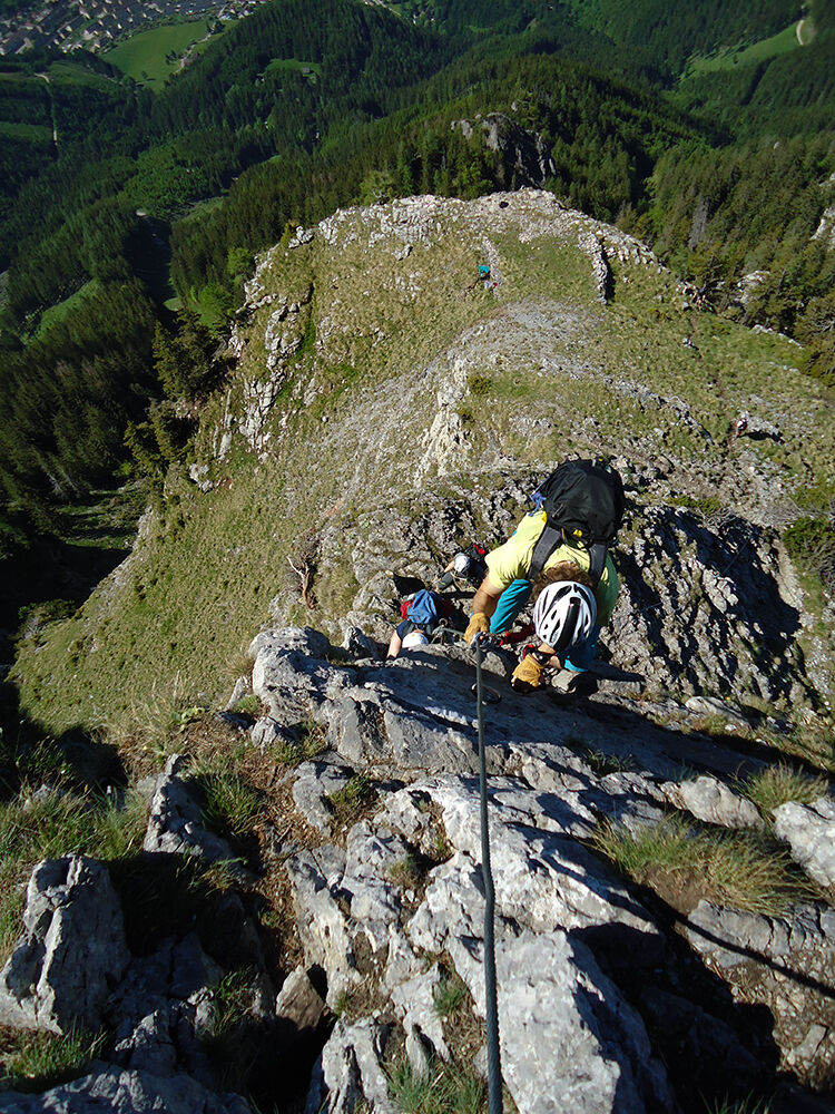
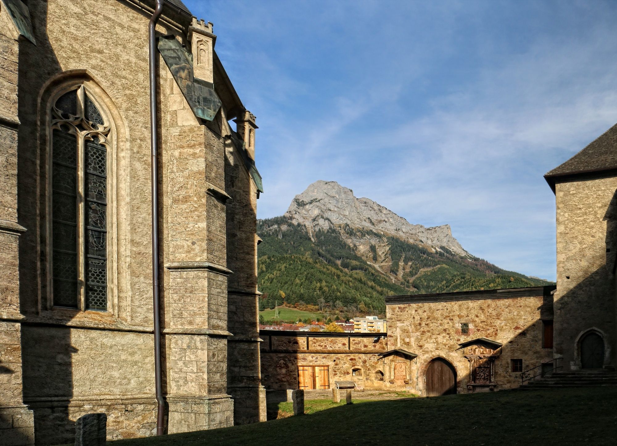
Pfaffenstein, western Hochschwab
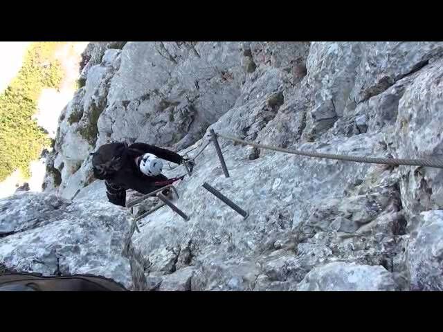
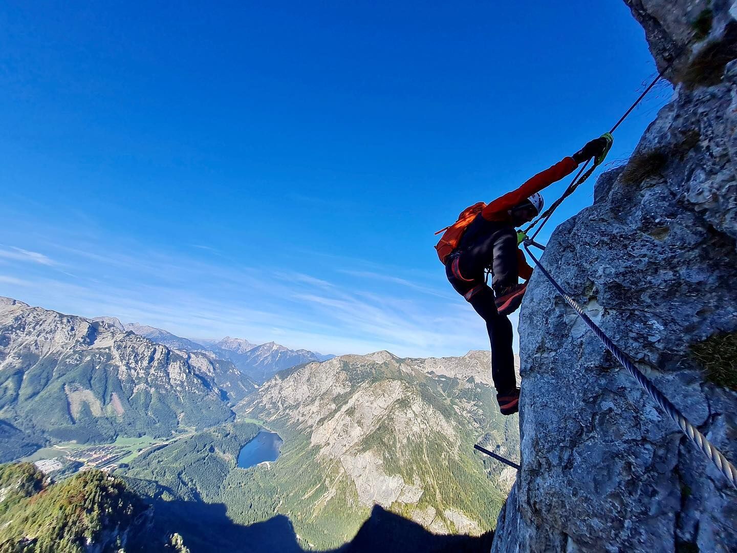
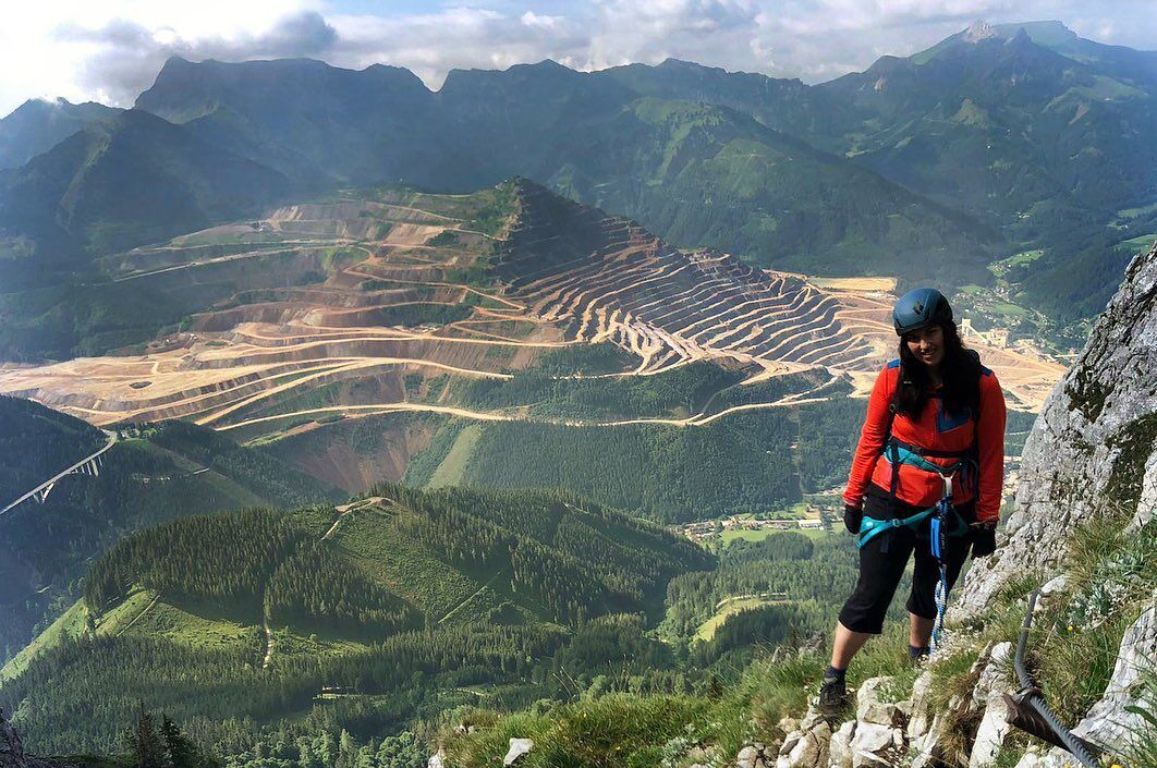
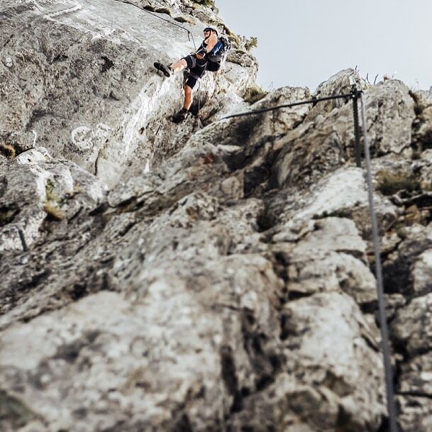
Along the entire via ferrata you can enjoy a magnificent view of the Erzberg, Lake Leopoldstein and the town of Eisenerz. Tough, strenuous and exposed sections make the via ferrata a very special climbing experience.
The trail was opened in 2005 and leads to the summit on a beautiful route. It was built for the 100th anniversary of the Naturfreunde Eisenerz. The Eisenerzer Steig is located in the ERZBERG LEOBEN region.
- Sværhedsgrad
-
tungSværhedsgrad C/D
- Evaluering
-
- Rute
-
EisenerzEisenerz7,4 km
- Bedste sæson
-
janfebmaraprmajjunjulaugsepoktnovdec
- Højeste punkt
- 1.835 m
- Destination
-
Pfaffenstein parking lot (near the power line)
- Exposition
- Højdeprofil
-


- Forfatter
-
Rundvisningen Eisenerzer Steig bruges af outdooractive.com forudsat.
GPS Downloads


Generel information
Lovende
Flere ture i regionerne
-
Erzberg Leoben
39
-
Hochschwab
22
-
Eisenerz
15