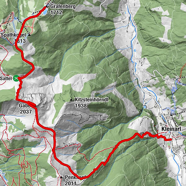
High-altitude hike: Grafenberg - Gabel - Kleinarler Hütte - Kleinarl


© Wagrain-Kleinarl Tourismus - Agnes Moser

© Wagrain-Kleinarl Tourismus - Stefanie Ostler
- Kort beskrivelse
-
Panoramic high-altitude hike (with gondola ascent) from the Grafenberg mountain station over the summit of the Gabel to the Kleinarler Hütte and on to Kleinarl.
- Sværhedsgrad
-
medium
- Evaluering
-
- Rute
-
Gabel (2.037 m)4,2 kmKleinarler Hütte7,8 kmKleinarl11,2 km
- Bedste sæson
-
janfebmaraprmajjunjulaugsepoktnovdec
- Højeste punkt
- 2.017 m
- Destination
-
Kleinarl bus stop
- Højdeprofil
-


- Forfatter
-
Rundvisningen High-altitude hike: Grafenberg - Gabel - Kleinarler Hütte - Kleinarl bruges af outdooractive.com forudsat.
GPS Downloads


Generel information
Forfriskningsstop
Lovende
Flere ture i regionerne


