© Foto: OÖ Tourismus, Röbl

- Kort beskrivelse
-
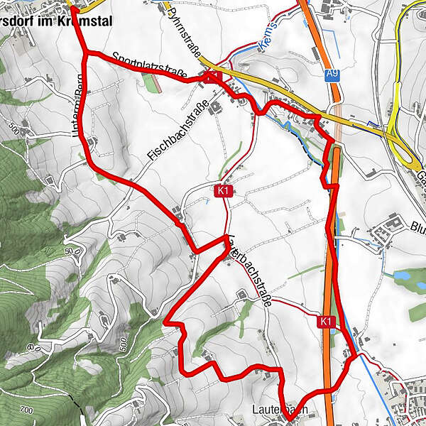
Circular trail with a view of the beautiful scenery of the Upper Krems Valley
- Sværhedsgrad
-
let
- Evaluering
-
- Rute
-
Inzersdorf im Kremstal0,1 kmLauterbach4,1 kmInzersdorf im Kremstal8,0 km
- Bedste sæson
-
janfebmaraprmajjunjulaugsepoktnovdec
- Højeste punkt
- 488 m
- Destination
-
Inzersdorf/center of the village
- Højdeprofil
-

- Forfatter
-
Rundvisningen Circular trail under the mountains in Inzersdorf bruges af outdooractive.com forudsat.
GPS Downloads


Generel information
Forfriskningsstop
Flere ture i regionerne
-
Traunviertel
1940
-
Tourismusregion Bad Hall
770
-
Inzersdorf im Kremstal
254