


A circular hike that offers many facets.
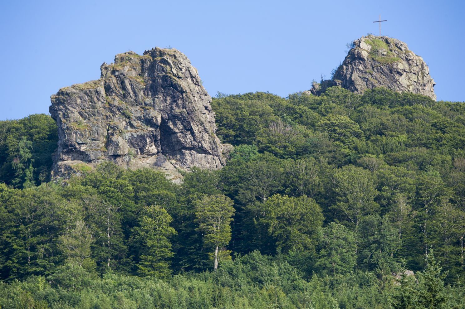
A hiking route with a view of the mighty Bruchhauser Steine (national natural monument), the four rock giants from the Ice Age.
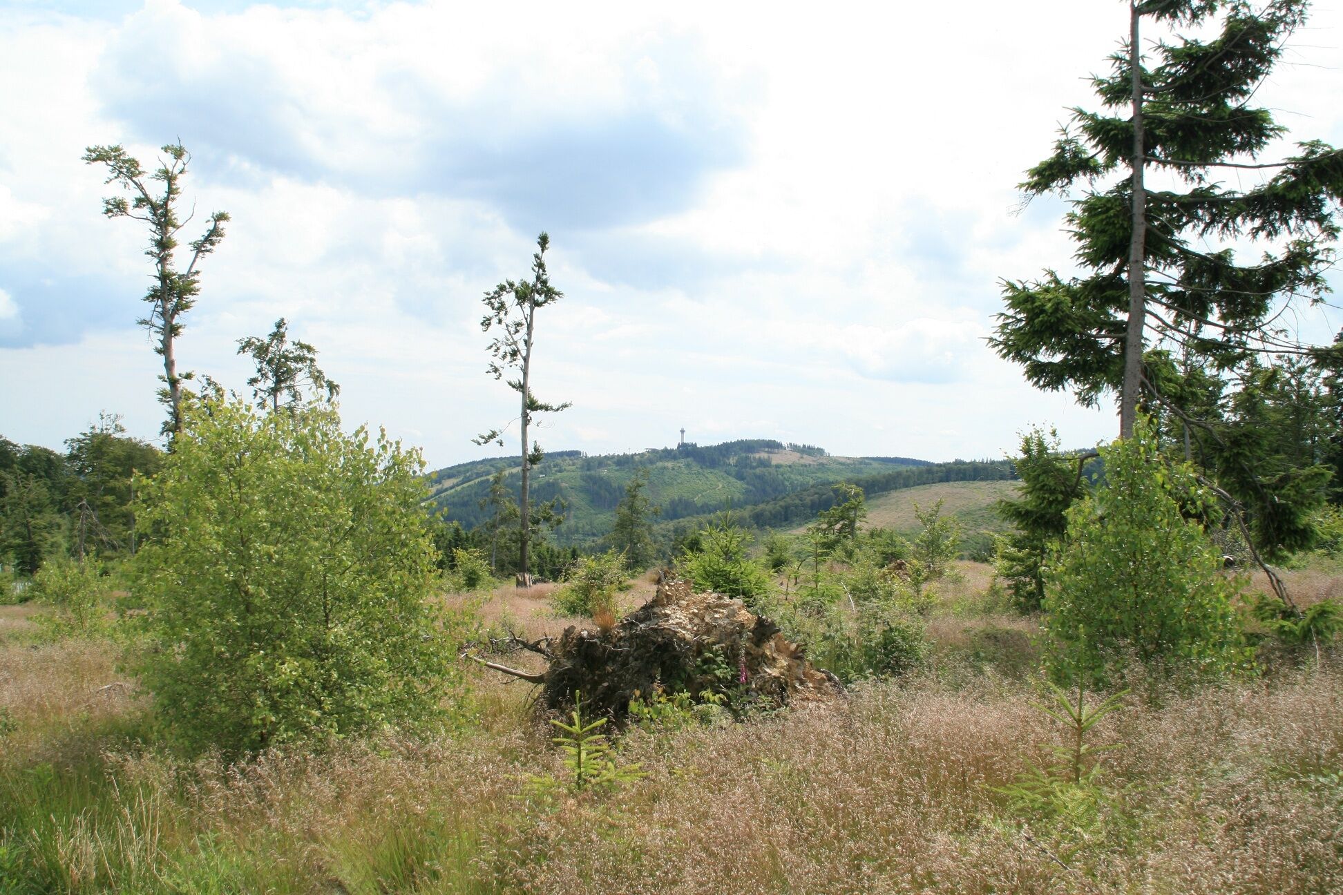
It goes up to the Langenberg, the...
A circular hike that offers many facets.
A hiking route with a view of the mighty Bruchhauser Steine (national natural monument), the four rock giants from the Ice Age.
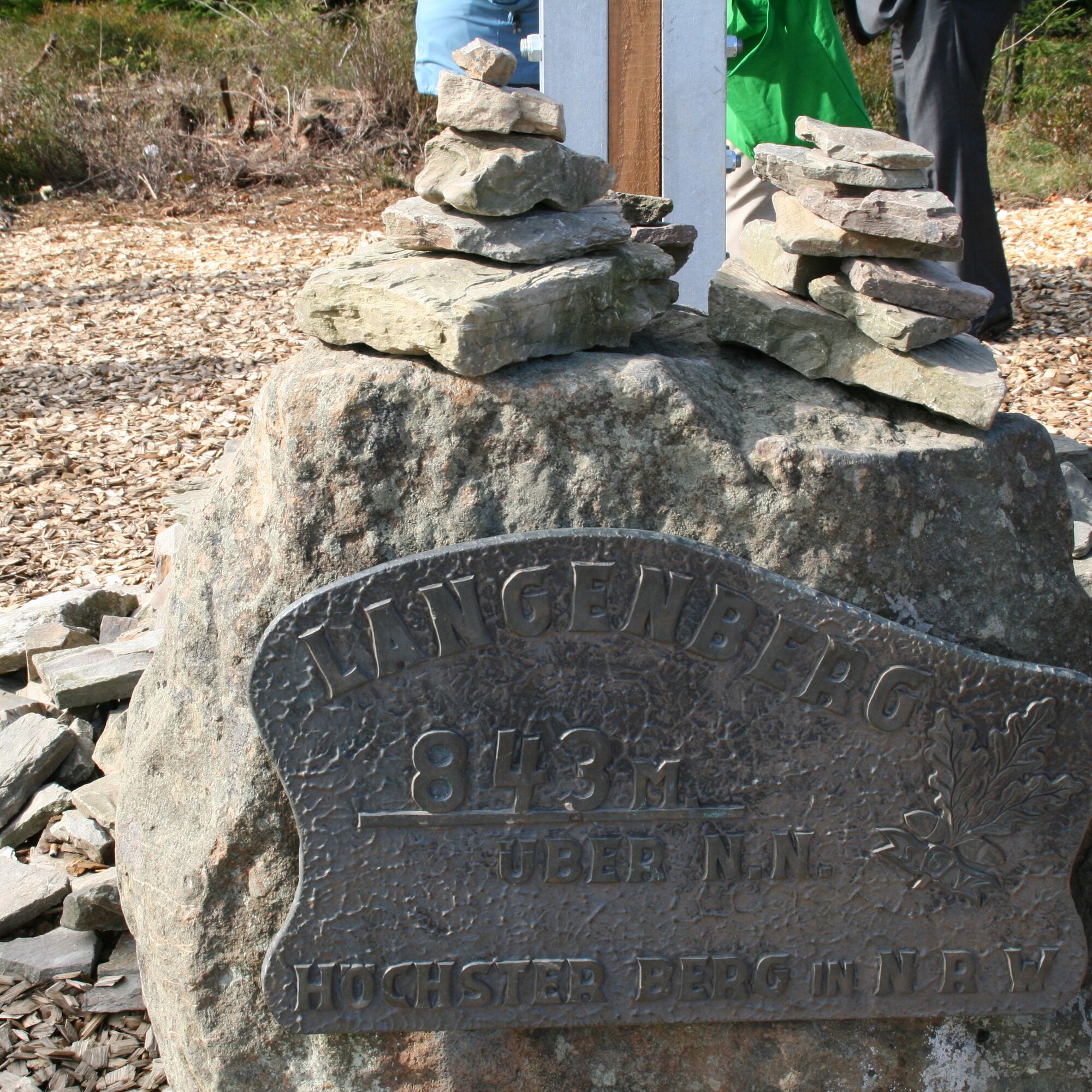
It goes up to the Langenberg, the highest mountain in NRW.
At 843 m above sea level, it is exactly 2 meters higher than the Kahler Asten in Winterberg. Here, nature is still nature.
Also the mountain station of the Sternrodt ski lift or the border between North Rhine-Westphalia and Hesse – old boundary stones mark this state border, many special points lie on this hiking route.
The Richtplatz, a medieval court site, is reached and not least the Europa-Gold Village Bruchhausen make this hike an adventure trip in the nature of the Sauerland.

The starting point is the hiking signboard in the center of the village.
Well marked with the trail sign B3, the path leads us south through the Europa-Gold Village Bruchhausen.
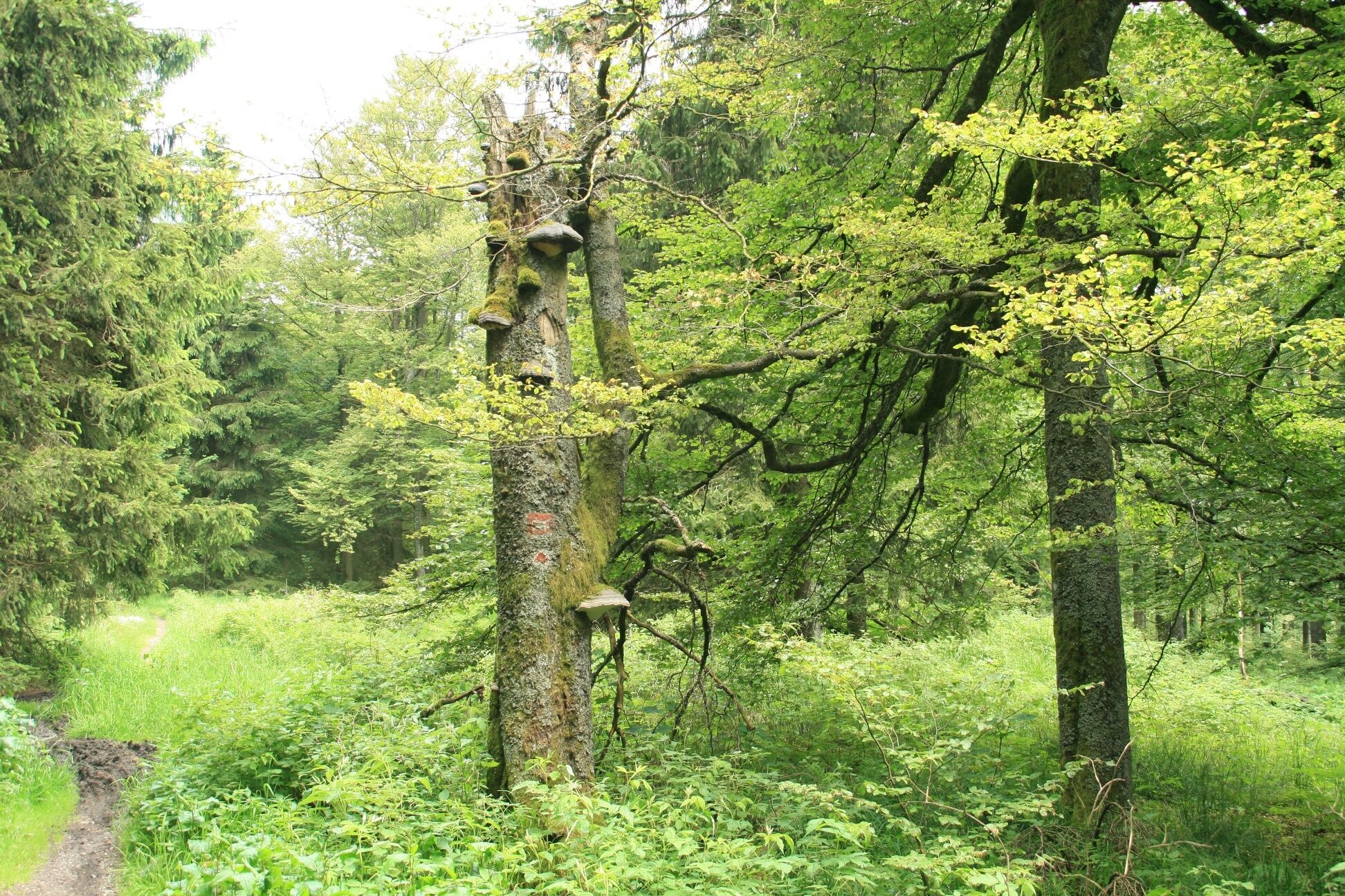
On this section, you have a very special view of the natural monument Bruchhauser Steine. You can't always admire the four rock giants together like this. High above the "Heu" it continues to the "Ochsenkreuz".
Here, a shelter invites us to take a break. Further on, it goes past the mountain station of the Sternrodt ski lift to Burbecker Platz.
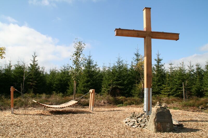
The path now runs together with the Rothaarsteig (well marked with the "lying" R on a red background) to the Langenberg, the highest elevation in NRW (843 m). A cross marks this special place. A bench invites you to rest. You can immortalize your tour in a summit book (attached at the foot of the cross). Well rested, the return journey to the village of Bruchhausen continues.
From here the path runs on the border between North Rhine-Westphalia and Hesse – old boundary stones mark this state border. The Richtplatz is reached, a medieval court site, where we turn left. Following the B3 marking on the Rothaarsteig (trail sign R), we reach the starting point in the Europa-Gold Village Bruchhausen via the access road.
Ja
Sturdy hiking shoes, a filled water bottle.
A filled water bottle should be taken along!
Note: mobile phone reception is not always available.
Sturdy footwear is required.
BAB 44, exit Bad Wünnenberg, via Brilon (B 480) to Olsberg. Now follow the signs to Bruchhausen or to the Bruchhauser Steine. Through the small village Elleringhausen, on to Bruchhausen - village center at the church parking is available. Below the kindergarten, next to the church, you will find the hiking signboard (starting point).
Click on the travel map on the left to enlarge it or use route planning
R 31 Brilon-Olsberg Bruchhausen
Directly at the hiking signboard in the village center or immediately nearby the parking lot at the church Bruchhausen.
The highest mountain in NRW is the Langenberg - not, as often thought, the Kahler Asten near Winterberg. The Langenberg is 843 m above sea level - the Kahler Asten 841 m above sea level.
Webkameraer på turen
-
Talstation Ettelsberg-Seilbahn
-
Talstation Ettelsberg-Seilbahn
-
Talstation Ettelsberg-Seilbahn
-
Talstation Ettelsberg-Seilbahn
-
Talstation Ettelsberg-Seilbahn
-
Kurhotel Hochsauerland 2010
-
Kurhotel Hochsauerland 2010
-
Kurhotel Hochsauerland 2010
-
Kurhotel Hochsauerland 2010
-
Kurhotel Hochsauerland 2010
-
Sternrodt Skilift
-
Hochheideturm - Ettelsberg
-
Skywalk
-
Skywalk
-
Skywalk
-
Skywalk
-
Skywalk
-
Stern Hotel Sauerland
-
Schwalefeld - Cafe Fernblick
-
Willinger Brauhaus
-
Ettelsberg
Populære ture i området
-
4.5
Hike to the waterfall
MediumVandring 15.8 km -
Olsberg summit cross tour (Quality route Germany's hiking network) 4th stage Kneipp hiking trail
tungVandring 5.47 km -
Schmalahtal circular route (quality route Walkable Germany)
MediumVandring 8.49 km -
5.0
Circular route Skywalk/Hill - Ettelsberg
lysVandring 4.10 km -
4.0
Willingen (W8)
MediumVandring 12.9 km -
4.7
Bruchhauser Steine B1
MediumVandring 11.8 km -
4.0
Mining trail in Ramsbeck
MediumTemaspor 9.94 km -
5.0
Rothaarsteig from Brilon to Willingen
tungVandring 25.8 km -
Bestwiger Panoramaweg (B)
MediumLangdistance-vandresti 56.2 km -
Bruchhausener Steine
tungVandring 5.15 km
Vandring og sporing


Gå ikke glip af tilbud og inspiration til din næste ferie
Din e-mailadresse er blevet tilføjet til mailinglisten.