


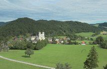
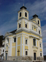
On this short but varied hike, the Tamberg, a 560 m high wooded ridge extending northeast from Hafnerberg, is circled clockwise. Before starting, one should visit the baroque pilgrimage church "Our Lady"...
On this short but varied hike, the Tamberg, a 560 m high wooded ridge extending northeast from Hafnerberg, is circled clockwise. Before starting, one should visit the baroque pilgrimage church "Our Lady" at Hafnerberg to admire the baroque high altar and the ceiling fresco.
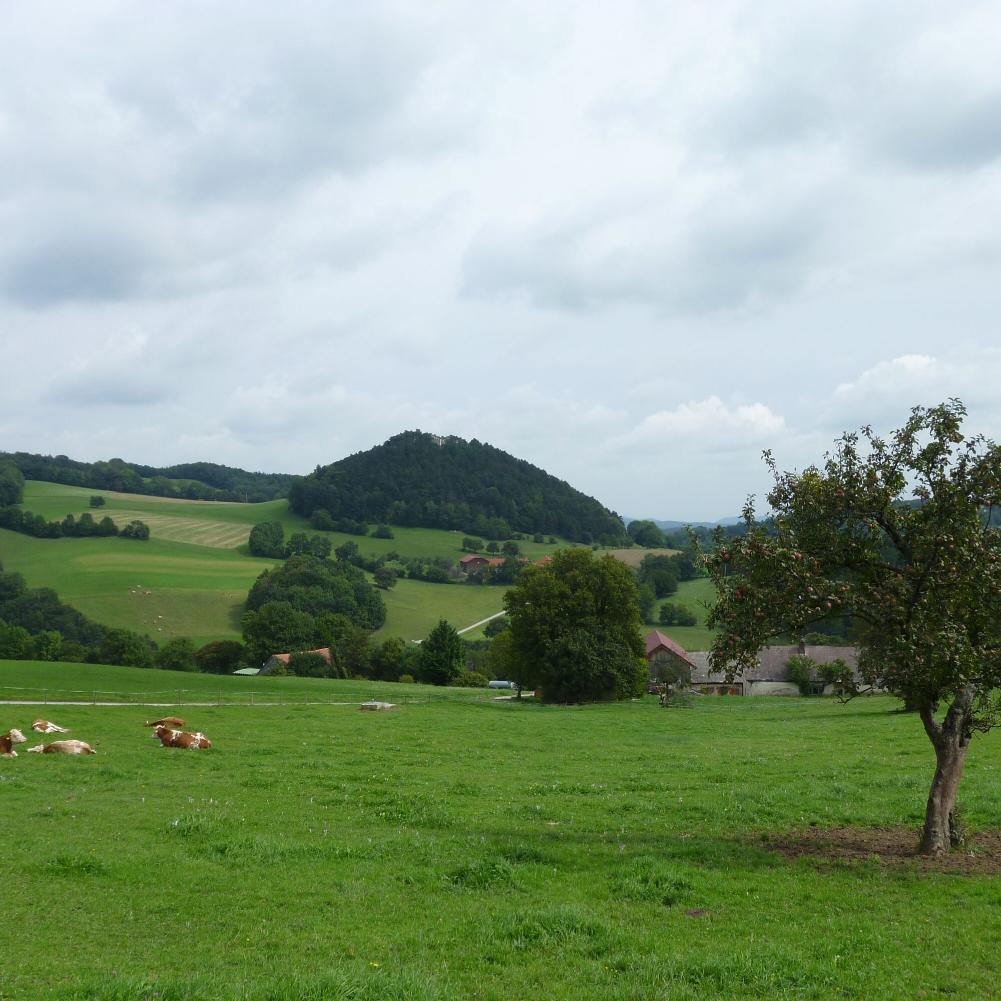
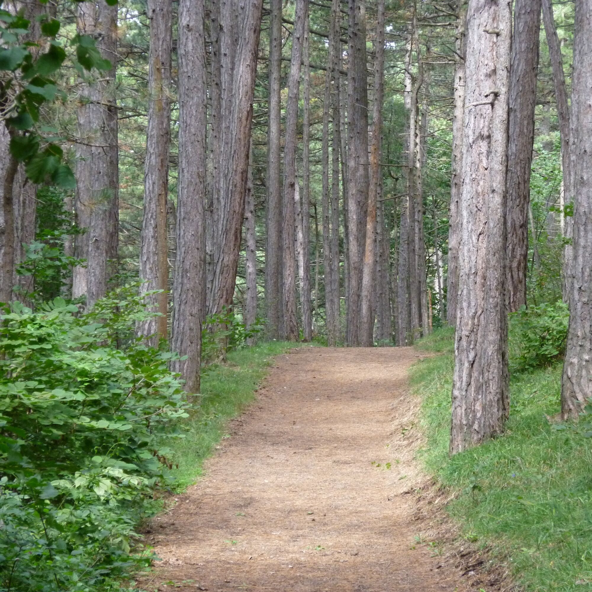
From the church, only a few steps lead to the bright pine forest, where a Stations of the Cross with 14 stations gently ascends to the Fuchsbauern Chapel. Along the way, you pass a mystical place with a hole stone. A short detour takes the hiker to the mystical place Druidenstein, a rock needle on a mountain summit. On the way to the Fuchsbauer farm, you pass the Kalendarium with the Visur hill and other hole stones. The view here ranges from Peilstein via St. Pankraz and in the other direction from Reisalpe via Araburg to Hocheck. After the junction at the Hübner Cross, turn right and lose about 100 meters in altitude down to the Nöstachbach. The return route mainly leads along the eastern edge of Tamberg with views of Peilstein and Nöstach back to Hafnerberg. There is a place to stop at the beginning and end of the route (Gasthaus zur Linde, Hafnerberg).


From the parking lot north of the church, follow the signposts Kleinmariazell: WWW 06 red-white-red
Via Sacra circular hiking route, "Mystical Places, Druidenstein and Kalendarium," and climb briefly steeply at the chapel "In Honor of Moricus." (Here, the Panorama circular hiking route branches off to the right.)
On a forest road over a saddle and then on a beautiful, wide hiking trail through bright pine forest, you pass 14 stations of the Stations of the Cross. After passing through a gate and past a hole stone, you reach the bright meadows around the Fuchsbauer Chapel. The path descends slightly to another gate, in front of which you briefly climb left on a path to a wooded hill where the Druidenstein is located. Back to the gate and level over the meadow you come to the Fuchsbauer farm (Kalendarium, hole stones), which you pass on the east side with a view. 300 m after the farm, you reach the Hübner Cross. Here you turn right onto the asphalt road and follow the blue marking towards Nöstach. Downhill on the asphalt road past the Seidl farm, after 700 m and 100 meters in altitude you reach the Nöstachbach with the Budler Bridge. You leave the asphalt road before the bridge to the right (sign Tamberg circular route) and follow a forest road briefly on the right side of the stream until, just before a meadow, a path leads right up along the forest edge. Soon you reach a comfortable forest road, which you follow gently uphill, always along the forest edge or just inside the forest, back to Hafnerberg.
Normal hiking equipment
A2 South Motorway exit Leobersdorf, on the Hainfelder federal road B 18 until just before Altenmarkt, turn right onto B 11 towards Alland, to Hafnerberg.
Alternatively via the A21 exit Alland or Mayerling, to Alland and turn onto B11 to Nöstach and continue to Hafnerberg.
Parking lot at the Hafnerberg church (parking lot north of the church)
Vienna Woods Tourism
3002 Purkersdorf, Hauptplatz 11
Tel. 02231/621 76
Fax 02231/655 10
Leader Region Triestingtal
2560 Berndorf, Leobersdorfer Strasse 42
Tel/Fax 02672-87001
office@triestingtal.at
Market town Altenmarkt an der Triesting
2571 Altenmarkt
Tel: 02673-2200
Fax: 02673-2200 2
marktgemeinde@altenmarkt.co.at
www.altenmarkt.co.at
Klein-Mariazell Basilica and Pilgrimage Church
Parish and Pilgrimage Church Hafnerberg
Cafe on the Via Sacra
2571 Altenmarkt, Hauptstrasse 34
Tel: 02673-2223
Adventure Farm "Meiselberghof"
2572 St. Corona am Schöpfl Nr. 107
Tel: 02673-8256, 0664-59026828
www.members.aon.at/meiselberghof
Populære ture i området
-
4.7
Schöpfl
lysVandring 9.52 km -
4.6
Angelos Touren: vom Helenental auf den Hohen Lindkogel
MediumVandring 11.4 km -
4.4
Berndorf Guglzipf Forest Educational Trail
MediumTemaspor 2.90 km -
4.5
Kieneck über den Enziansteig
lysVandring 12.6 km -
4.5
AUGUSTINERHÜTTE Parkplatz bei B210 Hoher Lindkogel, Langes Tal 20221030
MediumVandring 8.02 km -
3.9
Schöpfl von Sankt Corona
MediumVandring 10.1 km -
4.1
Erlebnisweg Peilstein...auf den Spuren der Kletterer
MediumTemaspor 6 km -
3.9
Gutensteiner Alpen: Myrafälle und Hausstein
lysVandring 2.92 km -
4.2
Helenental-Runde - Angelos Touren
MediumVandring 10.8 km -
4.6
Wienerwald: Maria Raisenmarkt - Peilstein
lysVandring om vinteren 6.82 km
Vandring og sporing


Gå ikke glip af tilbud og inspiration til din næste ferie
Din e-mailadresse er blevet tilføjet til mailinglisten.