HWW-Hiking route: Mönichkirchen - Spital am Hartberg (circular trail)


© Oststeiermark Tourismus - XKarin Hofer
- Kort beskrivelse
-
This HWW hiking route is part of the Wechselland Historical Long-Distance Hiking Trail (HWW), which tells the story of Wechselland along more than 100 HWW stations. More information can be found at www.wechsel-wandern.at.
- Sværhedsgrad
-
medium
- Evaluering
-
- Rute
-
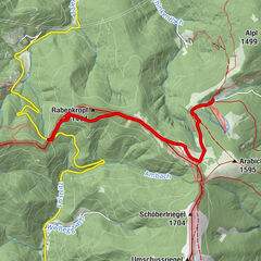
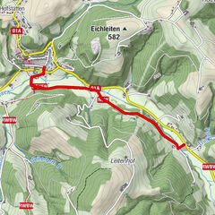
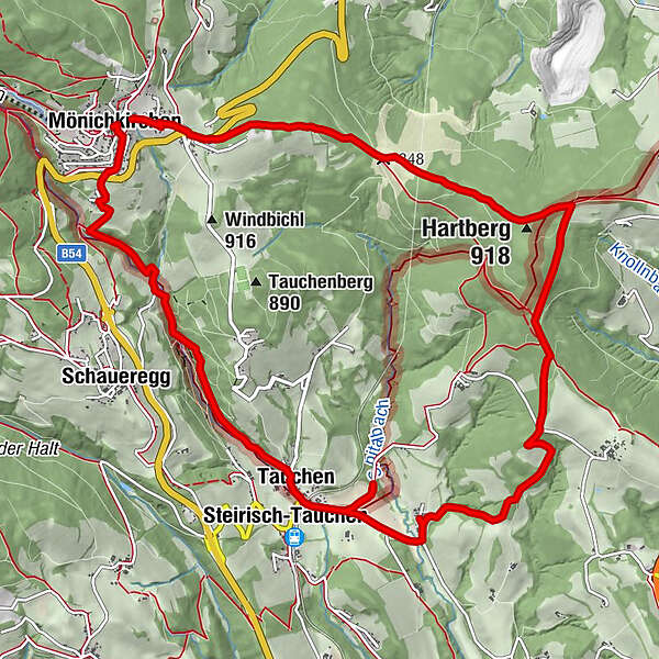
Pfarrkirche MönichkirchenMönichkirchen0,0 kmFriedhofskapelle0,4 kmPfeffergraben0,7 kmTauchen4,0 kmSteirisch-Tauchen4,2 kmSpital6,2 kmHartberg (918 m)10,2 kmRasthüttn Brettlbar12,8 kmHeiliger Leopold - Staatsvertag Kapelle13,2 kmMönichkirchen13,8 km
- Bedste sæson
-
janfebmaraprmajjunjulaugsepoktnovdec
- Højeste punkt
- 963 m
- Destination
-
Mönichkirchen
- Højdeprofil
-

-

-
ForfatterRundvisningen HWW-Hiking route: Mönichkirchen - Spital am Hartberg (circular trail) bruges af outdooractive.com forudsat.
GPS Downloads


Generel information
Kulturel/Historisk
Flere ture i regionerne
-
Wiener Alpen
3048
-
Wechselland - Wiener Alpen
1704
-
Mönichkirchen
358