
- Kort beskrivelse
-
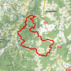
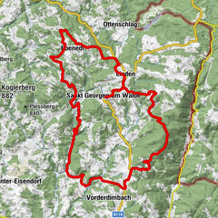
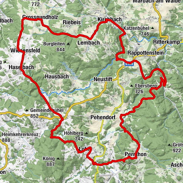
Kirchbach - Lembach - Groß Gundholz - Pernthon - Ebenöd - Grünbach - Kirchbach
- Sværhedsgrad
-
medium
- Evaluering
-
- Rute
-
Pfarrkirche hl. Michael0,1 kmKirchbach0,1 kmGasthaus Fremdenzimmer Kapeller0,1 kmLembach1,9 kmZwerlüß4,8 kmGrossgundholz5,3 kmWiesensfeld8,5 kmOrtskapelle9,4 kmHaselbach9,4 kmHoch Holzfeld12,4 kmPretrobruck13,2 kmLohn17,2 kmDisco Lohn Arena17,6 kmPernthon21,8 kmKleinkamp24,2 kmHammer30,8 kmEdmühlfeld32,6 kmGrünbach32,9 kmParadies35,7 kmMühl Leithen37,2 kmKirchbach37,2 km
- Bedste sæson
-
janfebmaraprmajjunjulaugsepoktnovdec
- Højeste punkt
- 815 m
- Destination
-
Kirchbach
- Højdeprofil
-

- Forfatter
-
Rundvisningen Höllmühl-Strecke bruges af outdooractive.com forudsat.
GPS Downloads


Generel information
Insider-tip
Flere ture i regionerne
-
Waldviertel
169
-
Südliches Waldviertel
84
-
Rappottenstein
36