© Fischland-Darß-Zingst - Vogelparkregion Recknitztal

© Fischland-Darß-Zingst - Vogelparkregion Recknitztal

© Fischland-Darß-Zingst - Vogelparkregion Recknitztal

© Fischland-Darß-Zingst - Vogelparkregion Recknitztal

© Fischland-Darß-Zingst - Vogelparkregion Recknitztal

© Fischland-Darß-Zingst - Vogelparkregion Recknitztal

© Fischland-Darß-Zingst - Vogelparkregion Recknitztal

© Fischland-Darß-Zingst - Vogelparkregion Recknitztal

- Kort beskrivelse
-
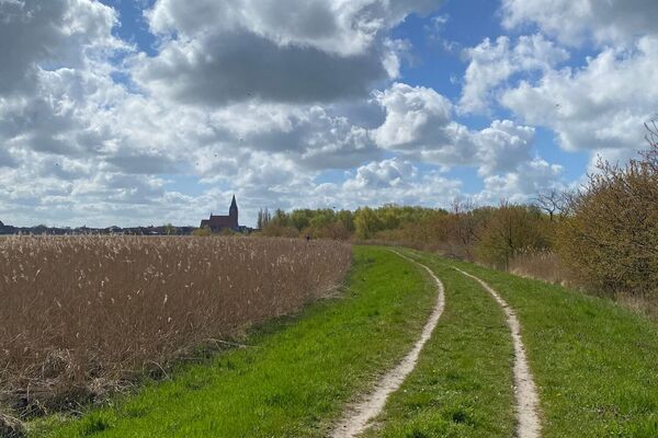
Schöne kleine Wandertour mit Besuch der Radfahrerkirche, slawische Wallanlage, frühdeutscher Turmhügel und ein bedeutendes Schlachtfeld im Recknitztal
- Sværhedsgrad
-
let
- Evaluering
-
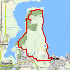
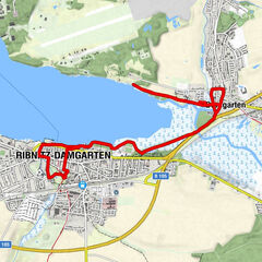
- Rute
-
Radfahrerkirche Pantlitz0,0 kmPantlitz2,1 km
- Bedste sæson
-
janfebmaraprmajjunjulaugsepoktnovdec
- Højeste punkt
- 18 m
- Destination
-
Kirche Pantlitz
- Højdeprofil
-
 © outdooractive.com


-

-
ForfatterRundvisningen Burgwall und Kirche Pantlitz bruges af outdooractive.com forudsat.
GPS Downloads


Generel information
Forfriskningsstop
Kulturel/Historisk
Flora
Fauna
Lovende
Flere ture i regionerne