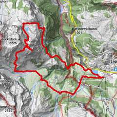
© Engelberg-Titlis Tourismus - Engelberg - Titlis Tourismus


- Sværhedsgrad
-
medium
- Evaluering
-
- Rute
-
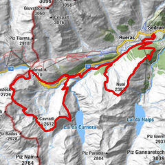
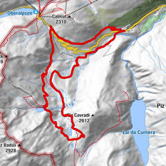
Talstation Herrenrüti1,1 kmNiedersurenen3,2 kmAlpenrösli3,2 kmStäfeli4,4 kmBerggasthaus Stäfeli4,4 kmTritt5,2 kmStäuberfall I6,2 kmStäuberfall II6,3 kmFürenalp9,7 km
- Højeste punkt
- 1.849 m
- Destination
-
Fürenalp mountain station
- Højdeprofil
-
 © outdooractive.com

-

-
ForfatterRundvisningen Fürenalp-Trail bruges af outdooractive.com forudsat.