
- Kort beskrivelse
-
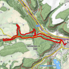
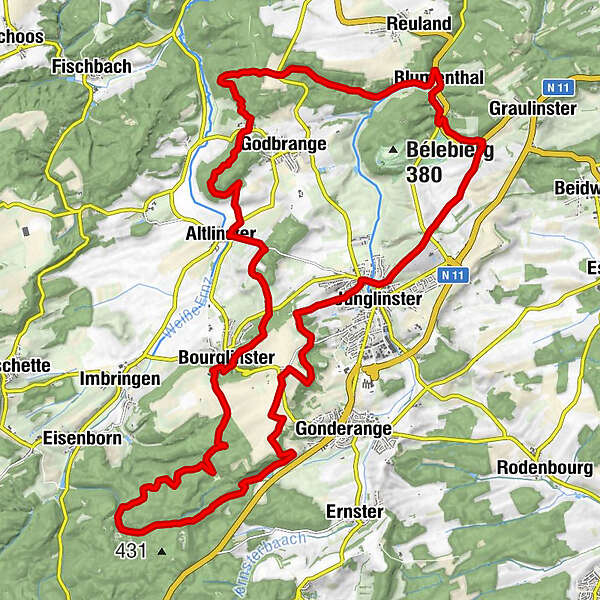
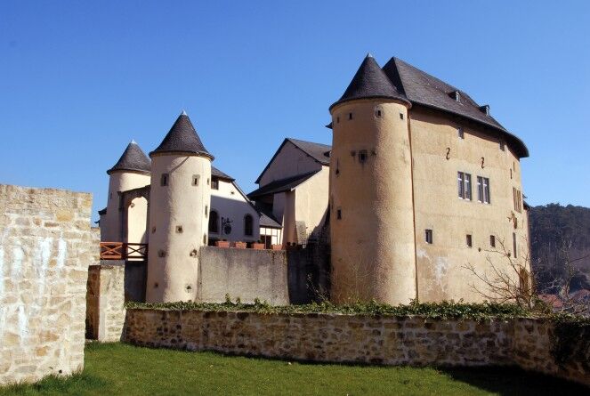
This tour takes you through mixed forests, along beautiful rock formations and the romantic Bourglinster Castle.
- Sværhedsgrad
-
medium
- Evaluering
-
- Rute
-
Brasserie Côté Cour0,2 kmBurglinster0,4 kmDohm0,4 kmSchënert0,7 kmAltlinster3,6 kmSchleifmillen4,3 kmSchleifspuren4,9 kmHärdcheslee5,0 kmFreylay5,1 kmSchiltzberg6,6 kmKoon8,8 kmBlumenthal12,3 kmJunglinster17,1 kmÉglise Saint-Martin17,4 kmBiirgerkräiz (412 m)25,5 kmKhéibierg27,0 kmIelzert29,3 kmBurglinster31,0 km
- Bedste sæson
-
janfebmaraprmajjunjulaugsepoktnovdec
- Højeste punkt
- 428 m
- Destination
-
Bourglinster: Castle
- Højdeprofil
-
 © outdooractive.com
- Forfatter
-
Rundvisningen Mullerthal Trail ExtraTour D bruges af outdooractive.com forudsat.
GPS Downloads


Generel information
Forfriskningsstop
Lovende
Flere ture i regionerne
-
Müllerthal
548
-
Niederanven
105