© © Franz Gerdl, 2018 - Franz Gerdl
© Mathias Prägant
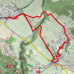
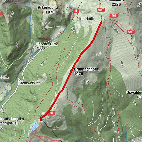
Turnédatoer
2,16km
1.894
- 2.014m
145hm
145hm
01:20h
- Kort beskrivelse
-
Biosphärenparkbahn Brunnach/ restaurant NockIN - Brunnachgatter (direction Mallnock) - back
- Sværhedsgrad
-
let
- Evaluering
-
- Udgangspunkt
-
Mountain station of the Biossphärenparkbahn Brunnach
- Rute
-
Nock INBrunnachhöhe (1.970 m)1,1 km
- Bedste sæson
-
augsepoktnovdecjanfebmaraprmajjunjul
- Højeste punkt
- 2.014 m
- Destination
-
Brunnachgatter - back to the mountain station of the Biossphärenparkbahn Brunnach
- Hvil/Tilbagetrækning
-
Restaurant NockIN