
- Kort beskrivelse
-
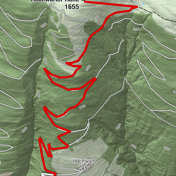
Von Hochwart über den Forstweg auf die Hochwarter Höhe, Abstieg über Schimanberger Höhe und Tramun - Waidegg möglich.
- Sværhedsgrad
-
medium
- Evaluering
-
- Rute
-
Hochwart0,7 kmHochwarter Höhe (1.655 m)3,8 km
- Bedste sæson
-
augsepoktnovdecjanfebmaraprmajjunjul
- Højeste punkt
- 1.647 m
- Destination
-
Hochwarter Höhe (1.688 m)
- Højdeprofil
-

- Forfatter
-
Rundvisningen Hochwarter Höhe bruges af outdooractive.com forudsat.
GPS Downloads


Generel information
Lovende
Flere ture i regionerne