


- Kort beskrivelse
-
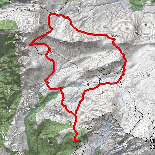
From the top station of the Älpli cable car, the path leads to the Obersäss/Vilan junction, then right along the hiking trail into the road in the direction of Obersäss.
- Sværhedsgrad
-
let
- Evaluering
-
- Rute
-
Älplibahn BergrestaurantÄlpli (1.801 m)7,3 kmÄlplibahn Bergrestaurant7,3 km
- Bedste sæson
-
janfebmaraprmajjunjulaugsepoktnovdec
- Højeste punkt
- 2.043 m
- Destination
-
Malans, Bergstation Älplibahn
- Højdeprofil
-
 © outdooractive.com

-

-
ForfatterRundvisningen Zuckerstock bruges af outdooractive.com forudsat.
GPS Downloads


Generel information
Forfriskningsstop
Lovende
Flere ture i regionerne
-
Heidiland
2201
-
Bündner Herrschaft
1202
-
Jenins
221


