- Kort beskrivelse
-
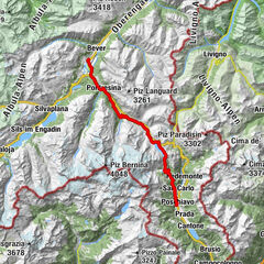
Historischer Weg, lässt Sicht gut als Folge-Etappe mit dem Tail “Pradel” verbinden.
- Sværhedsgrad
-
medium
- Evaluering
-
- Bedste sæson
-
janfebmaraprmajjunjulaugsepoktnovdec
- Højeste punkt
- 1.541 m
- Højdeprofil
-
 © outdooractive.com


- Forfatter
-
Rundvisningen Custin bruges af outdooractive.com forudsat.
GPS Downloads


Flere ture i regionerne
-
Veltlin / Valtellina
205
-
Puschlav / Valposchiavo
198
-
Puschlav
44