© Turizem Radovljica - Sašo Gašperin
© Turizem Radovljica - Jani Kolman

- Kort beskrivelse
-
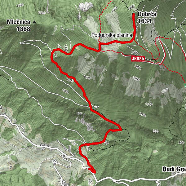
Lenghty ascent on the southeren slopes of Mt. Dobrča awards the hiker with broad views of the Kamnik-Savinja Alps, the Karavanke mountains, Ljubljana basin and the Triglav range.
- Sværhedsgrad
-
medium
- Evaluering
-
- Rute
-
MlakaPaloviče0,1 kmZadnja vas (623 m)0,5 kmKoča na Dobrči3,7 kmPodgorska planina4,0 kmDobrča (1.634 m)4,6 km
- Bedste sæson
-
janfebmaraprmajjunjulaugsepoktnovdec
- Højeste punkt
- 1.618 m
- Destination
-
Start of the forest road outside the Zadnja vas village near Begunje na Gorenjskem
- Højdeprofil
-
 © outdooractive.com


-

-
ForfatterRundvisningen Zadnja vas to Mt. Dobrča Trail bruges af outdooractive.com forudsat.
GPS Downloads


Generel information
Lovende
Flere ture i regionerne
-
Wörthersee - Rosental
1957
-
Gorenjska
141
-
Tržič
164