© Turizem Radovljica - Jani Kolman

© Turizem Radovljica - Kaja Beton

- Kort beskrivelse
-
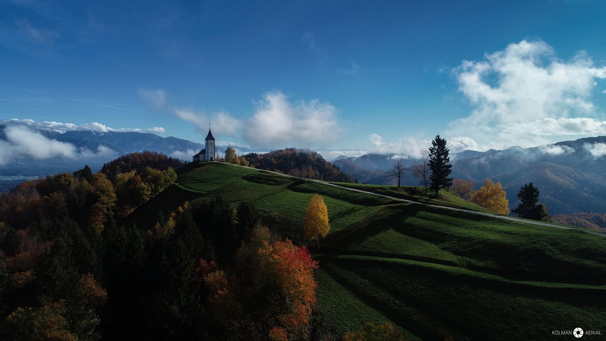
Eastern approach to the stunning mountain church of St. Primus and Felician on Jamnik - The classic picture postcard of the alpine Slovenia
- Sværhedsgrad
-
medium
- Evaluering
-
- Rute
-
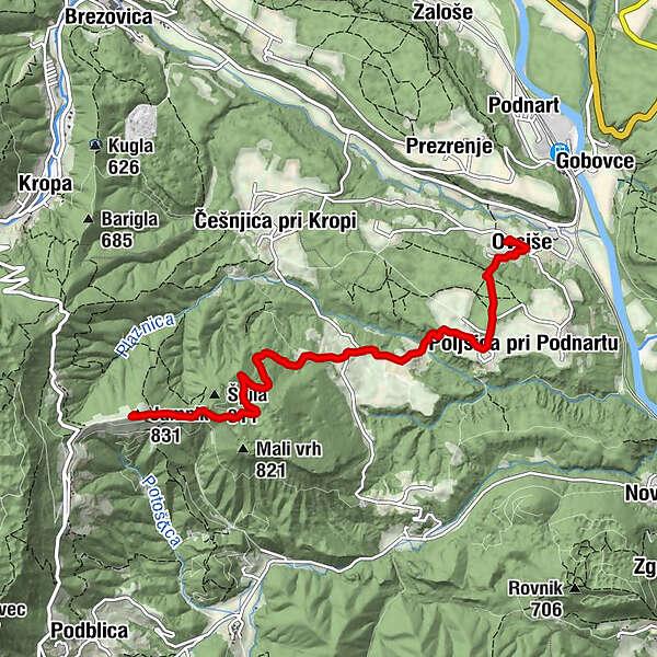
Cerkev sv. Nikolaja0,0 kmOvsiše0,2 kmPoljšica pri Podnartu1,2 kmRovte2,7 kmJamnik (831 m)5,4 kmKirche des St. Primus und St. Felician5,4 km
- Bedste sæson
-
janfebmaraprmajjunjulaugsepoktnovdec
- Højeste punkt
- 811 m
- Destination
-
Poljšica pri Podnartu
- Højdeprofil
-
 © outdooractive.com
-

-
ForfatterRundvisningen Poljšica pri Podnartu - Jamnik trail bruges af outdooractive.com forudsat.
GPS Downloads


Generel information
Lovende
Flere ture i regionerne
-
Klopeiner See - Südkärnten
1163
-
Gorenjska
140
-
Radovljica
166