© PromoTurismoFVG - Nicola Brollo

© Friuli Venezia Giulia - Fabrice Gallina

© Friuli Venezia Giulia - Fabrice Gallina

© Friuli Venezia Giulia - Marco Milani

- Kort beskrivelse
-
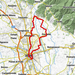
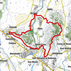
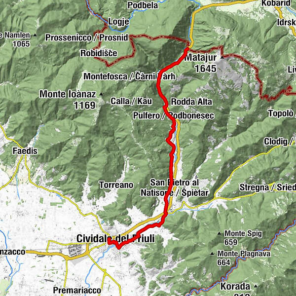
The itinerary travels along the Natisone River valley through small towns once teeming with life and herds.
- Sværhedsgrad
-
medium
- Evaluering
-
- Rute
-
Chiesa di San Pietro ai Volti0,6 kmDuomo di Santa Maria Assunta0,8 kmÖstrich0,9 kmBorgo di Ponte1,1 kmBorgo Brossana1,7 kmMadriolo3,0 kmAncona3,9 kmSanguarzo4,0 kmPurgessimo5,0 kmPonte San Quirino6,0 kmTrattoria Pizzeria Le Valli6,1 kmTrattoria al Giro di Boa6,2 kmVernasso7,3 kmVernasso Basso7,4 kmSan Pietro al Natisone8,0 kmOculis8,4 kmSpagnut9,8 kmBiacis10,3 kmCras10,7 kmTarcetta11,8 kmTrattoria ai Buoni Amici12,0 kmLasiz12,4 kmCicigolis13,5 kmPulfero13,8 kmPodpolizza14,2 kmPodvarschis14,9 kmAlla Trota14,9 kmSpecognis15,0 kmLoch15,1 kmPizzeria da Luciano15,1 kmLinder15,2 kmStupizza17,5 kmEx-valico Stupizza/Robič20,4 kmPostaja Poljana20,4 km
- Bedste sæson
-
janfebmaraprmajjunjulaugsepoktnovdec
- Højeste punkt
- 232 m
- Destination
-
Cividale del Friuli railway station
- Højdeprofil
-
 © outdooractive.com


-

-
ForfatterRundvisningen Natisone Valleys itinerary (Cividale - Stupizza) (P006) bruges af outdooractive.com forudsat.
GPS Downloads


Generel information
Forfriskningsstop
Kulturel/Historisk
Flora
Lovende
Flere ture i regionerne