© Terra Dinarica - Alan Čaplar
© Terra Dinarica - Alan Čaplar
© Terra Dinarica - Alan Čaplar
© Terra Dinarica - Alan Čaplar
© Terra Dinarica - Davor Rostuhar
© Terra Dinarica - Miljenko Ivković

- Kort beskrivelse
-
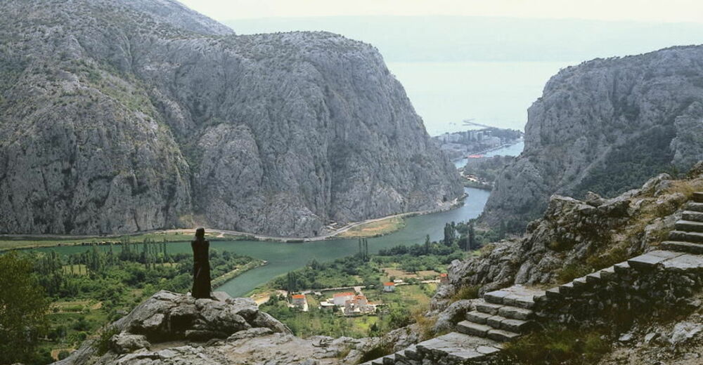
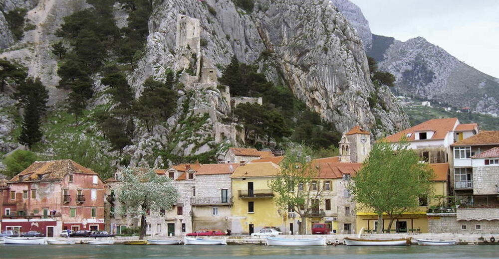
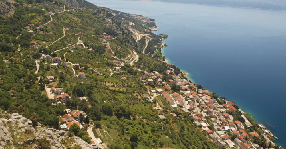
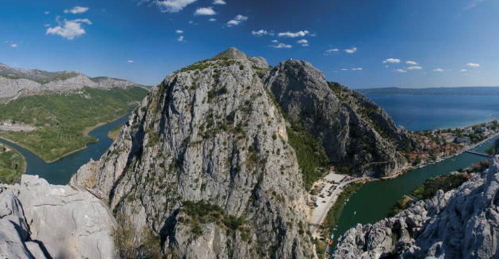
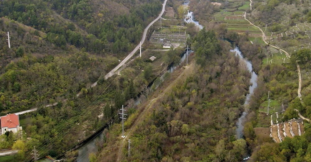
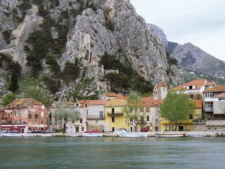
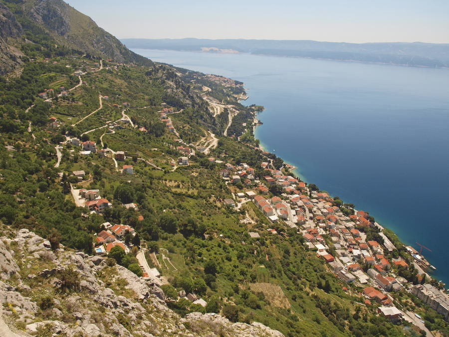
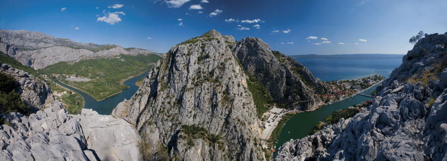
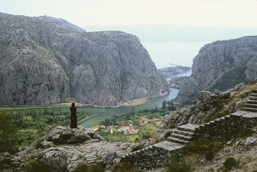
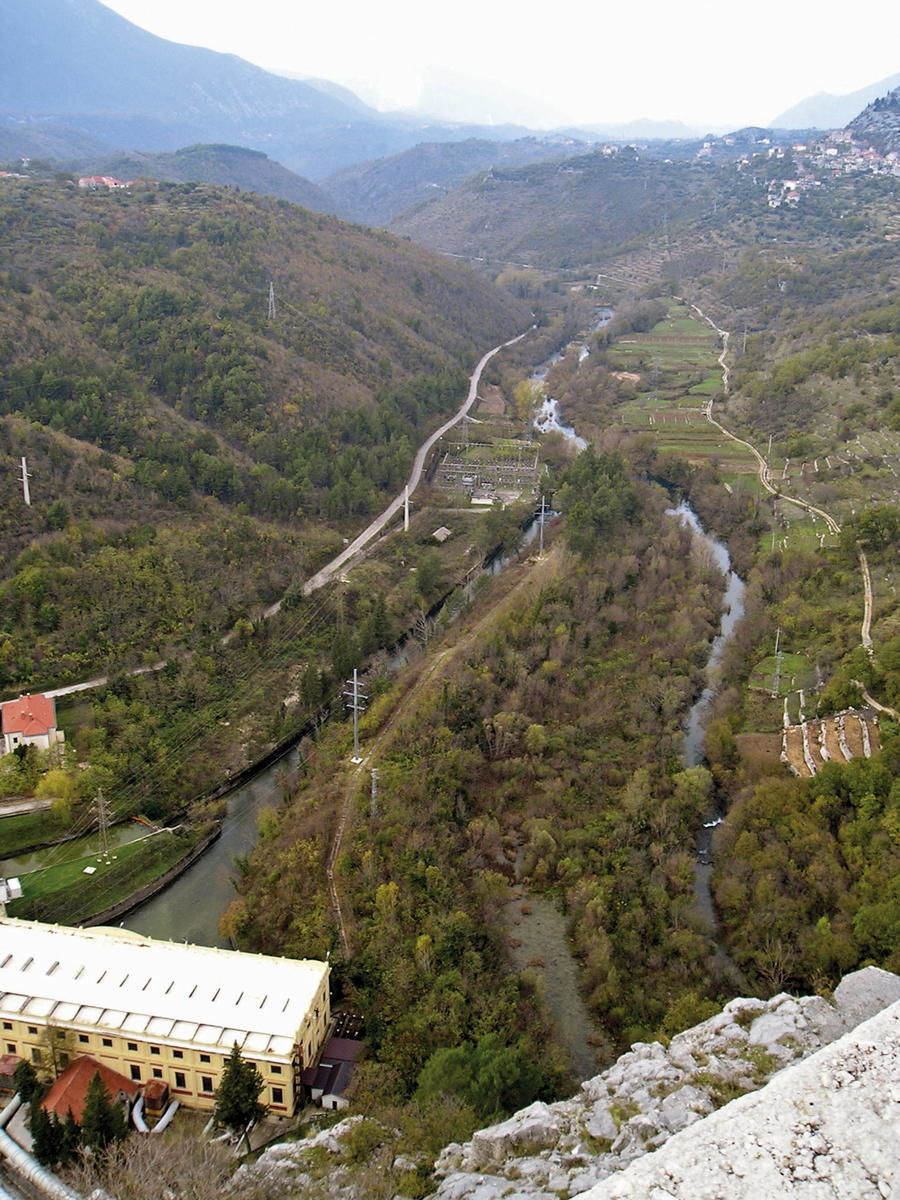
The Cetina River is one of the most beautiful Croatian rivers. It represents a key feature of the entire area in the narrow central land region of Dalmatia between the slopes of Dinara and the coastal belt. The river commences its path 105 kilometers long towards the Adriatic below the slopes of Dinara, at 385 meters above sea level, and completes the voyage with a spectacularly cut passage between the steep rocks of Omiška Dinara and Poljička planina.
- Sværhedsgrad
-
medium
- Evaluering
-
- Rute
-
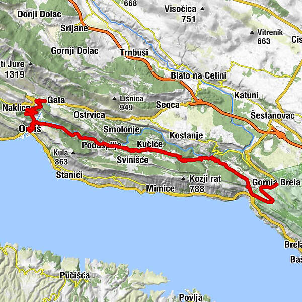
PodkunjovačaPodgradac0,3 kmZakučac3,3 kmChurch of the Holy Spirit6,5 kmAlmissa6,5 kmKaštil Slanica10,7 kmRadmanove mlinice12,4 kmSmoline17,3 kmTopići17,9 kmRadići18,2 kmKučiće18,9 kmKovačići19,0 kmJuričići20,2 kmBilići20,5 kmVukosavići21,3 kmPenšići23,6 kmČudani26,7 kmStranice28,0 kmČokići28,1 kmDubci30,3 kmIvandića Staje32,0 kmŠkrabići33,3 kmKonoba Roko33,6 kmSubotišće34,4 kmGornja Brela34,5 km
- Bedste sæson
-
janfebmaraprmajjunjulaugsepoktnovdec
- Højeste punkt
- 310 m
- Destination
-
Gornja Brela
- Højdeprofil
-
 © outdooractive.com

-

-
ForfatterRundvisningen Via Dinarica HR-B-17 Cetina River bruges af outdooractive.com forudsat.