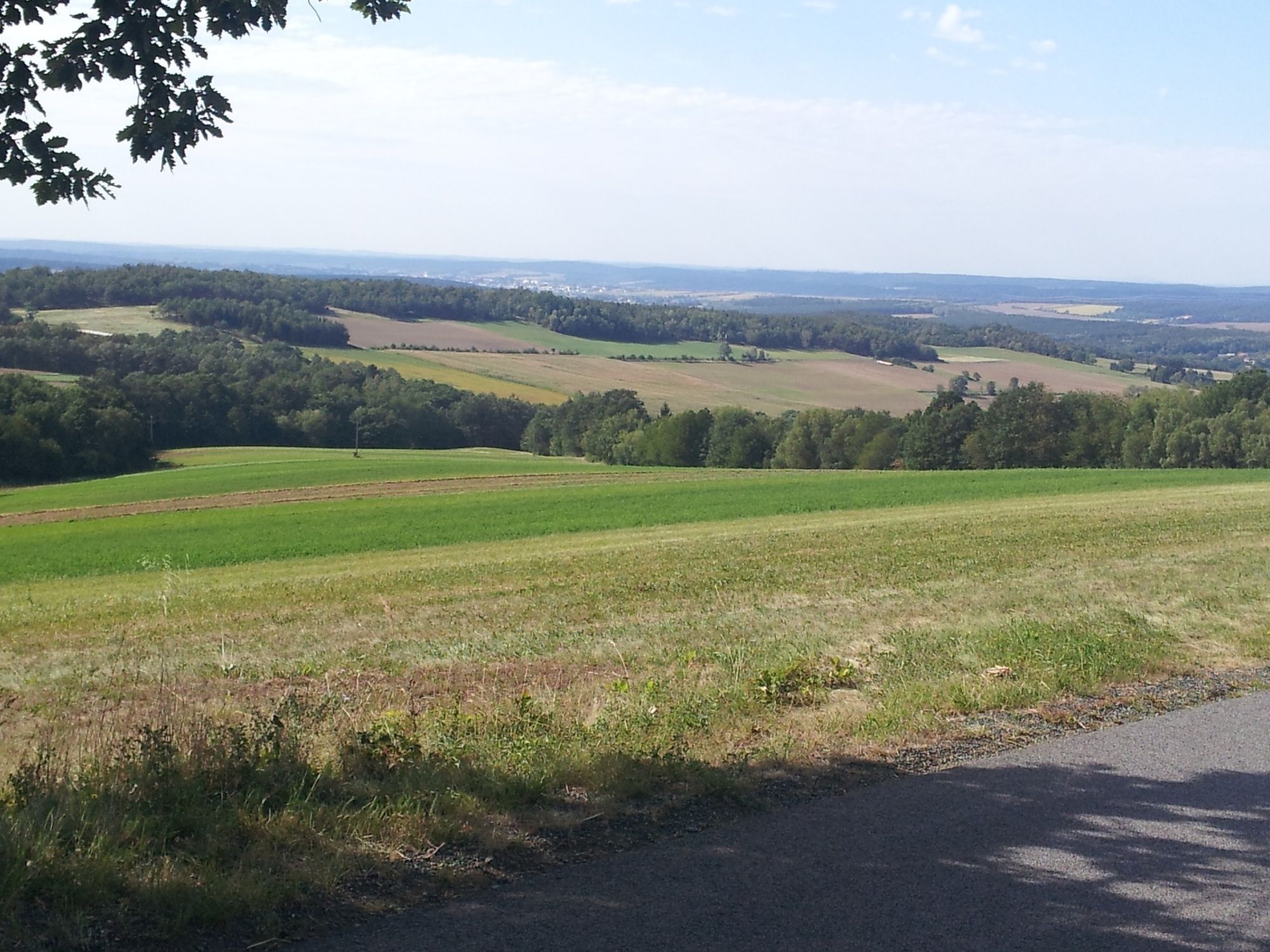
© Bad Tatzmannsdorf Tourismus - Erich Brunner
- Kort beskrivelse
-
Schöner Radweg mit herrlichen Aussichten!
- Sværhedsgrad
-
medium
- Evaluering
-
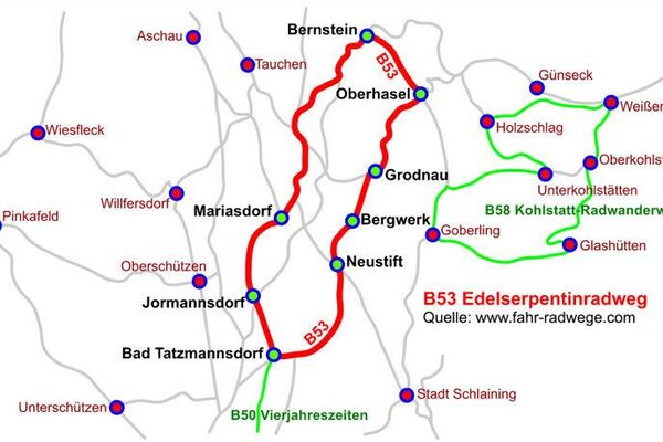
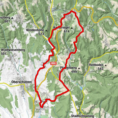
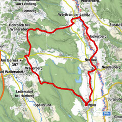
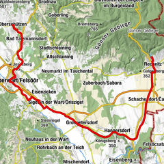
- Rute
-
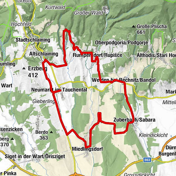
Neumarkt im Tauchental0,1 kmMiedlingsdorf4,9 kmFilialkirche hl. Antonius6,9 kmPodler7,0 kmGasthof Schitter7,1 kmZuberbach10,9 kmFilialkirche hll. Peter und Paul10,9 kmWeiden bei Rechnitz13,3 kmPfarrkirche hl. Johannes Nepomuk13,5 kmRumpersdorf16,4 kmFilialkirche hll. Petrus und Paulus16,4 kmAllersgraben18,1 kmMönchmeierhof19,1 kmFilialkapelle Mariae Namen19,3 kmRauhriegel20,6 kmAltschlaining24,0 kmNeumarkt im Tauchental26,3 km
- Bedste sæson
-
janfebmaraprmajjunjulaugsepoktnovdec
- Højeste punkt
- 463 m
- Destination
-
Kirche Neumarkt
- Højdeprofil
-

- Forfatter
-
Rundvisningen B52 - St. Martin Panorama-Radweg (Teilstrecke) bruges af outdooractive.com forudsat.
GPS Downloads


Generel information
Flora
Lovende
Flere ture i regionerne
-
Wiener Alpen
225
-
Südburgenland
128
-
Weiden bei Rechnitz
21