

- Kort beskrivelse
-
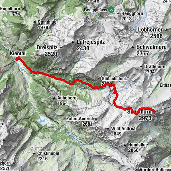
The long ascent from Kiental to the Schilthorn is much less frequently travelled than the one from Wengen. You first cross the Spiggengrund with its lush meadows, reach a fascinating karst landscape after Hohkien and finally cross a rocky desert at Rote Härd.
- Sværhedsgrad
-
medium
- Evaluering
-
- Rute
-
Kiental (958 m)0,3 kmSpiggenweide3,3 kmTschäggeren3,7 kmUnterburg5,8 kmGrunerli6,3 kmSchilthorn13,4 kmSkyline View Platform13,5 kmDrehrestaurant Piz Gloria13,5 km
- Bedste sæson
-
janfebmaraprmajjunjulaugsepoktnovdec
- Højeste punkt
- 2.957 m
- Destination
-
Schilthorn
- Højdeprofil
-
 © outdooractive.com

- Forfatter
-
Rundvisningen Kiental - Hohkien - Schilthorn bruges af outdooractive.com forudsat.
GPS Downloads


Generel information
Lovende
Flere ture i regionerne
-
Oberwallis
1872
-
Thunersee
1055
-
Kiental
266


