Turnédatoer
5,12km
641
- 729m
82hm
68hm
01:22h
- Sværhedsgrad
-
let
- Evaluering
-
- Rute
-
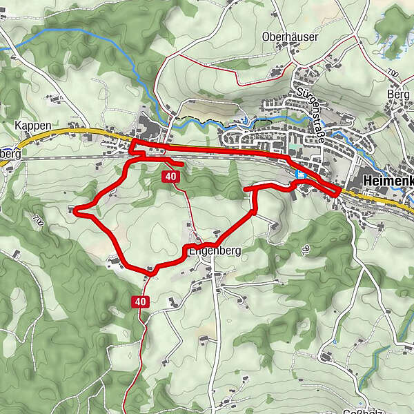
HeimenkirchHeimenkirch0,2 kmSt. Rupert0,6 kmEngenberg1,2 kmMeckatzer Bräustüble3,7 kmMeckatz3,7 kmZum Marktwirt4,4 kmHeimenkirch4,8 kmGasthof Hirsch4,9 kmLourdes-Grotte5,0 kmHeimenkirch5,1 km
- Højeste punkt
- 729 m
- Destination
-
Bahnunterführung in Heimenkirch
- Højdeprofil
-
 © outdooractive.com
- Forfatter
-
Rundvisningen Wandern mit Geschichte >>> Weg 1 bruges af outdooractive.com forudsat.
GPS Downloads


Generel information
Forfriskningsstop
Flere ture i regionerne
-
Allgäu
2370
-
Westallgäu
1265
-
Heimenkirch
428