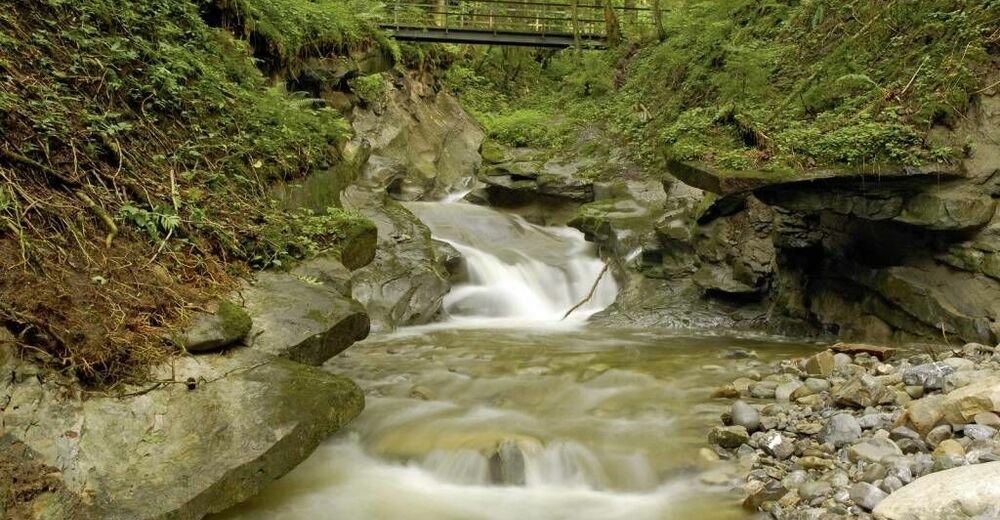
rway 9 in the westCreeks, ravines, moors - via The "Hausbachklamm to the Wildrosenmoos - Westallgaeu waterways 9

© Thomas Gretler - Sebastian Koch

")
- Kort beskrivelse
-
Rushing mountain creeks and deep canyons, green meadows and idyllic moors, splendid forests and picturesque villages -on this demanding cross-border one-day-hike you can explore the whole diversity of the landscape of the Western Allgaeu and the Bregenzerwald. If you like to take it easy, you can divide the tour into two easy stages or you can choose one of the two shorter tours around the "Wildrosenmoos" near Oberreute (tour 10 and tour11).
- Sværhedsgrad
-
tung
- Evaluering
-
- Rute
-
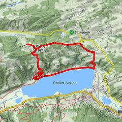
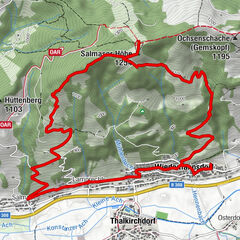
Weiler im AllgäuLourdeskapelle0,2 kmHasenried1,2 kmRiegen2,4 kmUntertrogen2,6 kmBächen3,7 kmSchnellers5,0 kmVorderschweinhöf5,6 kmGalgenholz (1.030 m)9,2 kmGasthof Alpenblick9,6 kmAdler Pizze&Pasta9,7 kmSulzberg9,7 kmGasthof Ochsen9,7 kmThal13,6 kmHl. Franz Xaverius13,6 kmEyenbach14,9 kmSalmers15,4 kmAlte Quellfassung der Siebersquelle16,4 kmSiebersquelle16,6 kmBremenried19,1 kmWeiler im Allgäu19,9 km
- Bedste sæson
-
janfebmaraprmajjunjulaugsepoktnovdec
- Højeste punkt
- 1.034 m
- Destination
-
Same as starting point
- Højdeprofil
-
 © outdooractive.com

- Forfatter
-
Rundvisningen rway 9 in the westCreeks, ravines, moors - via The "Hausbachklamm to the Wildrosenmoos - Westallgaeu waterways 9 bruges af outdooractive.com forudsat.
GPS Downloads


Generel information
Forfriskningsstop
Flora
Lovende
Flere ture i regionerne
-
Allgäu
2360
-
Westallgäu
1261
-
Sulzberg
642